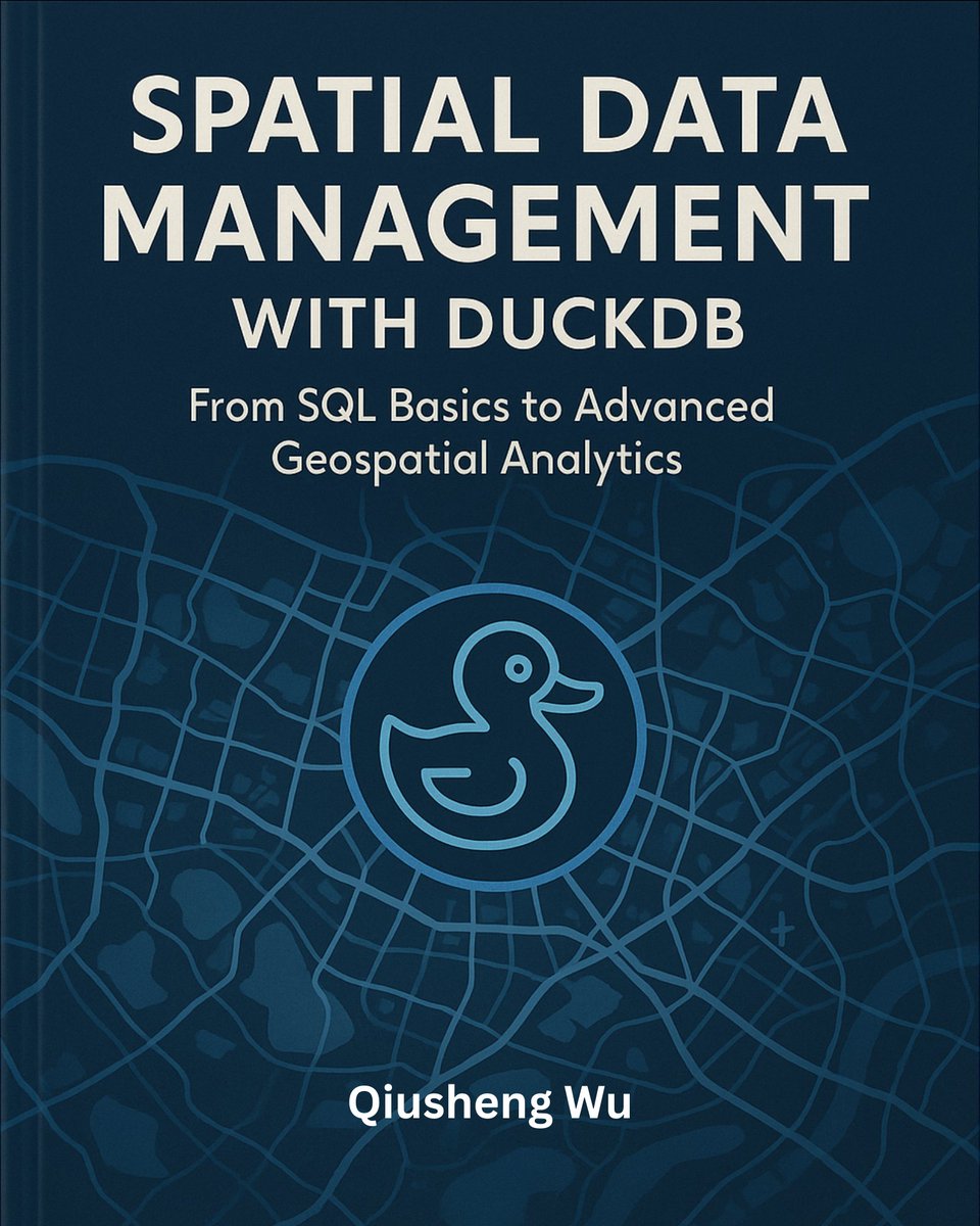
I’m thrilled to share that my new book (Spatial Data Management with DuckDB) is now published! 🎉
At 430 pages, this book provides a practical, hands-on guide to scalable geospatial analytics and visualization using DuckDB. All code examples are open-source and freely available on GitHub so you can follow along, adapt, and extend them.
Book website: https://t.co/PcrQNOdF53
GitHub repo: https://t.co/bovZybK0Yb
Table of Contents: https://t.co/ryTPGtS9Uj
The PDF edition of the book is available on @leanpub: https://t.co/2GKy9wXn4x
Full-color print edition will be available on Amazon soon. Stay tuned.
#geospatial #duckdb #python #leafmap #datascience
"The court enjoys good internet connectivity. Witnesses don't have to come to court. They can testify virtually from wherever they are." - Leah Kabaria, Head of Station, Msambweni Law Courts
A sneak peek of a new feature in the #GeoAI Python package! 🎉 Now you can detect cars from georeferenced aerial imagery using deep learning—all with just a few lines of code. Stay tuned for an in-depth video tutorial coming soon!
🛠️ Explore the GitHub repository: https://t.co/TBxio7GvtY
📚 Dive into the documentation: https://t.co/6zl0MjNf70
📺 Check out the entire YouTube playlist: https://t.co/KVHZDtgawR
NASA and IBM have just launched an updated foundation model for geospatial data.
It can remove clouds, detect crops, and identify floods.
Plus it's free.
Here's what you need to know about it:
Please attend the next Nairobi Show. I will arrange for the demonstration of our strategic use.
We have a couple of GIS staff members in the company.
I am almost thinking that we have a learning institution that is misinforming their students that they are pioneers of GIS.
We are seeking talented and motivated individuals to join our Management Trainee Program. Applications are now open to qualified candidates for various positions within the Company.
Apply online: https://t.co/HDcminYeKe
Deadline: Thursday, 22nd August 2024.
#IkoKaziKe
The Department of Geography and Sustainability @UTKGeography at the University of Tennessee is hiring an Assistant Professor in Geographic Information Science. We are especially interested in scholars making theoretical advances in the areas of GeoAI, spatio-temporal modeling, or geospatial data science
Apply: https://t.co/JHgv0lXfrQ
#job #jobalert #jobopportunities #geospatial
new 12m resultion of global mangrove canopy height map is online! Using TanDEM-X data, calibrated by GEDI
@GEDI_Knights
. Very important datasets for coastal forest structure and blue carbon dynamics!
https://t.co/hQhKnwKDf7
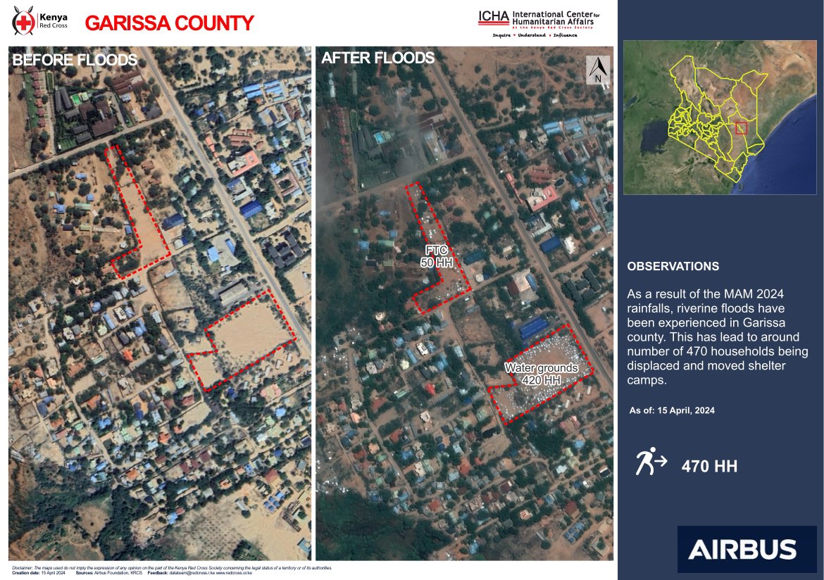
The Kenya Red Cross utilizes satellite imagery to monitor the impacts of floods across different areas.
Check out this map highlighting estimated displaced households in Garissa, now seeking refuge at the Farmer Training Center (FTC) and Water Ground areas.
On-ground assessments are ongoing to verify the number of households affected.