MapBH is an open source project that aims to make historic maps of Bahrain accessible and available to the public. Part art project, part dataviz, and part archive; we try to give people a canvas to tell their generational stories on. Explore it yourself! https://t.co/m4BMtMBVdo
The Muharraq map also comes in 2 sheets, North and South. It also labels the neighbourhoods of the city by their common name in Arabic and English. It's contemporary to many changes in Muharraq: burial of the sea and construction of new blocks.
https://t.co/T9P8S0ySVW
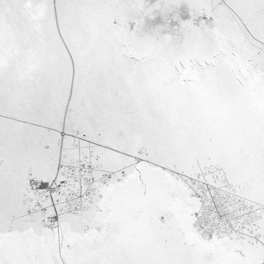
1981 National Addressing Project, 2 releases:
Muharraq and Manama. During the NAP, Bahrain was divided into 11 geographical regions: Hidd, Muharraq, Manama, Jidhafs, North Region, Sitra, Central Region, Isa Town, Riffa, Western Region, Hawar islands (11)
The Manama map comes in 2 sheets, North and South with an inset of Nabi Saleh in the South sheet. Accompanying this map is a manual that denotes the roads, landmarks, and blocks. https://t.co/kXTt2ebvwv
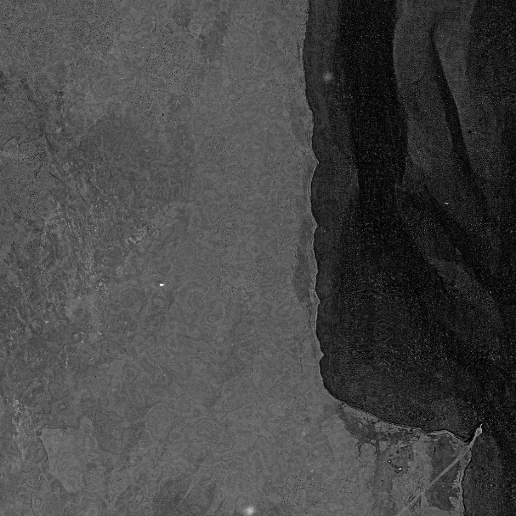
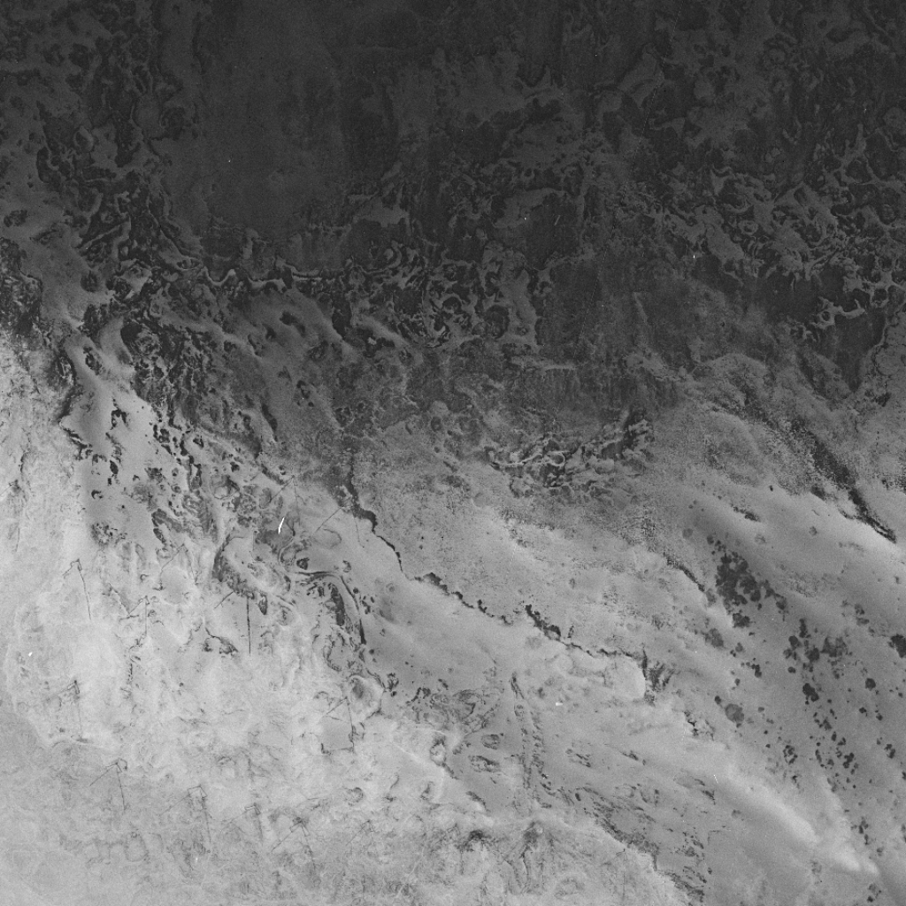
new release: 1904 map of Bahrain, 1:63360 scale.
It contains a wealth of information on derelict villages, springs, burial mounds, dirt roads, and changing shorelines. For some now-lost villages and springs, little other evidence remains.
Explore: https://t.co/TAenmWDSwf
Today's also the eleven year anniversary of this map being re-published in AlWasat News. Their beautiful interface remains useful today as it provides a quick index to locate villages and towns as well as the Arabic names of the surveyed towns. https://t.co/jElRZBV6oM
new release: 1904 map of Bahrain, 1:63360 scale.
It contains a wealth of information on derelict villages, springs, burial mounds, dirt roads, and changing shorelines. For some now-lost villages and springs, little other evidence remains.
Explore: https://t.co/TAenmWDSwf
This is an important map, the first detailed survey of the islands done by the British. It was published in Lorimer's 1908 ‘Gazetteer of the Persian Gulf, Oman, and Central Arabia.’ Every place listed in the map has a detailed description in the Gazetteer. https://t.co/fvDnDO2mtg
1875 - Panorama of the coastline from Qalali to the eastern shore of Bahrain island. Can you imagine seeing Jabal al Dukhan from Qalali?
١٨٧٥ - بانوراما للساحل من قلالي حتى الساحل الشرقي لجزيرة البحرين.
تخيل جبل الدخان كنت تقدر تشوفه من قلالي؟
🧵19th century skylines:
1875 - Sketch of the view of Bahrain Fort from the sea.
أفق البحرين في القرن التاسع عشر:
١٨٧٥ - رسمة لمنظر قلعة البحرين من البحر.
Athari is not a myth. It existed, it fed villages far from where it spouted. It was surrounded by lush green gardens. Children, today near 40 years old, swam and played there. Athari lives on in memory but, with every passing year and funeral, it fades from our collective soul.
Not unlike the Garden of Eden ascribed to Bahrain, so much of our folklore and mythic history involves a fresh water spring that's no longer there. It's been destroyed. The stories don't make sense anymore. The gentlemen of our era have murdered Bahrain. Now it withers.