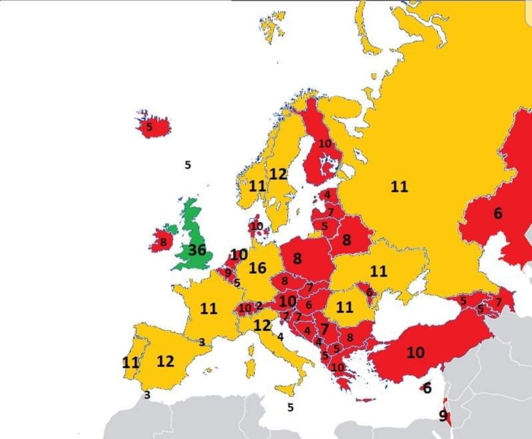
Map shows the unemployment rate by region across Europe in 2018. Remember that an unemployment rate of under 3.5% means that it's very hard to find enough qualified workers. Source: https://t.co/6ZykGWSxgz
Fairly recently it was discovered that Oceania is a continent in its own right. This overlay map shows just how vast this continent of seafarers really is. Source: https://t.co/JSpJscHz0x
The Pan-American Highway is almost 30,000 miles long and the longest single road trip in the world. Just in case you are looking for an idea for your next road trip. Source: https://t.co/L7iV97ZBis
Map shows the largest Jewish communities in Germany in 1933 - just before the Nazi party took power and before the start of the horrors of WWII. Source: https://t.co/uXIGT37Som
Ciekawe porównanie rozmiarów rzeczywistych. Demokratyczna Republika Konga na mapie Europy.
Autor: Krzysztof Grajek, za @mapawka (grupa Jak będzie na mapie? sekcja geograficzno-kartograficzna)
#HubbleClassic Hubble captured this view of Mars between April 27 and May 6, 1999, when the Red Planet was about 54 million miles from Earth. Surface features as small as 12 miles across are visible, including craters, volcanoes, and a storm churning near the north polar ice cap.
This graphic lists the frequency of flag colors by continent and creates a standard flag for each continent. As silly as it is charming. I am sold 😜 Source: https://t.co/MX1bGvFJRz