A masterpiece of precision and artistry: Guillaume Henri Dufour’s Topographische Karte der Schweiz (1833–1863). Created at an impressive 1:100,000 scale, this 25-sheet national map set a new standard for scientific cartography in the 19th century. Steel-engraved with extraordinary detail, it uses delicate hachures to sculpt the Alps in three dimensions—capturing Switzerland’s dramatic terrain with remarkable clarity. Centered on the Bern Observatory and produced during a period of rapid technological progress, the map supported military planning, infrastructure, and national unity.
See all sheets: https://t.co/7tsAPRvJxG
I built "Avalanche Map" as a desktop app with @glazeapp to plan ski touring adventures! The Glaze agent just figured out how to pull the latest avalanche report from the official Swedish avalanche website - including detailed topo shading and slope angles. It supports 3d maps and can filter map output by the aspects affected by today's danger.
Building niche software like this with just a few prompts is great
🎉 To mark the release of over 700 georeferenced declassified spy satellite images, Harry has made his 1960-1984 map collection fully searchable: https://t.co/47v4qrBQ0Z
Explore anywhere in the world and jump straight to the interactive maps to compare them to modern day.
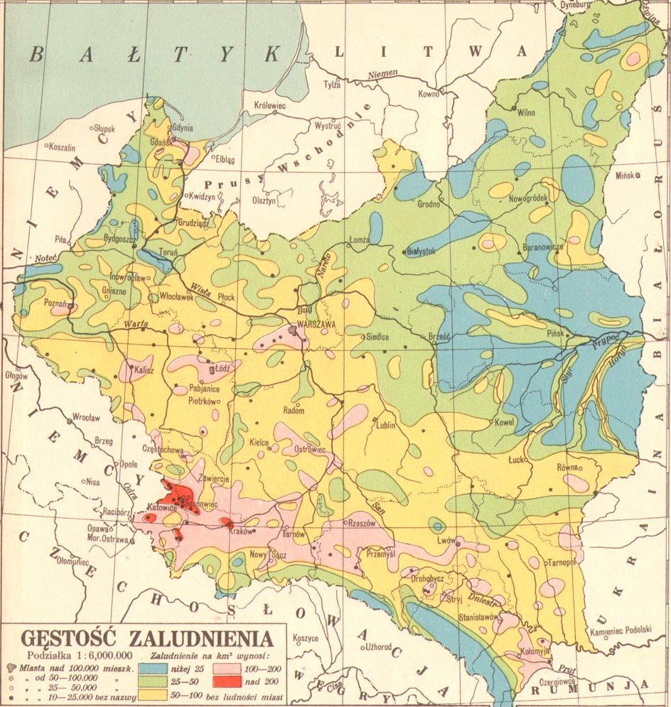
Zrobiłem współczesną rekonstrukcję mapy Eugeniusza Romera, przedstawiającej gęstość zaludnienia https://t.co/ExXT4j6fkx w oparciu o aktualne dane: Kontur Population Dataset (https://t.co/34bsbDYhTc) oraz Urban Areas GHSL (https://t.co/UTUc2YwTtm).
#MakingMapsPretty
I’m developing a #QGIS tool to generalize and smooth a DEM, then generate a shaded relief and matching contour lines, all adapted to the selected level of generalization. Azimuth, height, Z-factor, and contour interval are controlled with a single click.
For Day 6 of the #30DayMapChallenge - Dimensions, Geospatial Consultant Hannah Wright highlights the scale of @ScottishMR call-outs in 2024.
Some incidents demanded over 200 volunteer hours, showing the immense effort to reach and resolve emergencies.
#30DayMapChallenge Jour 2 : Lines
Fruit de 5 ans de travail, c'est enfin l'heure de vous présenter la carte de toutes les étapes de l'Histoire du Tour de France (1903-2025)
Datas :
➡️1903-1947 : @GallicaBnF
➡️1947-2000 : https://t.co/zs21RqmKcu
➡️2000-2025 : @laflammerouge16
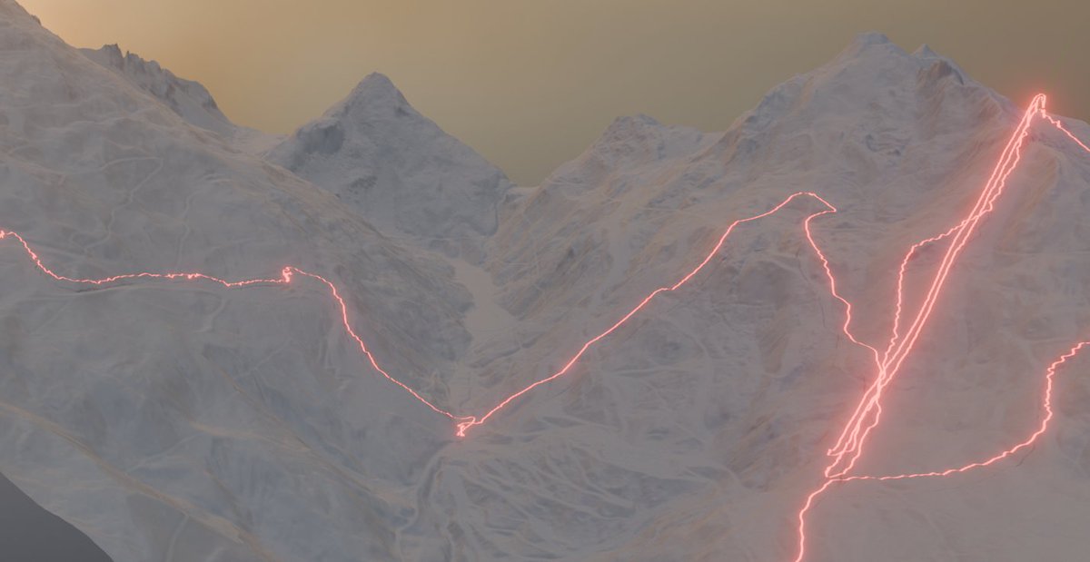
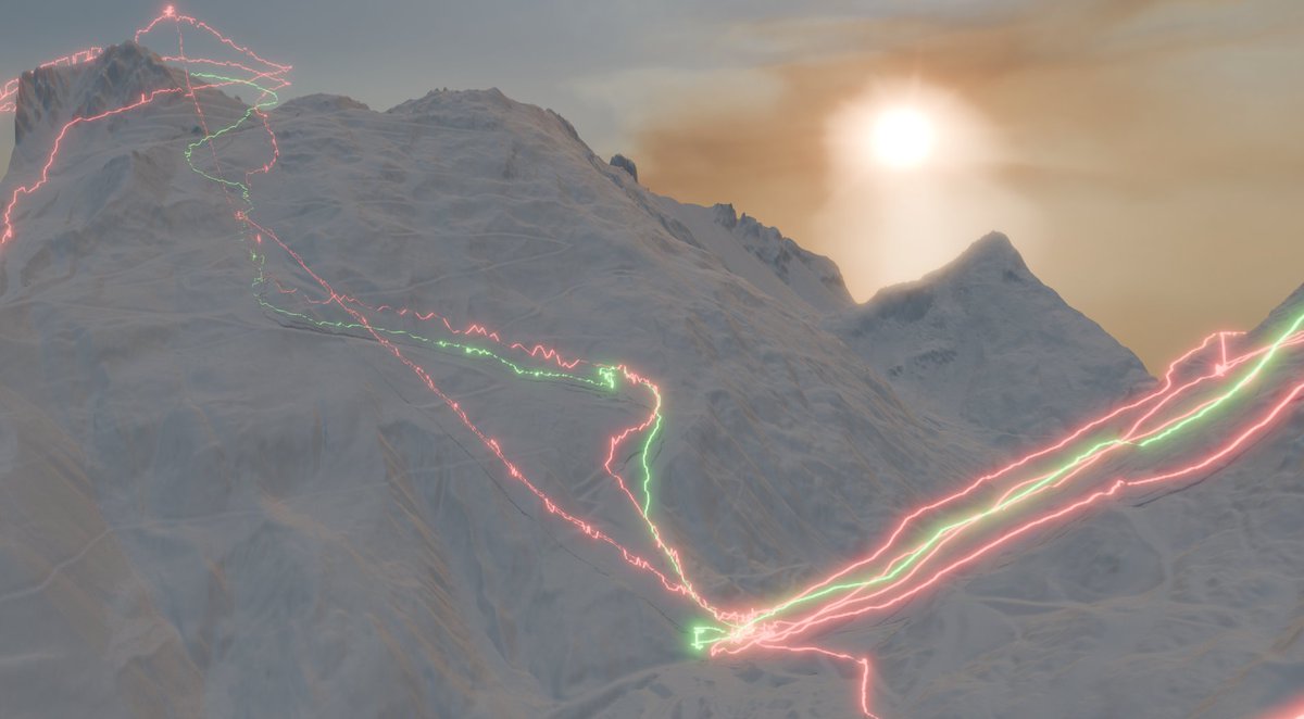
#30DayMapChallenge Day 4: My Data Playing around with some of my ski GPS tracks from Les Trois Vallées earlier this year. Made with #qgis and #b3d using RGE ALTI data
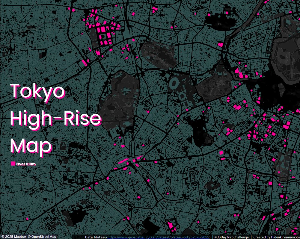
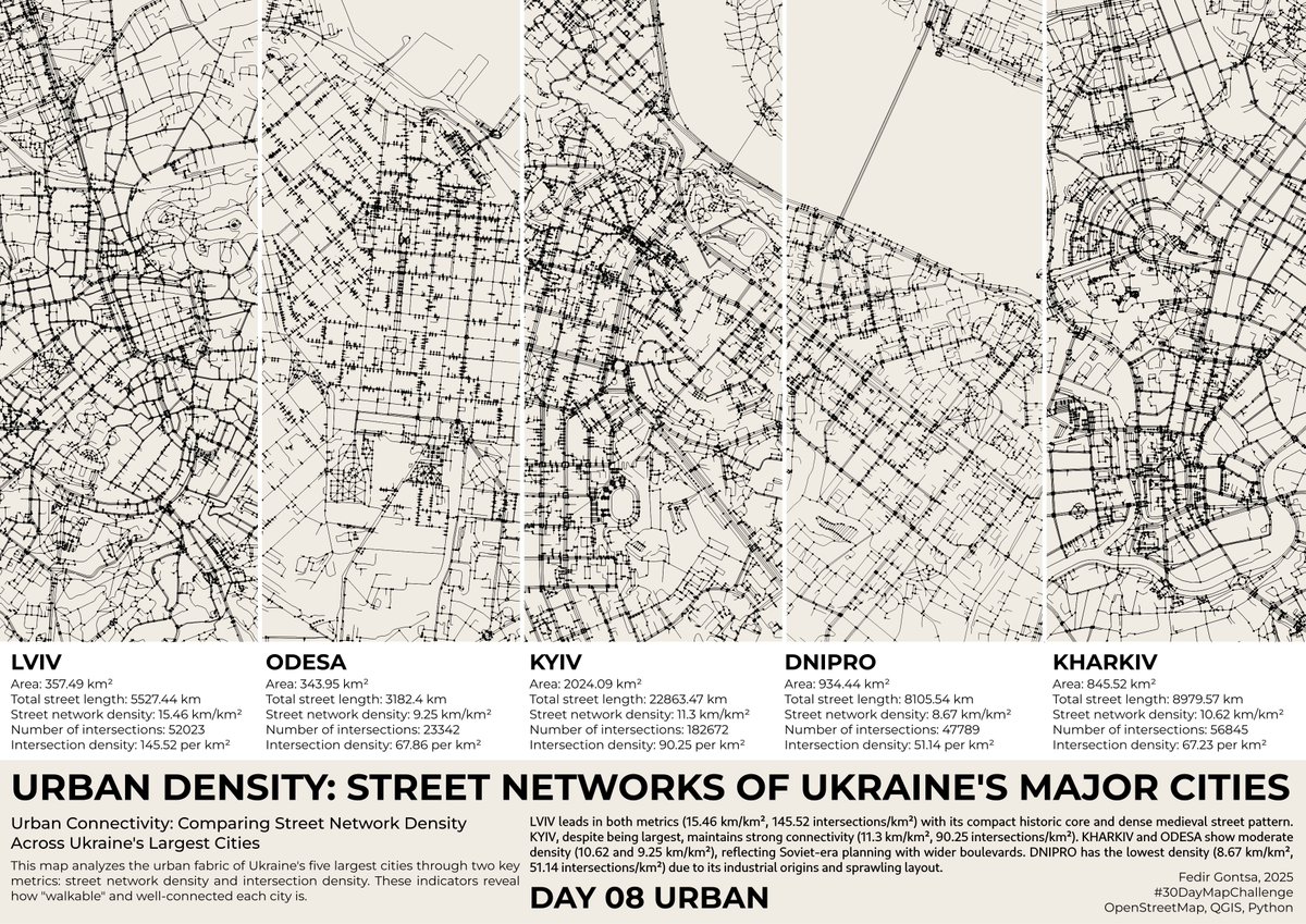
#30DayMapChallenge Day8:Urban
I used Plateau data for the first time.
It's incredibly rich and detailed, and Id love to explore it more.
I created it using #Tableau and #QGIS.
https://t.co/ZrdpDqLjpn
🌎I’m actively seeking full-time roles as a #Cartographer (on-site / remote). With rich experience in cartography & GIS, my work has been widely recognized with 70+ achievements. If your team’s hiring or you know openings, I’d truly appreciate any referrals or shares! #OpenToWork
New maps and factsheets published in the Atlas of Ungulate Migration today! Learn about the conservation successes and challenges facing Poland’s migratory moose and European bison. https://t.co/lXUdrt3HP7 @BonnConvention@ScienceinPoland@mriBialowieza