Straightforward CAD-ready & raster mapping for Architects, Surveyors and property professionals. Save 70% vs the market leader. RIBA CPD provider & OS partner.
Need to build a quick site analysis map?
✅ Add land use data via OS NGD
✅ Draw a radius in AutoCAD
✅ Hatch hospitals, care homes etc.
✅ Export to PNG or PDF
Fast, visual insight for planning packs.
#Mapping#OSNGD#SiteAnalysis#AutoCAD#PlanningApplications#MapServe
Need to export your OS map with tree data as a PNG?
✅ Add the National Tree Map
✅ Download DWG or DXF
✅ Export from AutoCAD (PNGOUT)
✅ Toggle off any unwanted layers
Quick and clean — ideal for tree surveys or planning docs.
#Mapping#AutoCAD#TreeSurvey#GIS#Planning
Mark’s a solo planning consultant.
His old map supplier? Charged for previews. Charged for edits. Final bill? Always a guess.
Now he uses MapServe®.
Free previews. Clear pricing. No surprises.
He quotes with confidence — and keeps clients happy.
#PlanningConsultant#Mapping
Need to create a location plan in AutoCAD?
This 3-min tutorial covers:
🛠 Setting units + scale
📄 A4 layout at 1:1250
🔴 Red boundary outlines
📤 Exporting as PDF
Perfect for planning apps. #AutoCAD#CADTips#PlanningTools#MapServe
Meet Danny, a Telecoms Project Manager.
His teams move fast — but missing contours, bad file formats, and outdated maps slowed them down.
Now he uses MapServe®.
Accurate CAD files. Clean interface. No surprises.
His teams hit the ground running — and stay there.
#Telecoms
MapServe started after seeing our biggest competitor flooded with complaints:
❌ Confusing UX
❌ Support queues
❌ Fees just to preview maps
We knew we could build something better.
Today? Clean, simple mapping — trusted by 1000s every month.
#MapServe#Proptech#Architecture
Meet Ellie, an Urban Designer.
Her proposals rely on complete, layered maps — tree cover, contours, boundaries, aerials.
But before MapServe®, she juggled 3 providers — and missed data meant missed deadlines.
Now? One platform. Full picture. No setbacks.
#UrbanDesign#Maps
Bad maps waste time.
💥 No editable layers
💥 Broken linework
💥 Text as geometry
Here’s what clean CAD should look like — and how to spot time-wasters before they derail your project.
🎥 Worth 3 mins:
#AutoCAD#CADTips#Mapping#Architecture#MapServe
Meet James. He runs a team of land surveyors.
What slowed them down? Not fieldwork — bad map platforms.
Clunky UI. Login walls. Wrong files. Missed deadlines.
Then he found MapServe®.
Now? Fewer clicks. Fewer errors. Happier clients.
#Surveying#Geospatial#LandSurveying#Maps
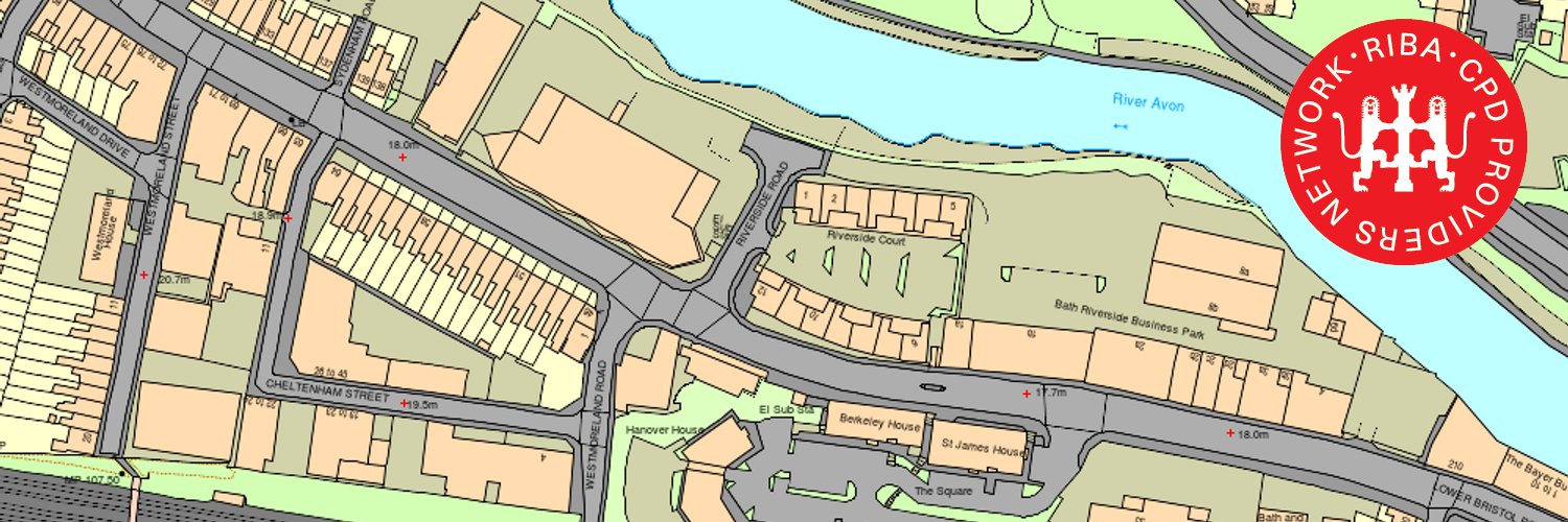
Need building heights in your site plan?
Quick how-to:
✅ Select your site
✅ Add building height layer (CAD only)
✅ Export to PNG in AutoCAD
#AutoCAD#MappingTools#Architects#Surveyors