Now that it’s official… I’m very excited to share that I’ll be continuing my NWS career at @NWSWPC! Thrilled to be moving back to Maryland and working at a top-notch national center with an amazing team! Can’t wait to get started!
🧵time! We've got a high complicated forecast for Wednesday into Friday (even for Colorado standards). Let's take a deeper dive into the forecast.
Here's a look at what will be our storm, spinning away over southern Alberta/British Columbia.
🛰️GOES-18 via @CIRA_CSU
So far today, three Florida NWS offices have issued 133 tornado warnings associated with Hurricane Milton.
Miami - 49
Melbourne - 35
Tampa - 49
Stay safe Florida, we are wishing everyone well.
#ncwx#scwx#gawx#cltwx
A jaw-dropping, high resolution view of Hurricane Milton's powerful, small eye.
This 30-second imagery from GOES-19 is preliminary and non-operational.
...MILTON RAPIDLY INTENSIFIES INTO A CATEGORY 5 HURRICANE...
Data from an Air Force Reserve Hurricane Hunter aircraft indicate that Milton has strengthened to a category 5. The max sustained winds are estimated to be 160 mph with higher gusts. https://t.co/dv1LkCViaN
@oriolesreview Stumbled upon your account earlier this year and I’m glad I did. Thanks for the great analysis and commentary this season. Appreciate you!
☃️ Seasons are changing and so are forecasting responsibilities at WPC. As of today, the Winter Weather Desk is now officially open for the season!
Use this time over the next few weeks before snow begins to fall to review winter weather safety tips at: https://t.co/JGZT313IDH.
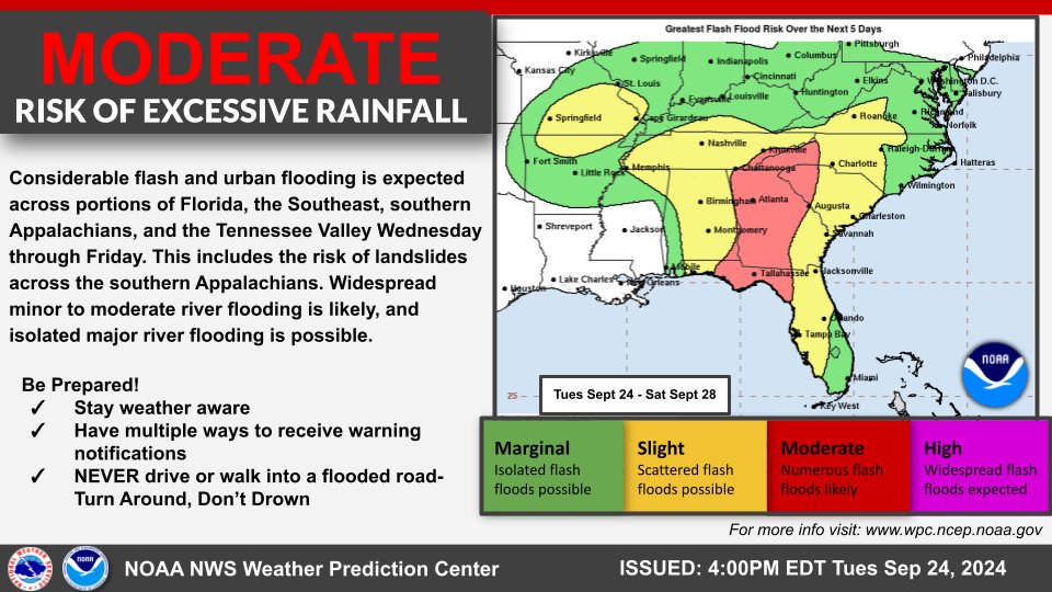
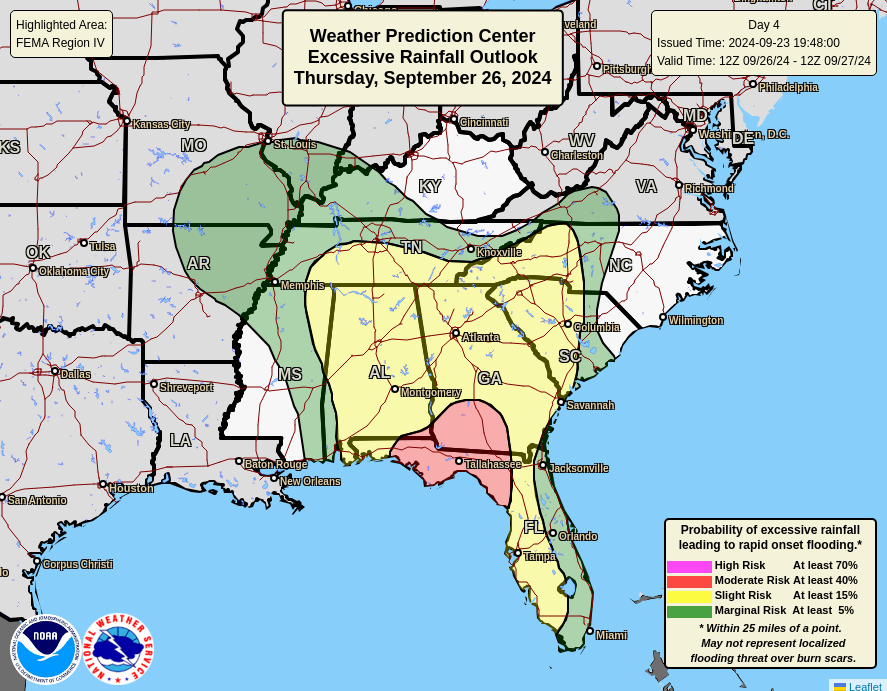
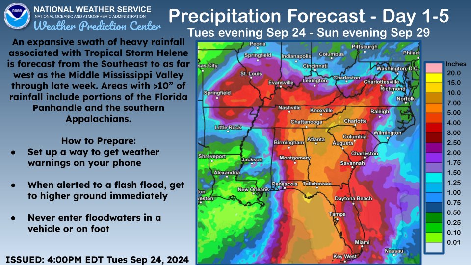
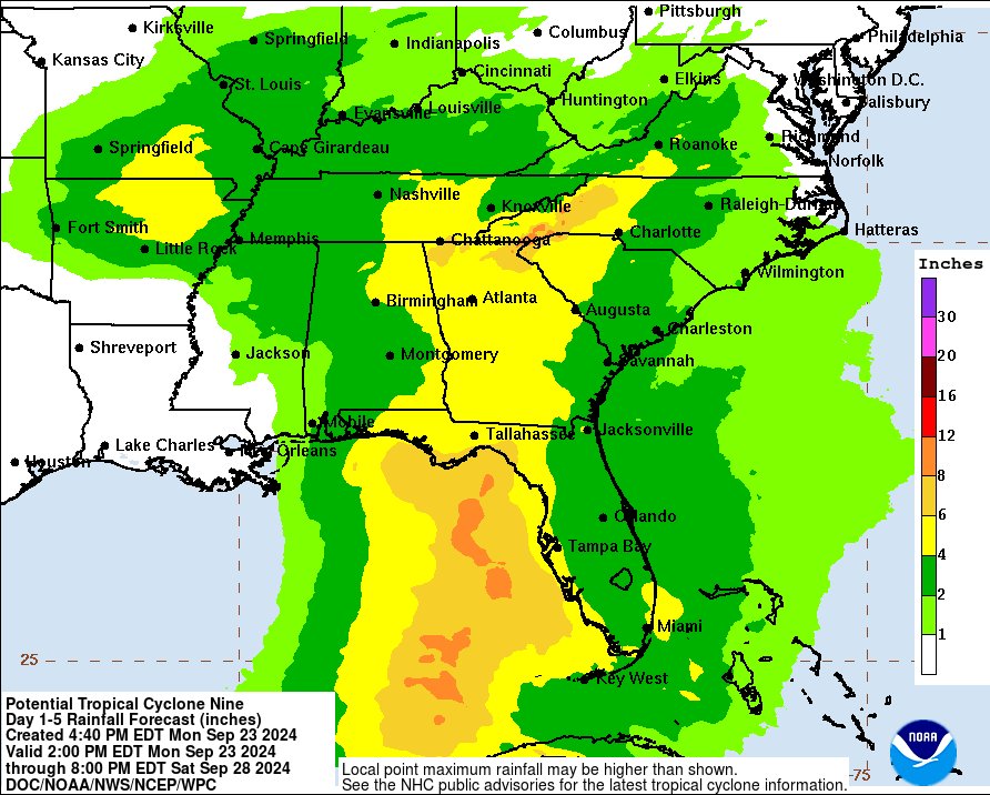
All eyes are on #Helene as the storm strengthens & heads for the Southeast U.S. later this week. The following images depict rainfall totals over the next 5 days & the cumulative Days 1-5 Excessive Rainfall Outlooks. Please visit @NHC_Atlantic for the latest on #Helene.
Heads up! Potential Tropical Cyclone Nine 🌀 is expected to bring significant rainfall and the threat of flash flooding to much of the Southeast later this week. A Moderate Risk of excessive rainfall has been issued for parts of Florida, Alabama, and Georgia on Thursday 9/26. 🌧️
More promising verification data from the CDC for HeatRisk in 2024 (so far). They took a population-weighted average of daily HR against a daily rate of Heat-related ER visits, including those days where it exceeded the 95th percentile of the average daily heat-related ER visits.
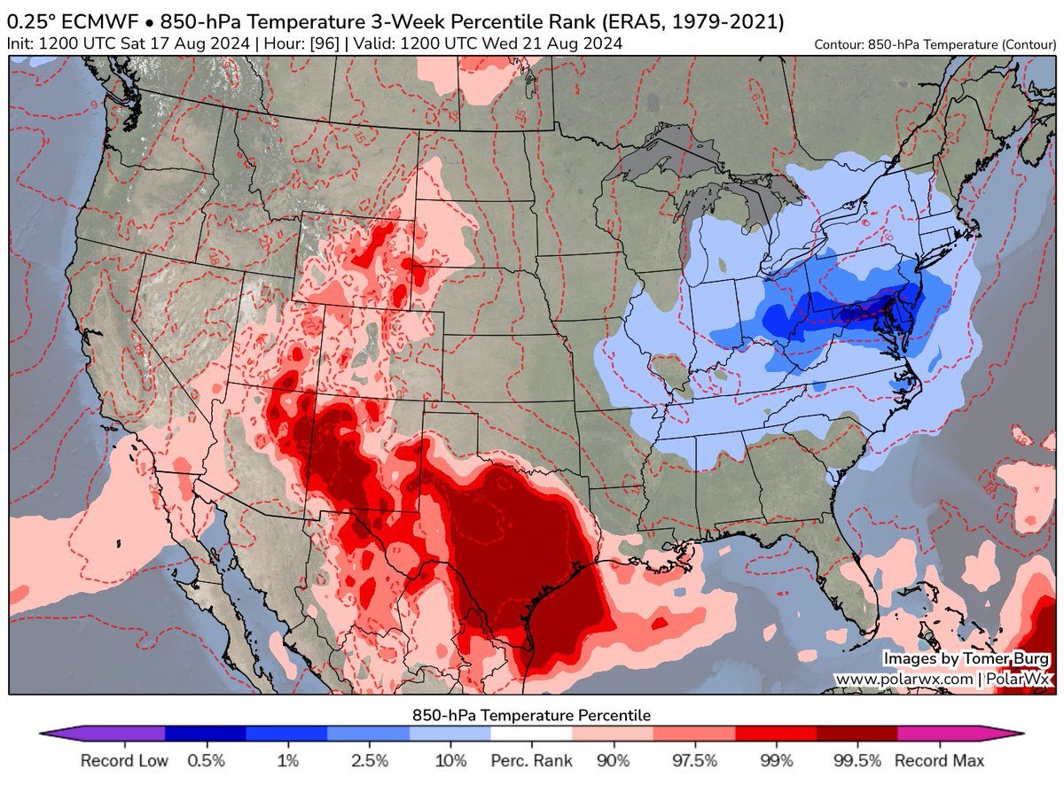
The forecast for this upcoming week isn’t just relief from the summer heat/humidity — the airmass is actually anomalously cool for this time of year, more typical of September:
🌀 Debby is forecast to bring heavy rain to portions of FL and the Southeast this week. Heavy rain will likely result in widespread severe, potentially historic, flash and urban flooding near the Southeast Coast and considerable flash and urban flooding in northern Florida.