Hey @NWSBinghamton, my extended family on Irish Hill Rd in Addison, NY says they had massively heavy debris thrown in multiple directions on their property yesterday. A heavy pergola that was cemented into the ground was split and thrown. (42.1674708, -77.2062435)
@NWSBUFFALO There was a full 8 inches of snow in far southern West Seneca between 5:30pm and 10:30pm when I left. Driving back to South Buffalo was treacherous. Location: near Michael Rd & Union Rd (42.80420N, 78.75313W)
@NWSBUFFALO Thanks, that makes sense. I looked at the current model soundings and didn’t see much of an inversion for it to duct off of over the lake, but I know they aren’t always accurate. I figured you all would have a better idea what it was.
Adding to the #aurora photos on your timeline. These are from Hinsdale, NY south of Buffalo. First photo is from my iPhone, the rest are from my DSLR camera, all unedited. #northernlights
@SamLMontano And while we had a retrofit program to make buildings safe to use as shelters, the $3 million we had per year didn't go far. Since covid, building costs for hurricane mitigation have increased significantly and stayed elevated, so fewer shelter projects have been done per year.
@SamLMontano I worked for years helping to find safe hurricane shelter space with the state of FL, and it is so incredibly difficult. When you have the risk of Cat 5 hurricanes, all of the shelters have to be built well above the standard building code requirements, which is rare & expensive.
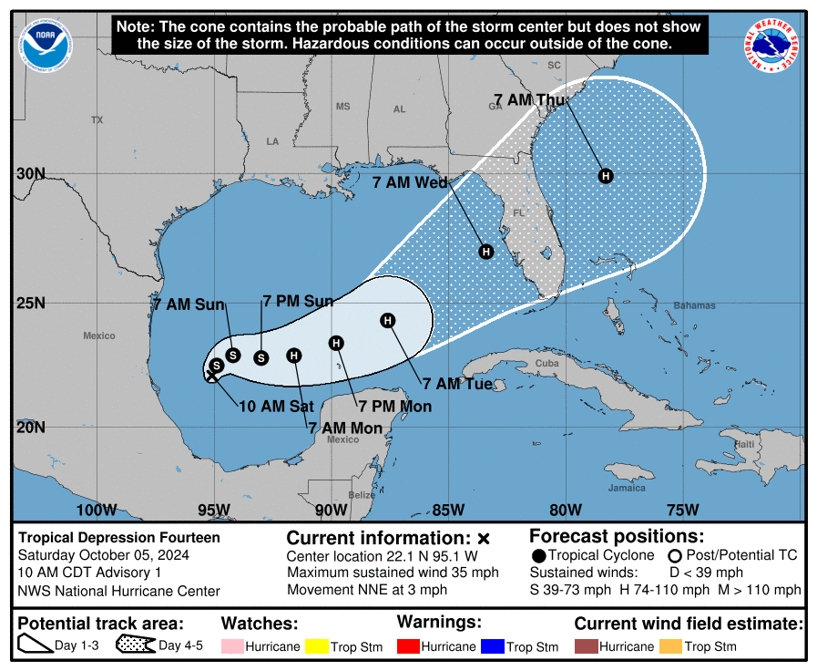
The name #Milton replaced #Michael in the naming list. Michael made landfall as a Cat 5 in the FL Panhandle six years ago Thursday (10/10/2018). Milton is forecast to make landfall in FL on Wednesday (10/9/2024) as a borderline Cat 2/3 hurricane—one day off the name it replaced.
It is truly awful seeing #Helene getting ready to make landfall within miles of where #Idalia made landfall at Cat 3 just 13 months ago. I feel for the people of the Big Bend having to deal with another disaster while still trying to put their lives back together after last year.
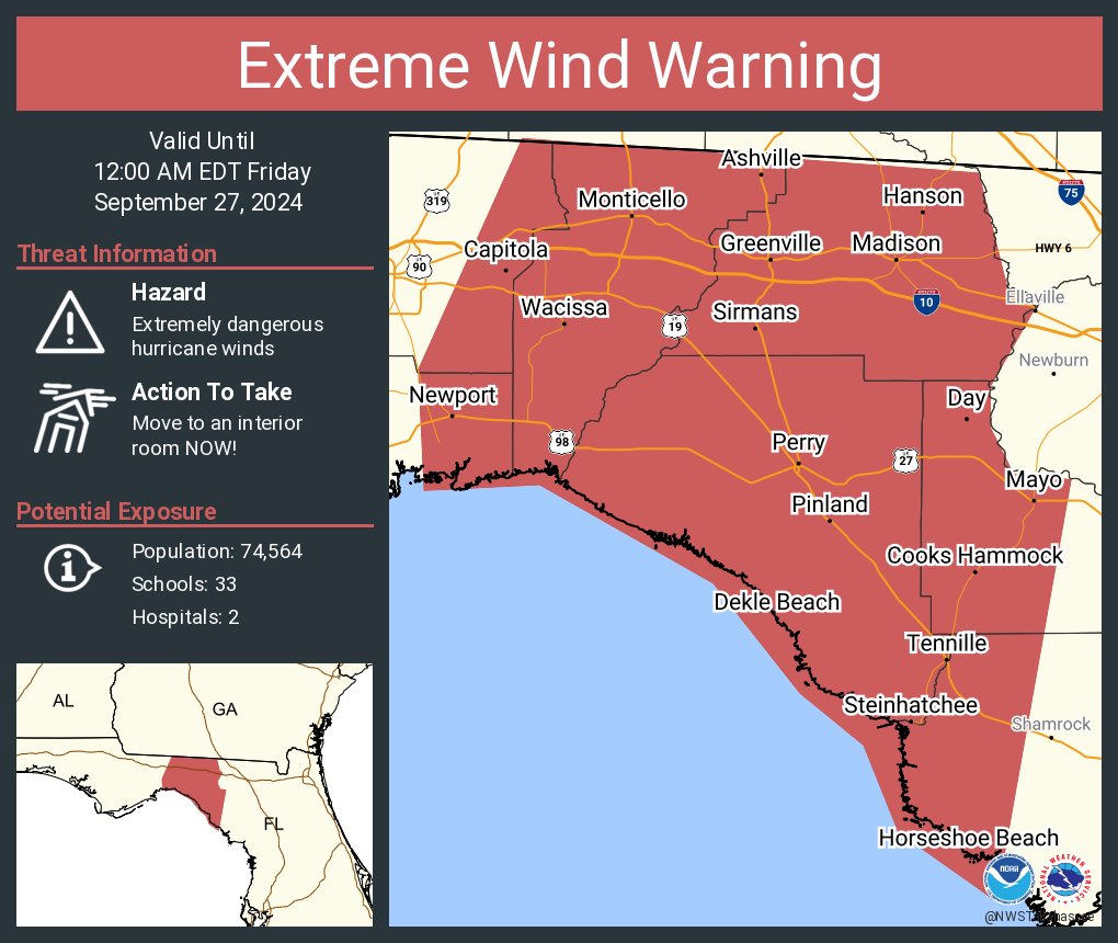
An extreme wind warning is in effect for Perry FL, Madison FL, Monticello FL until 12:00 AM EDT for extremely dangerous hurricane winds. Treat these imminent extreme winds as if a tornado was approaching and move immediately to an interior room or shelter NOW!
@wxkylegillett I think you have the wrong units for your wind graph. Those are the m/s numbers. It peaked at 32.0 m/s sustained with a gust of 48.0m/s. In knots, that was 62.2 & 93.2kts, respectively.
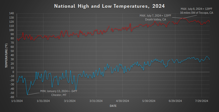
I was bored, so I made a graph of the National High and Low Temperatures for every day so far in 2024.
(Data only includes the contiguous United States)
National High/Low temps for Wednesday August 07, 2024: 119 at Death Valley, CA, Stovepipe Wells, CA; 30 at 9 miles southwest of Big Bay, MI #cawx#cawx#miwx https://t.co/b9vl7CRDVJ
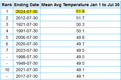
Buffalo, NY has had a very hot year so far. We are set to break the record for the hottest January to July average temperature in the 150 years of records in Buffalo. With a month left, we have already had more 80°F days this summer (40) than we had all of last summer (35)*
Radar screenshot with my location and radar timestamp just before the hail started. Largest single hailstone I saw was around penny sized (3/4”), but most were in the 1/4”-1/2” range. @NWSBUFFALO
2024 #Beryl feels a lot like 2012 Beryl. Both had a broad, almost subtropical wind field. Both had very favorable environments for strengthening but ended up battling dry air in the core. Both had winds around 55-60 knots.