This is exactly why hourly reanalysis matters.
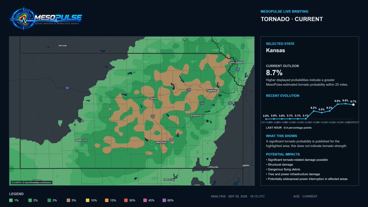
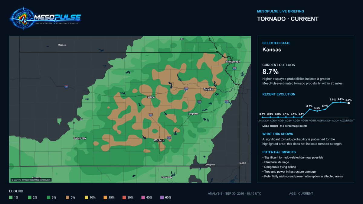
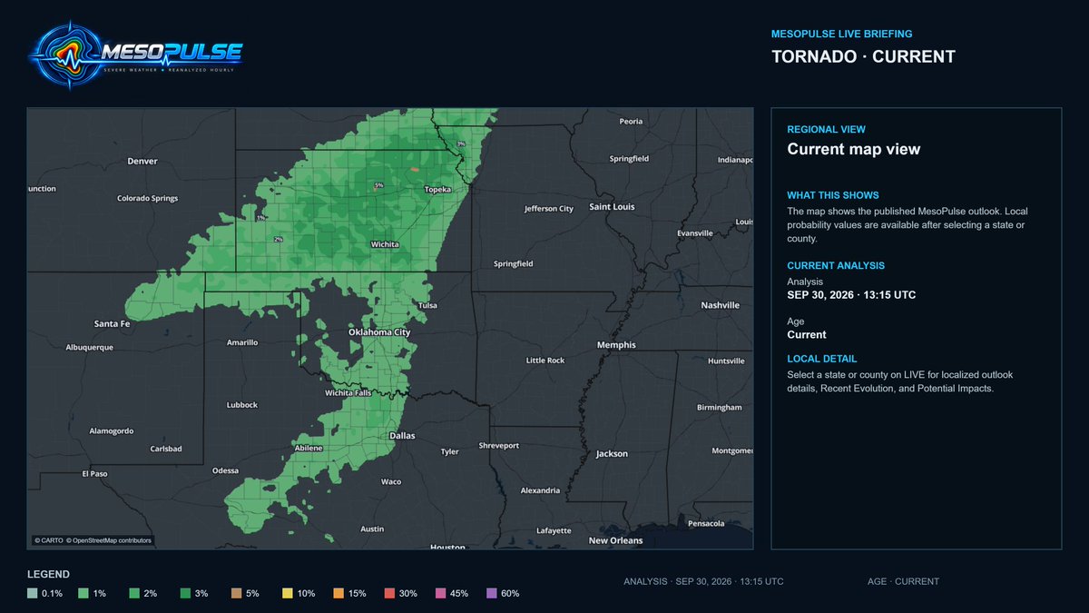
Despite competing signals, supportive wind dynamics yet limited heating, the MesoPulse Kansas tornado signal climbed from 3.1% to 8.7% in six hours.
The atmosphere evolves. The outlook should too.
https://t.co/USN4yAf7C0 #KSwx #tornado
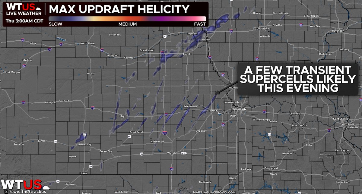
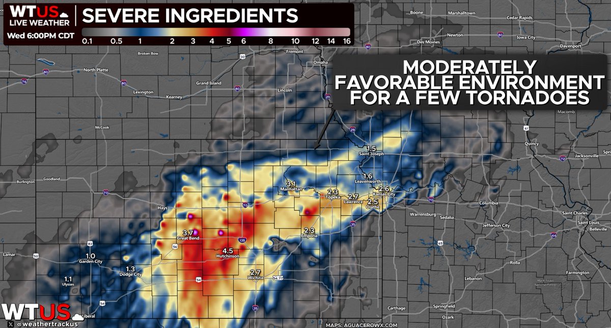
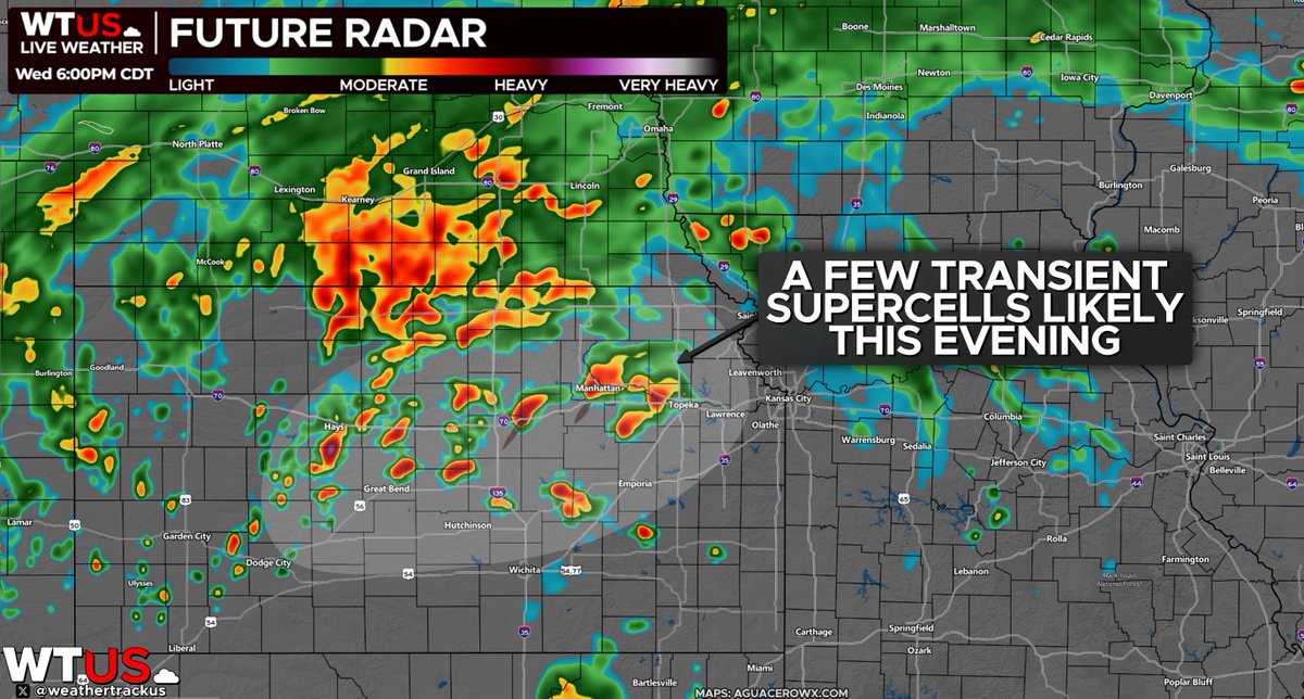
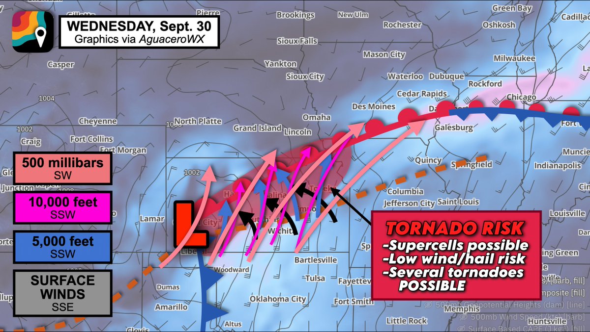
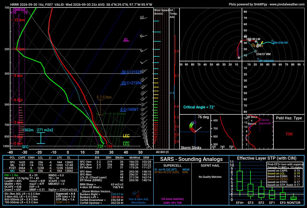
We have the wind dynamics to support a few tornadoes in Kansas today... BUT there are a couple limiting factors.
1.) It's cloudy. That cuts back on daytime heating, reducing storm fuel.
2.) Storms will be tiny. Moist low-levels and low cloud bases will lead to small updrafts.
Ahead of the 4–8 p.m. window, MesoPulse has climbed from 3.1% six hours ago to 8.7% now, after reaching 9.0% last hour.
The 5% corridor now covers much of central and eastern Kansas.
Probability, not intensity.
https://t.co/J4anfDHK9O #KSwx
A few tornadoes remain likely in Kansas between 4-8 p.m. local time.
We could also see pockets of flooding in Kansas, Nebraska and Iowa, with up to 5 inches of rain possible:
MesoPulse agrees with the upward trend.
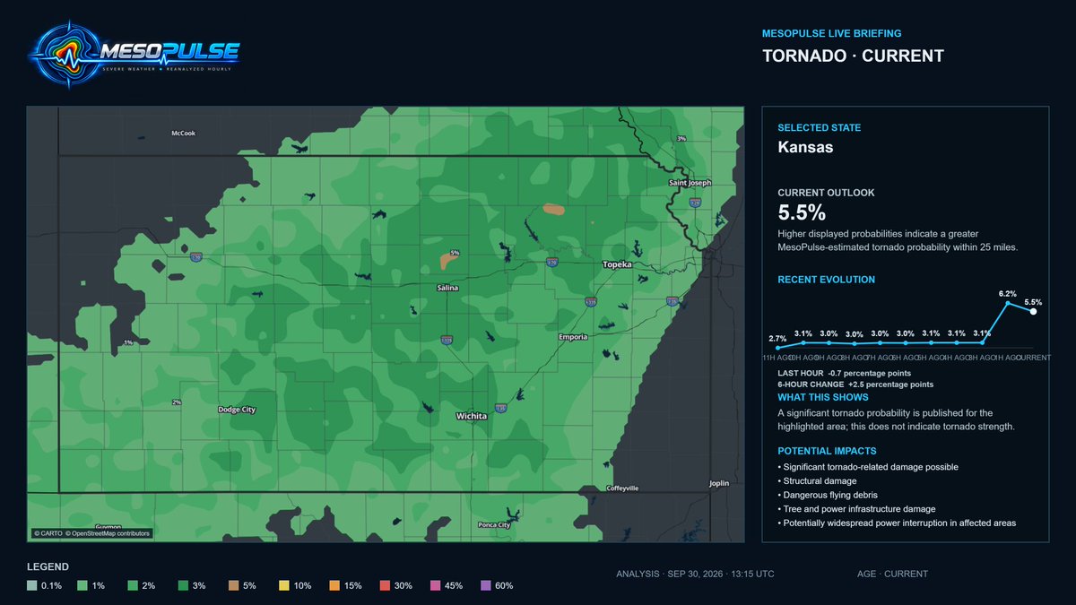
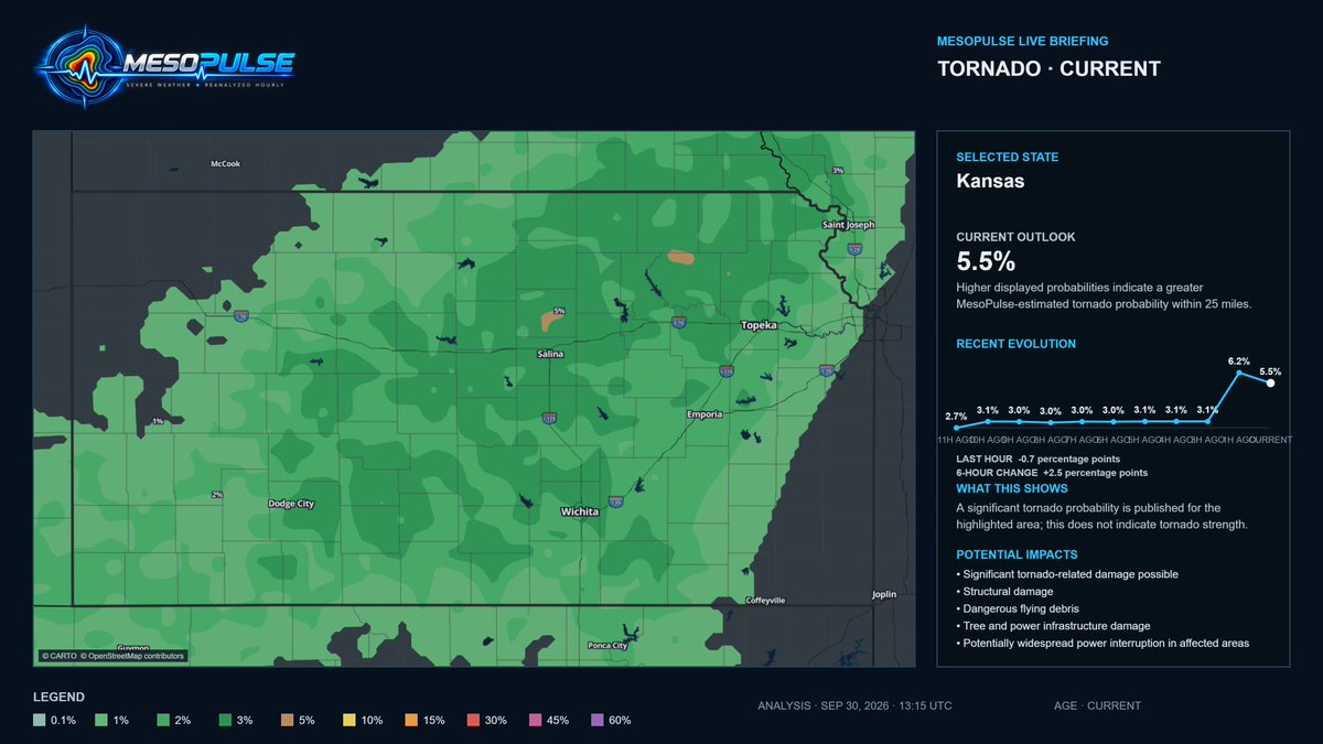
The Kansas tornado signal climbed from 3.1% six hours ago to 8.7% now, peaking at 9.0% last hour. The 5% corridor has expanded across much of central and eastern Kansas.
Probability, not intensity.
https://t.co/J4anfDHK9O #KSwx#NEwx
UPDATE:
The tornado threat looks to be a little bit higher than predicted this morning, with perhaps a few to several tornadoes possible across parts of Kansas and far Southern Nebraska this evening.
While there is still some lingering uncertainty regarding destabilization, and lapse rates, strong wind shear, and a mostly discrete supercellular storm mode should still support the threat for at least a few tornadoes.
A strong tornado can't entirely be ruled out, but most, if not, all tornadoes that occur today will likely be weak and short-lived.
⚠️ Kansas #Tornado Signal Continues To Increase!
MesoPulse is now 8.7% across Kansas, up from 3.1% six hours ago. The 5% corridor has expanded across central and eastern Kansas, including Salina, Wichita, Topeka and Emporia.
This is probability, not intensity.
Follow for more.
https://t.co/USN4yAezMs #KSwx
@weathertrackus Good agreement this morning.
MesoPulse’s 12:15 UTC cycle placed Kansas at 6.2% before the new SPC outlook was issued. The 13:15 update remains elevated at 5.5%, with a focused 5% pocket in north-central Kansas.
Updated hourly: https://t.co/J4anfDHK9O #KSwx#NEwx
⚠️ OUTLOOKS CONVERGE ON KANSAS
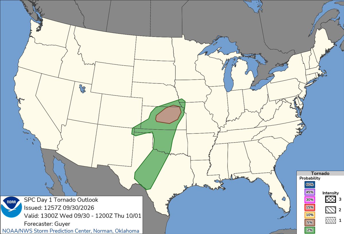
SPC raised today’s tornado outlook to 5% across parts of Kansas and southern Nebraska matching the focused 5% corridor MesoPulse highlights this morning.
A few tornadoes are possible later today.
Reanalyzed hourly: https://t.co/USN4yAezMs #KSwx #NEwx
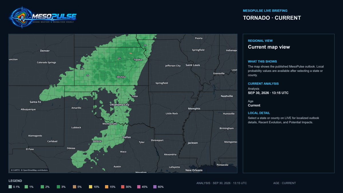
Lower tornado probabilities extend southwest through Oklahoma and Texas, with additional low-end potential across northern New Mexico and southeastern Colorado.
MesoPulse probabilities are within 25 miles and do not indicate tornado strength. #OKwx#TXwx
⚠️ TORNADO CORRIDOR SHIFTS NORTHEAST
A 5% focus sits over north central Kansas within a broader 1 to 3% corridor. Later today, risk shifts toward SE Nebraska, SW Iowa and NW Missouri.
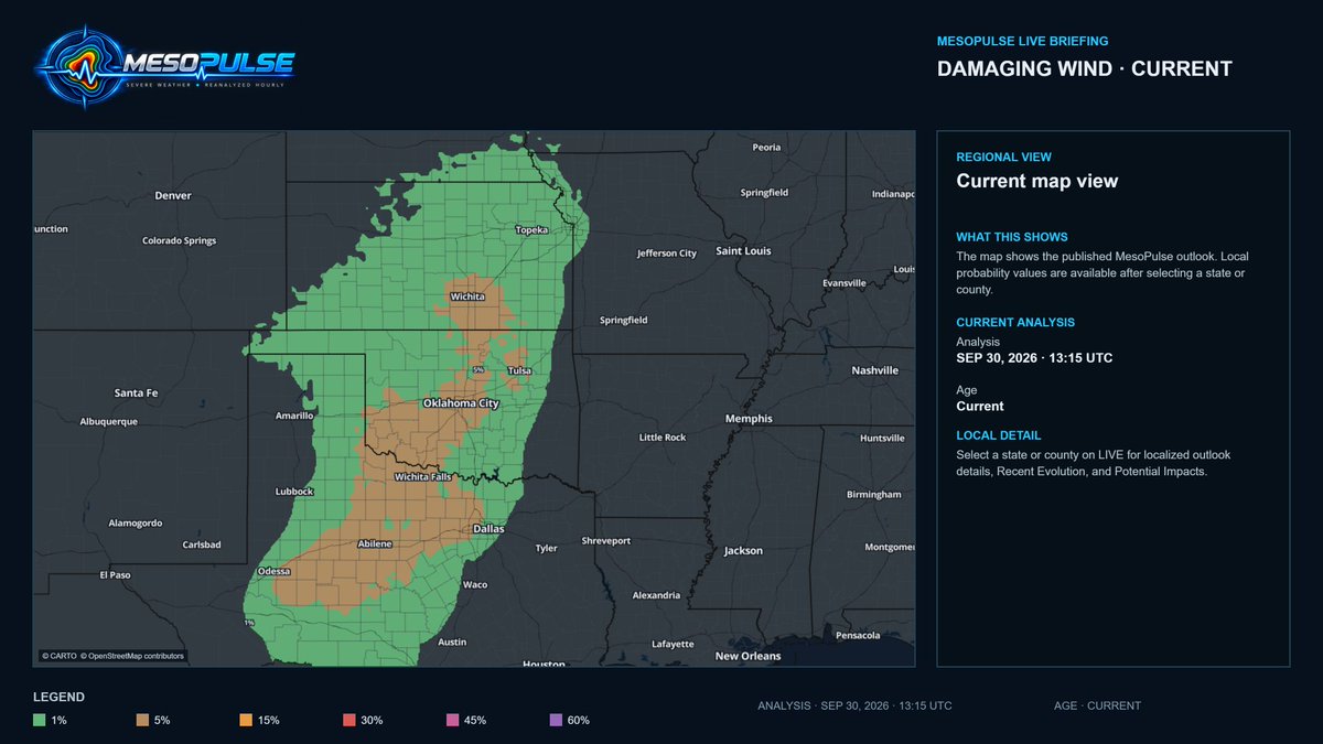
A few tornadoes and damaging winds are possible.
Reanalyzed hourly: https://t.co/USN4yAezMs #KSwx #NEwx
@therobdale Cleaning up the 0.1% from the outlooks yet when when the numbers are increasing, yes some noise, yet that is where we are seeing tornadoes occur greater than 80%. Anything below 3% is definitely more noisier that the larger percentages. Thanks for the feedback
⚠️ MESOPULSE UPDATE
This is why hourly MesoPulse outlooks matter...
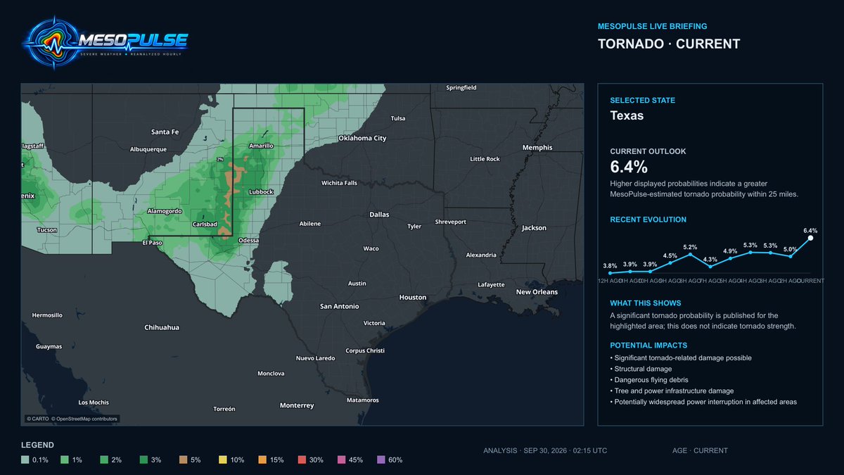
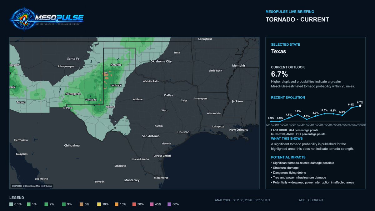
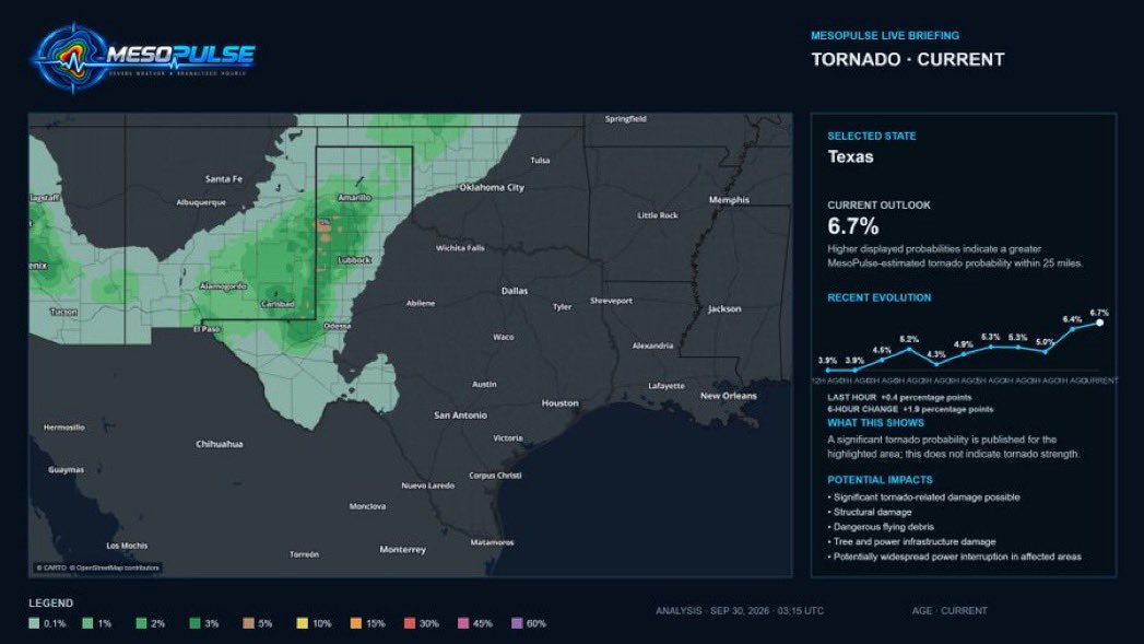
The tornado threat has shifted ENE into the Texas Panhandle.
10:15 PM CDT analysis: Texas 6.7%, up 0.4 points in one hour and 1.9 in six hours. Greatest focus: Lubbock to Amarillo.
Probability is within 25 miles not tornado strength. Follow warnings. #TXwx
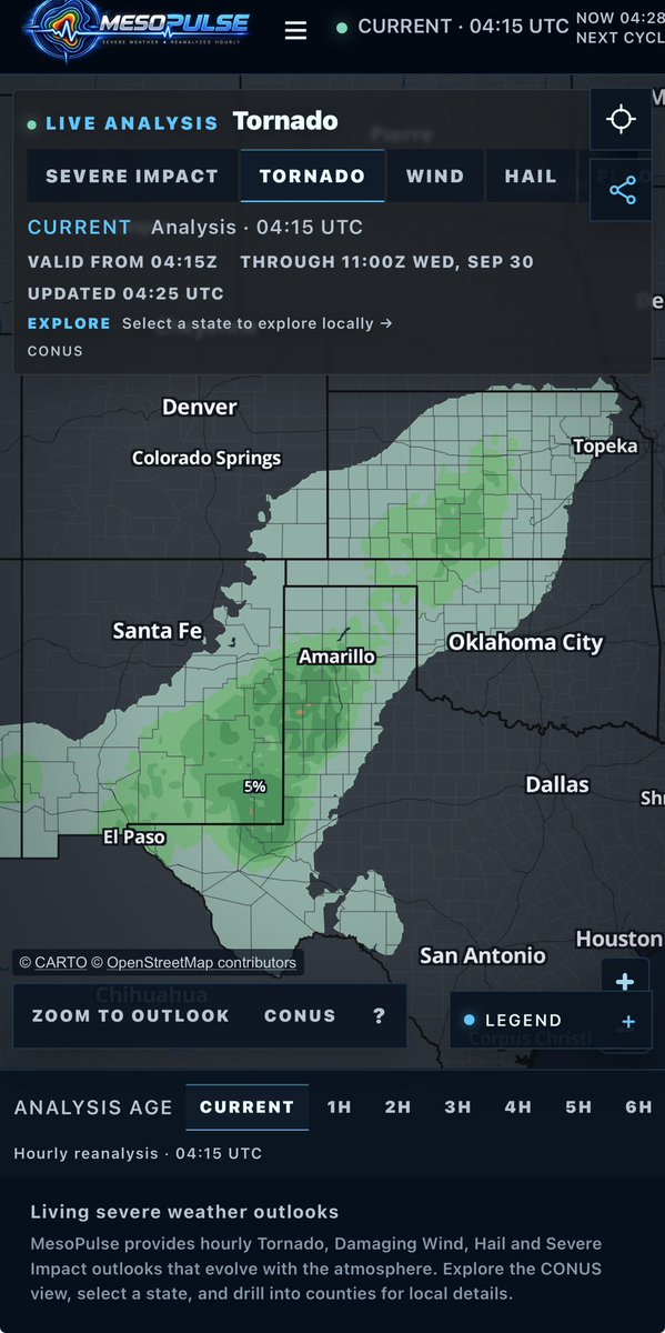
A 5% tornado risk region remains active across parts of the Texas Panhandle (near Amarillo), eastern New Mexico, western Oklahoma, eastern Colorado, and western Kansas.
Track living severe weather outlooks hourly at https://t.co/ueU32QXpsu
Stay weather aware through early Wednesday morning!
#MesoPulse #SevereWx #Tornado #TXwx #OKwx #NMwx #COwx #KSwx
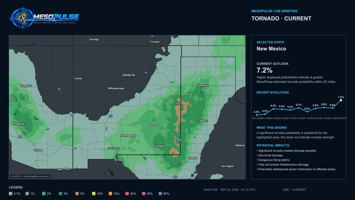
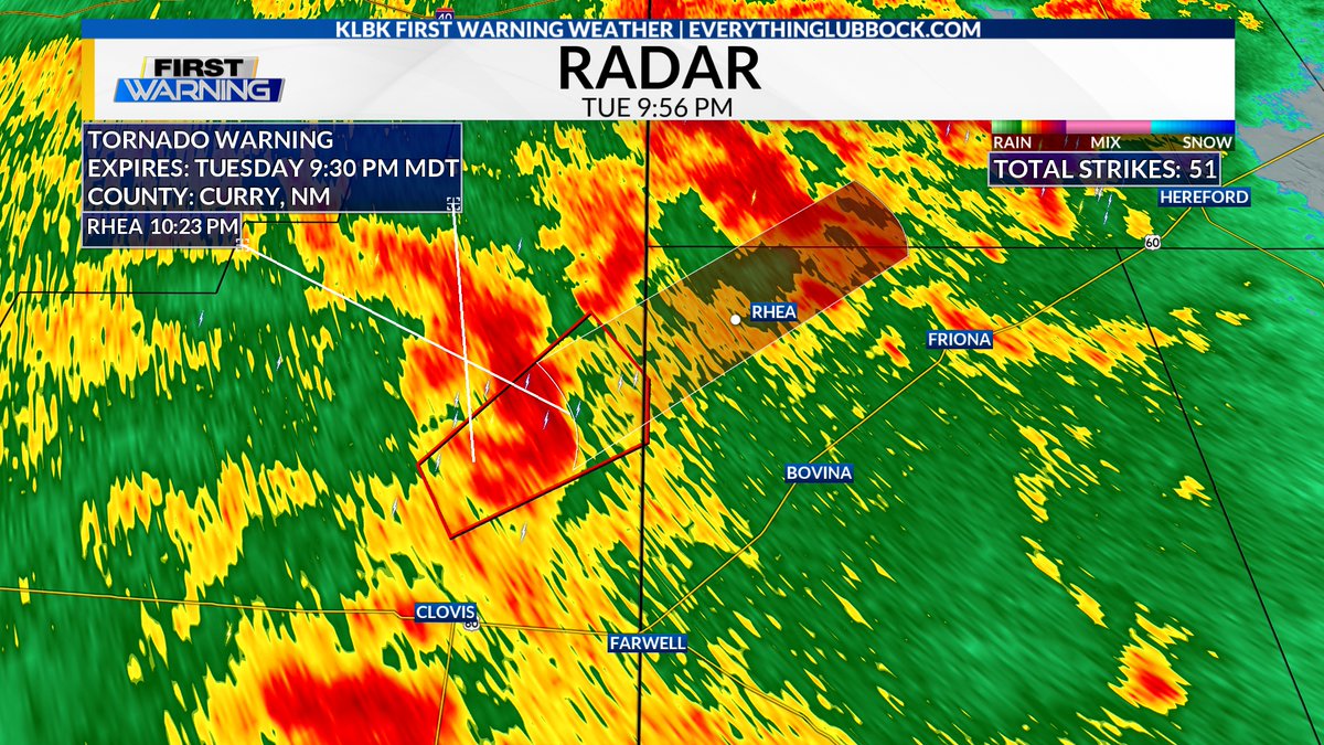
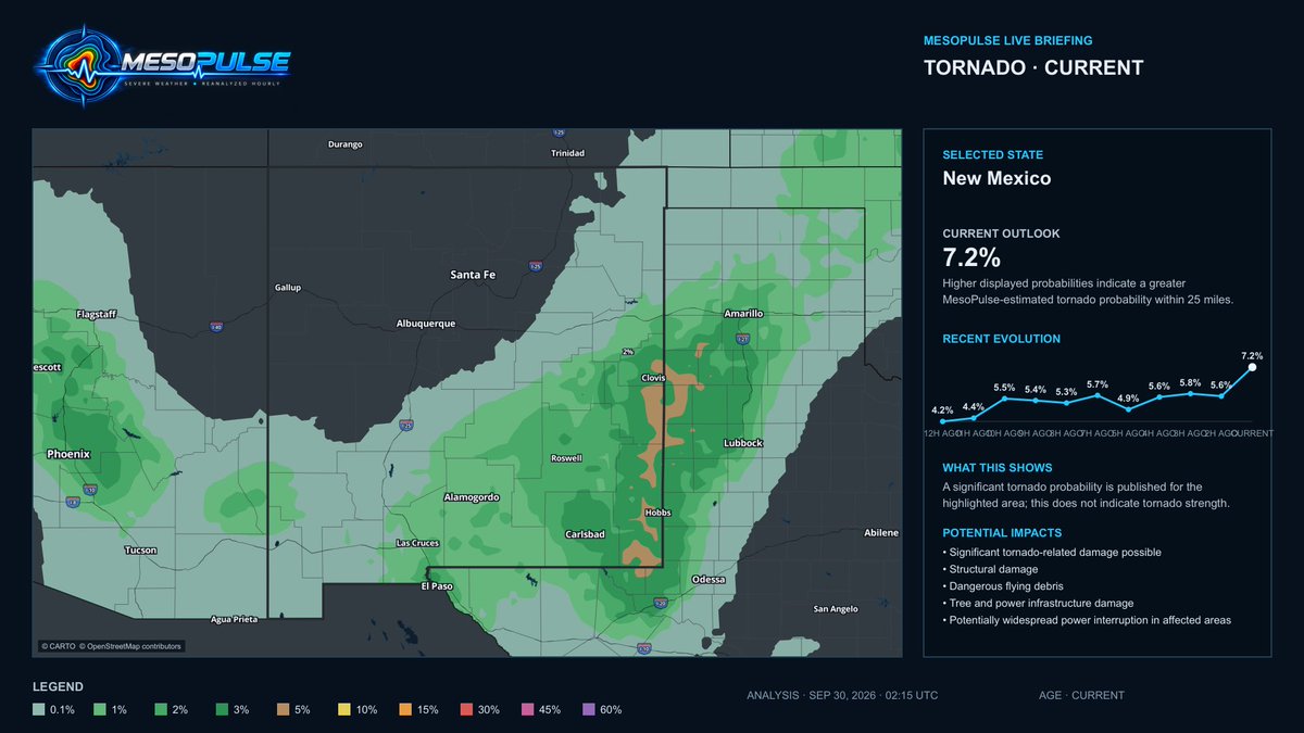
MesoPulse highlighted the Clovis corridor throughout the day.
Tonight, a tornado warning was issued after a potential tornado was identified 7 miles north of Clovis, moving NE.
This is what a living, hourly outlook is built to do, tracking the environment as it evolves. #NMwx
8:56 PM MDT 09/29/2026 - A Tornado Warning has been issued for portions of Curry County, NM until 9:30 PM MDT. A potential tornado was located 7 miles north of Clovis, tracking NE @ 25 MPH. Seek shelter if you are in the path of this storm. #KLBK#NMwx#SevereWeather#Tornado
@MatthewCappucci@MyRadarWX 👀 NEXT UP: KANSAS
Attention turns to Kansas Wednesday, where the environment may support a few tornadoes—especially near the I-70 corridor.
MesoPulse will reanalyze the setup hourly as the potential corridor and timing become clearer.
https://t.co/J4anfDIhZm #KSwx
@JayLesykWX We’ve been highlighting Clovis all day.
The signal remained persistent across eastern New Mexico, and tonight the tornado threat materialized near the city.
This is why MesoPulse updates hourly to track the evolving environment before storms arrive. #NMwx
@F5Video@StrmchsrHunterF@NWSAmarillo Another clear visual of the tornado near Amarillo earlier tonight.
The 10:15 PM MesoPulse analysis now shows the broader tornado corridor shifting ENE across the Texas Panhandle.
The threat continues follow warnings and shelter immediately if alerted. #TXwx
This is the tornado southwest of Amarillo around 9:37 PM CDT.
Since then, the 10:15 PM MesoPulse analysis shows the tornado threat shifting ENE through the Texas Panhandle, with the statewide peak increasing to 6.7%.
Stay alert and follow all warnings tonight. #TXwx