‼Red Flag Warning Issued 5.16.2026‼
Another windy, dry day is forecast. @ NWS issued a RFW today until 9 pm. Northwest winds of 10 -25 mph, gusting to 25 - 30 mph, with RHs dropping below 25% are forecast. 👀Spot a Wildfire🔥? ☎ CALL 911 to REPORT from a safe location.
‼Red Flag Warning Issued 5.15.2026📷Another warm, dry & windy day is in store for today.
@NWS
issued a Red Flag Warning for counties in NE, NW & SW MN through this evening due to strong gusty winds and low RH. - 📷
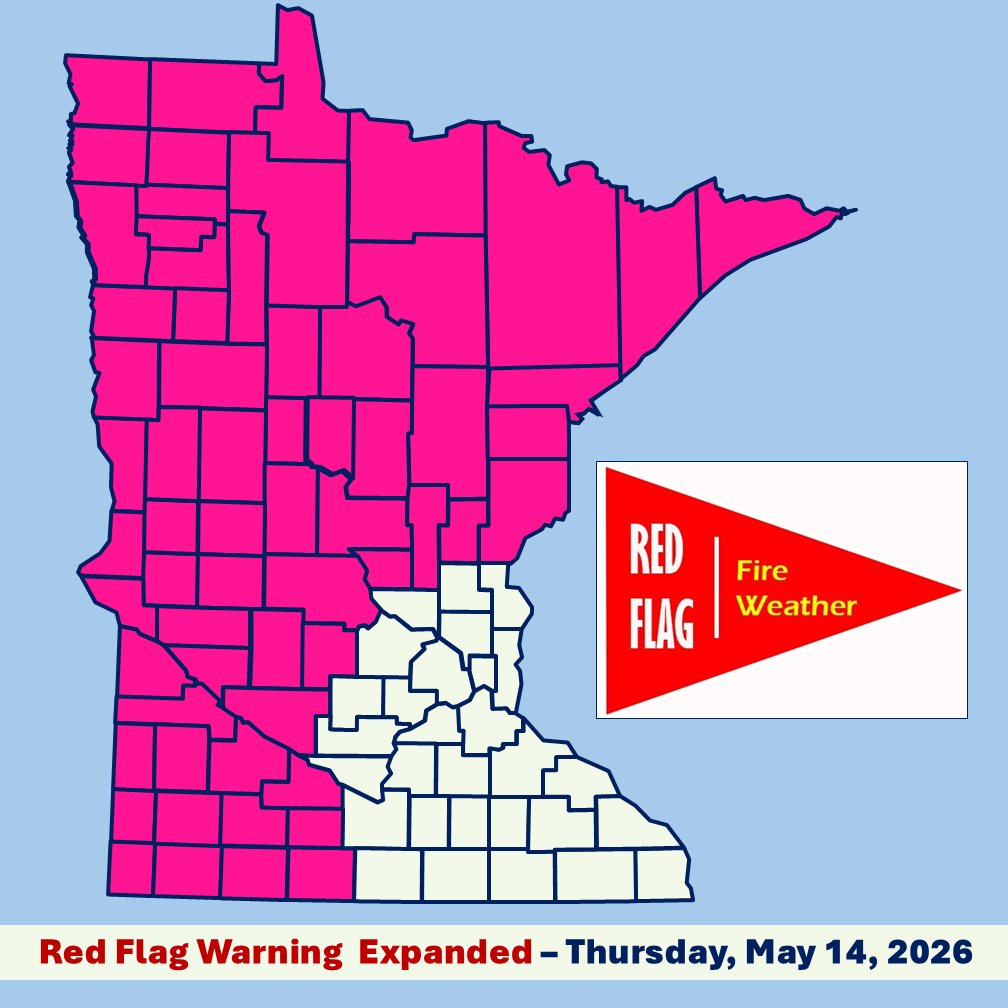
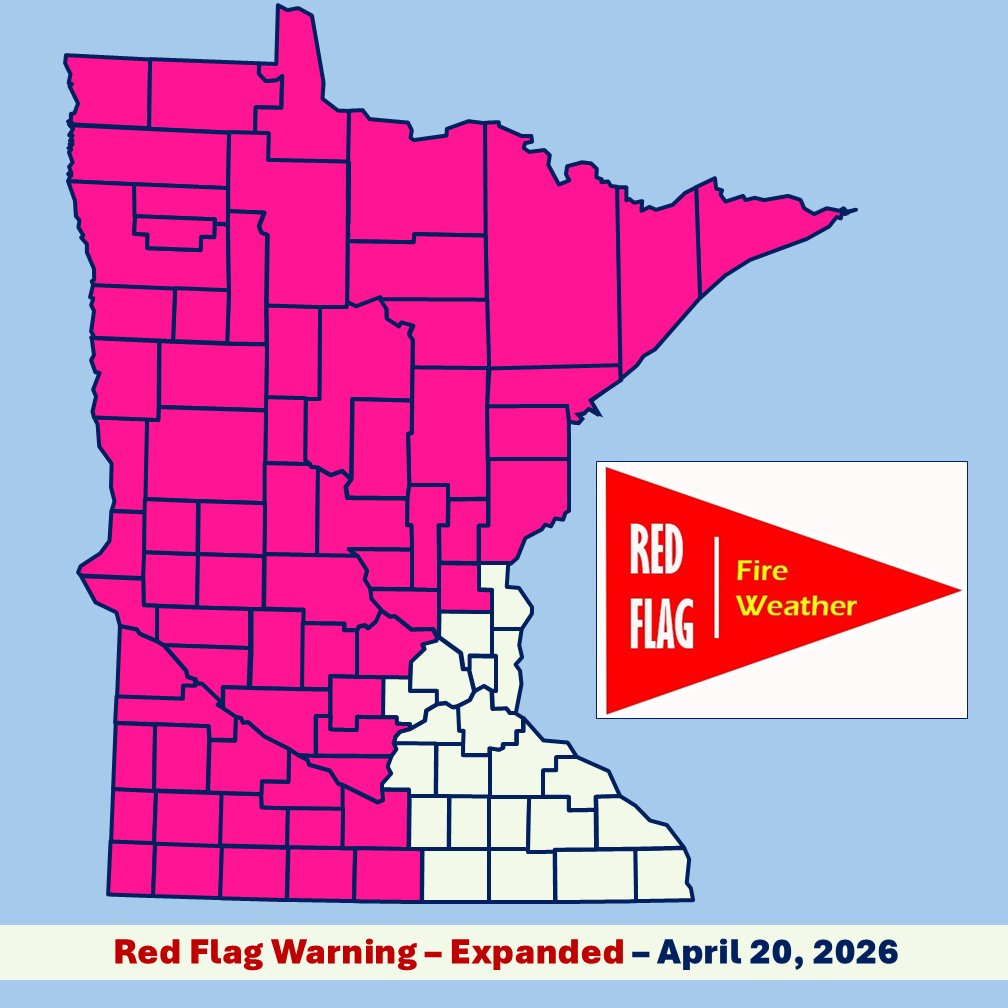
‼Red Flag Warning Expanded‼
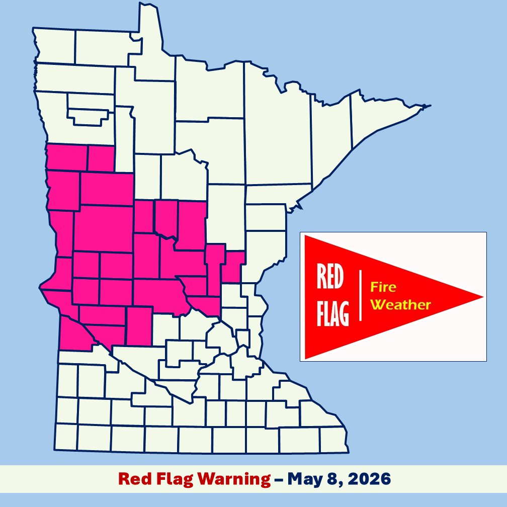
@ NWS expanded the RFW in effect today to NE, NW & SW Minn., through this evening. Strong winds of 25-40 mph, gusting to 45-50 mph, with RHs dropping below 25% are forecast. 👀Spot a 🔥? ☎911 to REPORT from a safe location.
https://t.co/sRpo8fvOIU
📷RED FLAG WARNING ISSUED📷
@NWS issued a RFW today for SW, W. Central & NW MN. Strong winds of 25-40 mph, gusting to 45-50 mph, with RHs dropping below 25% are forecast. A Fire Weather Watch remains in effect for Friday.
More fire weather information https://t.co/985o0L8df0.
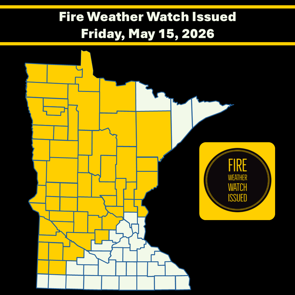
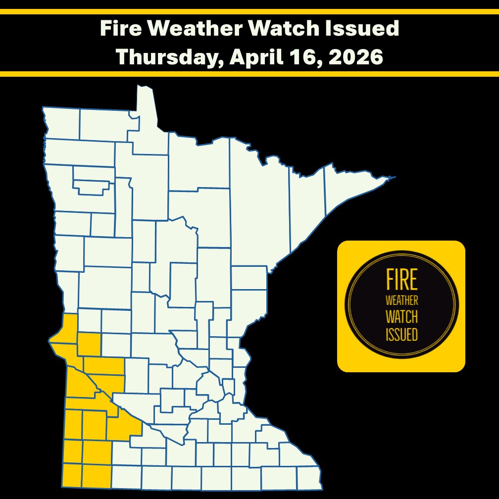
⚠️ Fire Weather Watch Issued 📷Dry, warm & windy conditions are forecast for the next couple of day. @ NWS issued a FWW for Friday (5.15.26) a.m.-p.m. for W.Cent. & NW MN due to windy conditions & low RH. 📷
‼RED FLAG WARNING ISSUED‼
@NWS has issued a RFW today 11am - until 9pm for West & Central MN. NW winds 25-35 mph gusting to 40-45 mph & RH below 25% - are forecast. Fire danger remains high to very high throughout MN today. https://t.co/n1zSDsNZhe
‼RED FLAG WARNING ISSUED‼
@NWS has issued a RFW in effect now-7 pm. for S. Cass, Crow Wing, Aitkin, Carlton, S. St. Louis & Pine counties. Critical fire weather is forecast w/NW winds 15-20 mph gusting up to 30 mph and RH dropping around 20% this p.m. https://t.co/985o0L7Fps.
‼RED FLAG WARNING‼
@NWS has issued a RFW today 1 pm to 6-8 pm for Central & W Cent. MN. Critical fire weather is forecast with W/NW winds gusting up to 35 mph & RHs around 20%.🔥Wildfires will spread rapidly in RFW conditions.🔥
More info @ https://t.co/985o0L7Fps.
‼RED FLAG WARNING Issued‼
@NWS has issued a RFW today for western MN from 1pm - 7pm. Critical fire weather w/ winds gusting 35-45 mph & RHs dropping to around 20% is forecast. 🔥 Wildfires will spread rapidly under these conditions. More info at https://t.co/985o0L8df0.
‼RED FLAG WARNING Issued‼
@NWS expanded the RFW area effective from noon-8pm today. Critical fire weather is forecast with So. winds gusting to 35-40 mph & RHs as low as 20%.
🚫NOT A BURN DAY🚫
🔥A wildfire that sparks will spread rapidly.
More info @ https://t.co/985o0L8df0
‼RED FLAG WARNING & Fire Weather Watch Issued‼
@NWS issued a RFW for SW MN tomorrow Noon-8pm. Critical fire weather forecast w/south winds gusting 35-40 mph & low RHs. 🚫NOT A BURN DAY🚫
⚠ FWW ⚠ Also in effect for a broader area of MN.
More @ https://t.co/985o0L7Fps.
‼RED FLAG WARNING Issued‼
@NWS issued a RFW for most of MN today from 10am - 8pm. Critical fire weather is forecast with southerly winds gusting 30-40 mph & RH's 20-25%.🚫 NOT A BURN DAY🚫 Call 911 to report a wildfire. More weather info at https://t.co/985o0L8df0.
Updated Map
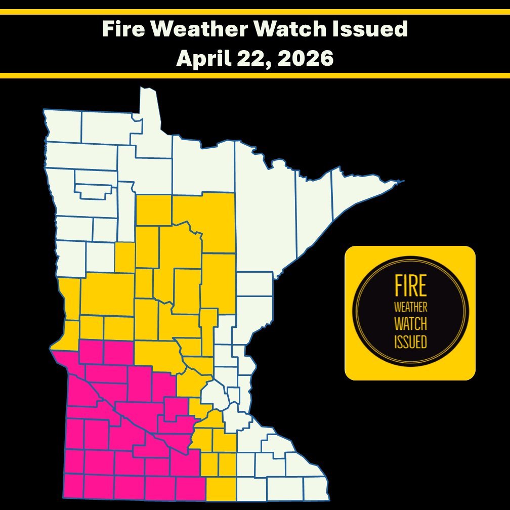
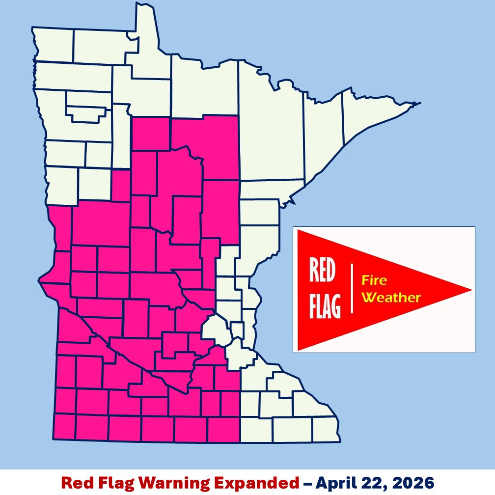
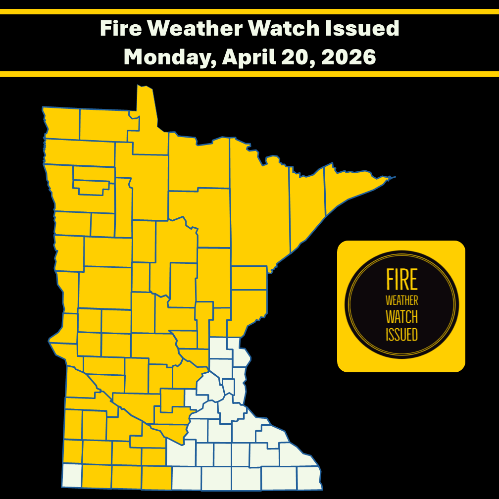
⚠️ Fire Weather Watch 4/20/26📷The next couple of days are forecast to be dry & sunny across MN. Gusty winds & low RHs for a large area of MN will result in critical fire weather conditions tomorrow, prompting a FWW the A.M. & P.M. More info @ https://t.co/2f22NcvqWS.
‼RED FLAG WARNING ‼
@NWS issued a RFW for SW & W. Central MN today starting @ 11am - until 8 pm. Critical fire weather is forecast with winds gusting up to 30-40 mph & RH dropping as low as 13%.
🚫 NOT A BURN DAY 🚫
More weather info @ https://t.co/985o0L8df0.
⚠️Heads Up SW & W. Cent. MN! @NWS issued a Fire Weather Watch for tomorrow p.m. Critical fire weather resulting from low RHs and windy conditions are forecast. Stay alert! Critical fire weather can lead to potential red flag warnings. Weather updates https://t.co/985o0L7Fps.
Stop and think before flying a drone toward a wildfire. Consider the view from the firefighting pilot's seat. If you think it’s hard to spot a drone from this point of view, imagine being closer to the treetops and thick smoke impairing your view.
Remember! If you fly, we can't!
!!RED FLAG WARNING!! @NWS issued a RFW for many counties in MN on 3.28.26 from 10am-7pm. SW winds gusting to 35-45 mph & low RH will lead to critical fire wx. !!NOT A BURN DAY!! Wildfires will spread rapidly in these conditions. More info at: https://t.co/985o0L7Fps
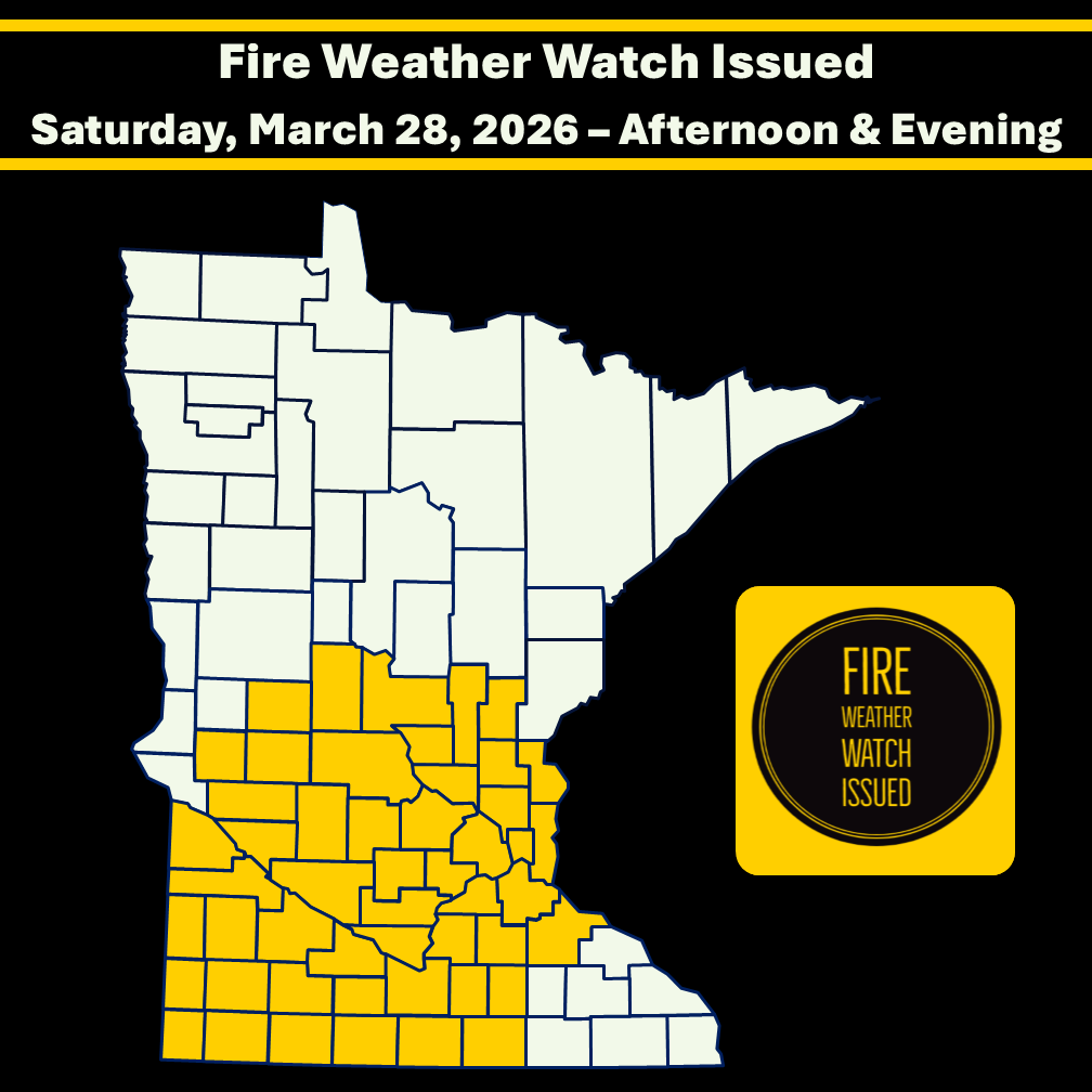
⚠️Fire Weather Watch⚠️
@NWS issued a FWW for Cent & So. MN - Sat, Mar. 28 afternoon & eve.
Stay alert for warm/dry/windy conditions that may lead to critical fire Wx. !Not a burn day! Be safe & check that any recent burning is out cold.
More info @ https://t.co/985o0L7Fps
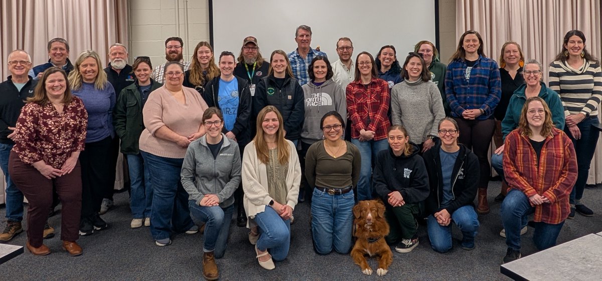
Last week, 23 developing Public Information Officers (PIOs) attended the NWCG S-203 course @ the MN Interagency Fire Center in Grand Rapids, MN.
The week-long course guided students through the important work the PIO oversees within the incident command system. Great work, PIOs!
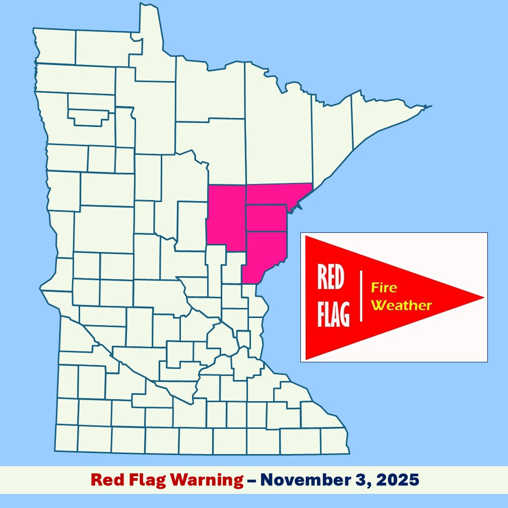
‼ RED FLAG WARNING ‼ today in NE MN 11am-5 pm. Critical fire weather w/RH dropping to 20-25% and gusty west winds up to 30 mph forecast.
Elevated fire wx is expected throughout northern MN today. ❌TODAY IS NOT A BURN DAY!!! ❌More wx info at https://t.co/985o0L8df0.