📡Radar Update [6:20AM] - Good Morning Bay Area, looks like a wet commute this morning as a few showers continue to sweep across the region. Steadier rainfall is lurking offshore and will move in later today. It's also pretty windy out there too, esp in the mts. #cawx
If you live out west check this map. This is not just one warning, this is a whole system hitting 4 states at once.
🩷 California is getting hit the hardest in the Sierra. That pink is Winter Storm Warning from around Susanville down through Reno and Carson City and all the way through Mammoth Lakes to Bishop and Lone Pine. That means heavy snow, low visibility and chain controls likely on the passes.
🟨 That gold strip along the Sierra front is High Wind Warning. Gusts will be strong enough to push cars around, especially high profile vehicles.
🟫 That big tan area is Wind Advisory. It covers a ton of northern Nevada and northeast California. Winnemucca, Elko, Battle Mountain, Ely, Fallon, all in it. Gusty, dusty, tough driving, especially on I 80.
🟩 That green along the California coast is Flood Watch. And that 🩵 light blue along the southern coast is the coastal flood and high surf side of this. Rain plus wind plus surf all at once.
🟦 That blue in the Sierra around Mammoth and Bishop is the Winter Weather Advisory side, so a little less than the pink warning but still messy travel.
Nevada is basically all wind except for Reno and Carson City where it flips to winter. Utah is getting clipped by the same wind in the west around Wendover and Delta, but not much snow on this map for Utah. Arizona is the quiet one here, outside of a small spot near Gila Bend most of AZ is clear.
Bottom line, if you are in the Sierra do not travel unless you have to. If you are in northern Nevada or northeast California secure loose stuff and expect power flickers from the wind. If you are on the CA coast watch for localized flooding and high surf.
Drop your city in the comments and I will tell you what color you are in.
#CaliforniaWeather #NevadaWeather #UtahWeather #ArizonaWeather #WinterStormWarning #WindAdvisory #SierraNevada #Reno #MammothLakes #Bishop #LakeTahoe #WeatherUpdate
Quiet this morning with line of showers and embedded storms late this morn into aftn. Some storms could produce gusty winds, heavy rain, and small hail. Timing for Metro between 2-4pm. #azwx
A system moving through the region will be accompanied by gusty winds, mountain snow, and valley rain. Precipitation will expand across the area this afternoon and tonight, lingering into Saturday morning. Plan ahead, especially if you have any outdoor plans!
#cawx#nvwx#azwx
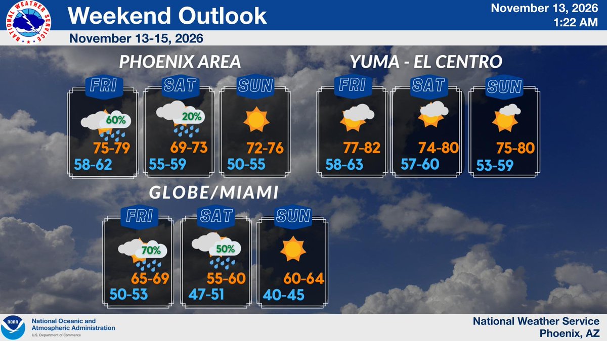
Look for a few showers moving into south-central Arizona this afternoon as temperatures cool several degrees from readings the past few days. Gradual clearing through the weekend will result in a beautiful Sunday.
Remember folks, gusty conditions are strong enough to bring down power lines and trees. Reports are already coming in from NW California. Please secure loose items and seek shelter if you are near trees or power lines, especially if winds increase in your area. #cawx#california
A powerful swell will bring 30 to 40 foot breaking waves to northwest California beaches starting Friday afternoon through Saturday morning. Powerful waves can rush far up beaches, wash over rocks & jetties, and erode at coastal bluffs. Stay back from the ocean this weekend.
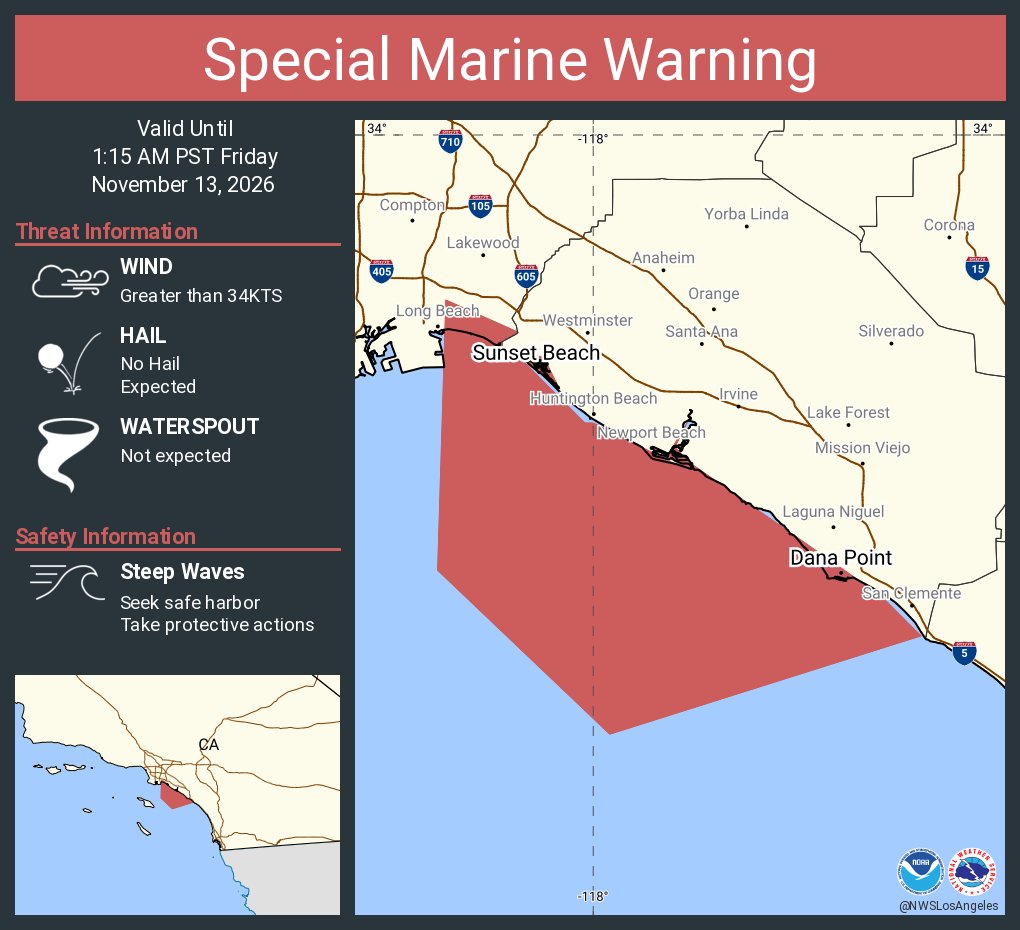
Special Marine Warning including the Waters from San Mateo point to the Mexican Border Extending 10 to 60 nm out including San Clemente Island and Coastal Waters from San Mateo Point to the Mexican Border and out to 10 nm until 4:30 AM PST
Radar returns show pre-frontal showers across the coastal regions which continue overnight. Main rain band & strong winds expected to come through later this morning into the afternoon. Post-frontal showers continue into Saturday morning. #CAwx
Scattered showers across several areas, with some moving toward the coast. Thunderstorms are possible in the southern Bight and northwest California. Stay weather aware overnight. #cawx#california
Rain chances return across northern and central Arizona today and tonight, with the best odds (40–65%) along and south of the Mogollon Rim. Drier weather holds across northeast AZ. 🌧️
Along the coast and inland, there is potential for flooding, mudslides further north, and runoff or debris flow. Please stay alert to weather conditions and report any hazards you encounter. #cawx#california
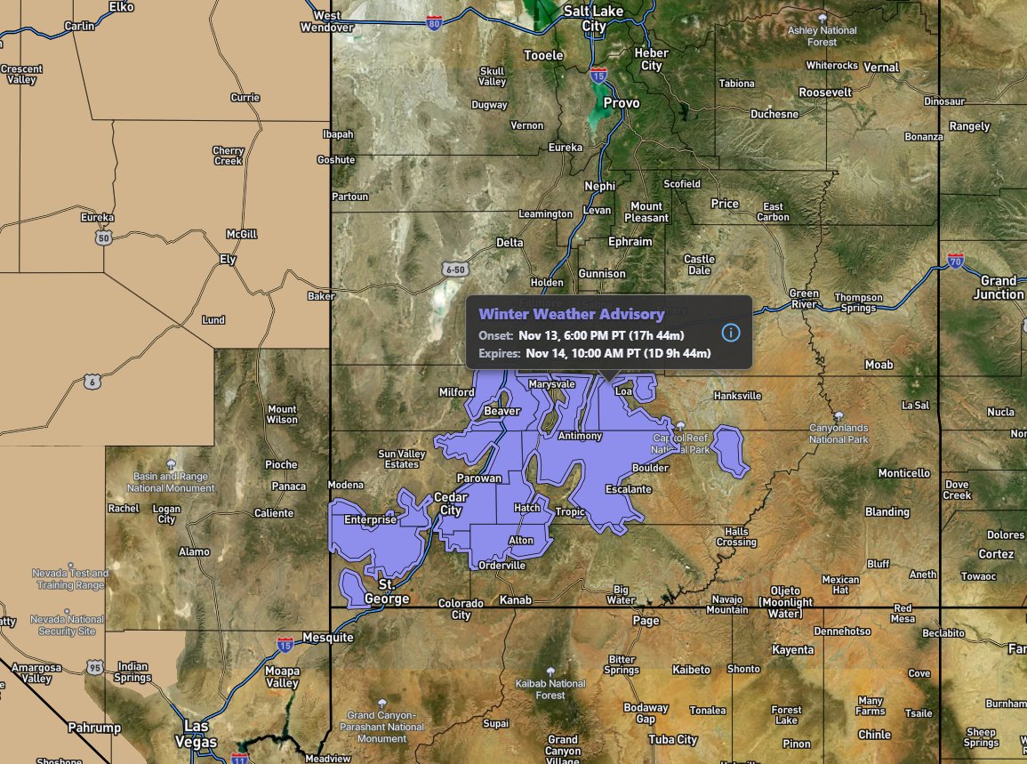
NWS has added a Winter Weather Advisory and could expand further north especially for those higher elevations. #utwx#utah
**NWS Salt Lake City UT
1:09 AM Fri Nov 13 2026
Winter Weather Advisory issued November 13 at 1:09AM MST until November 14 at 11:00AM MST by NWS Salt Lake City UT
* WHAT...Snow expected. Total snow accumulations 2 to 5 inches above 8000 feet, 5 to 10 inches above 9000 feet.
* WHERE...Southern Mountains.
* WHEN...From 7 PM this evening to 11 AM MST Saturday.
* IMPACTS...Winter driving conditions may occur overnight Friday night on high elevation routes including SR-143, SR-14 and SR-148.
PRECAUTIONARY/PREPAREDNESS ACTIONS...
Slow down and use caution while traveling. For winter road conditions from the Utah Department of Transportation, visit https://t.co/H75NRvPQv5.
For graphical depictions of the snowfall forecast, including Official NWS Forecast, High End Amount, and Low End Amount, visit https://t.co/9RdpCmwnvy.
EXPIRES...Nov 14, 10:00 AM PT**
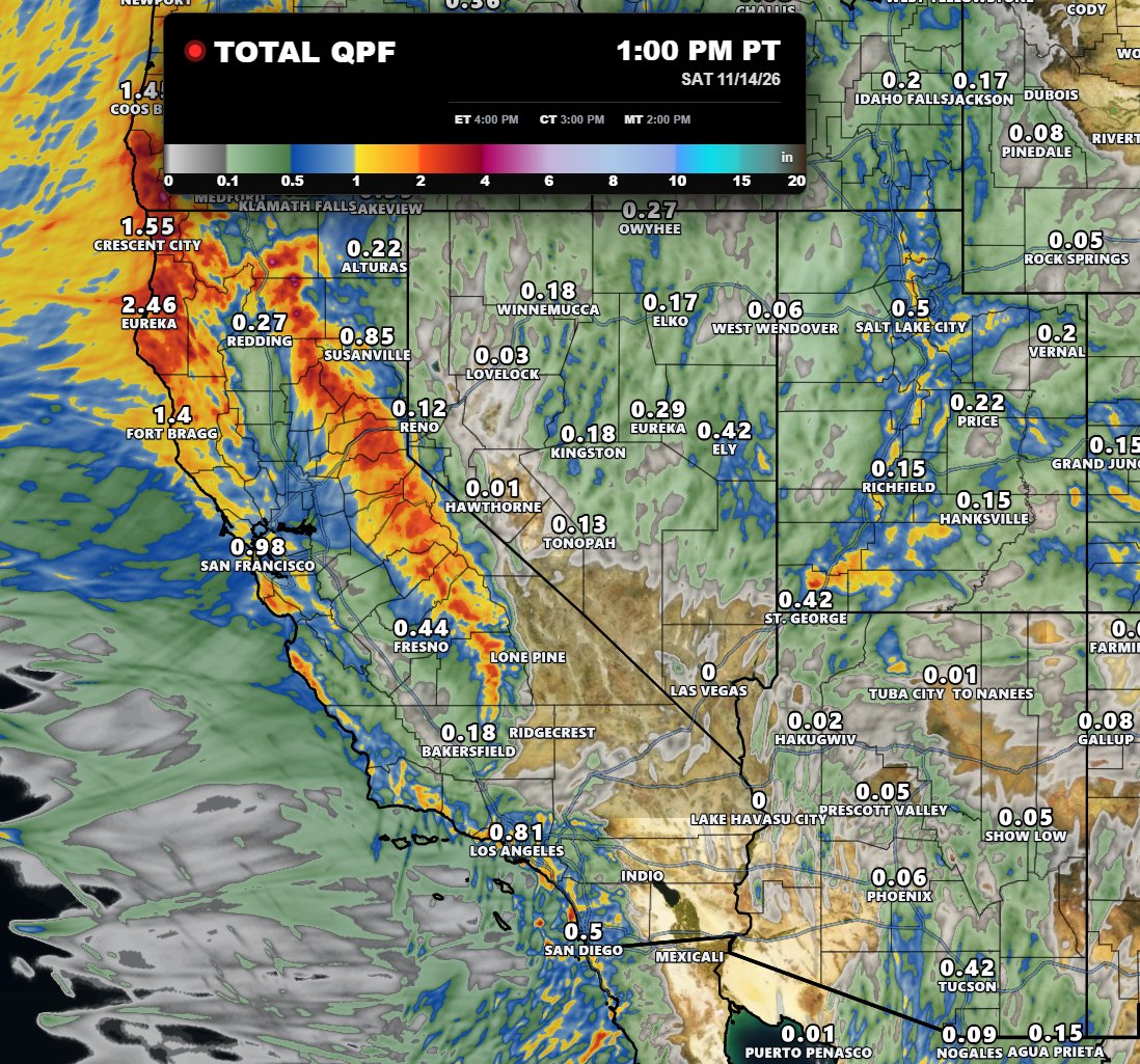
Models have been very consistent, which is reassuring. Most of the rain will impact Northern California and coastal areas, while snow is spreading across the region, with Utah seeing significant accumulation at higher elevations. The Sierra Nevadas are going to experience substantial winter storm activity. Gusty conditions are potentially creating hazardous situations in northern and central California, as well as much of Nevada. Commuters, especially those in high-profile vehicles, should exercise caution tonight and tomorrow, as strong winds could pose a tipping risk. Elevated areas are likely to experience particularly intense gusts. Most of our region will experience some type of precipitation. #cawx #nvwx #utwx #azwx