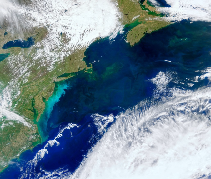
The ocean has a hidden garden of phytoplankton.
You just need to know how to see it, and NASA’s PACE mission has the tools! 🌊🛰️
With PACE, scientists can identify types of phytoplankton in the water, which each play a different role in ocean ecosystems.
How will El Niño affect hurricanes? NASA satellites are helping improve predictions. 🌀
NASA and European Sentinel-6 satellites measure sea level height to track changes in ocean heat and better understand shifts in hurricane patterns. The data can help guide disaster response.
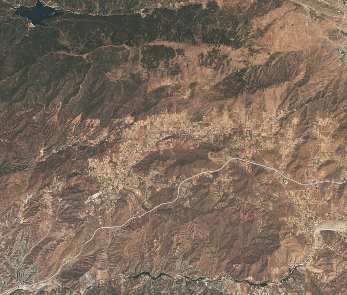
Do you recognize this area? If so, you might be a Star Trek fan! 🖖
This @NASA satellite image shows Vasquez Rocks Natural Area in Southern California. Multiple Star Trek scenes were filmed here, including an iconic battle between Captain James T. Kirk and a reptilian alien.
Clean air matters for everyone. 🌎 With missions like TEMPO, NASA helps track air quality across North America, helping communities plan for a healthier future. #CleanAirDay
Learn more: https://t.co/qVKcLgbdDF
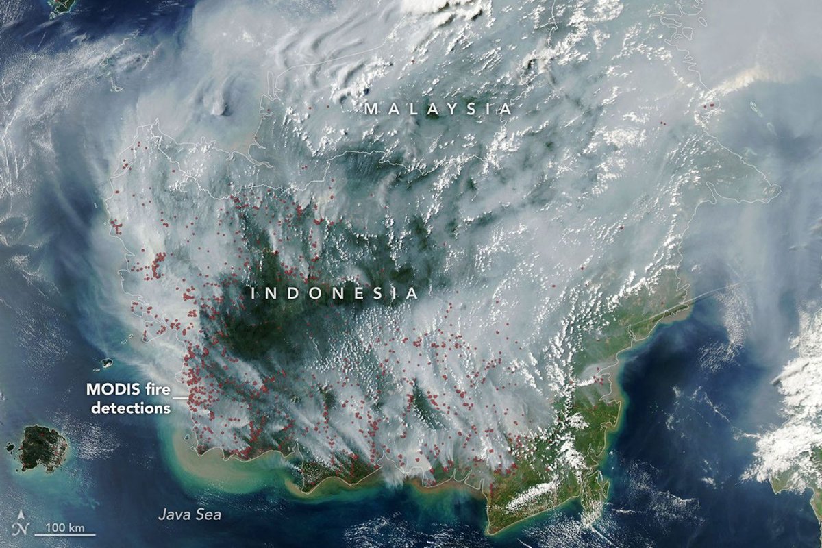
This image from @NASA’s Aqua satellite shows smoke covering much of Indonesia and Malaysia on September 1, 2026. Red dots have been added where the satellite’s MODIS instrument detected thermal anomalies indicative of fire. https://t.co/BTsczWwoxL
Fires are smoldering in Indonesia, which is in a severe and widespread drought. Some of these are tropical peatland fires, which burn slowly, release higher amounts of air pollution, and are notoriously difficult to extinguish.
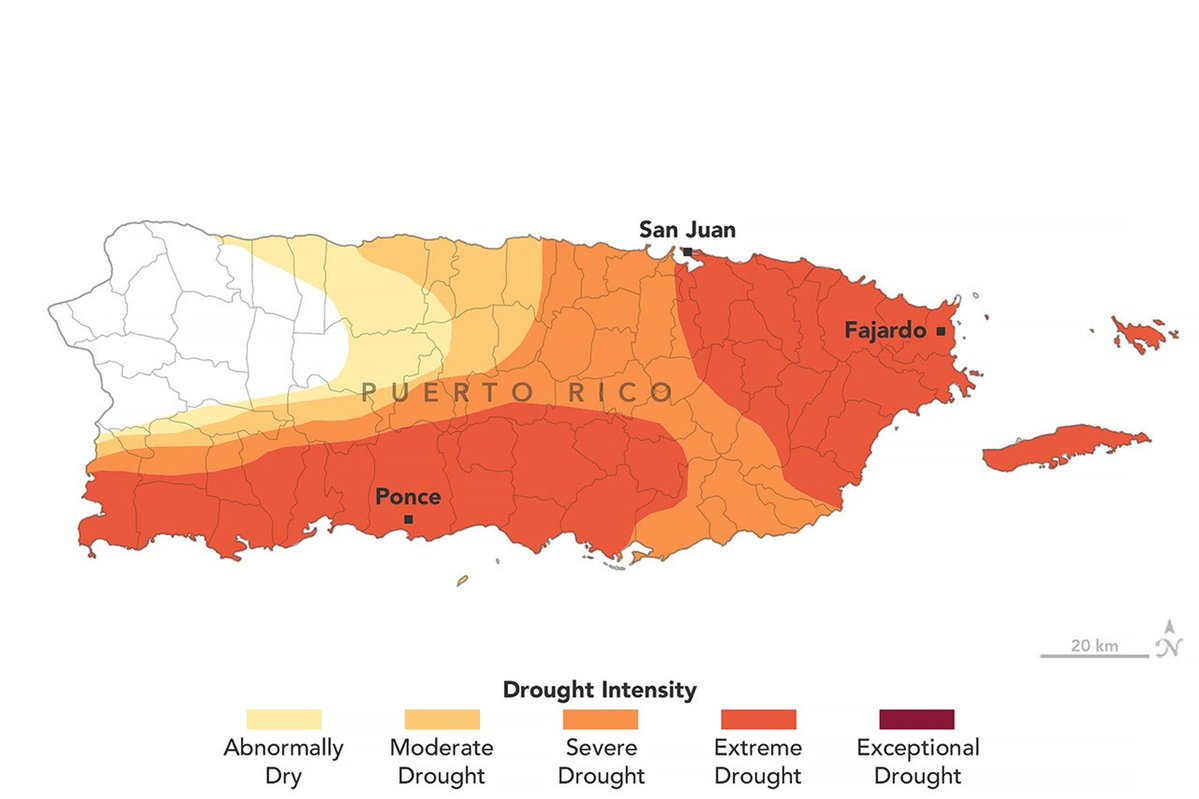
Puerto Rico’s wet season usually begins in May, but rainfall has been low this year.
By late August, drought had spread across much of Puerto Rico, contributing to water shortages and rationing in some areas. NASA data is helping scientists track drought conditions.
From Texas to Maine, coastal wetlands and marshes are releasing over 1.45 billion pounds of carbon into the ocean each year.
The finding comes from a study analyzing Landsat images and @USGS elevation data to track marsh loss in the area from 1985-2022. https://t.co/T0uxkl5fJg
Emperor penguins living in Antarctica rely on fast ice – sea ice that is attached to the shoreline – to breed, raise chicks, and molt.
As sea ice declines, scientists are using @NASA satellite data to understand how penguins responded to sea ice disruptions in the past. 🐧
@NASA Emperor penguins are endangered, and some models project they could disappear by 2100. However, new research based on @nasa data offers some hope.
Two new studies suggest many colonies have persisted for decades and may be more flexible about where they breed.
It’s #NationalParkWeek! ⛰️🥾🌲
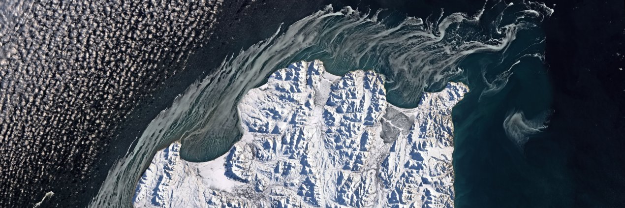
Can you identify these @NatlParkService parks from space?
Check out these satellite images and drop your guesses in the comments. Bonus points if you’ve visited or can identify any iconic landmarks!
@taigaspruce@NatlParkService Yes, this is Yosemite! This satellite image was captured in November 2022, when the park was blanketed in snow. https://t.co/6IumlV7BFO
A partial lunar eclipse will pass over the Americas—and parts of Europe and Africa—tomorrow night! It will reach its peak around 12:12am ET (0412 UTC) on Thursday, Aug. 28.
More info: https://t.co/deDCMRSq74
For a few million years, Earth may have been left out in the cold — literally.
New NASA research shows the Sun's protective bubble has shrunk smaller than Earth's orbit at least three times in the past 10 million years, possibly triggering ancient ice ages. 🌍
Full story: https://t.co/KoCN5rYoc2