Rescues are underway in New Orleans after a tanker struck a cruise ship on the Mississippi River Friday evening.
📷: Kern Studios https://t.co/ZPspGtM0Yr
COLDER WEEKEND AHEAD:
Above average temperatures will only be around for one more day as the 60s return for highs starting on Friday through at least the beginning of next week. Far inland areas may even reach the freezing mark for lows this weekend. Enjoy the beautiful weather!
COLDER WEATHER ON THE WAY:
While we did see some rain this morning, it has cleared out and we are back to seeing sunny conditions this afternoon. A cold front arrives tomorrow morning that will bring a nice chill to the air just in time for Friday and the weekend.
#alwx#cold
FROST/FREEZE WATCH up for next weekend as the coldest air of the season drops south. Trends continue to indicate we likely see some frosty mornings inland, still a question mark if we can hit freezing. Watching closely for my gardeners! 🥶🥶🥶 #lawx
THE FIRST CANADIAN FRONT of the season is about 5-6 days away. Late week into next weekend brings a big dip over the east yielding a blast of cold air. We’ll be watching trends in the coming days to see if we need to worry about a frost/freeze along the Gulf Coast. 🥶🥶🥶 #lawx
WARM NOW, COLDER THIS WEEKEND:
While it is warm and humid right now, temperatures will fall below normal by this weekend as a cold front will make its way through the area on Friday. Temperatures will struggle to make it out of the 60s on Sunday. Lows will get into the 40s.
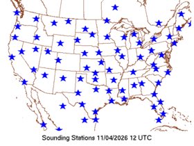
GOOD NEWS: National Weather Service morning balloon launches have officially returned to normal levels while offices across the US have filled various vacancies. It seems like after an incredibly stressful and tumultuous 20 months in our industry, things are moving back to normal.
It’s important to remember though that the fight must continue. The United States of America has long been the global leader in weather infrastructure. We must do everything to ensure NOAA, and by extension the NWS, is fully and properly funded to maintain this status and continue to innovate. Accurate and timely forecasts save lives and keep money in your pockets.
WARM FOR NOW:
It is warm and humid with rain off to the west. Temperatures will be on the decline after tomorrow and throughout the weekend as a cold front comes through the area. Temperatures will be struggling to get out of the 60s on Sunday.
#alwx#fall
WEDNESDAY 2PM UPDATE:
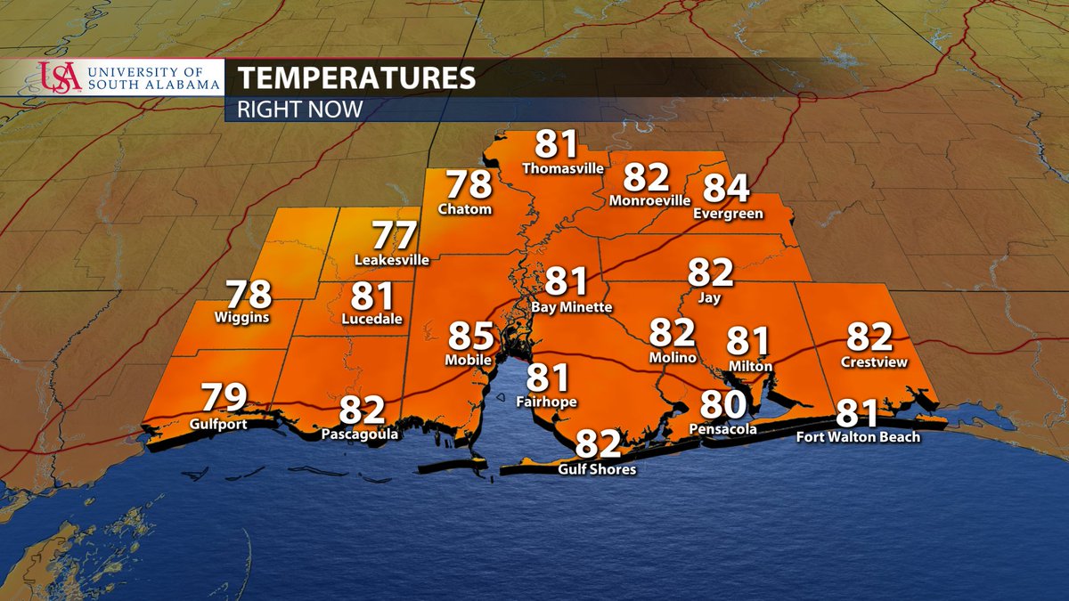
It is super warm outside with temperatures in the 80s and dew points in the 70s, almost feeling summer like! There is some rain off to the west in Mississippi that may bring a quick shot of rain to some areas throughout the next few hours.
#alwx#flwx#mswx
We’re not just losing the NAM. We are losing:
Nadocast
HREF
3km NAM
12km NAM
HWRF
ARW
We’re losing half of the available CAMs and being replaced by a model that has preformed horribly. It makes no sense whatsoever. Forecast confidence will decline even more.
@NWS@NWSDirector