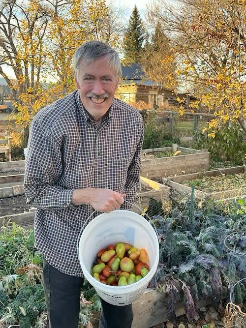
#CoCoRaHS Founder, Nolan Doesken (January 1952 - November 2026), passed away peacefully at his home in Fort Collins after a courageous battle with Parkinson's. His zest for life, kindness, encouraging words, and folksy way of making you feel as if you had known him. #MEwx#NHwx
In case you heard otherwise, there is no radar outage and https://t.co/sKhgAVX4eI is fully operational! Outdated content from isolated webpages stating otherwise has been circulating, but NWS radars are operating normally.
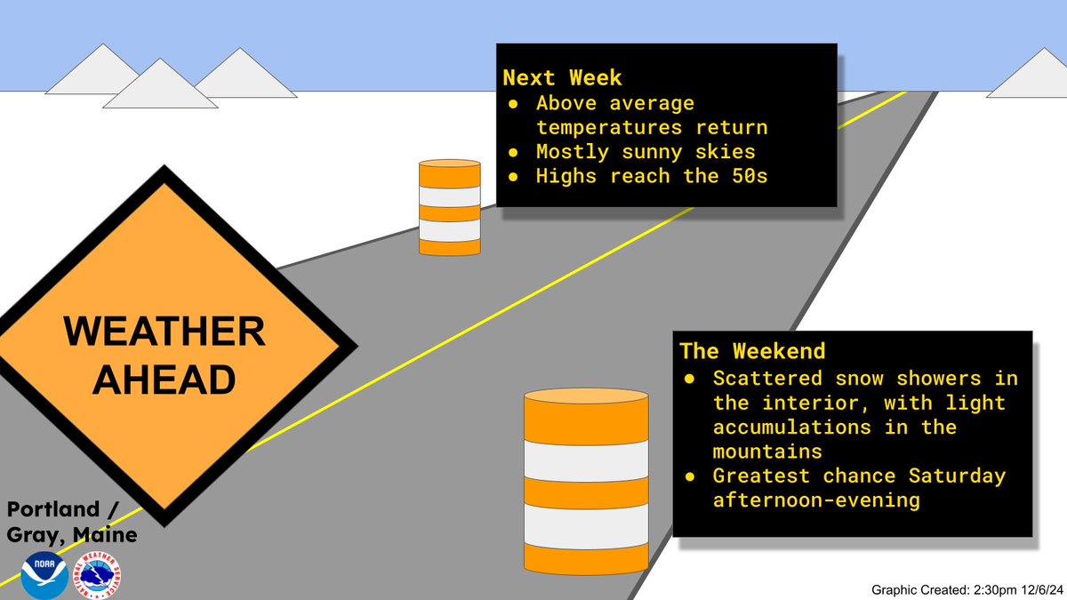
Good morning. Cold conditions will persist through the weekend with some light snow showers in the interior, but milder conditions are on the horizon for next week. #MEwx#NHwx
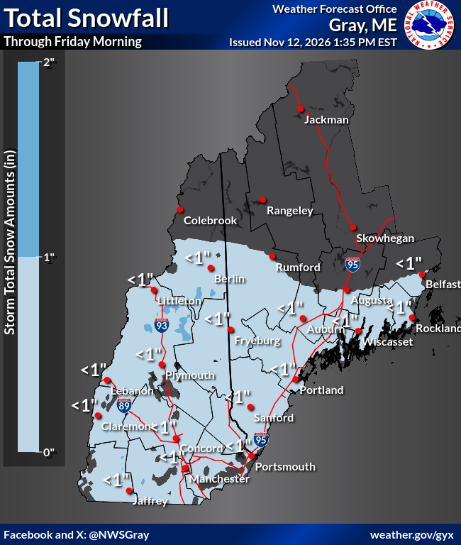
Good afternoon. Rain is pushing across southern locations this afternoon, with some brief pockets of ice pellets or snow flurries. Rain and snow continues overnight, with mainly higher terrain locations seeing the vast amount of snow accumulation. #mewx#nhwx
Forecast confidence is increasing for this weekend's system to bring rain and snow to the area. Accumulating snow is likely at 1500 ft+, where the greatest amounts are expected. There remains more uncertainty elsewhere based on marginal temps and northward extent. #mewx#nhwx
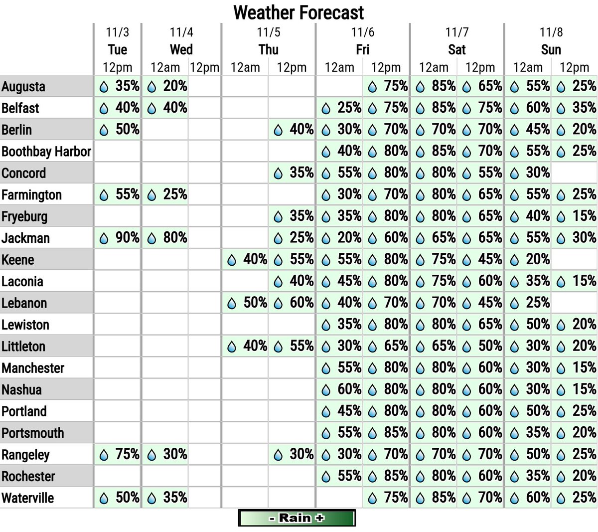
Rain and snow showers continue this week in the mountains, before a larger storm system enters the region into the first half of the weekend. It will bring rain and some snow, but confidence is not yet high enough for exact location and amounts of rain and snow. #mewx#nhwx
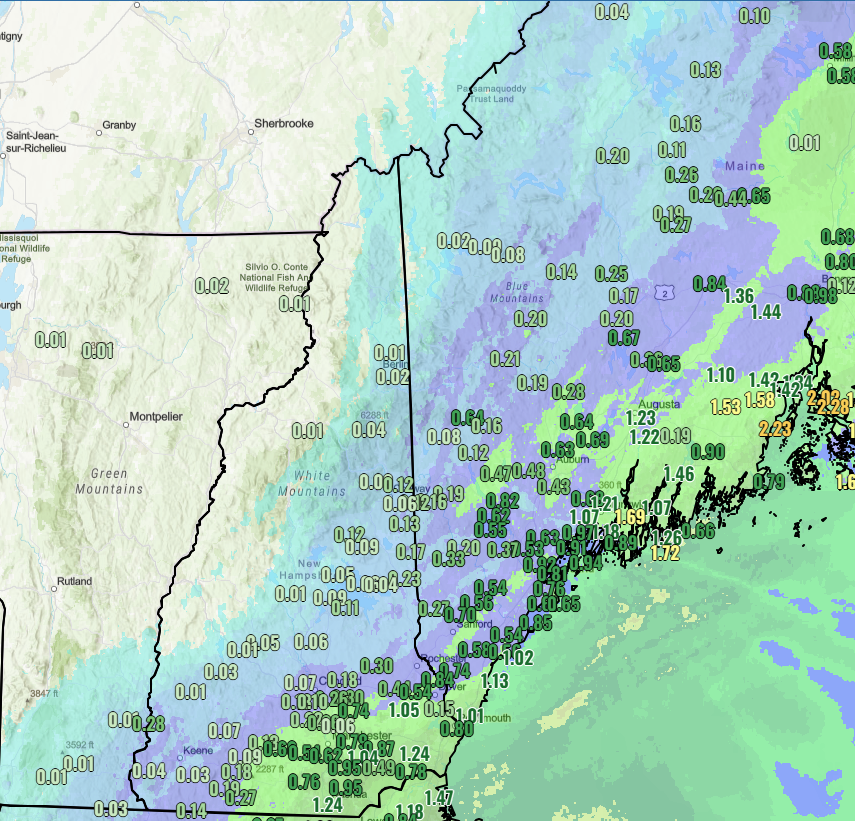
The past 72 hours we have seen much welcomed rain (along with some snow in northern zones this AM). The next chance for widespread precip looks to arrive later this week. Thank you to our spotters and COOP partners for the reports! #MEwx#NHwx
Text List: https://t.co/ZvIfOxazjt
Over the last 24 hours coastal areas have seen rainfall totaling 1-2" with localized amounts exceeding 2" around Penobscot Bay. Locations further inland have seen much less, but showers are expected to continue through today. #MEwx#NHwx
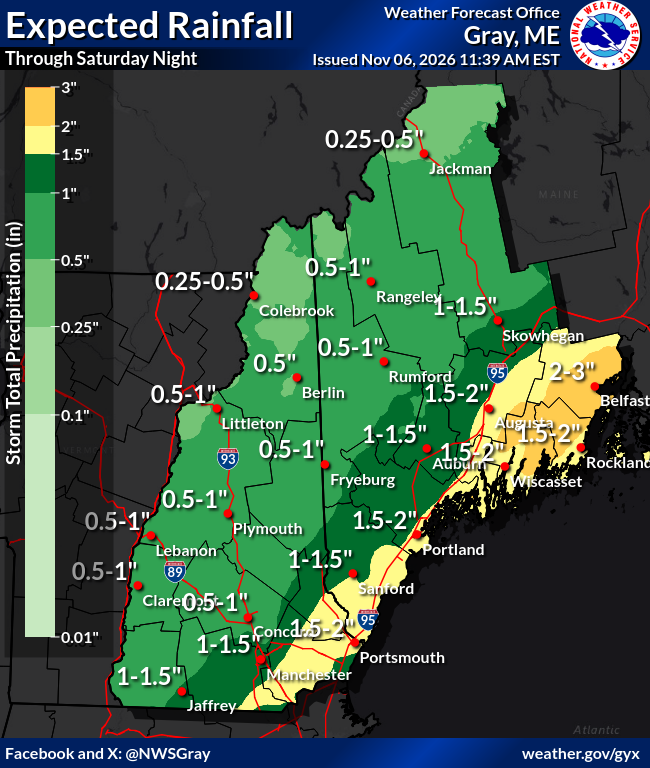
More (and beneficial) rain is on the way. Here's the amounts we're forecasting through Saturday night, and the bulk of these is expected from this afternoon through early Saturday, especially south of the mountains and toward the coast. #nhwx#mewx
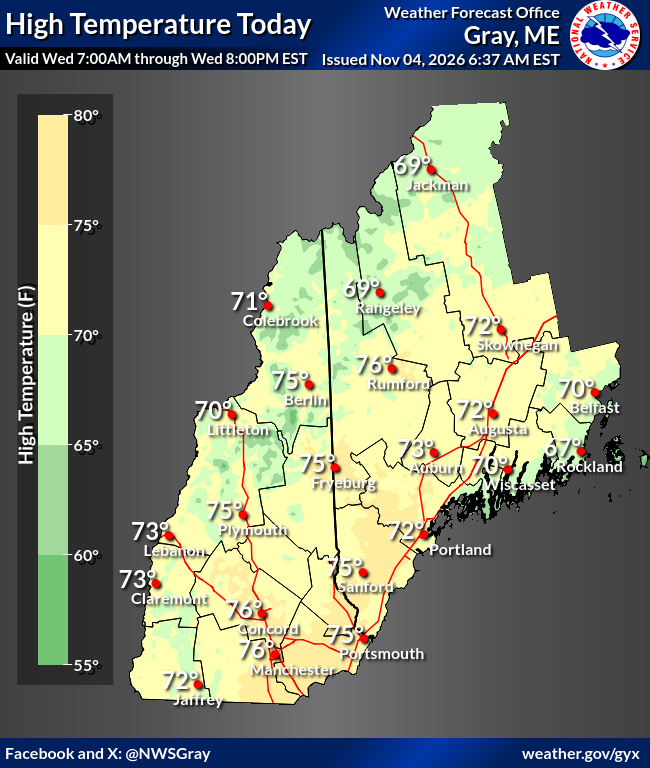
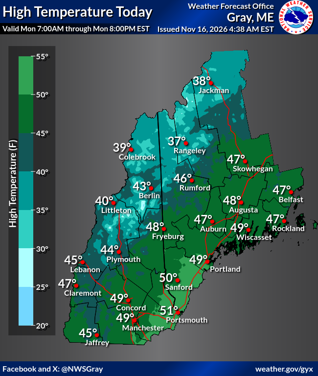
Warm has been an understatement to start the month. Record highs fell at Concord and Manchester on Wednesday 11/4, while Augusta tied their record. #NHwx#MEwx
NWS Drought Update: Multi-year rainfall deficits of 12"+ are keeping low groundwater, streamflows, and lake levels. 150–200% of normal rain is still needed before the ground freezes.
Send Drought Reports to CMOR https://t.co/kHlGIJ0Vqe
#MEwx#NHwx
Some areas will receive light rainfall amounts today and tonight. Then, for the first time in quite a while, chances increase for a beneficial soaking rainfall later this week and the start of this weekend. #mewx#nhwx
.Winter Weather Preparedness Week.
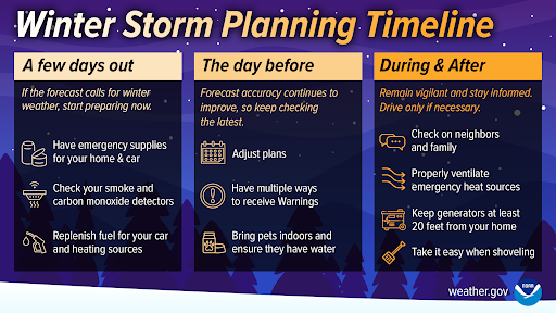
You are most likely planning a lengthy trip by car this winter. Know how to prepare, and know that the decisions will differ depending on where you are on the Winter Travel Timeline: https://t.co/Au7HDNR7b4 / https://t.co/H5GrMRTWL9 #nhwx#mewx
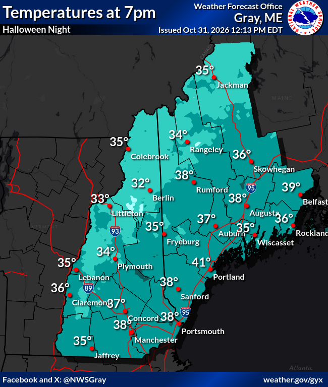
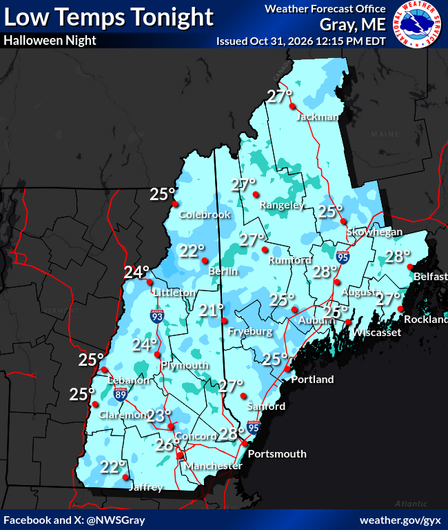
A dry and cool night is in store for trick-or-treaters tonight. Temps quickly fall through the 30s this evening, eventually reaching the teens and 20s in most spots by Sunday morning. 🎃
..Winter Weather PreparednessWeek..
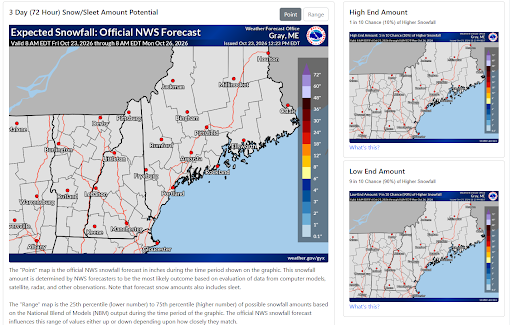
Stay informed! The NWS supplies detailed winter weather forecasts from town specific point-n-click forecasts to graphical snow & ice accumulation graphics. Visit our winter page before traveling! https://t.co/VELbc7sxl9 #mewx#nhwx
..Winter Weather Preparedness Week..
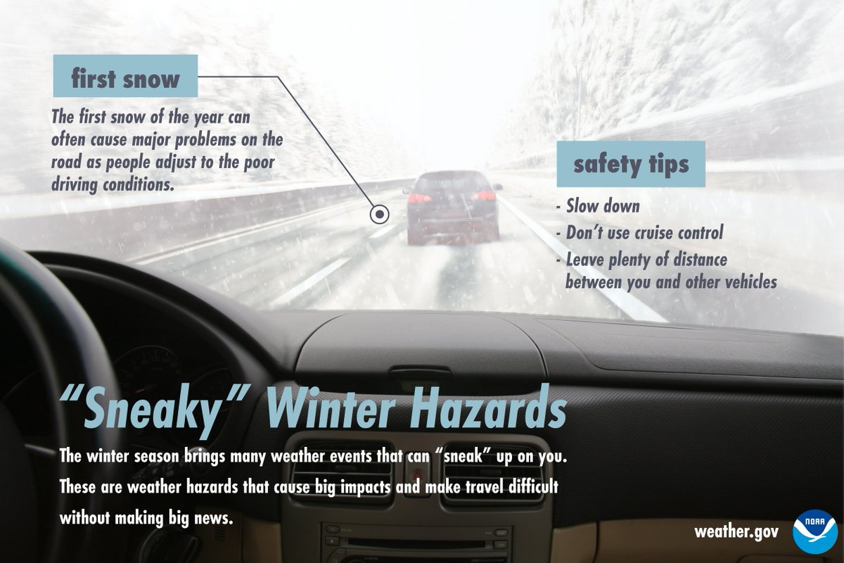
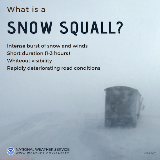
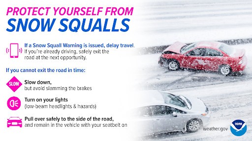
During a snow squall, the last place you want to be is on the road. Delay your travel if a warning is issued. If already traveling, get off the road to a parking lot and wait while the snow squall passes. #mewx#nhwx https://t.co/Ji4Dmo4gka