Analysis and documentation of large-scale destruction from disasters & conflicts. We make open databases to help the world 🌎 By @kayleighruiter & @bendobrown
Just over five years ago Myanmar's military waged a violent campaign against the Rohingya in northern Rakhine.
This thread shows how @KayleighRuiter & the team documented 38,000+ buildings destroyed during that campaign. 👇
https://t.co/sOskbZTkIm
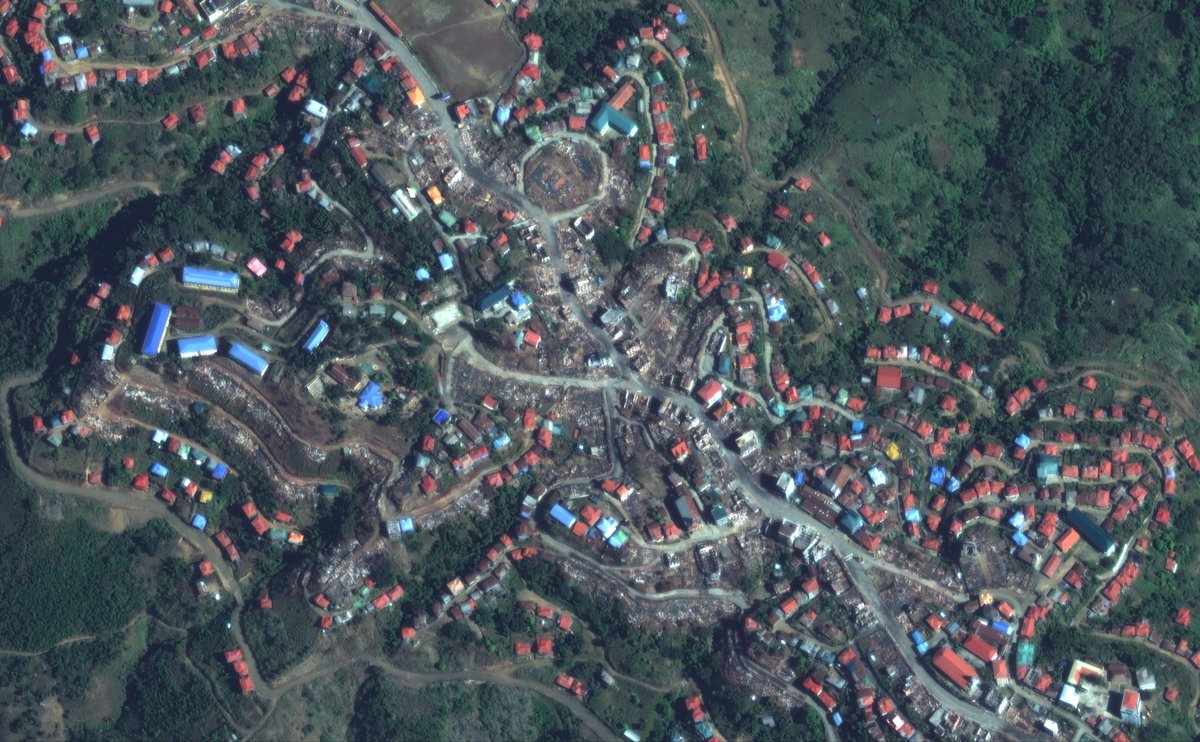
Today we release a database showing WHERE, WHEN and HOW more than 38,000 buildings were destroyed in Myanmar's Rakhine State between 2017 & 2020.
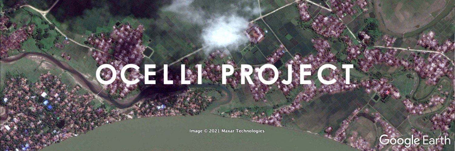
Here is the data: https://t.co/2Y65WCPVZn. Here is an explainer thread on the work by @ocelliproject@KayleighRuiter & @C4ADS👇🛰️
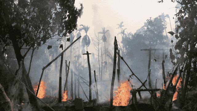
🔥NEW Map of Fire Incidents in Myanmar
Browse by location or date.
Each fire is linked to relevant footage, social media reports and any other supporting evidence.
Each report has an easy to use confidence rating
🔥https://t.co/N73ZrnAG3o
#WhatsHappeningInMyanmar#OSINT
🔥NEW Map of Fire Incidents in Myanmar
Browse by location or date.
Each fire is linked to relevant footage, social media reports and any other supporting evidence.
Each report has an easy to use confidence rating
🔥https://t.co/N73ZrnAG3o
#WhatsHappeningInMyanmar#OSINT
We created this dataset of destroyed villages in Myanmar when the military ran its clearance operations in Rakhine State between 2017 & 2020.
Now it looks like villages are being destroyed again in Myanmar as seen on this map: https://t.co/kdqYPvdEsN
Today we release a database showing WHERE, WHEN and HOW more than 38,000 buildings were destroyed in Myanmar's Rakhine State between 2017 & 2020.
Here is the data: https://t.co/2Y65WCPVZn. Here is an explainer thread on the work by @ocelliproject@KayleighRuiter & @C4ADS👇🛰️
Since September we have seen an alarming rise in burnings of villages in Myanmar, many which are linked to the military. Today, we launch our @MyanmarWitness Firemap, which uses geolocation, satellite imagery & NASA FIRMS fire data to track these events https://t.co/hANd8B0U0Q
We traced a shipment of armoured vehicles from Vladivostok, Russia that arrived in Myanmar's Yangon yesterday.
This report shows how we made those findings using #OSINT techniques at @MyanmarWitness
https://t.co/TX1oQv7K2P
For background on #WhatsHappeningInMyanmar, check out https://t.co/QmFNMJRoDr, a free/public tool we built with @ocelliproject that uses PAI to catalogue the scale of systematic displacement and genocide in #Myanmar.
Adding this kind of context to imagery can make it a vastly more powerful resource — see our work with @ocelliproject on village destruction in Myanmar:
https://t.co/KnKjnhbJTR
When we heard @KayleighRuiter, @BenDoBrown & @ocelliproject team were using PAI to catalogue village destruction across #Myanmar’s Northern Rakhine State, we wanted in.
Together, we built https://t.co/QmFNMJzNLT, a public, free, replicable tool to track mass atrocity at scale.
How do you document mass atrocity at scale using PAI? We teamed up with @ocelliproject's @kayleighRuiter & @BenDoBrown to find out.
The result = https://t.co/QmFNMJzNLT, the most comprehensive analysis of village destruction in Myanmar's Rakhine State between 2017-2020.
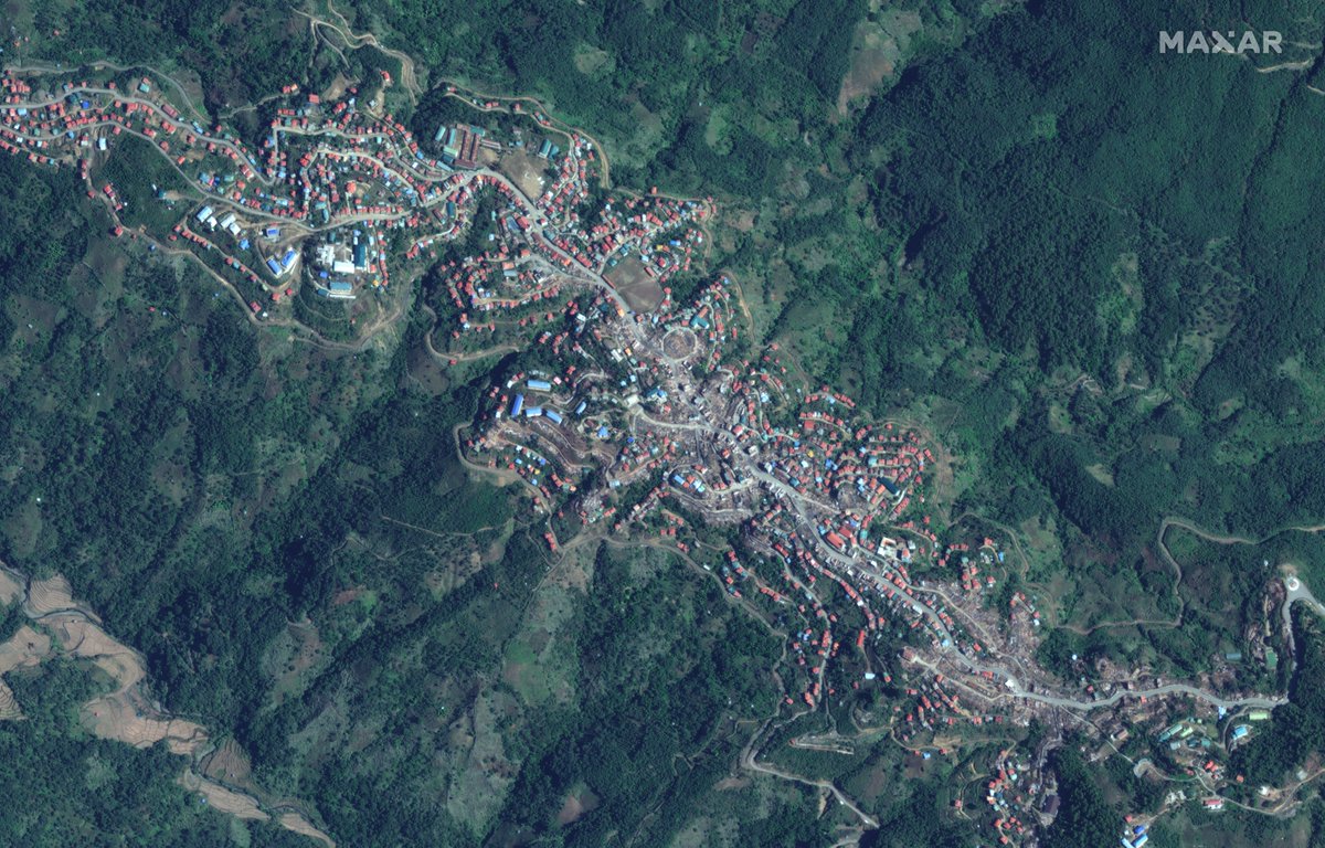
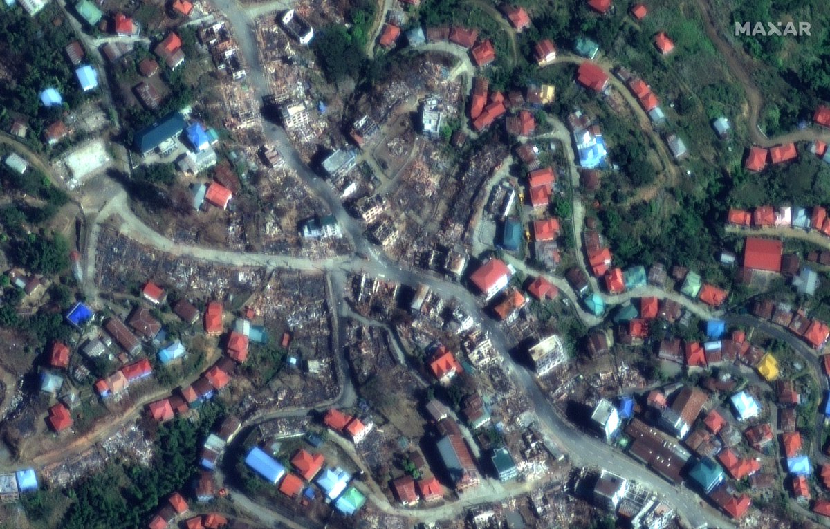
New satellite imagery from December 18 of Thantlang in Myanmar's Chin State shows the full scale of destruction in this once thriving town after it has been targeted numerous times. 📸 @Maxar#WhatsHappeningInMyanmar
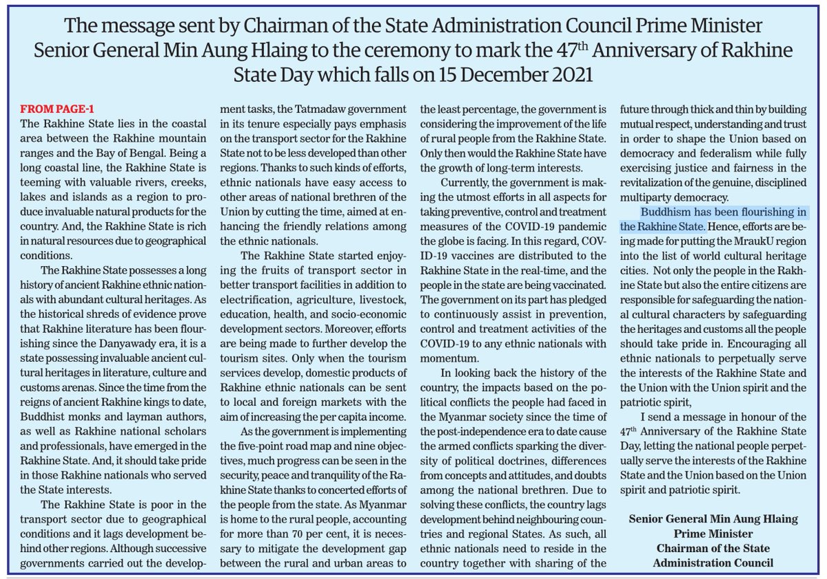
From the Myanmar Government's daily newsletter - "Buddhism has been flourishing in the Rakhine State".
Not difficult when you attempt to wipe out another religion from a whole State. See our work for visual evidence on the clearing of Rohingya homes.
Today we release a database showing WHERE, WHEN and HOW more than 38,000 buildings were destroyed in Myanmar's Rakhine State between 2017 & 2020.
Here is the data: https://t.co/2Y65WCPVZn. Here is an explainer thread on the work by @ocelliproject@KayleighRuiter & @C4ADS👇🛰️
Ominously, independent researchers @ocelliproject yesterday released a database of findings which suggests that, between 2017-2020, 38,000 homes were destroyed in Rakhine State. Of these, 24,000 were found to show signs of having burned down.
One sad thing about open source investigation is knowing there's so many situation that could be investigated if not for a lack of resources and skilled investigators, so it's great to see this work being done on Myanmar.