OMCh usa, facilita, experimenta, desarrolla y promociona las soluciones geoespaciales basadas en #DatosAbiertos y estándares, con #SoftwareLibre u #OpenSource
Interesante artículo: Actualizar el callejero local en #OpenStreetMap: una oportunidad para pequeños municipios https://t.co/c9IjmkxlMs CC @fempcomunica
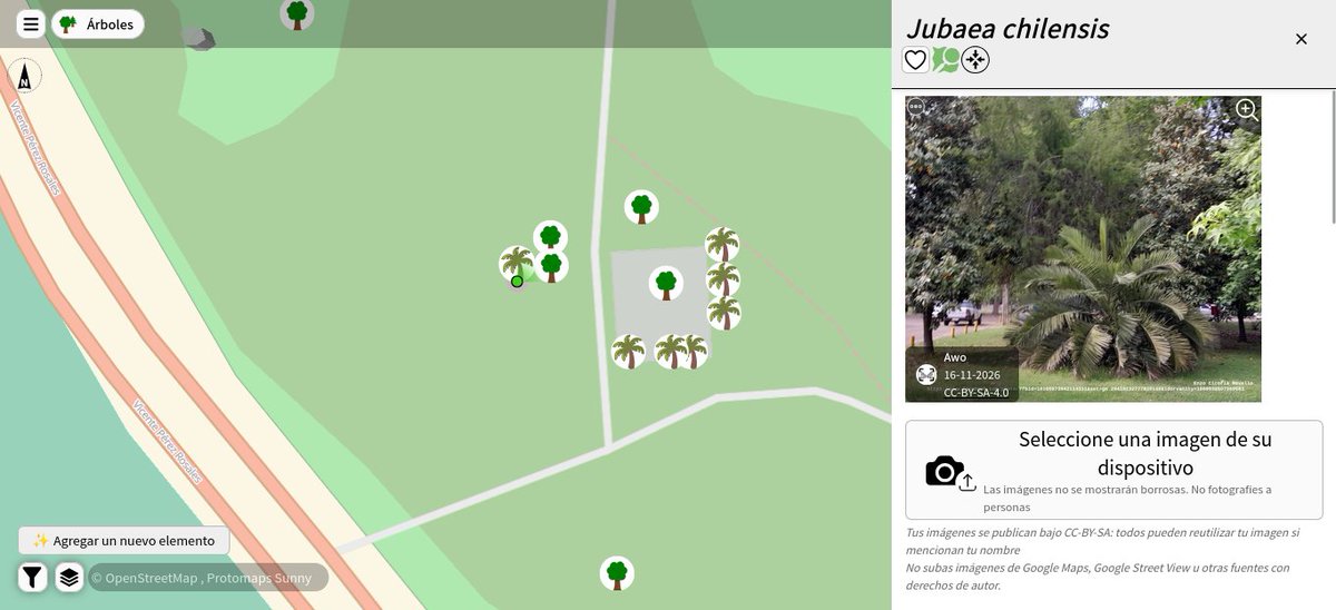
🌴📌📸🗺️ Ultimas #Jubaea chilensis mapeadas en #OpenStreetMap contabilizando 5925, ambas en La Reina - Stgo de #Chile leaf_type=palm 🌴preferible a leaf_type=broadleaved 🌳#ArboladoUrbano#AUPV https://t.co/VoC25nZitF
Los Ríos: realizarán cuatro jornadas de participación ciudadana sobre el anteproyecto de normas para proteger lagos nor-patagónicos. Invitamos a la comunidad a asistir a estos encuentros. Toda la información la encuentran en https://t.co/Y7nDlzzYzP
Goldman Sachs vlucht uit New York en laat socialistische burgemeester Mamdani in paniek achter.
De burgemeester van New York krijgt een harde klap te verduren nadat bevestigd is dat Goldman Sachs, een van de historische reuzen van Wall Street, honderden van zijn managers en medewerkers dwingt te kiezen tussen verhuizen naar Dallas, Texas, of Salt Lake City, of de onderneming volledig te verlaten, als gevolg van de onhoudbare operationele kosten veroorzaakt door de belastingverhogingen en regelgeving die door zijn socialistische bestuur worden gedreven.
De massale uittocht van het iconische bedrijf naar zakenvriendelijkere staten markeert het begin van een aangekondigde economische ineenstorting in de Big Apple.
❗️"عـالم متعدد الأقطاب بلا أوروبا.."
زلزال سياسي يغير خارطة الكوكب.. قمة تاريخية غير مسبوقة تجمع بوتين وشي ترامب لتكتب رسمياً ولادة النظام العالمي متعدد الأقطاب! 🇨🇳🇷🇺🇺🇸🔥
الكرملين والخارجية الصينية يؤكدان رسمياً التوصل لاتفاق لعقد أول قمة ثلاثية تاريخية على الإطلاق تجمع الرئيس فلاديمير بوتين، والرئيس الصيني شي جين بينغ، والرئيس الأمريكي دونالد ترامب في 19 نوفمبر الجاري بمدينة شنتشن على هامش قمة "أبيك" (APEC)!
غياب القارة العجوز عن هذا الطاولة الكبرى يعكس السقوط المدوي للدبلوماسية الأوروبية وتهميشها التام،
بينما يتولى زعماء القوى العظمى الثلاث إعادة هندسة قواعد الأمن والتجارة الدولية بأنفسهم في مشهد يعيد للأذهان مؤتمرات تقاسم النفوذ الكبرى!
اللقاء المرتقب يمثل لحظة فارقة في التاريخ الحديث؛ حيث يجتمع قطبا الشرق الأوسعان مع العائد إلى البيت الأبيض لترسيم حدود التفاهمات الكبرى وحل العقد الجيوسياسية الشائكة بمعزل عن وصاية واشنطن التقليدية أو إملاءات بروكسل!
الكوكب يدخل مرحلة "عالم متعدد الأقطاب" رسمياً.. بوتين وشي وترامب يرسمون مستقبل البشرية وجهاً لوجه!
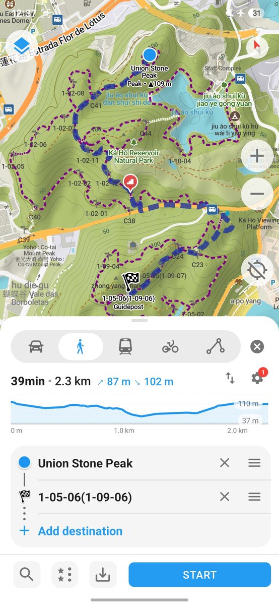
New Organic Maps release: 3D terrain, ocean depths, imported areas and route reversal with all stops. Track directions, public transport routes, and many other improvements!
Free. No ads or tracking.
Install now: https://t.co/Yt0LVTBW0i
More details: https://t.co/dRRfW1a1Lw
OSM2World
Turn OpenStreetMap data into 3D world models
Export models as glTF/glb, OBJ or POV-Ray files, generate 3D Tiles, or render images with OpenGL.
Use it from the command line or through the desktop graphical viewer.
You can also use it as a Java library through Maven or Gradle, or in a browser as a JavaScript module.
https://t.co/EQW2FEXHp5
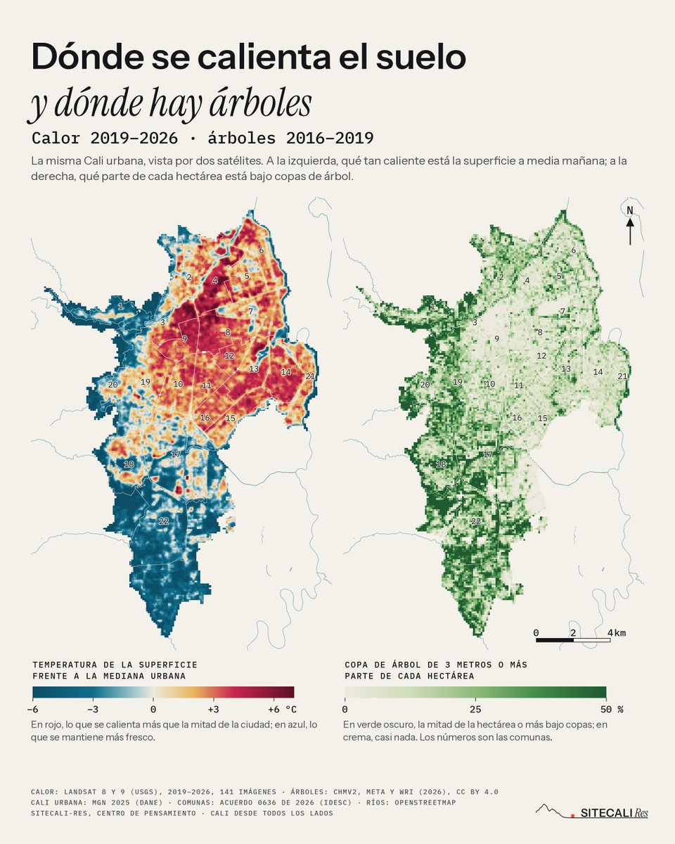
Dos mapas de la misma Cali urbana en tiempos distintos. A la izquierda, dónde se calienta el suelo a media mañana (2019–2026); a la derecha, qué parte de cada hectárea está bajo copas de árbol (2016–2019). Mírelos lado a lado, muchas cosas encajan.
Fietsland ("bike country") rebuilds Amsterdam from public records: every building from 3DBAG, every street, tree and lamp from OpenStreetMap, BGT and live OV data/weather https://t.co/ZysniPhz3G
Nouvelle exploration et conception d'outil de complétude pour mettre en miroir la donnée routière de référence sur la voirie départementale publiée dans @data_sud et celle d'OpenStreetMap afin de pouvoir ultérieurement avoir une base musclée multithématique (wikidata, Panoramax).
Un nuevo dataset experimental de Google trae modelos de elevación de superficie y terreno casi globales (15 m) ya está disponible de manera abierta, no obstante, en República Dominicana tiene huecos en ciertas zonas, sobre todo, en los cursos de los ríos, eso complica un poco los análisis hidrológicos, mientras eso se corrige le podemos sacar utilidad en ciertos aspectos cartográficos y de simulación. Drenaje por precipitación sobre la sierra Martín Garcia. Creditos a @traviss22
geojs
Explore geospatial data and scientific plots in JavaScript
GeoJS brings GIS, scientific visualization and information visualization together for exploring location-aware datasets.
It reads and renders GeoJSON files and data from WMS servers. You can display points, lines and polygons, or use heatmaps and choropleth maps.
Scientific data can be shown as vector and contour plots. Annotations, legends, animated transitions and widgets support interactive presentations.
https://t.co/oPYte2v8JD
NASA has been mapping Earth’s forests with space-based LiDAR since 2019!
This is Brazil’s canopy height, measured from aboard the ISS using the GEDI Instrument.
Watch the second clip: the map builds track by track as the station passes overhead. You’re seeing 500,000 lidar waveforms, a tiny fraction of the billions GEDI has collected worldwide!
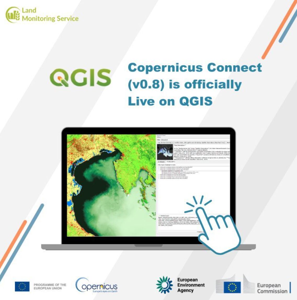
A popular piece for everyone using QGIS and remote sensing data - 𝐂𝐨𝐩𝐞𝐫𝐧𝐢𝐜𝐮𝐬 𝐂𝐨𝐧𝐧𝐞𝐜𝐭 by @Copernicus EEA , a smart QGIS plugin allowing you easily to download, visualize, and explore Copernicus layers:
More: https://t.co/14looamVIK
𝐓𝐡𝐞 𝐍𝐞𝐰 𝐒𝐜𝐢𝐞𝐧𝐜𝐞 𝐨𝐟 𝐌𝐚𝐩𝐬 - https://t.co/qRwV1ryEG1
Googleが15m解像度の準グローバル標高モデルの実験版をGoogle Earth Engineのデータセットで公開している
CC BY 4.0ライセンスで使えるとのこと
Pléiades Neoや、WorldView、GeoEye、Pléiades、SPOTといった光学衛星のステレオ撮影画像から作成しているみたい
https://t.co/SWPRs2aazs