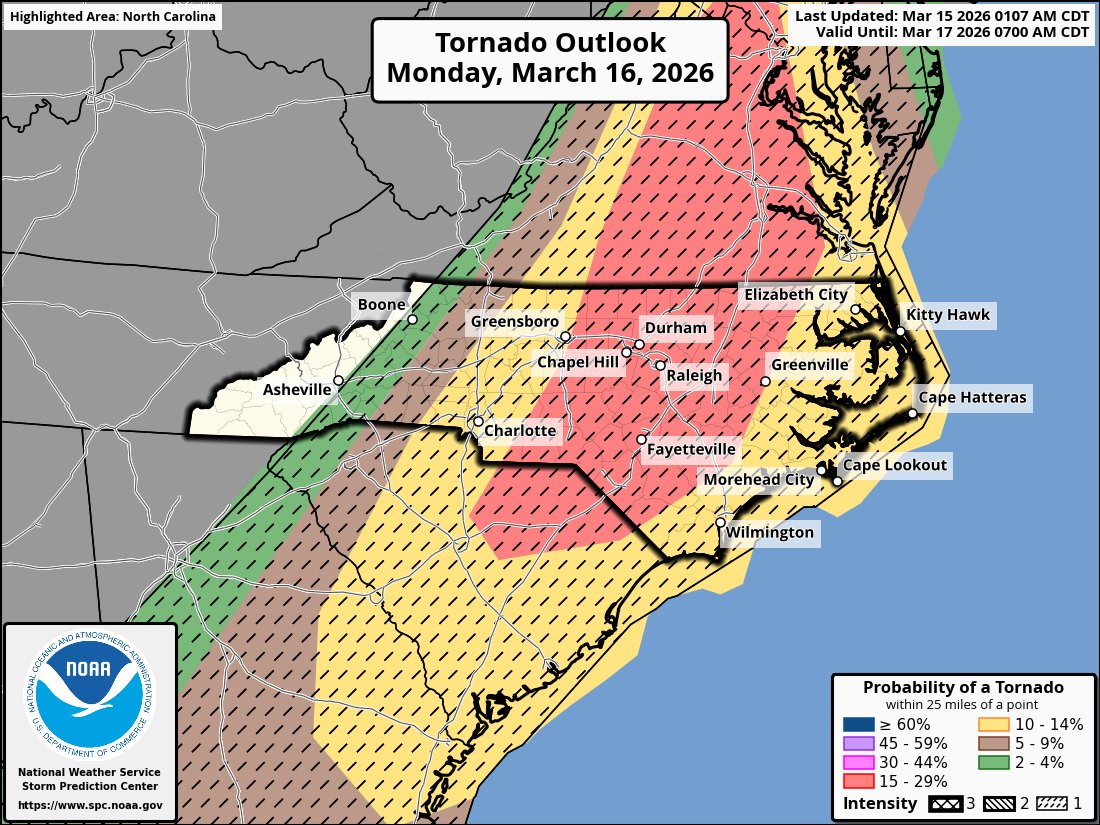
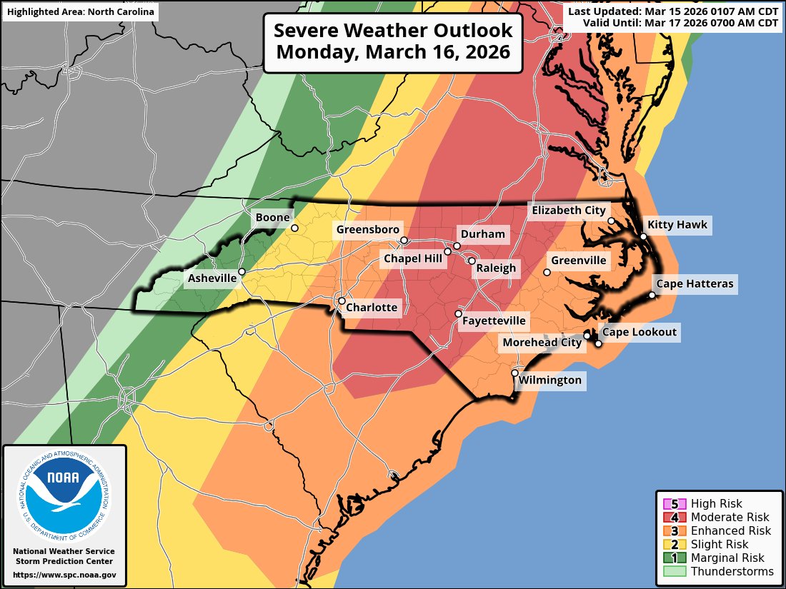
A rare level 4 risk out of 5, moderate, for parts of Va/NC/SC including the Triangle. This threat looks legit tomorrow midday through afternoon the highest risk. Please be weather aware.
Yes there is a chance of some light snow/sleet Wed evening/night across NC/S Va. But this is not a bread and milk type event. Marginal temps (low 30s) and lighter precip, means any snow will accumulate lightly. But it is looking likely we will see some snow again.
A Snowstorm is now looking likely for someone in the Southeast Sunday.
The details will continue to emerge over the next 2-3 days.
Expect shifts all the way up til game time. There will be last second heartbreak & last second excitements.
Another day of tracking ahead. Morning video & update once morning guidance is done. ❄️
A period of snow looks likely tomorrow for areas of NC/Va including the Triangle as an arctic front drops through the area and an upper level disturbance moves along it. Will have my pattern article and first map up early later this morning/early afternoon.
An isolated snow flurry/shower is possible late Monday evening/overnight Monday east of the mountains esp along the NC/VA border. No accumulation is expected even a stray flake is seen.
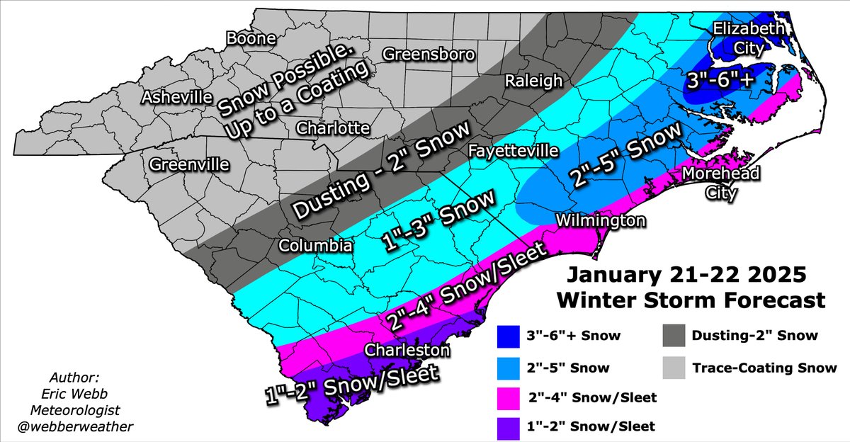
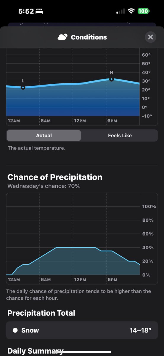
Here's my first call map for tomorrow & Wednesday's winter storm in the Carolinas.
Given the forcing mechanisms in place here (warm advection & isentropic upgrade) & knowing how models tend to handle these, I'm expecting the ongoing north trend on most models to generally continue up to near verification.
The greatest chance for significant accumulating snow in the Carolinas exists from about the US-1 + I-95 corridors & points eastward. Snow may also mix with sleet along the coast.
☃️❄️
#ncwx #scwx