Want to know who’s who at FDL Europe 2022?
We are delighted to share our FDL Europe 2022 Handbook introducing our talented research teams and generous partners. Read all about our scientific challenges and our summer research program.
https://t.co/x6BTRGOlvk
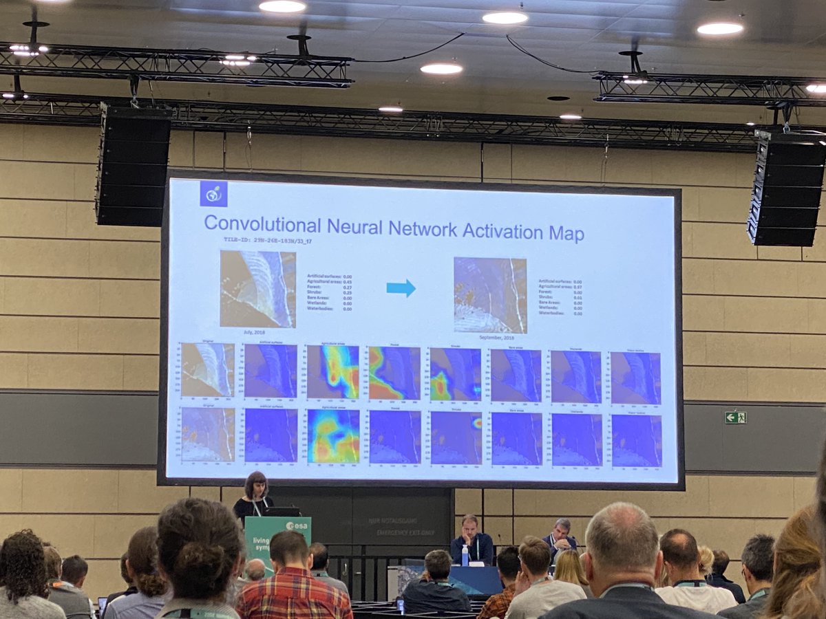
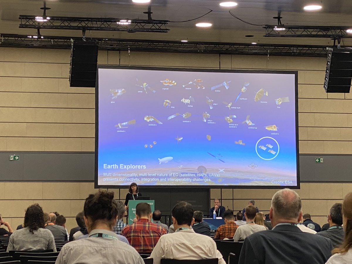
Exciting to see our #H2020#RAPIDAI4EO project at @esa's Living Planet Symposium #LPS22 in #Bonn🤩 Many thanks to Annett Wania from @planet and @RubenVDKerchove from @VITO_RS_ for the great talk and session🙌 If you attend #LPS22 and want to chat, please feel free to reach out.
Are you interested in how we've built a solution for large-scale forest monitoring using Sentinel-2 imagery and machine learning? Join the webinar to see @benjaminbischke introducing our pan-European forest type mapping, developed within #QueryPlanet, an ESA-funded project.
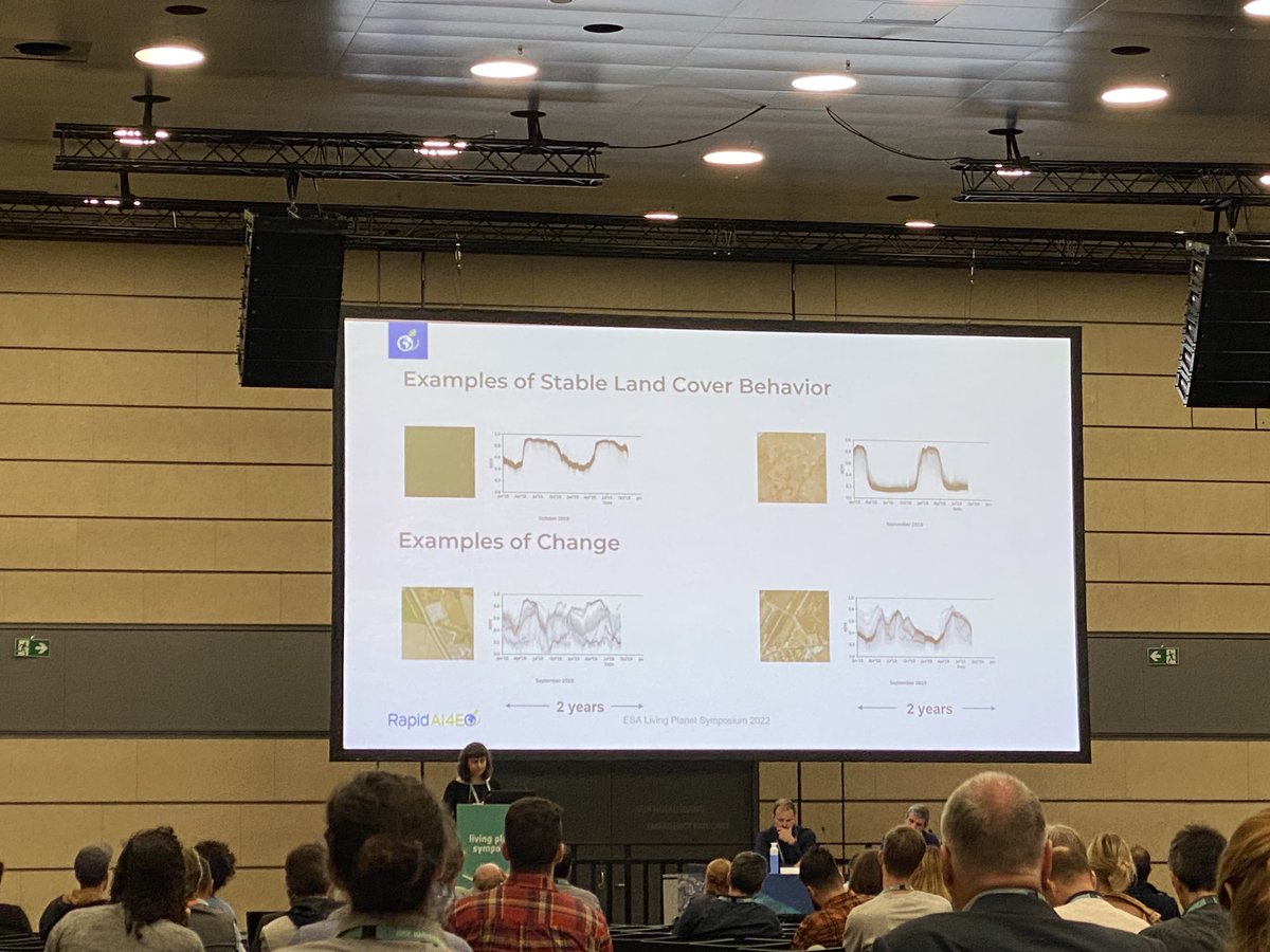
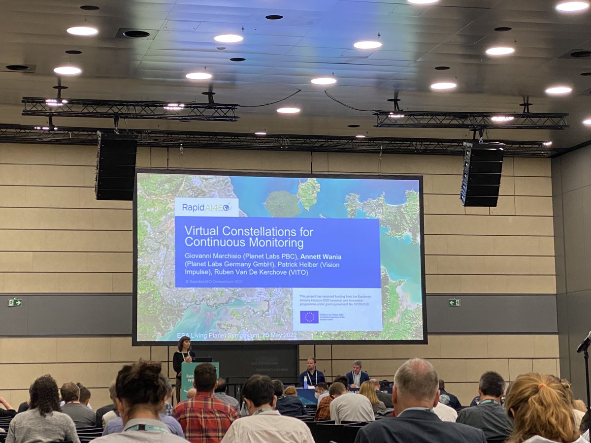
Excited!🛰️😊 Today, @planet and @VisionImpulse will share first insights into the work of the RapidAI4EO consortium advancing rapid and continuous land monitoring with Machine Learning models. Join our #IGARSS presentation TH1.O-9.3! RapidAI4EO is funded under the H2020 program.
🌿🌱🌳🌲 from space!
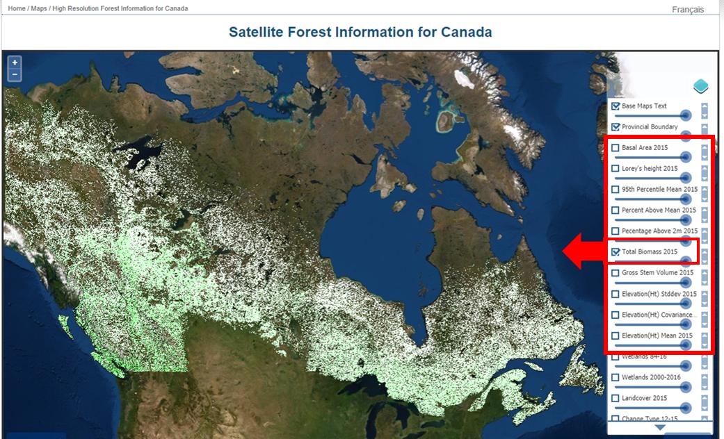
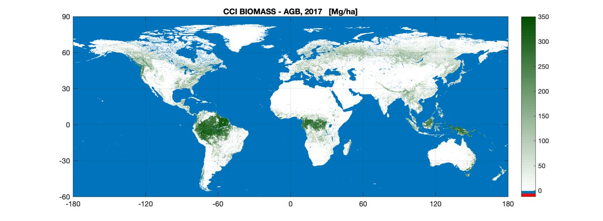
New maps, generated by a research team working as part of @esaclimate, provide a global view of above ground biomass distribution and spatial density over three separate years – 2010, 2017 and 2018.
ℹ️ https://t.co/cd4jAKYScp
Exciting times 🛰️😊. We are looking for motivated and proactive researchers, machine learning engineers, software engineers, and frontend developers to extend our team. We offer full-time, part-time, and internship positions.
Check out our website: https://t.co/sF3SDQxQVJ
We are proud to be part of the RapidAI4EO consortium. Together with our partners (Planet, VITO, IIASA and ONDA DIAS/Serco), Vision Impulse leverages innovative machine learning models to bring land monitoring to the next stage. RapidAI4EO received funding under the H2020 program.
Ready for #H2020#RAPIDAI4EO to establish state of the art #AI for #EO!🤩
🆙Let's leverage the spatiotemporal dimension at scale & realize rapid, continuous land monitoring for #sustainable development.🛰️💚🌍
➡️https://t.co/d8wzXO4tXR
Die @faznet über Erdbeobachtung, Künstliche Intelligenz und Startups wie unser Spin-Off @VisionImpulse: "Aus der Luft gegriffen" https://t.co/ywReke8f7C
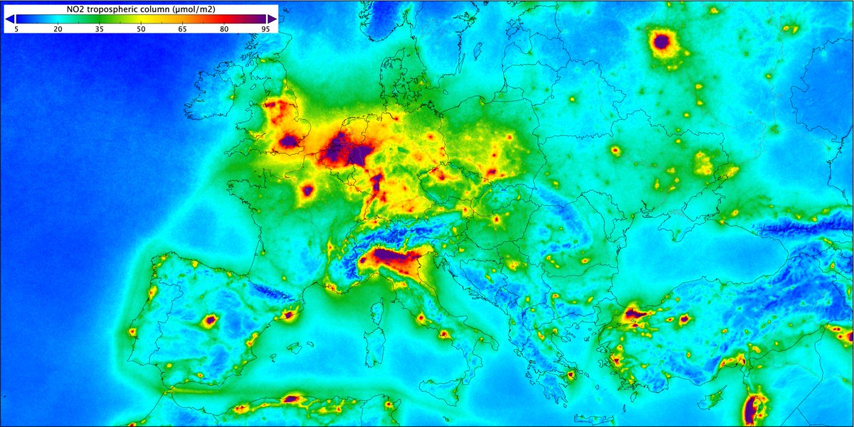
This image shows nitrogen dioxide concentrations over #Europe based on measurements gathered by @CopernicusEU#Sentinel5P from Apr 2018 to Mar 2019. Nitrogen dioxide pollutes the air mainly as a result of traffic and industrial processes. Read more: https://t.co/psdDkXHwCK
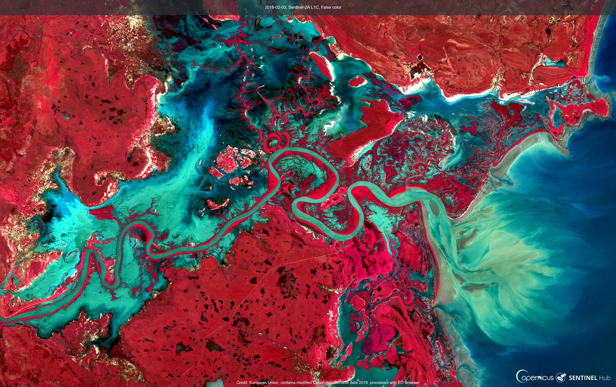
Wishing you all a happy holiday season ❤️ with this colourful view of the Roper River, Australia ➡️ seen with the 👀 of #Sentinel-2 🛰️
More about the location and full-res image ➡️ https://t.co/XwVD67cTBM
📸 in #EOBrowser: https://t.co/YYjhpHq9uu
#EarthArt#EarthObservation
@VisionImpulse haben ein Neuronales Netzwerk geschaffen, mit dem trockene Bäume identifiziert werden können. So sollen langfristig Wälder besser geschützt werden. via @tagesschau
https://t.co/d8S2yt4ezH
A new global map quantifying change in carbon stored as #biomass across the world has been released by @esaclimate during #COP25. The map integrates data acquired in 2017 and 2018 by @CopernicusEU#Sentinel1 and #Japan’s #ALOS mission. Read more👉 https://t.co/A3hBuOxSlv