@OzIndustries Also interesting trump mentioned on Rogan a while back that California have major issues as they have cut funding and aren’t cleaning up the ground vegetation that has died and essentially become kindly and to hear no water in roadside hydrants is incredible.
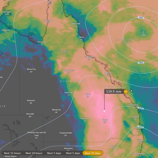
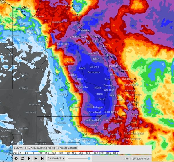
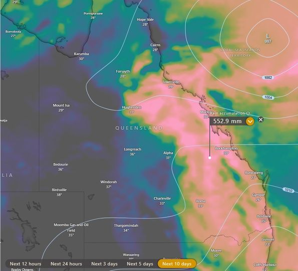
While we wait out a probable tropical cyclone impact on the Qld coast (Cardwell - Mackay regions) future rainfall is the next focus of conversation.
For some time now I have mentioned wet signals for week 4 that may extend into early February.
This indicates a long duration wet period and is likely to be associated with the path of any tropical system (this includes the western system).
Future tracks of the eastern system may become an issue for the eastern parts of the country as any low tracks southwest into the Qld interior and south - southeast.
Should the low track further inland toward inland Central Qld the northern Monsoonal flow may enhance prolonged rainfall for the Nth Tropical coast south to the Mackay Whitsunday region while also injecting higher moisture levels into the interior.
Due to the shape of the coast from Cardwell to Bowen, this can act as a convergence funnel and there is the risk of intense rainfall outcomes over an extended period.
If the system remains confined closer to the coast and tracks southeast essentially all major rainfall would be restricted to coastal regions about the track and to the south of the low.
Rainfall potential may be higher than models indicate for the Cardwell -Herbert Burdekin to Mackay coastal regions should any tropical feature track south southwest into the eastern interior.
Speed of movement is also a factor as a slower moving feature may prolong rainfall durations also.
Rainfall accumulation maps are a guide only although there is fair agreement of 100-500mm+ over the coming days.
Pre cyclone rain since November has already primed many waterways in the east and the coming events have significant risks to homes, infrastructure property and live stock regarding flood outcomes.
Flood events may be over widespread regions and include many major catchments and rivers in the east from the northern Qld to parts of NSW.
Follow all official warnings moving forward.
More to come as the Coral Sea system develops, however models have been trending closely over recent days and weeks and this must be considered to indicate future risks are a higher probability of occurring.
This should come as a reminder of the wet period that is due to form in Q2 and Q3. The trend of wetter events leading into 2024 that I have been mentioning since early 2023 is clearly evident.
Microsoft defying the crash claims to date too.
For reliable forecasts ahead of time become a member at https://t.co/CdpOcHnmvg
Join the Discord!
Join a growing online community and gain access to Gann materials as well as many other esoteric topics, mindset and trading resources.