Stonehenge Original Moon Circle: another mystery falls to ECDO Theory?
Stonehenge began not as the famous sarsen monument, but as a 56-position Moon circle. Why 56?
ECDO offers a potentially testable resolution to that mystery: 56 years closely approximates three 18.61-year lunar nodal cycles - the cycle governing the Moon’s extreme positions relative to Earth’s equatorial bulge (Panel 1).
The Aubrey circle also provides an angular unit of 6.4286°, with 4 surveyed subdivisions offering still finer resolution. Such a system could potentially track the observable ingredients of maximum lunar gravitational-gradient forcing: nodal position, syzygy, lunar distance/perigee, and horizon azimuth.
The conjecture: Stonehenge I (moon circle - Panel 2) may have functioned not merely as a lunar calendar, but as an instrument for identifying a recurring lunar torque-risk window - one potentially relevant to ECDO rotational risk.
Hence why 80% of UK circles are moon circles, not solar - and all this ancient fixation on the phases of the moon.
The value of the hypothesis is that the geometry can be tested against the mechanics rather than assumed from the monument. In addition, we conjecture this as the basis for the square north-blocks buried into the aurora borealis on Gobekli Tepe Pillar 43.
🚨 NOW: President Trump says he's WELCOMING every business fleeing Canada for America — saying they will face 0% TARIFFS
Mark Carney and Doug Ford are fuming.
"Let all Canadian Companies that are doing business with America move to the United States, immediately. Many of them are Companies that moved out years ago due to stupid U.S. Leadership. When you move back, there are no TARIFFS! President DONALD J. TRUMP" 🇺🇸
🚨BREAKING: EVERY major AI: SuperGrok, ChatGPT-5, and Google Gemini — independently concluded that vaccines cause autism after reading our landmark study.
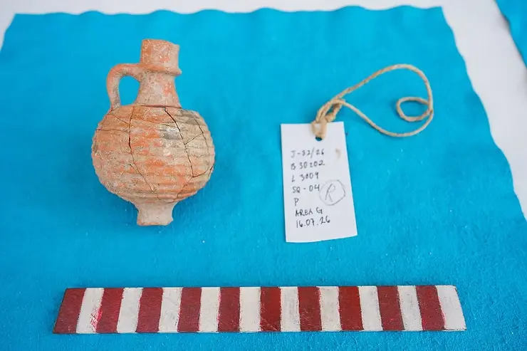
🇮🇱 Archaeologists say they finally found the lost city where Jesus fed the five thousand
Ten years of digging on the shore of the Sea of Galilee, and this summer the ground finally gave it up. Coins, makeup tools, Roman walls, and half a carved column that once decorated a public building.
Then came the oil lamps. Three of them in a single day out of one patch of dirt, and that style was only ever made in Jerusalem before the year 70.
Find those and you have proof that Jewish families were living right there while Jesus walked the region.
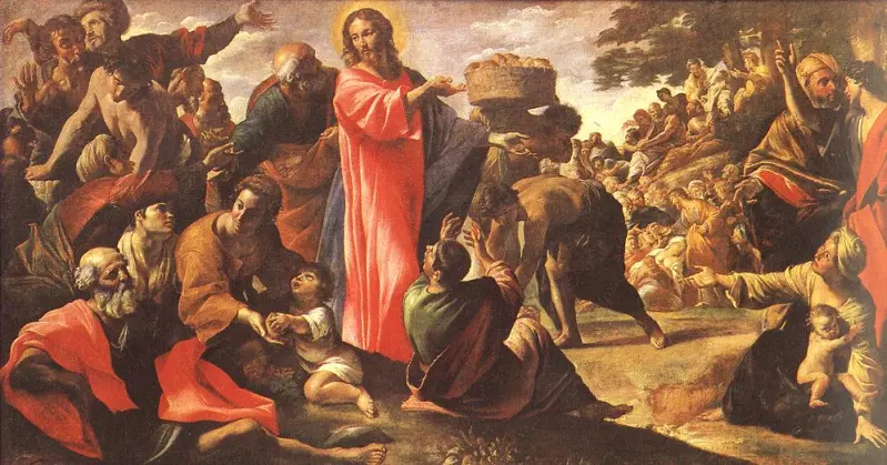
This is Bethsaida. The Gospels put the feeding of the five thousand here and the healing of a blind man. Peter, Andrew and Philip called it home.
The dig director calls it the last lost city of the Gospels, and after a decade of pulling artifacts out of it, he says nothing they have found argues against it.
Source: New York Post / Writer: Daniel
Okay… I Googled this and end up going down an insane rabbit hole.
These are Demodex mites.
Almost every adult has them living in facial pores. They hide during the day and come out at night to feed and mate.
The cream in that post is prescription ivermectin that kills them.
Logging off for the night.
Biblical Bethsaida may now have been located. Previously it was thought to be, well, someplace else. Isn’t it interesting that so many artifacts and sites that lay hidden or undiscovered for thousands of years are being found now?
‼️WOW - Alberta Premier had to explain to Mark Carney and Doug Ford
what would HAPPEN if she turned off oil to the USA
"Line 5 goes through Michigan to Ontario....Pearson Int'l Airport would run out jet fuel."
Her IQ is easily 140 and shes dealing with imbeciles.
“The World Health Organization” now states on its website:
“Vaccination against COVID-19 can trigger multiple sclerosis through cross-reactive CD4+-T cells that recognize the spike protein of SARS-CoV-2 and myelin peptides.”
In other words: Your own immune system destroys the nerve pathways and then attacks your brain and spinal cord.
The crime against history most don’t know about…
ISIS destroyed Assyrian archeology.
They burnt Aramaic manuscripts.
They blew up Old Testament history including the Tomb of Jonah.
They erased ancient Churches, driving Assyrians out of Nineveh.
How much was lost?
What's this?
Oh nothing really...
Just a series of reptilian humanoid sculptures on display at the EU Parliament with one of the reptilians holding a window box with humans inside, living their lives obliviously.
Don't worry about it.
The Ancients Knew Something We Don’t!
It seems we’re the primitive ones😉
The Ancients all had advanced technology, We still do not know how they built these Megaliths also many otherw have been found across the planet. The didn't have digital computers nor printers either. Maybe they did, everyone can only speculate.
https://t.co/hI2NsdgqdQ
🚨 LMAO! BILL MAHER JUST DROPPED:
"Trump [renamed] Lake Ontario to Lake America — liberals are VERY pissed at this. They say, 'you can't just go around renaming things to suit your agenda!'"
"Just ask my LatinX birthing person!"
💯🎯
🚨Recent satellite imagery suggests that the Department of War has conducted a covert dredging operation to open up a never-before-used shipping corridor through the Omani side of the Strait of Hormuz.
The corridor in question is an approximately 1,600-foot-wide waterway with a natural depth of about 93 feet, meaning that only a small amount of dredging would have been necessary to make it safe for VLCCs (Very Large Crude Carriers).
Worth noting, ships navigating this corridor remain completely outside the Iranian regime’s line of sight due to the Omani island of Jazirat Musandam and the curvature of the Earth.
Follow: @MorseReport
President Trump with class.
King Harald of Norway has passed. A strong, proud, and greatly respected man who loved his country and was truly loved by his people.
Our hearts are with the Royal Family and all of Norway.
A truly BIG loss. 🇺🇸🇳🇴
Lost city 'perfectly matches' Biblical site where Jesus fed the 5,000... as humble birthplace of Keeper of Heaven's Keys is uncovered https://t.co/JQpSwEAHNg
🚨 BREAKING: In a MASSVE move against the meatpacking monopoly, President Trump is hereby authorizing farmers and ranchers to DIRECTLY PROCESS their OWN FOOD
Trump is declaring WAR on artificially high meat prices! 🔥
"For years I have heard that they have had a tremendous problem with the Big Processors, who many say are a nasty Monopoly."
"There are, essentially, 4 of them, a very non competitive number, and they make life miserable for our wonderful Farmers and Ranchers, and I can’t let that happen, can I?"
"So, in order to break this powerful monopoly, with much of its ownership based outside of the U.S., I am authorizing legal documents to be drawn in order to allow Farmers and Ranchers to be given the right to PROCESS THEIR OWN FOOD."
"This should move quickly. Thank you for your attention to this matter! President DONALD J. TRUMP"
Another ancient map mystery falls to ECDO Theory.
Previously, we resolved the Piri Reis map under the ECDO construct. Now we resolve the infamous "upside down" Fra Mauro Map.
Contention: The Fra Mauro Map preserves an ancient Np′-referenced geography from Mesopotamian resource maps.
1. The map. The Fra Mauro Mappamondo, produced in Venice around 1450 (with the surviving work associated with the 1448–1460 period), is among the most important surviving maps of the pre-Columbian world. Fra Mauro was a Camaldolese lay brother and cosmographer at San Michele in Venice, active in cartography, topography and hydrological work - not a navigator who personally surveyed the world.
2. Fra Mauro was a compiler of earlier cartography.
This is not conjecture. Scholarship recognizes that he used existing maps, Ptolemaic material, nautical charts, traveler reports and geographical drawings supplied by others. Remarkably, the maps reportedly supplied to him for the African interior have themselves been lost.
Hint: One NAVIGATES by the visible celestial north pole to determine latitude - that is WHY the closest visible pole is always UP on navigation charts. This chart is no exception. The local visible pole was up.
3. The standard interpretation calls his great map “south-up.” Modern scholarship explicitly describes the main map this way. Yet Fra Mauro himself never explains why he oriented it so.
4. But Fra Mauro knew perfectly well which way north was. The cosmographic material surrounding the principal map demonstrates that he understood the conventional terrestrial/celestial framework. Thus TES does not regard the main map's peculiar orientation as evidence that Fra Mauro personally believed geographic south should be “up.” Fra Mauro purposely places the Artic up in the globe depiction on the bottom right, so the "south up" convention CAME FROM HIS SOURCE MAPS.
Hint: But South is not actually "up" on this map.
5. When recognizable geography is registered to the modern globe, the principal map does NOT simply resolve with today's South Pole at its top.
TES finds the present polar axis displaced by approximately 30° from the map's apparent polar axis.
6. Something remarkable occupies that apparent pole instead: Np′. The map's upper pole resolves near the ECDO State-2 North Pole, Np′, independently derived at approximately 13.93°S, 30.80°E, in south-central Africa.
7. Np′ was not derived from Fra Mauro. This is critical. TES derived Np′ independently from the convergent obsequience of 118 (thus far) ancient monuments. The Fra Mauro map therefore constitutes a separate dataset potentially pointing toward the same geographic coordinate - JUST AS DID THE PIRI REIS MAP.
8. The geography provides a second line of evidence.
Fra Mauro depicts anomalous African and Indian-Ocean geography—including the Diab region, unusual East-African hydrology and extensive Indian-Ocean islands/lands—that does not correspond straightforwardly to today's geography.
9. Independently, the Havenbound ECDO simulation generates altered State-2 geography in these same broad regions. Most notably, the model produces major changes to Indian-Ocean land distribution and inundation associated with the East-African Rift.
Preliminarily, these model results show the same chains of novel islands and land emergence (Lemuria) as is depicted on the Fra Mauro map.
10. TES's inference therefore is NOT simply “Fra Mauro drew an upside-down map.” Historians are wrong.
It is:
Fra Mauro appears to have incorporated older source maps whose underlying geographical reference frame was Np′. Fra Mauro recognized their geography but apparently did not recognize that their “north” represented a former geographic pole. He consequently preserved portions of their geometry while reconciling them with the State-1 world known in his own time.
11. This would explain an otherwise curious combination: recognizable medieval geography (centered on Mesopotamia, not Europe or Italy), anomalous paleogeography, an apparently peculiar orientation, and a map axis that TES contends resolves upon the same Np′ independently indicated by ancient monument orientation.
12. The hypothesis is testable. Georeference Fra Mauro using recognizable geographic anchors without specifying Np′, solve independently for the map's implied polar axis, and compare the resulting coordinate with Np′. Then compare Fra Mauro's anomalous land/water distribution against the independently generated Havenbound State-2 geography.
TES contention: Fra Mauro did not deliberately make an ECDO map. He unknowingly preserved fragments of one or several maps from Mesopotamia, which were ECDO State 2 maps.