Have you joined the Missoula #FireLab for its 1-hour seminars? This Thursday at 11am MST, research ecologist Russell Parsons presents on his work using 3D models that support prescribed fires. https://t.co/9dB57UOt3a (1/3)
@stefanopuliti Awesome, as a forester that codes on the side, tutorials/scripts are 🔑 Would love to play around with some of the new segmentation models.
Job alert 🚨! My lab is hiring a Graduate Research Assistant (Masters):
Uncrewed Aerial Systems Applications in Fire Management
The research will use UAS, IR imagery, and advanced geoprocessing tools to study fire
https://t.co/tEVHgf62Sb
@NAUForestry@ERI_NAU@fireecology
Big News. NVIDIA just announced Neuralangelo.
The new model can turn videos from any device into detailed 3D structures, fully replicating buildings, sculptures, or other real world objects or spaces virtually.
Here's how it works:
A model utilizes a 2D video with multiple angles of an object or scene. It selects frames from different viewpoints to understand depth, size, and shape.
The AI creates an initial 3D representation, similar to a sculptor shaping a subject. The render is optimized to enhance details, like a sculptor refining texture.
The outcome is a 3D object or scene suitable for virtual reality, digital twins, or robotics.
In fall of 2024 GEDI will be back at its original location and again collecting data, potentially through 2030, starting a new epoch of ecosystem structure observations. Congratulations to the entire GEDI team for an amazing first chapter and looking forward to the next! 🚀🌟
@bi0m3trics @SKrisanski It was fun, I bet if I run it longer with more training data I’d get better classification results. Excited to see y’all’s CWD classes.
@bi0m3trics @SKrisanski Nice! I tried to train with sub-canopy SfM plots last fall for a term project. Stock model reports were pretty good, but local model was underfit. Had to emulate x86 environment and only ran a dozen epochs.
Our open-source teaching materials from the COST action @3DForEcoTech summer school are online!
Hopefully a useful resource for all, but especially for educators who want to include UAV/TLS/mobile laser scanning or photogrammetry in their teaching.
➡️ https://t.co/F8VKQ2iCEs
11 ways ChatGPT saves me hours of work every day, and why you'll never outcompete those who use AI effectively.
A list for those who write code:
1 of 16
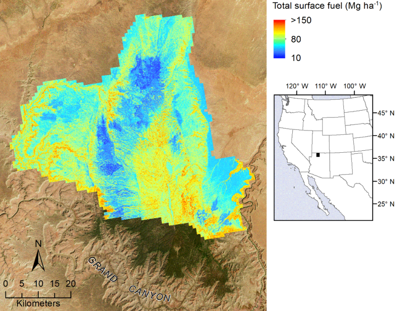
Researchers developed a method for pairing field plot data and airborne lidar to map fuel loads across Arizona’s Kaibab Plateau. By combing these fuel maps with fire history information, researchers can estimate fuel load accumulation through time. https://t.co/OZOr8hxAam
After more than five years of work: our new publication on how to almost double woodland carbon overnight; or, when models work a bit too well.
Full paper: https://t.co/m7x2Gs3Ktm
[1/10]
@HannahWe8 @kimcalders@IuricichF@ArmstonJohn Second this! I know it’s a lot of work but I’m a forester with ~some~ coding and would love to try this out. Great paper!
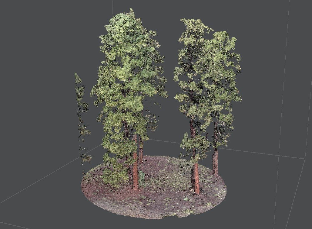
Been working on a sub-canopy SfM project to run through and train FSCT for some SW ponderosa forests.
Pretty happy with the "low complexity" point cloud results. "Only" used ~120 photos and a couple hours processing on my Mac. Let's see what FSCT can do with this... @SKrisanski