Check it out! Here is a 3D visualization of the 1 second GPS data points from the #tornado sensor launched into EF4 wedge south of Lawrence, KS last week, created by @ChasinSpin! The tornado/meso carried the sensor over 30 miles, losing signal at 34,000'! RED is prior to apogee
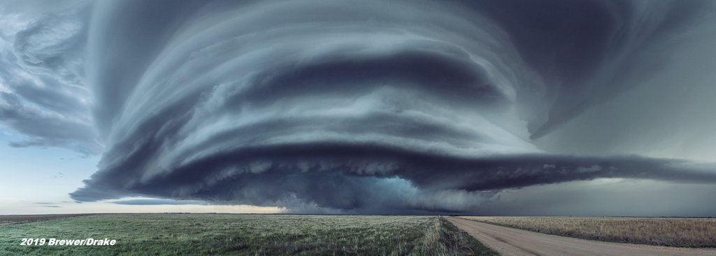
Panoramic photos from yesterday of the striated 'Beast of May' supercell near Imperial, NE.
#weatherpicofday
w/ @JustonStrmRider
(need to retry one - alignment of striations is off)
UPDATE: @ChasinSpin receiving live meteorological data from rocket sensor inside wedge #tornado while preliminary data shows the tornado lofted the sensor to 10,422 meters or ~34,000' in a matter of minutes @SeanSchofer@aaronjayjack
We are on the lookout for search and rescue