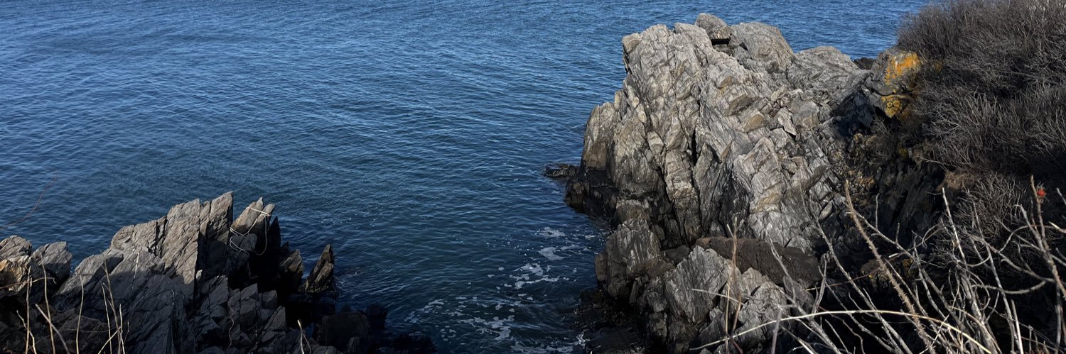
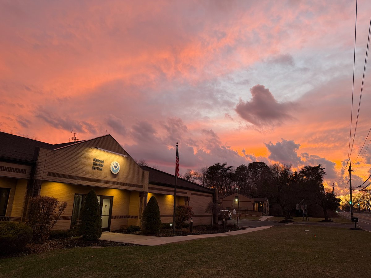
🌇 We were treated to a spectacular sunset this evening! We are also hearing the spring peepers for the first time this season in the wetlands behind our office. It seems as if spring has sprung!
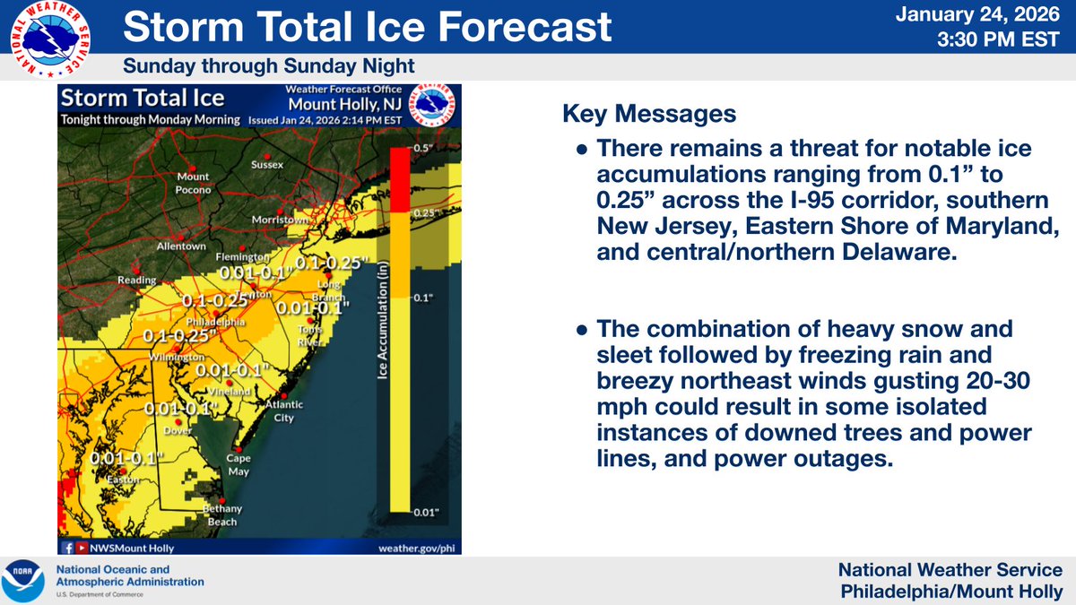
⚠️Strong winds are expected today, and power outages are possible⚠️
Power outage safety:
🔦 Use flashlights, not candles
❄️ Keep fridge/freezer doors closed
🚫 Never use generators or grills indoors
🏠 Generators should be 20+ ft from doors/windows
🤝 Check on elderly neighbors
🚨 EXTREME Impacts
The latest Winter Storm Severity Index highlights areas including southeast PA, NJ, Long Island, RI, and southeast MA as having the highest impact level. This means extensive and widespread disruptions to daily life, as well as dangerous or impossible travel.
The First EVER "High" risk of extremely dangerous winter storm conditions has been issued for tonight / tomorrow around the NYC area. This product went live at the beginning of this winter...
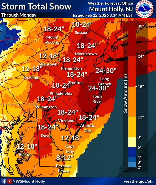
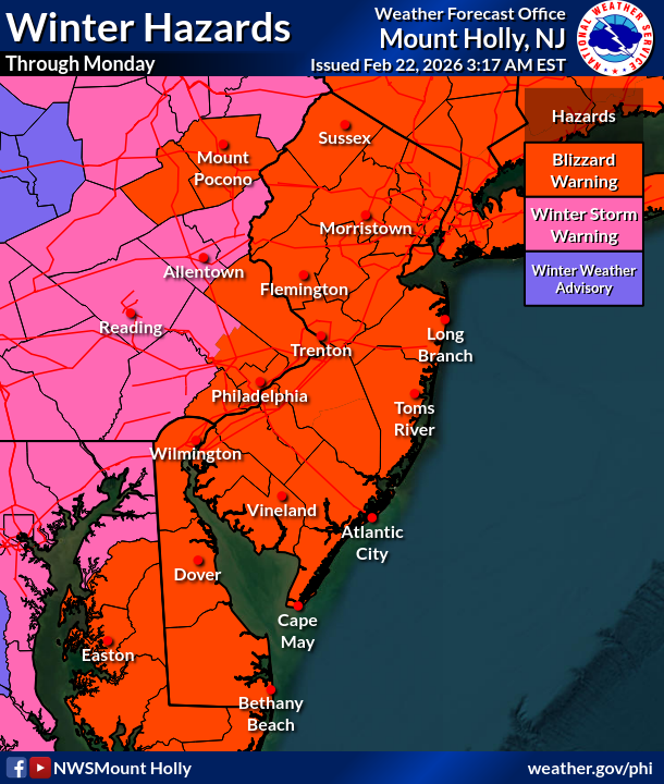
3 AM Sunday: Here's our latest snowfall forecast. Blizzard Warnings were expanded a few counties inland, and now include Philadelphia, adjacent portions of SE PA, all of NJ, all of DE, and the southern Poconos. heaviest snow/winds will occur tonight. (1/3) #PAwx#NJwx#DEwx#MDwx
Portions of the region are under a blizzard warning. It has been a few years since the region saw a blizzard, so as a reminder, here is the definition of a blizzard. The combination of winds and blowing snow result in whiteout conditions. #NJWX#DEWX#MDWX
Monster nor'easter about to absolutely bury the Northeast on Sunday / Monday. We're talking over a foot of now, blizzard conditions, near-zero visibility along the coast. If you're anywhere from Jersey to New England, get your bread and milk now. This one's legit.
Happy "Solar Spring"! Today is the mid-point between the the Winter Solstice and the Spring Equinox, marking the quarter of the year of most rapid daylight gain. We're now gaining over 2 minutes of daylight every day and this will continue until May.
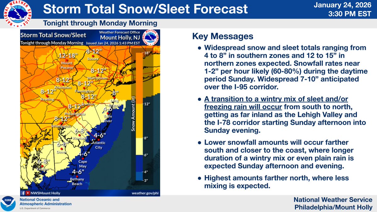
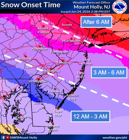
❄️🧊 Here is the latest forecast update for the winter storm starting after midnight tonight through Mon morning. The heaviest precip will occur during the daytime Sun through the evening, then wind down overnight. Lingering light precip into Mon morning. #PAwx#NJwx#DEwx#MDwx
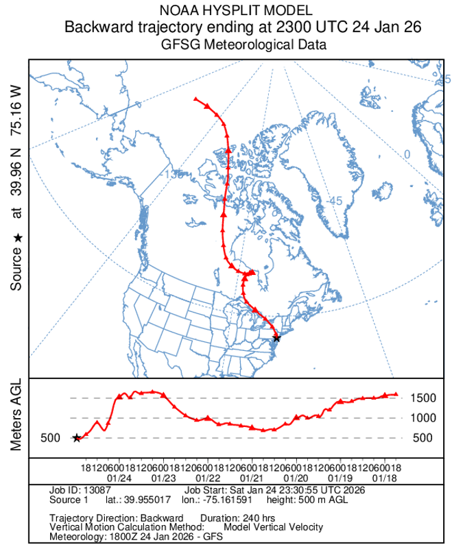
Why is it so cold & dry, & where is all this cold air coming from? Last weekend, the airmass in place across our region was located near the North Pole, which is shrouded in sea ice. It then crossed the tundra of northern Canada and eventually found its way to the Mid-Atlantic!
A #winterstorm is in the forecast, bringing the potential for ice, heavy snow, & strong wind gusts that could damage power lines & cause outages. Please be prepared & stay attentive to weather updates. If you experience a power outage, report it to your #utility company.
We've received questions asking how we could get sleet with surface temps near 20°. Here is a model projection of the temperature profile Sunday evening at PHL. There is a warm layer aloft of air temps just above freezing, enough to melt snow, despite a surface air temp of 23°!
Confidence continues to increase in a major winter storm impacting the region Saturday night through early Monday afternoon. Major impacts from accumulating snow are likely areawide. (1/2)
❄️The latest Key Messages describe a lengthy & highly disruptive winter storm for much of the southern & eastern U.S. starting Friday & lasting throughout the weekend. From significant snow to treacherous ice, expect numerous travel impacts in affected areas. Here's the latest-
Risk of a big winter storm continues to grow, tho uncertainty remains on how much snow falls, & any poss. mixing with ice &/or rain. Consider your plan of action regarding a large snow storm. Travel may be very difficult Sunday, even Monday. Further clarity as we get it.
Very cold air will remain in place over the area tonight. Some moderation in temperatures is expected Wed and Thu before cold air returns. We are monitoring increasing potential for an impactful winter storm across portions of the area this weekend.
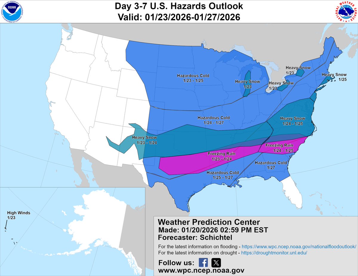
A wide-ranging winter storm will produce great swaths of heavy snow, sleet, and treacherous freezing rain from the southern Rockies/Plains and Mid-South starting Friday and shifting toward the East Coast through Sunday. With a few days to go, the forecast will continue to evolve. Keep up with the latest at https://t.co/qk3BcVP5M8.
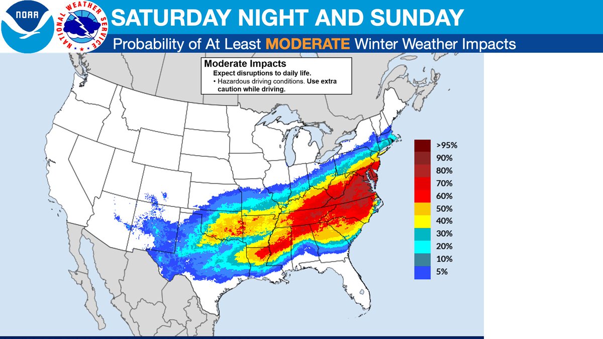
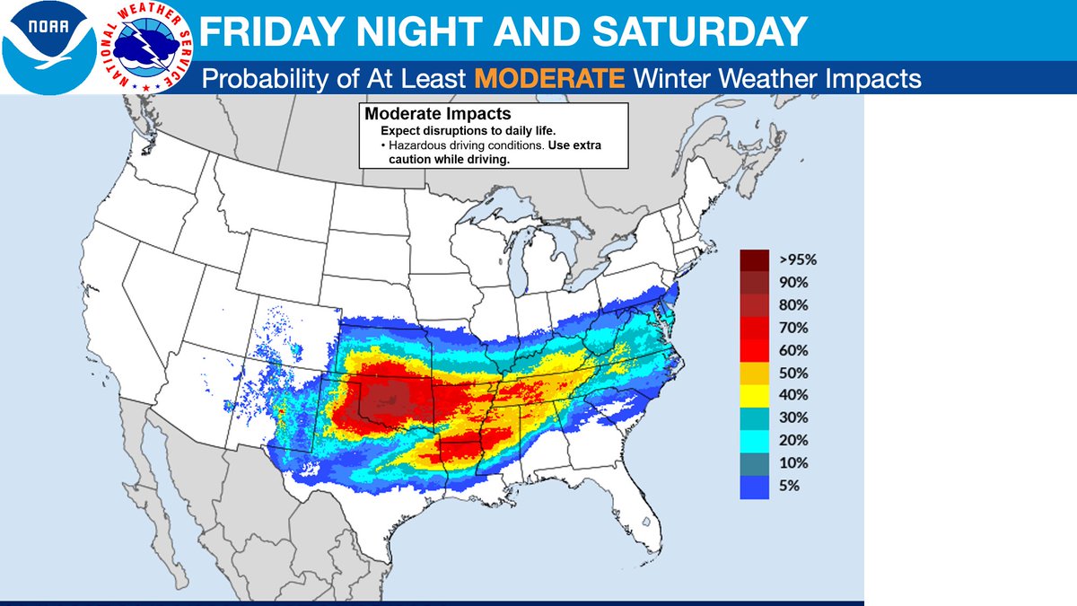
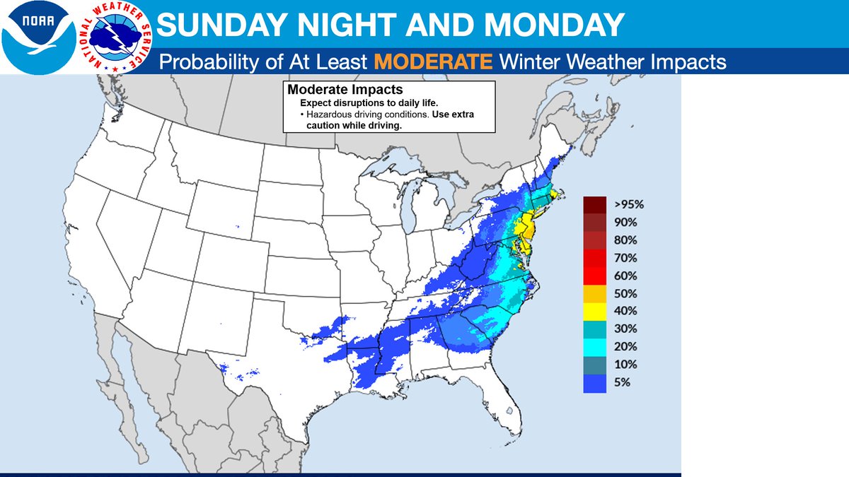
Probabilities of at least MODERATE winter weather impacts (see thread for MAJOR):