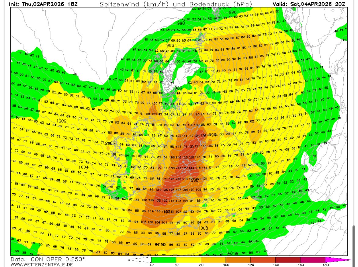
ICON massively upgrades wind gusts for the Welsh coast on Saturday.
I will be on an exposed peninsula in Pembrokeshire on holiday, looking forward to it! 🤣
#StormDave has been named and is forecast to bring damaging winds across northern parts of the UK, with some disruptive snow possible in northwest Scotland later on Saturday and into Easter Day #WeatherAware
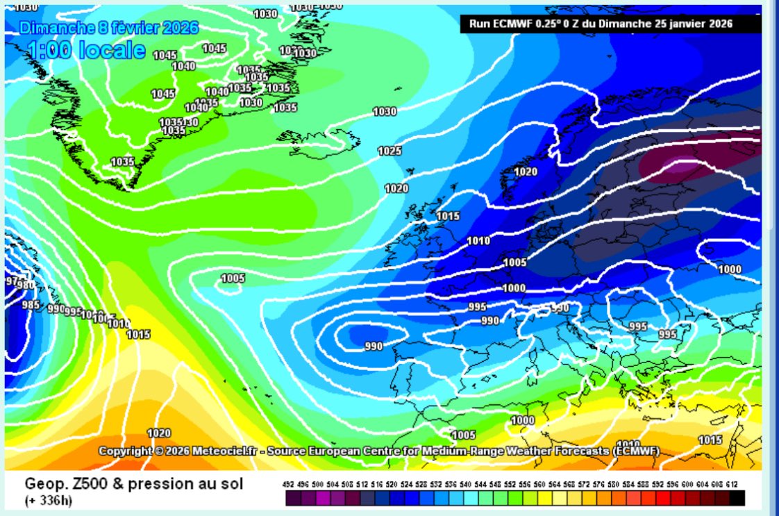
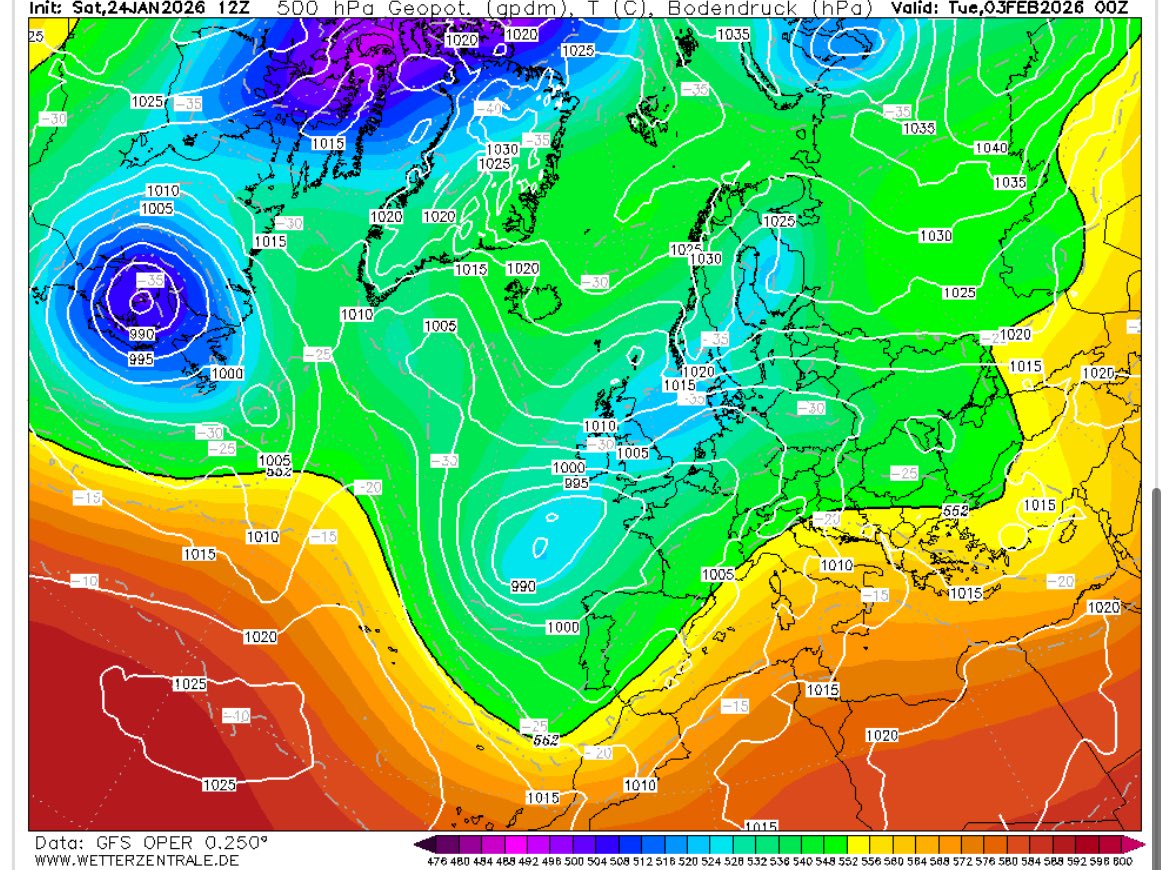
The ECM adds to the growing momentum for something much colder and snowier into early Feb. Our current pattern could easily flip to cold, just as easily as it could flip to mild like this week, watch this space 👀👀👀
IMPORTANT:
🚩 REVOKED.
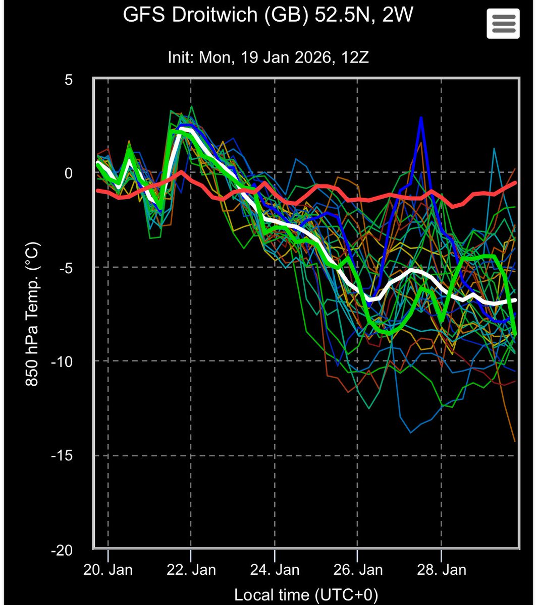
Substantial shift back towards colder patterns starting 26th.
We are now back to 0 flags with an increasing likelihood of cold weather.
The mist is finally starting to clear this Sunday on ECMWF, UKMO & GFS the original big 3 all singing from similar hymn sheet. Low pressure disrupting south into France and a cold easterly fetch to end this week.
In terms of potential ❄️ that is more relevant into next week. However, the far north including Scotland will likely start seeing snow risks as early as Saturday.
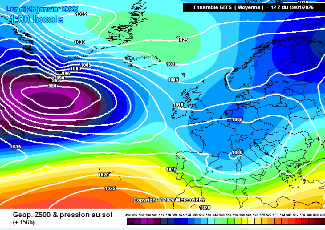
Huge improvements on the GEFS 12z, looks mainly down to an increased confidence in the energy from the Atlantic heading south into France, opening the door to easterlies, rather than southeasterlies, for the UK this weekend