@vetopropac You need to check your payment systems. If I hadn’t been using a virtual card from @PrivacyHQ , this would have been a disaster for me. Seems others were impacted as well https://t.co/46WfgmT5c4
@CityofWeslaco please consider the possibility of a traffic light at 88 & 5 1/2. You probably know there’s been a lot of accidents there (go count all the crosses at that intersection) and I just had another near miss this morning. Please help
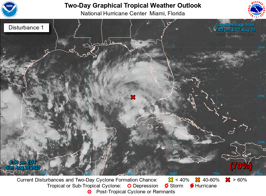
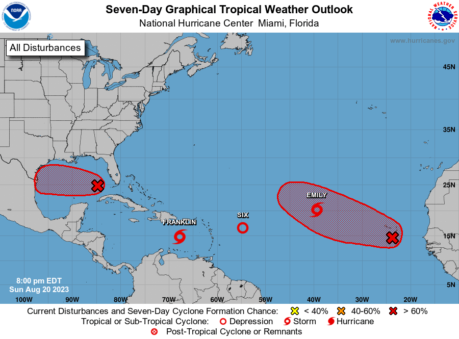
8PM EDT Aug 20: The system in the Gulf of Mexico has a high chance of formation. Interests in the western Gulf of Mexico should monitor the progress of this system. Tropical storm watches or warnings may be necessary on Monday. Visit https://t.co/tW4KeGe9uJ for the latest
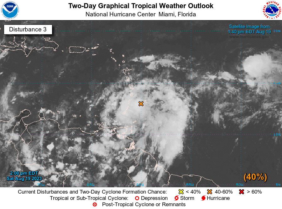
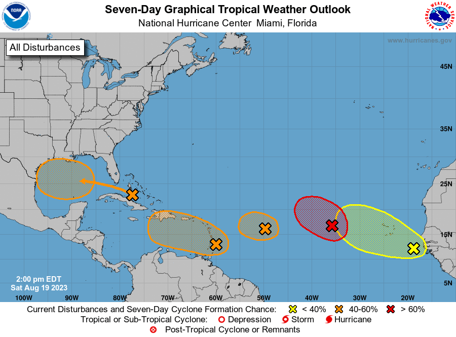
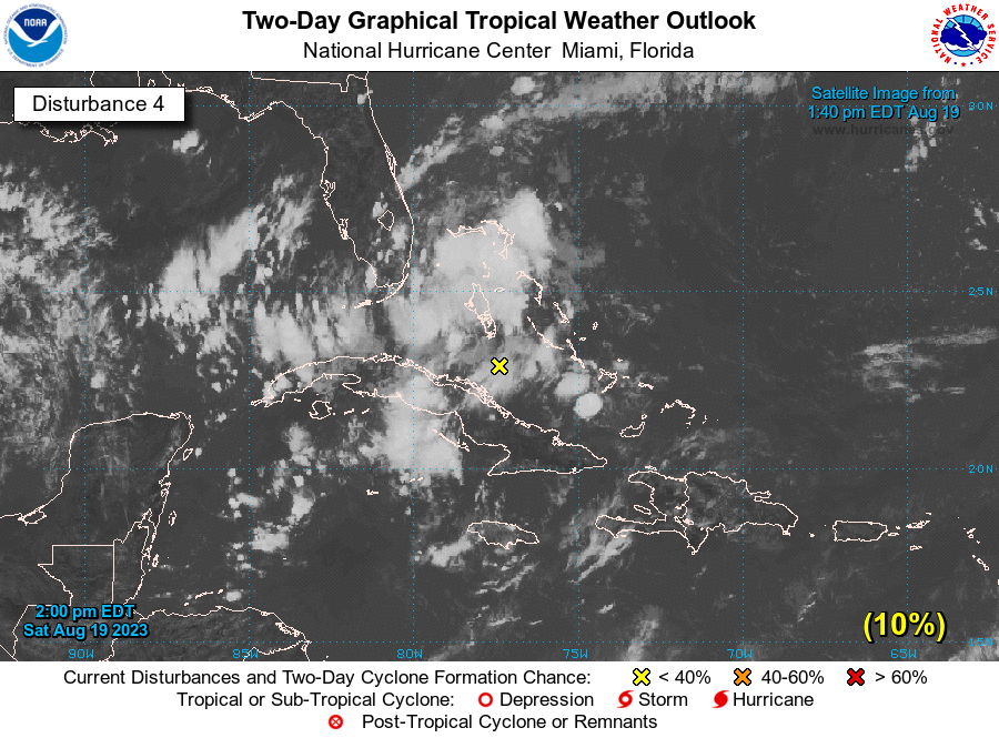
2pm EDT Sat 19 August: There are now 5⃣ systems we are currently monitoring in the NATL basin for TC formation.
Of these features, both Invest #90L near the Windward Islands & another system near the Bahamas pose a risk of land impacts.
Latest Outlook:https://t.co/DboWSR44Dt
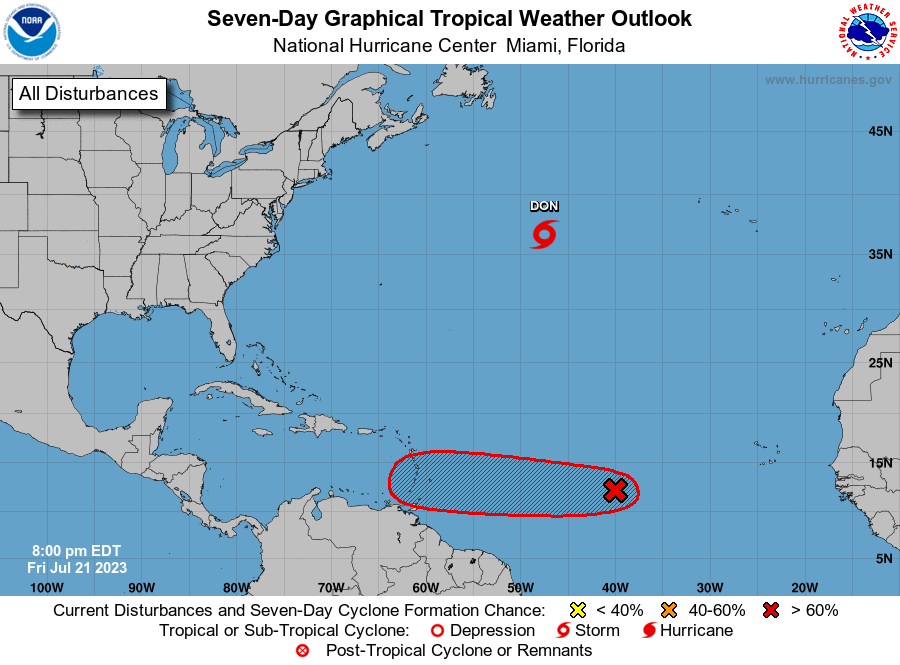
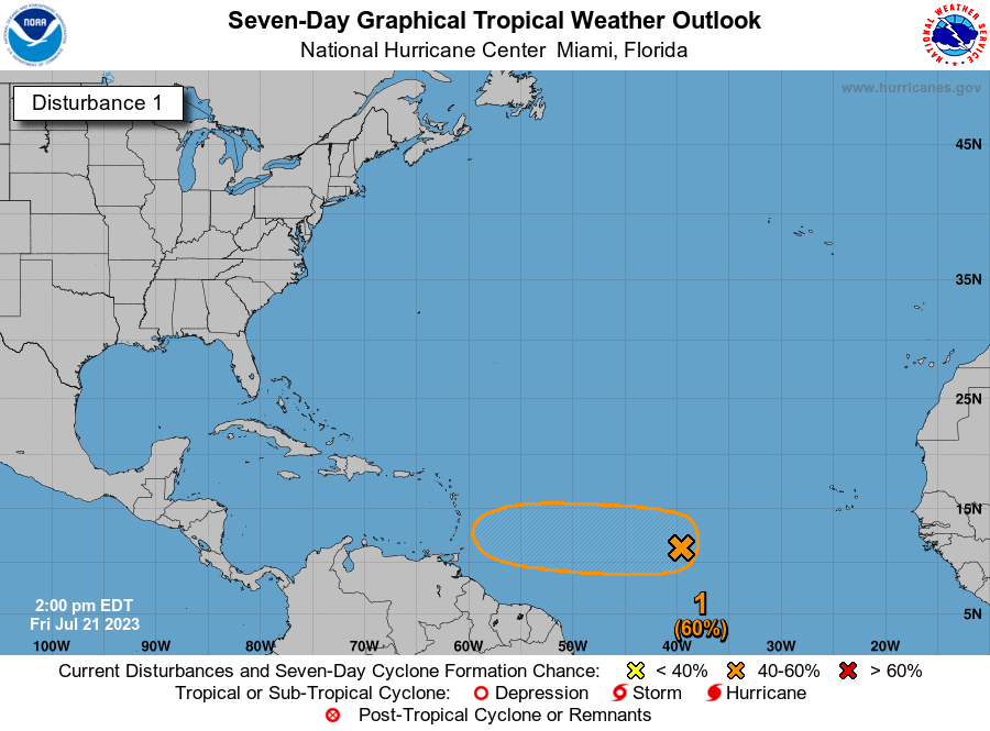
2PM EDT 21 July: An area of low pressure over the central tropical Atlantic has a medium (🟠) chance of development through early next week as it moves westward over the tropical Atlantic. Get the latest information at https://t.co/Iqeygf1jum. #AL95
16 June 8AM EDT: NHC is monitoring a tropical wave off the west coast of Africa. A tropical depression could form during the early to middle portions of next week while the system moves westward across the tropical Atlantic. For more: https://t.co/tW4KeGe9uJ