📢Another hiring alert! CGS is hiring a Geologic Mapping Unit manager. Lead geologic mapping projects, assess geologic hazards, and prepare maps & reports. #hiring#geologyjobs#geotwitterApply now at: https://t.co/yUwgoKoL9D
🚨Exciting job opportunity! CGS is hiring a Geologic Framework Program Manager. If you're a geologist passionate about surface & 3D geologic mapping, this is for you!
Apply now: https://t.co/hAf1CKy47z #nowhiring#geology#geotwitter
The movement of the tectonic plates along the fault captured by satellites at Nurdağı, Turkey, following the 6-7 February earthquakes. The relative shift is around 3-4 meters
[📷Andreas Schafer, Maxar Technologies]
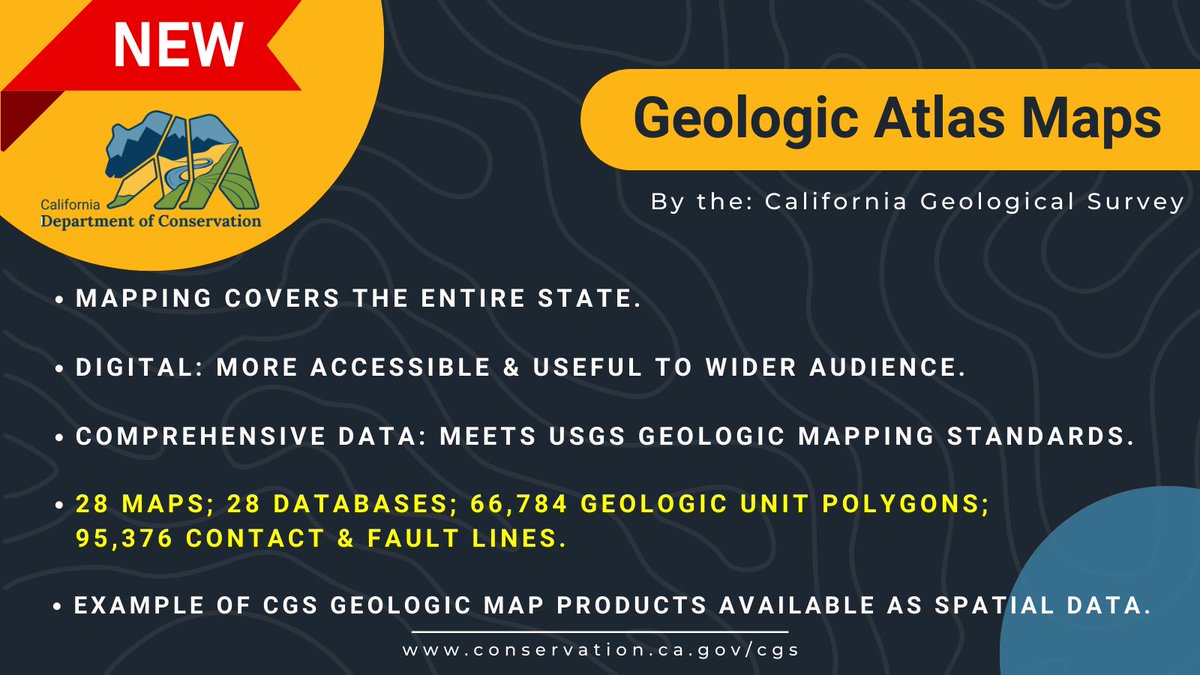
🌎The California Geologic Atlas 250K Map Series is now available for direct download on our website. The new files are completely digitized, spatially corrected, & Level 3 @USGS GeMS compliant. #GIS#mapping https://t.co/9LzMqrV3kN 1/2
Starting in 1 hour!
Power & Indigeneity
Part 1: Indigenous Scientists on the Sustainability of Humanity
Wed, Jun 15, 2022 11:00 a.m. - 12:30 p.m. MDT https://t.co/J1aWOynkw0
Co-hosted by @ESAL_us@ITEPnau and GSA
@magabritle
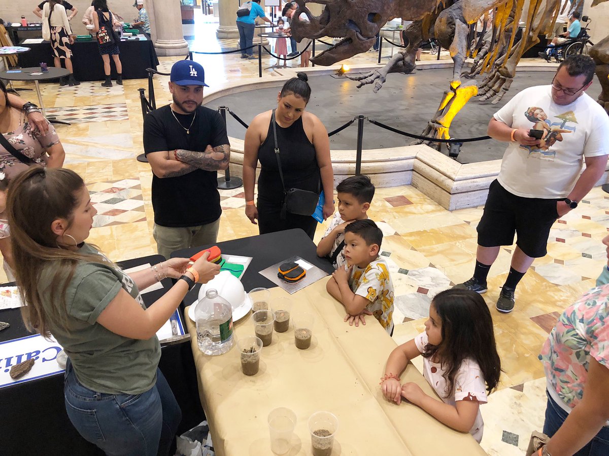
CGS geologists are at the @NHMLA this afternoon from 12-4p for the opening of the new “LA Underwater” exhibit! Come down & learn about fossils, earthquakes, & rocks!
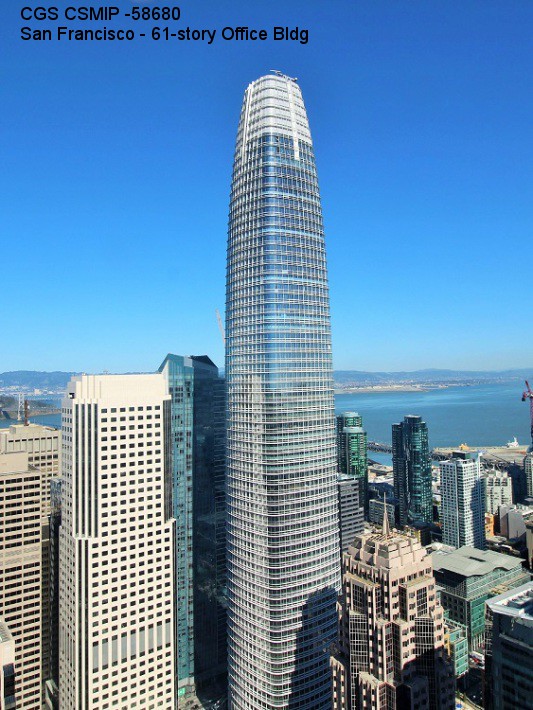
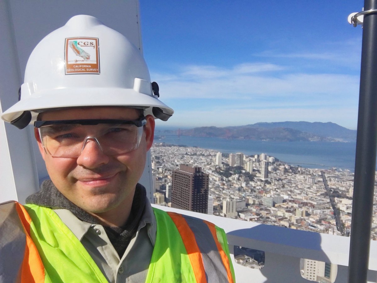
Salesforce Tower is part of California’s network of structures equipped w/ earthquake motion sensors. These instruments are installed by technicians from CGS’s Strong Motion Instrumentation Program like Valdimir Yanusik (pictured here). 1/3
Geologic maps are the building blocks for many specialized CGS products. To build our seismic (earthquake) hazard zone maps, we start w/ a geologic map showing the geographic distribution of different bedrock & soil types. This one is for the Antioch area. #GeologicMapDay 1/4
We❤️science teachers! Last week CGS geologist Cindy Pridmore led a teacher workshop on "The Science behind the ShakeAlert® - California’s Earthquake Early Warning System!" for the 2021 CA Science Educators (CASE) conference. @CAScience@USGS_ShakeAlert@IRIS_EPO#CAscience21 1/7
🌎Today is #GeologicMapDay, part of #EarthScienceWeek! Geologic maps depict the locations & ages of different bedrock/soil types, landslides, & earthquake faults.
Check out our interactive browser for the entire state of California: https://t.co/8utzeoZQFy
If you haven't tried @focusmate yet, you're missing out! It's a great way to stay motivated, productive, and focused throughout the week 🙌🏼 It's a game/life changer!
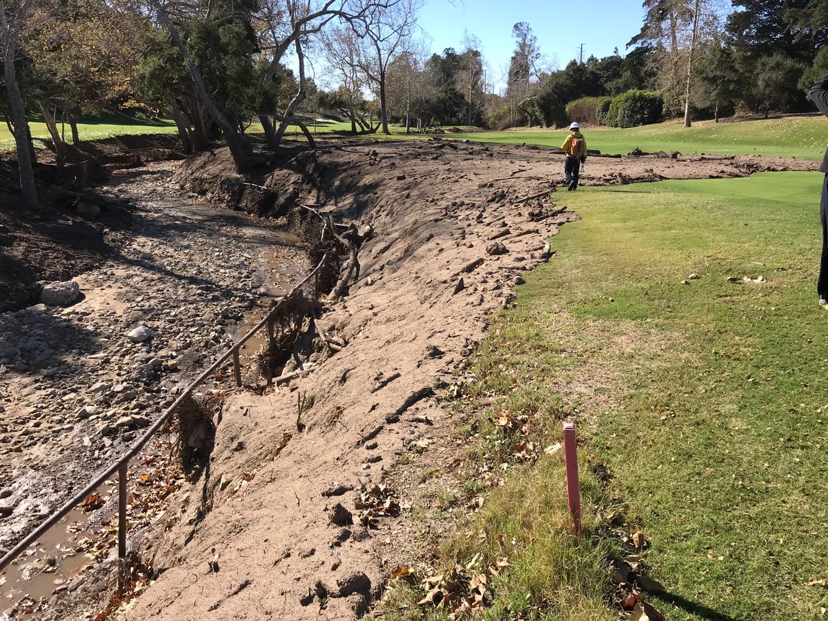
🔥Post-wildfire debris flows can start suddenly, move quickly, & travel long distances.
CGS works with @CalFIRE & @CalOES to identify ahead of time those areas most at risk for these damaging debris flows so we can be better prepared. 1/