Fixed in Pahang, Malaysia. 35/36 satellites, H 0.005 m, V 0.005 m, on a highway topo survey. Sent in by a trial user who’s been on RTKsub for three days. No base station needed, just an NTRIP login on the GEODNET network. https://t.co/cS1GQ407GY
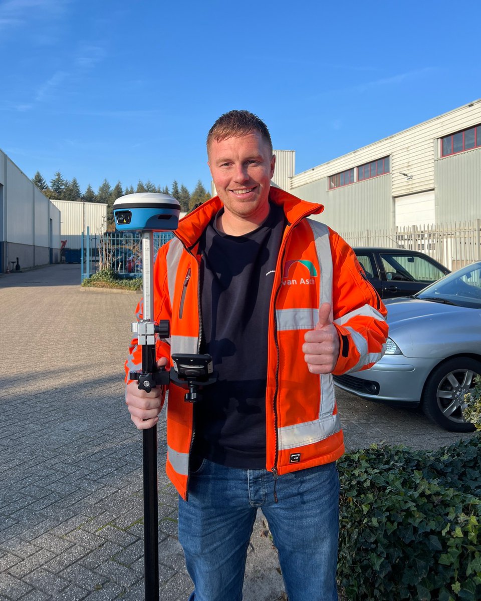
Site manager Tim Kramer of Van Asch Infrastructuur spent a few weeks with the SpatiX X5 on his own road projects.
✅ Accurate
✅ Laser for points you can't reach
🔧 The screen could be bigger
Available in the Benelux through RTKsub, € 4,150 excl. VAT.
https://t.co/mYBdhsQ0c7
What do RTK corrections actually do? And why does your receiver stay on FLOAT instead of FIX?
Our video explains how RTK works and what to check in the field.
Watch the full explanation:
https://t.co/XE7Q2wedUa
#RTK#GNSS#RTKsub
📢 Recently we welcomed @RTKsub_ to UST, a provider of real-time RTK correction data via NTRIP for drones, robots, surveying equipment and other RTK-capable GNSS systems.
Learn more about RTKsub 👇
https://t.co/eCgAsZ7izq
@Starlink Starlink is quietly solving one of RTK’s biggest field problems too. NTRIP corrections need an internet connection, and remote sites rarely have one. Satellite internet plus network RTK means centimeter accuracy anywhere. We see it more and more with drone operators.
We’re heading to INTERGEO Munich, September 15-17. No booth, no sales pitch. Yuri and Wilko will simply be walking the floor.
Three days of GNSS, surveying and drone tech. We’re especially curious about what’s new in RTK hardware and how the correction market is evolving.
Will you be there too? Send us a DM and let’s grab a coffee. #INTERGEO2026 #RTK
One driver leads, autonomous trucks follow. No RTK, no convoy. Centimeter accuracy is the foundation of everything autonomous. #RTK#GNSS#AutonomousTrucks
https://t.co/OvWPCFWCXV
“Normal GPS drifts. Robots can’t.” That’s exactly why RTK corrections exist. We stream them over NTRIP via the GEODNET network, so mowers, rovers and drones know where they are down to the centimeter. No drift, no guesswork.
Your RTK question, answered in seconds.
https://t.co/iHgdttROOA is live — completely rebuilt. Setup guides, troubleshooting and an AI assistant for RTK, GNSS & NTRIP. Free, 24/7, in your language.
"Why is my drone stuck in FLOAT?" → just ask.
👇 https://t.co/9Ak4Xx1NMC
Cherry season in the Betuwe 🍒
Our customer Kok Agro-service spent the past few weeks applying chalk to orchard covers using spray drones. This keeps the temperature underneath up to 7–8°C lower, helping protect the cherry crop during the heatwave.
Drones, cherries and a heatwave. Not your average day at the office.
What’s the most unusual job your drone has taken on this season?
#RTK #DroneSpraying #PrecisionAgriculture
Proud sponsor moment 🦌
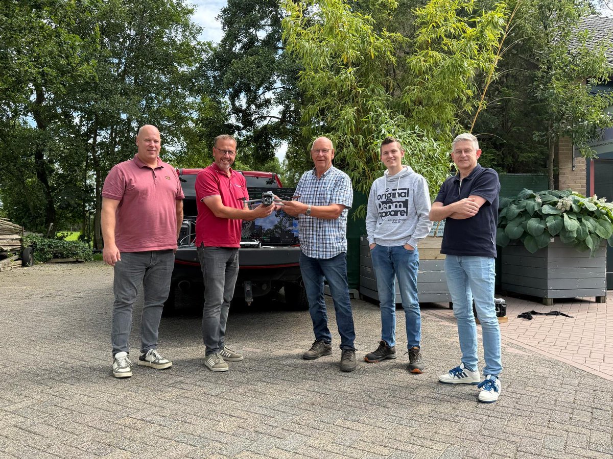
Today we joined the handover of a DJI Matrice 4 with thermal camera to a local wildlife management unit in the Netherlands. They will use it to locate roe deer fawns hiding in tall grass before mowing season, helping save hundreds of young animals every year.
The drone flies on RTKsub NTRIP corrections, so every detected fawn gets a centimeter-accurate position and the team can walk straight to the right spot.
Precision tech isn't just for surveying. Sometimes it saves lives.
#wildliferescue #RTK #NTRIP #DJI #drones
@hackablemag Excellent article ! Le piège de la hauteur ellipsoïdale (36,8 m « au niveau de la mer » 😄) est de loin la question la plus fréquente qu'on reçoit de nos utilisateurs RTK. La différence géoïde/ellipsoïde mérite d'être bien plus connue. Bravo pour la pédagogie 👏
The lasers get all the attention, but there are two positioning systems working together here. Computer vision targets individual weeds at millimeter level, while RTK-corrected GNSS keeps the machine itself tracking the rows at centimeter level, pass after pass, field after field.
That GNSS correction layer is our part of the stack at https://t.co/3CZrJA4kif. Ag robotics like this is exactly why demand for cm-accurate positioning keeps growing.
Solar farm construction is actually one of the classic RTK use cases. Every pile and frame has to match the design layout within centimeters, across thousands of positions. Machines like this navigate on RTK-corrected GNSS, that's how they hit the exact spot every time without surveyors staking out each point.
That correction layer is what we provide at https://t.co/3CZrJA4kif. Great to see the installation side getting automated too.
@kstonekuan@ycombinator@brandon1@hbr_pbc Congrats! Infrastructure work in hard-to-reach places is exactly where robotics should be heading. We work on the GNSS/RTK side of outdoor autonomy, so I'll be following what you build with extra interest. Good luck with the batch!
Night operation has another hidden advantage: navigation. Cameras and vision systems struggle in the dark, but GNSS doesn't care if the sun is up. With RTK corrections, a field robot follows crop rows with cm-level accuracy at 3 AM just as well as at noon.
That correction layer is what we provide at https://t.co/3CZrJA4kif. Love seeing autonomous ag robots like this scale up.