Time-lapse of the snowfall between ~3AM and ~9AM showing 8.5" to 30" inches of snow. Max snowfall rates at approx. 20 seconds into the video (!! >6"/hr !!). Will post the full time-lapse soon! @NWSAlbany
Powerful storm systems called atmospheric rivers can cause flooding and billions of dollars in damage.
@benstracy joined a team of hurricane hunters who are flying into the extreme weather events to gather more and better data for forecasters. https://t.co/p3zn2uSIzz
Continuing with the last session of the Keyser symposium — Eric Hoffman presenting an objective climatology of @NWSWPC analyzed stationary fronts, finding a maximum near the Rockies front range. #AMS2024
A partnership between the United States Air Force, NOAA, and the Scripps Institution of Oceanography at UC San Diego is helping generate data that is improving the quality and accuracy of weather forecasts. https://t.co/4ImLD6nl42
If you have an issue with a baseball stadium hosting a football game sponsored by a cloud storage system named after a Japanese horseradish kicking off at 11 a.m. on a Thursday, then I’m not sure we can be friends
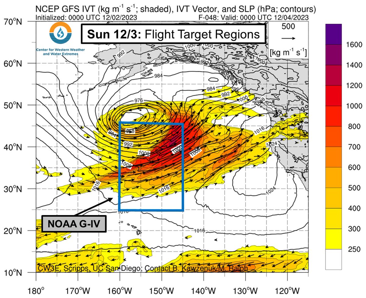
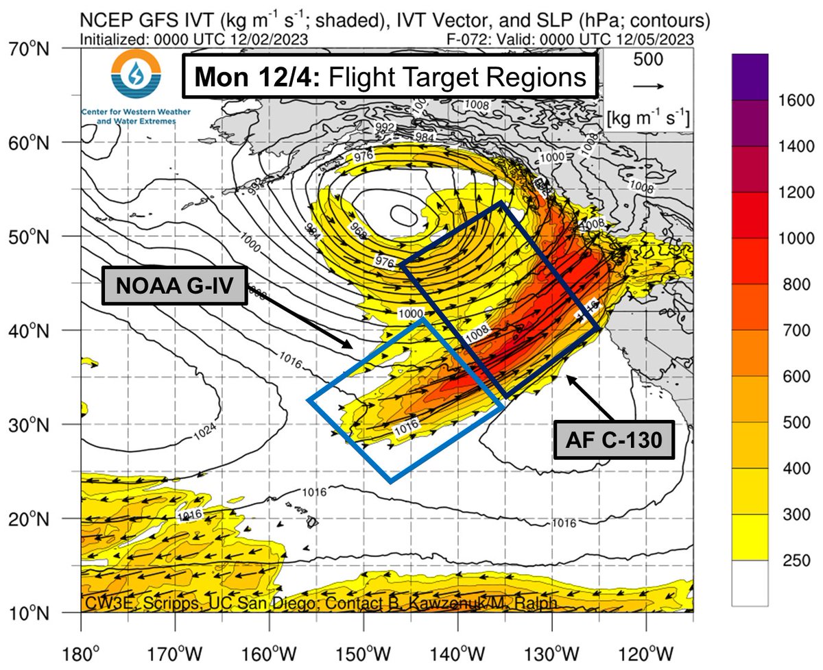
AR Recon has begun a sequence of sampling flights into the #AtmosphericRivers forecast to bring rain and snow to the Pacific Northwest. We’ll be using the @53rdWRS C-130s and @NOAA_HurrHunter G-IV to sample these storms over the N. Pacific in the coming days
The Atmospheric River Reconnaissance and NAWDIC Workshops have now finished.
If you missed any sessions or want to watch them again, videos and slides are now available online. ➡️ https://t.co/eCgJ2GExKd
#ARRecon2023
🧵1/2
Awesome to attend the #ARRecon2023 Workshop with @CW3E_Scripps here at the @ECMWF in the UK to present a poster on the Logistical Accomplishments of last year's field campaign! Super exciting to hear how this project will grow over the coming years.
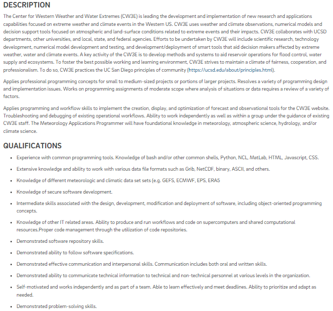
CW3E is looking to hire a Meteorology Applications Programmer to assist in the development and optimization of forecast and observations tools. For more information and to apply visit: https://t.co/XKsFDnWU1W
The current AR is forecast to make landfall as an AR3. Curious about how CW3E ranks ARs? See below for assoc. benefit-hazard spectrum from Ralph et al. (2019) [adapted by Bartlett & Cordeira (2021)], & a table of information on recent #atmosphericrivers for comparison. #CAwx
Sometimes on a midnight shift when the weather is quiet, we track trains instead of precipitation on radar! Whenever there is a strong morning inversion, weather radar can detect some interesting non-meteorological signatures. #kswx#trains
Did you know that under certain conditions our radar can detect things other than weather? When a temperature inversion is present, ducting can bend the radar beam downward and result in non-weather returns. Tonight we can track several ships in the Florida Straits! #flwx#FLKeys
The cold front sweeping south along the CA coast with the latest #atmosphericriver has taken on a gap and core structure often observed with narrow cold fronts rainbands (NCFRs). Expect brief bursts of heavier precip along the front as it sweeps south and then east this evening
CW3E AR Update: Strong #AtmosphericRiver to Impact Washington and Oregon #WAwx#ORwx
For more info on the AR and potential impacts visit: https://t.co/mgklLYYdTn
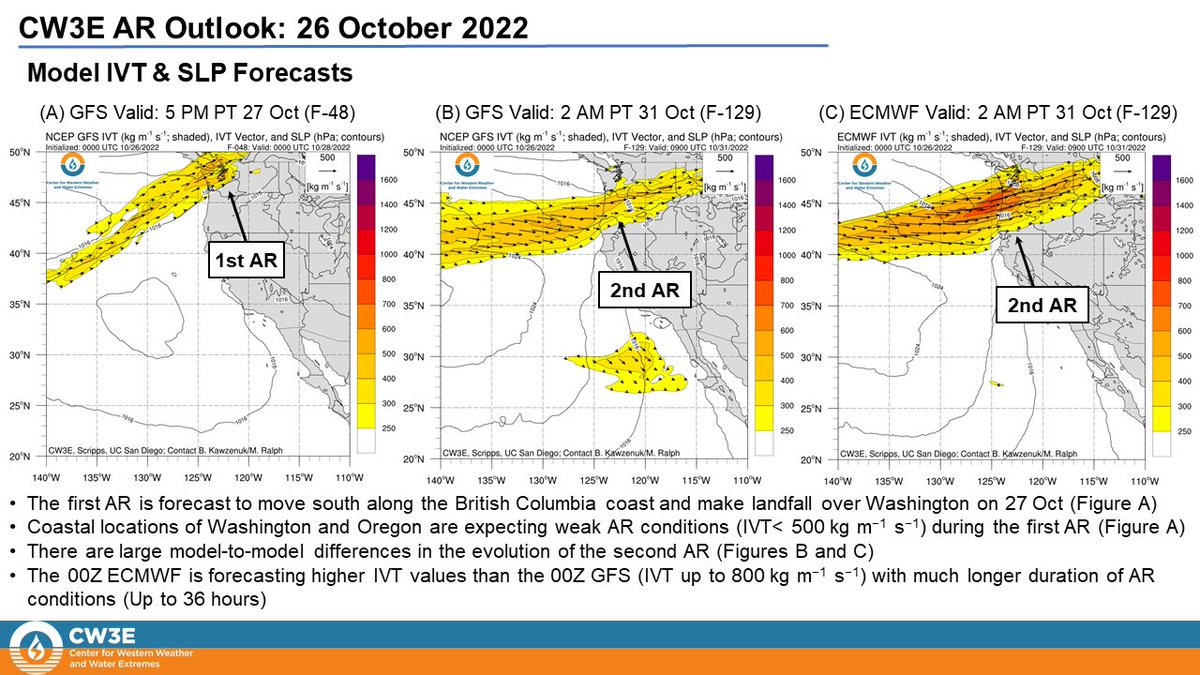
CW3E AR Update: Two #AtmosphericRivers are forecast to move south along the British Columbia coast and bring AR conditions to the Pacific Northwest through the end of October #WAwx#ORwx
For more information, see our latest AR outlook: https://t.co/4BnodNznHz