New paper exploring combined fire and drought impacts in southeast Australian forests, using a Sentinel-2 monthly time series. Thanks to co-authors, including @DrChoat @Rachael_H_Nolan
https://t.co/4IqitC3Wjd
How are our forests recovering after the Australian #BlackSummer fires? This remote sensing study by Bec Gibson identifies which areas may be showing delayed recovery.
CSIRO PUBLISHING | International Journal of Wildland Fire https://t.co/gvVyoDqVNB
📢Importance of reference data for monitoring forest disturbance and #forestrecovery. Multiple uses for collected data.🌿 🇦🇺 🦘
Hislop et al. A reference data framework for the application of satellite #timeseries to monitor forest disturbance. #Landsat
🔗https://t.co/WQ2R7C4bQ6
Did fuel reduction burning reduce the severity of last summer's catastrophic Australian wildfires? We conducted a landscape scale assessment to see what Sentinel 2 had to say. @AndrewKSkidmore
https://t.co/9YqO2mwhri
Fourth paper from my PhD finally published. An investigation into wildfire trends in global temperate and boreal forests using #EarthEngine with #MODIS & #Landsat. Current Australia fires (not included) would be off the charts. #openaccess@ProfCoffeeRMIT https://t.co/U2udWMq2X2
We propose an alternative approach for monitoring change in forestry AGB by combining #Landsat time-series with single-date inventory data when multiple-date inventory and LIDAR data and is unavailable.
Check it out here: https://t.co/EbMe4NCSUz
Recently the RMIT Remote Sensing Centre had the opportunity to travel to Quinlan’s on the Sunshine Coast to work alongside the Australian Koala Foundation on koala habitat mapping. @savethekoala#uav#LiDAR#drone#remotesensing#koala#research
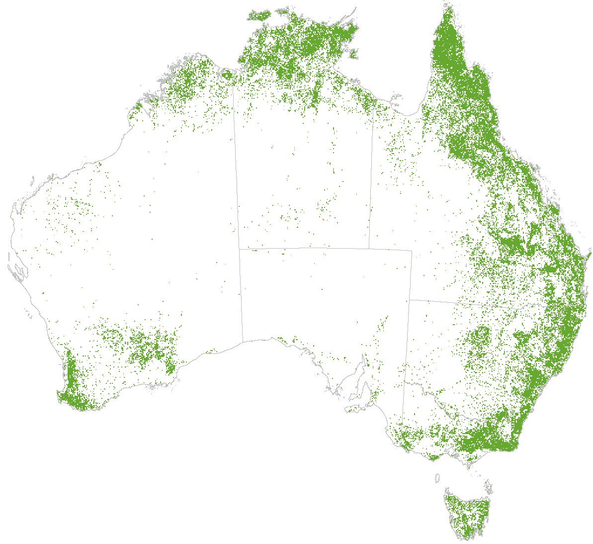
How much forest is in Australia? 113 Mha according to the new #TanDEMX forest cover map. Not far off the 'official' figure of 134 Mha (Australia's State of the Forests Report 2018)
#Eucalyptus grandis (Flooded Gum) in northern NSW. Usually I only look at these forests through the lens of Landsat or Sentinel satellites. Slightly different from this angle!
Does a higher magnitude of fire disturbance result in longer recovery in southeast Australian forests? #Landsat time-series was used to find out. Open access paper available now! @sammoh https://t.co/h49xRNLqvs
Study examines 8 spectral indices for characterizing fire disturbance & recovery in sclerophyll forests. Not temperate or boreal! 🇦🇺
Hislop et al. Using #Landsat Spectral Indices in #TimeSeries to Assess #Wildfire Disturbance & Recovery. #forestrecovery
https://t.co/MTYjQxEAGn