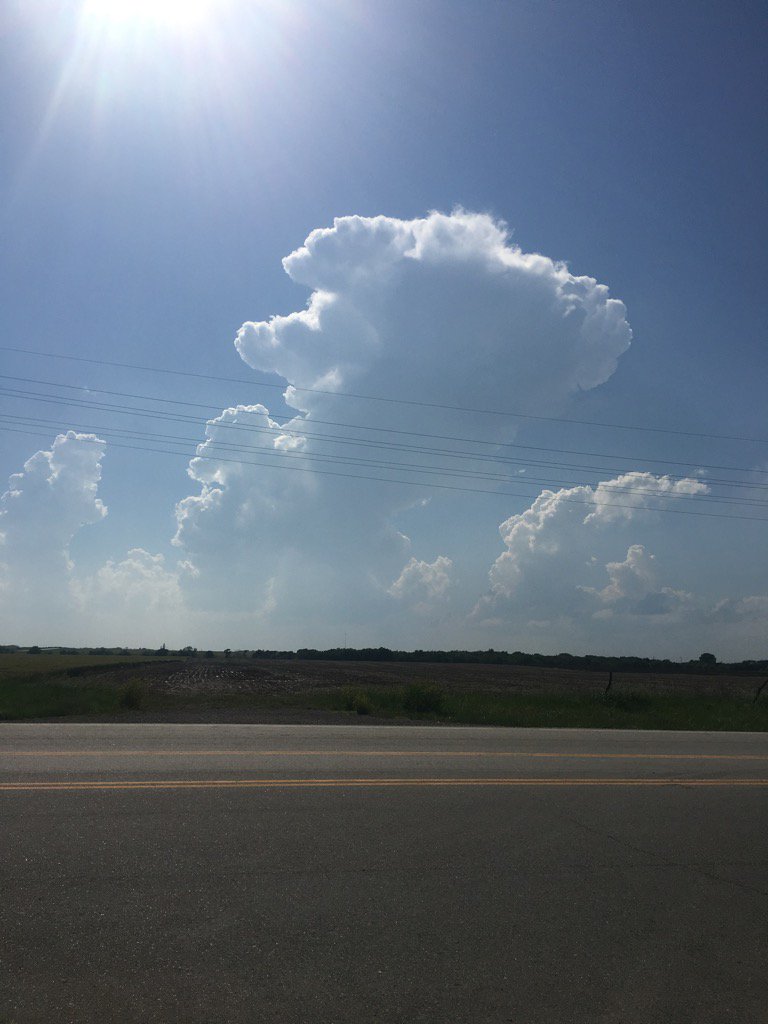
10 short years ago these towering CU went on to produce one of the stronger long track 🌪️ ‘s I’ve seen - all in a marginal 2% risk area! Reminder how even subtle summer boundaries can yield chaos.
Long video of just a few of many stages from this 🌪️!
https://t.co/2Ouic03IiM
@AaronRigsbyOSC@BJontzPhoto I forgot how that was such subtle under hyped day - might not have even been in risk area? I recall a lot of focus was S.
I had opted for less dramatic CO 🌪️’s at secondary target day before, & already being N on I-70 & visually seeing how amped that boundary was paid dividends!
Clearly visible double warm front across #NEex region w/ convectively enhanced OFB across NW MO into NE KS & the true warm front stretching from LNK to Red Oak.
As LLJ ramps up overnight & OFB surges north these setups often lead to enhanced MCS & yield corridor of very heavy🌧️
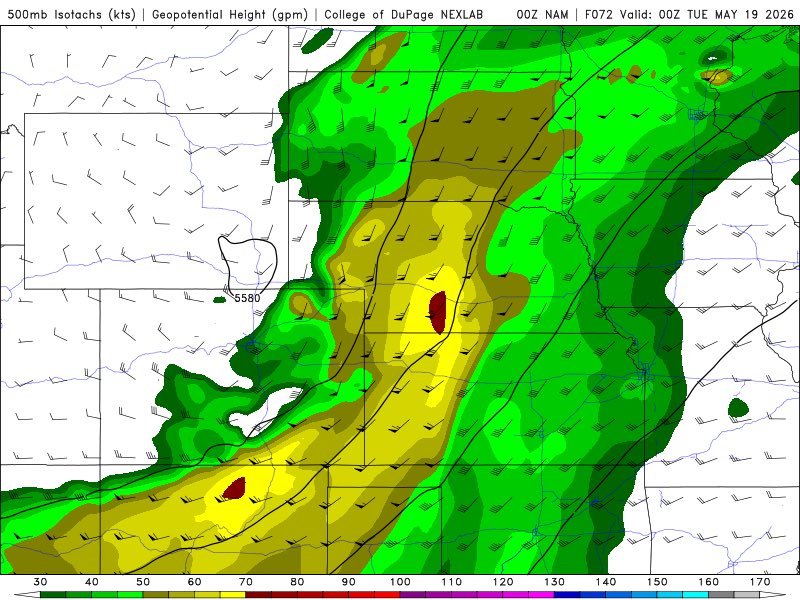
NAM similar to Euro & demonstrating one variable that would aid in mitigating 🌪️ threat some across NEB on MON - how that COLD front behaves will be key.
Warm sector is prime for 🌪️’s, but mean vectors propagating storms into cold air would severely limit the threat for #NEwx.
MON has a widespread outbreak ceiling- but for NEB, many variables remain unknown. Location & orientation of boundaries will be key, among other atmospheric details that won't be resolved by models or forecasters until later SUN. Remain wx aware & regularly check daily forecasts!
#NEwx severe wx hype-🚂 full speed ahead!
Synoptics in place for sig severe risk across NEB SAT-MON, even Panhandle❄️- however, there are still potential derailing variables.
I'd recommend staying tuned to daily forecasts & not getting too wrapped up in scary 2-3 day predictions
SUN brings higher end sig risk - but likely much less widespread.
As overnight wave exists, a strong CAP will take over, the next wave & upper dynamic support looks to arrive by late evening- this will likely set the stage for a localized, but very high end thrat across C & E NEB
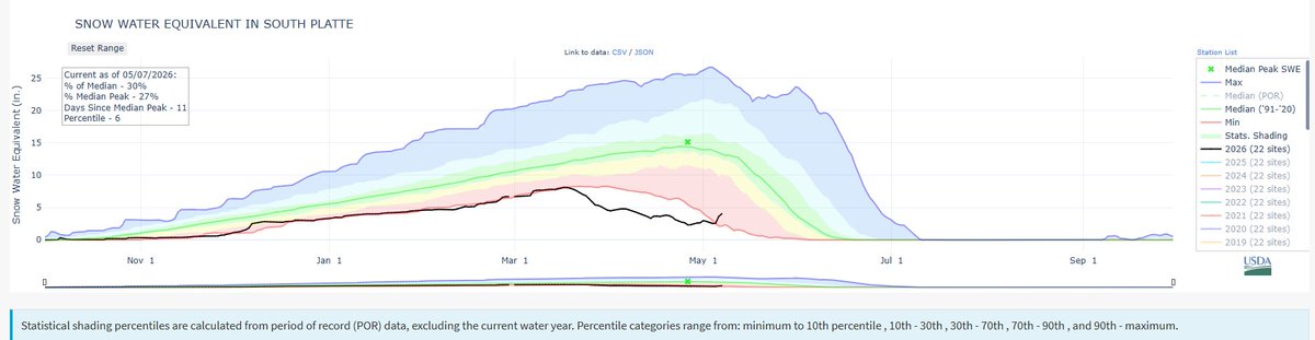
Good News: This week's storm brought decent snow to North & South Platte Basin & pushed snowpacks above all-time lows for period of record!
Bad news: They're still basically at POR lows (2nd & 6th percentile) - with no real big storms through the mid-range forecast. #COwx#NEwx
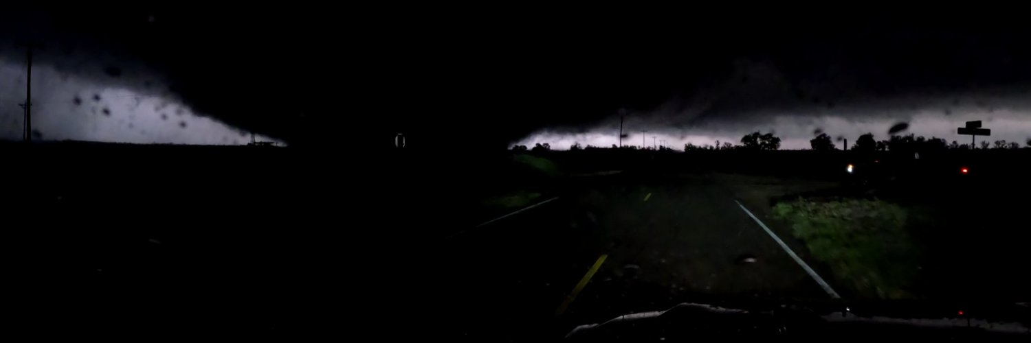
MiniCOW packs MegaPOWER! Observes birth and ingestion of satellite tornado
and Fujiwara effect deflecting tornado. Tornado transitions 2x between clear eye and debris ball. Prelim data from most powerful mobile radar, 1 MegaWatt C-band storm-penetrating miniCOW in Braman, OK 🌪️
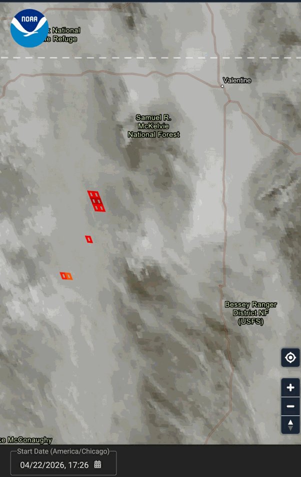
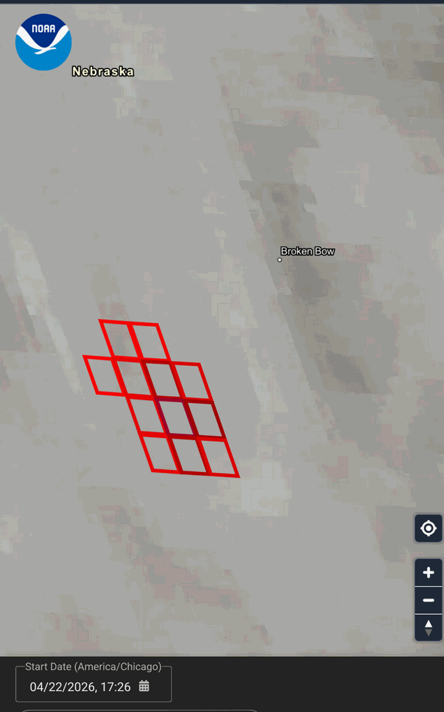
Concerning fire event unfolding in Nebraska. Appears to be multiple lightning starts southwest of Valentine. Another very large fire southwest of Broken Bow. Winds turning Westerly through tomorrow will present significant issues with a fuels landscape that is mostly continuous.
Breaking Weather: The OTUS Project team first ever 360 drone video inside of the Wyoming IA tornado today! Contact me via DM to license the footage. #iawx#WyomingTornado
If all the red doesn’t make it clear, just look at the % of Median!
ALL Western US Basin snowpacks FAR below average - w/ most experiencing POR all time lows.
South Platte Basin as an example currently @ 28% of Median - low totals & then an exceptionally early runoff. #Newx
Mountain snowpack, which feeds our rivers in spring and summer, is at its lowest value in the historical record after declining weeks ahead of schedule due to the extreme warmth in March. Season to date snowfall is near record lows in Cheyenne and Scottsbluff
#wywx#newx
A fast-moving wildfire has burned about 80,000 acres in six hours in the Ashby area, according to fire officials. The town of Ashby and portions of Hyannis have been evacuated. The Grant County Sheriff’s Office says structures have been burned, and local homeowners report the fire reached the town.
Video courtesy: Michaella Fenster
https://t.co/E91I7M8alx
Nebraska desperately needs 🌧️!
I don’t want to be too optimistic given how fickle long range forecasts & spring systems are - but ensembles favoring at least a temporary pattern shift conducive to leeward cyclogenesis & subsequent 🌧️ chances across Plains & #NEwx late next week!
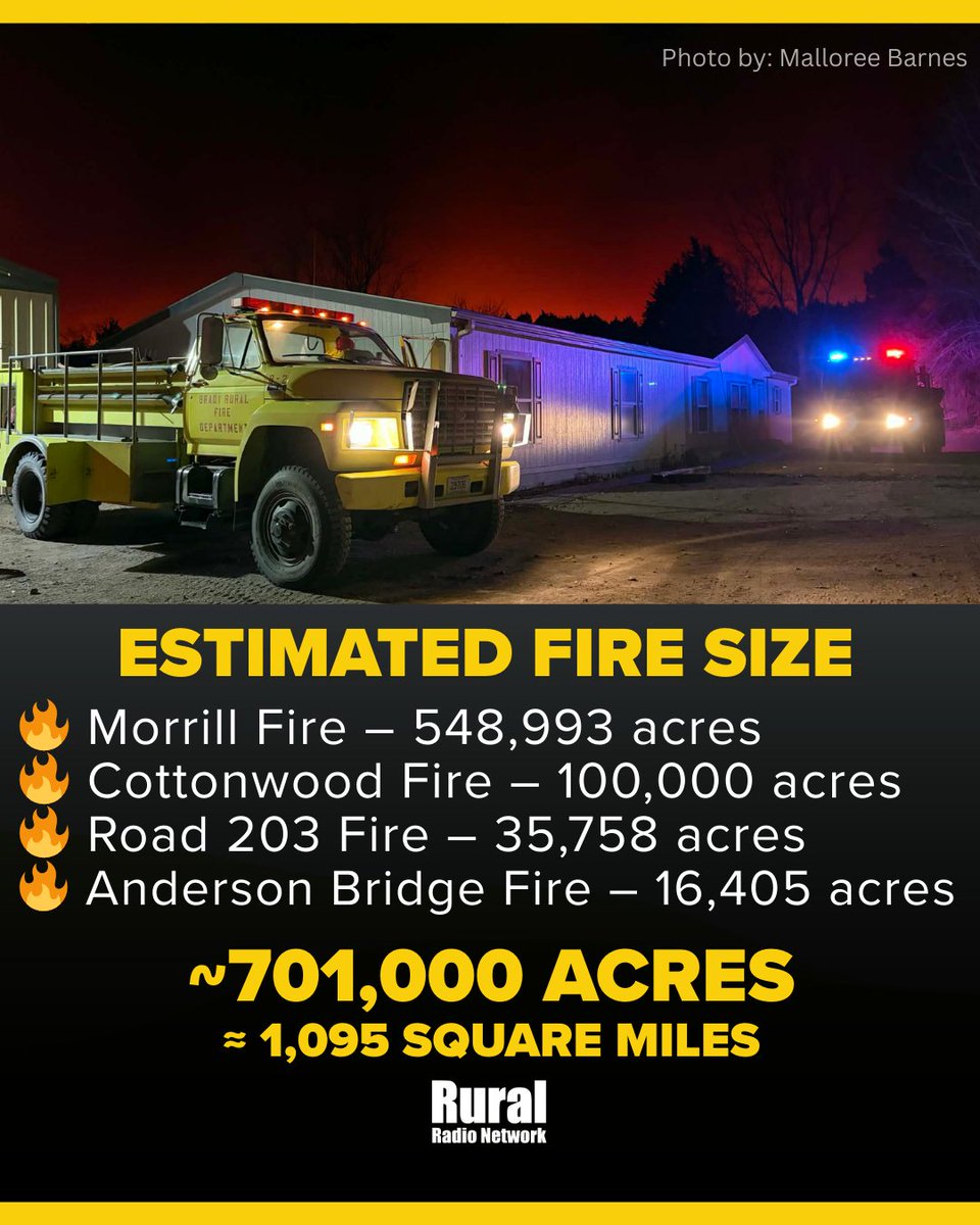
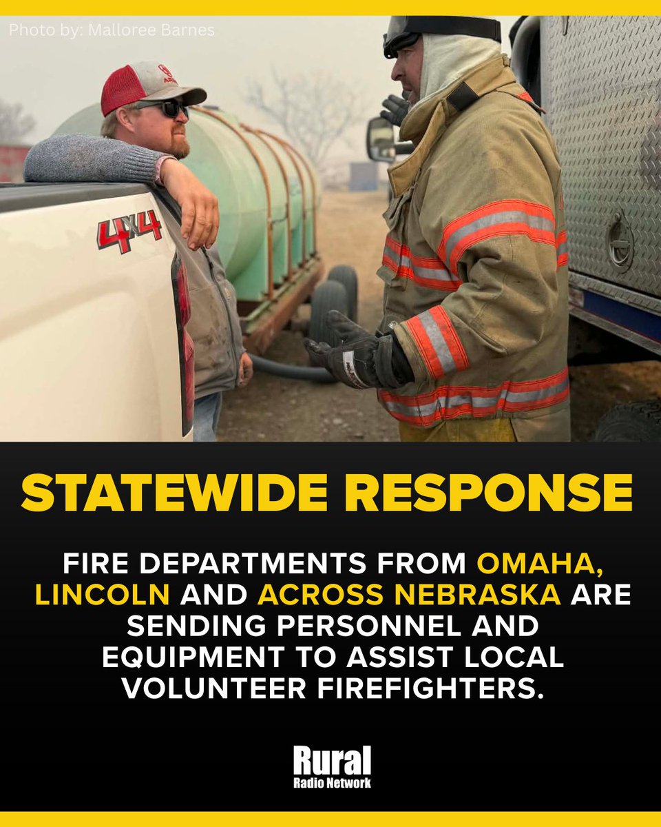
SUNDAY 🔥 UPDATE:
Nebraska wildfires have now burned more than 700,000 acres — nearly the size of Rhode Island.
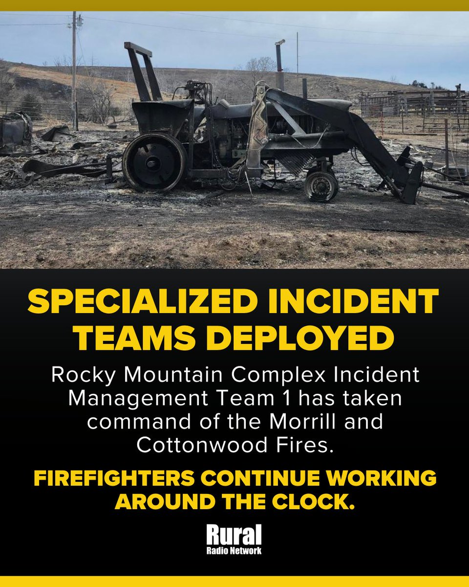
Major fires continue across central and western Nebraska as firefighters from across the state work to slow the spread.
Omaha Beach on the west end of Lake McConaughy at 8 p.m. Saturday.
REMINDER: Immediately evacuate the Cedar View to Omaha Beach area of Lake McConaughy, including the K2area, due to a wildfire. Evacuate to the Keystone Lemoyne Fire Hall.
📹 Justin Loghry
Another Red Flag Warning for parts of south central #NEwx and north central #KSwx on Saturday. Conditions will worsen in the afternoon as temperatures near 80 degrees, southwest winds increase and the relative humidity falls.