A student flew from Los Angeles to UC Berkeley about 3 times a week for a year and spent $5,600 on flights because it was cheaper than rent, graduating with a 3.88 GPA 🎓✈️
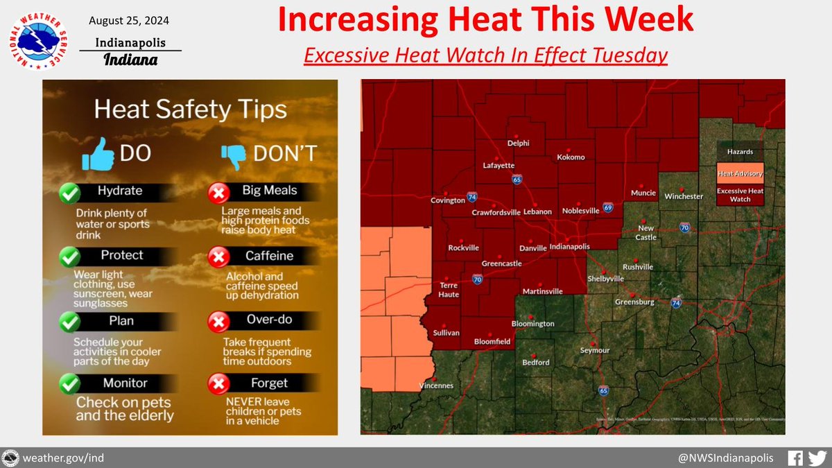
While it was hot today, even hotter weather is on the way tomorrow through Wednesday. An excessive heat watch is now in effect for Tuesday since heat index values may reach 105-110 in places. Now's the time to have a plan as the heat threat continues to increase. #INwx
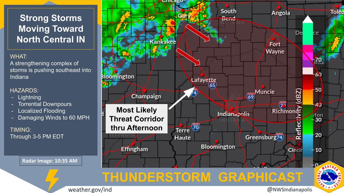
Strong to potentially severe storms are strengthening and approaching north central Indiana late this morning. A severe threat is possible through the afternoon hours, primarily NE of the I-74 corridor. Lightning, heavy rain, and damaging winds are the primary threats. #INwx
Thunderstorms are expected to develop over Central IL and arrive in Central Indiana after 800 PM. The main hazards will be damaging winds and heavy rain, but large hail and an isolated tornado cannot be ruled out. Stay weather aware this evening. #inwx#indy
Gusty northwest winds will continue this afternoon under partly to mostly sunny skies. The strongest gusts will peak as high as around 35 mph. Gusts will drop off quickly near sunset. #inwx
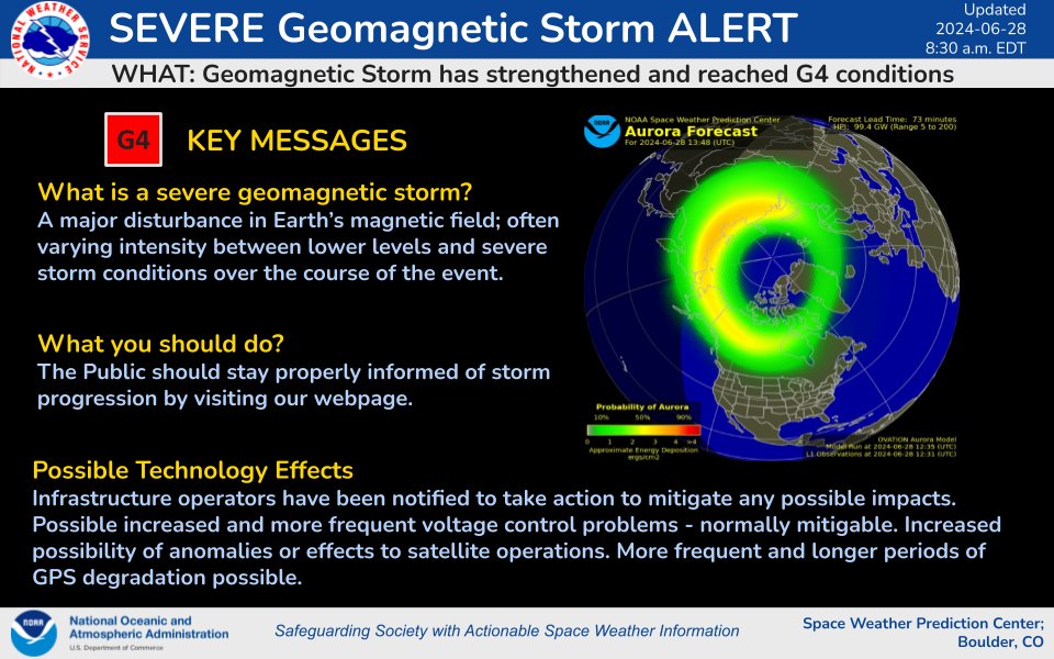
Unfortunately it isn't looking great for potential #aurora viewing across central Indiana tonight, with fairly expansive midlevel cloudiness steadily moving into the area. #INwx#solarstorm
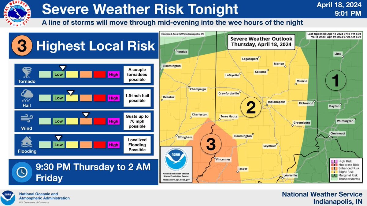
Much of IN remains in a slight risk, and an enhanced risk remains over west central to southwest IN, for severe storms. A line of storms prompting severe thunderstorm 🙴 tornado warnings in IL will push east thru IN between 9:30 PM 🙴 2 AM EDT, slowly weakening. #INwx#nwsind
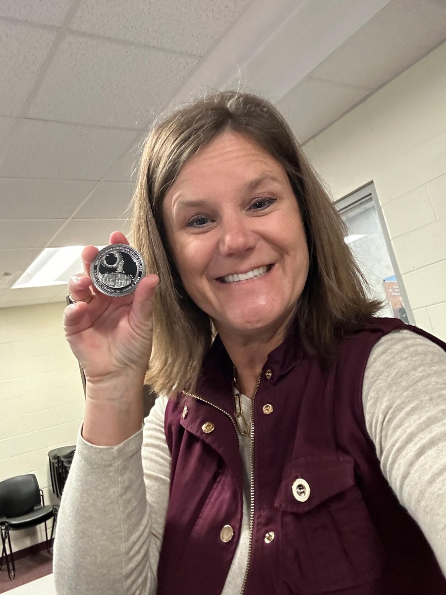
Shane Booker, executive director of Hamilton County's Emergency Management team, presented me with an out-of-this-world gift - an eclipse-themed challenge coin for our work together this past year in preparing for the total solar eclipse. How cool is that? Thanks Shane!
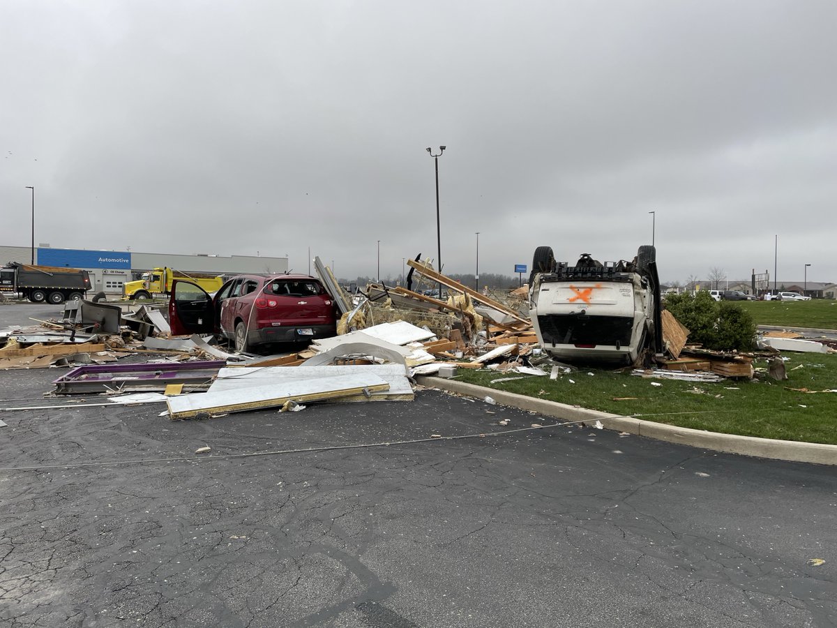
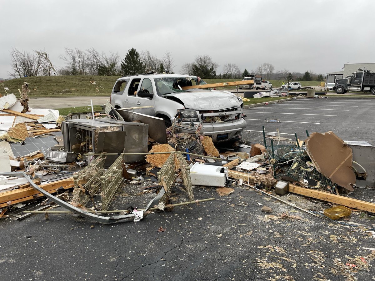
IDHS has personnel on scene assisting the affected public and responders in the aftermath of the severe storms. Hoosiers are asked to avoid affected areas as the damage is assessed.
If you need shelter, the Red Cross is set up at Winchester High School at 700 N. Union Street.
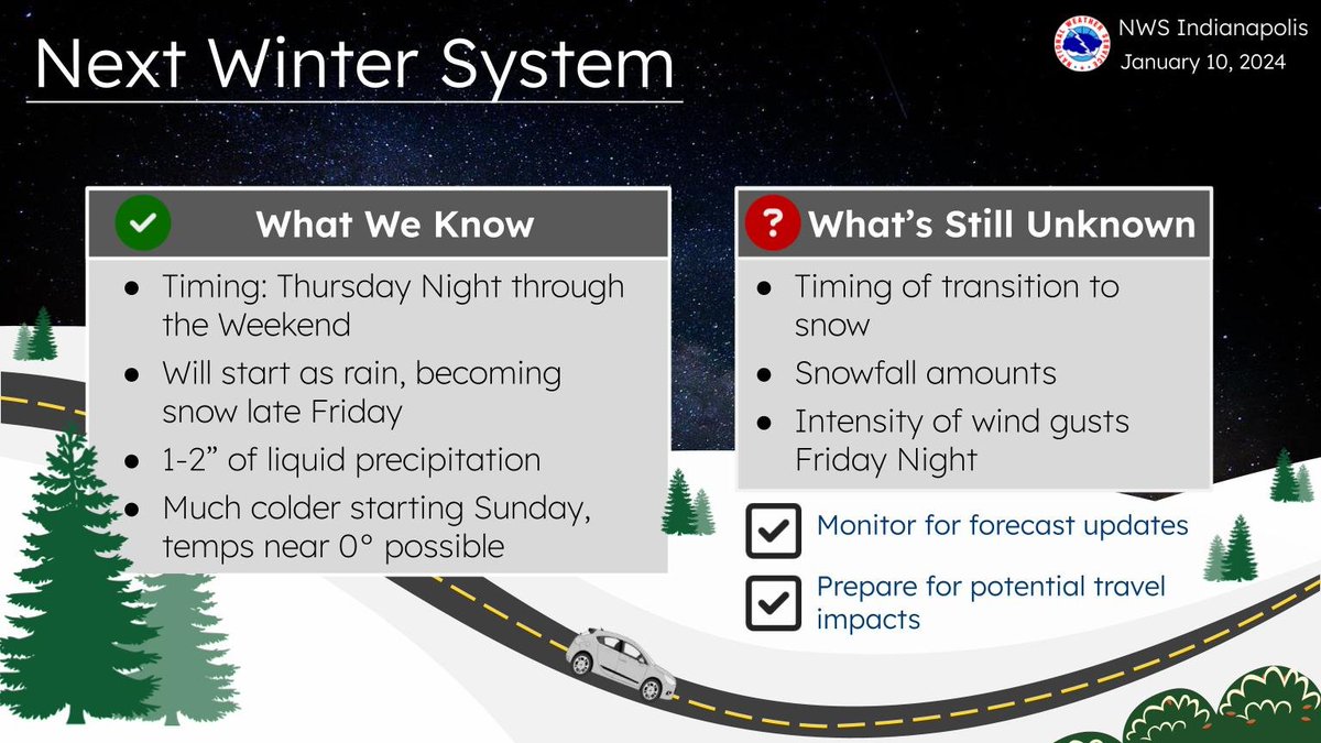
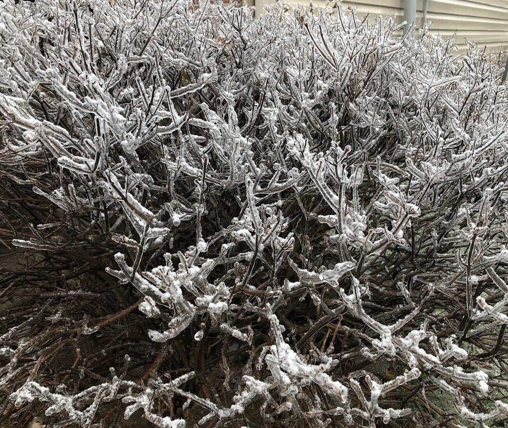
The next winter system will arrive late Thursday night. It will bring a good amount of rain, some snow, and more gusty winds. Exact snowfall amounts are still unknown as they will depend on the transition over to snow on Friday. #INwx
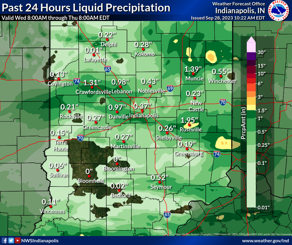
Below are 24 hour rainfall maps, ending at 8AM 9/27 and 8AM 9/28. Many areas received beneficial rainfall, while others still remained mostly dry. #inwx
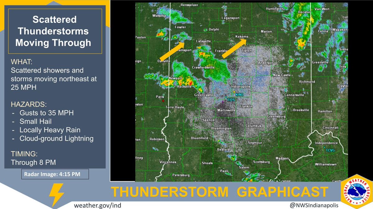
Scattered showers and thunderstorms will continue to develop across central #inwx this afternoon. Some storms may produce gusty winds, small hail, and locally heavy rain.