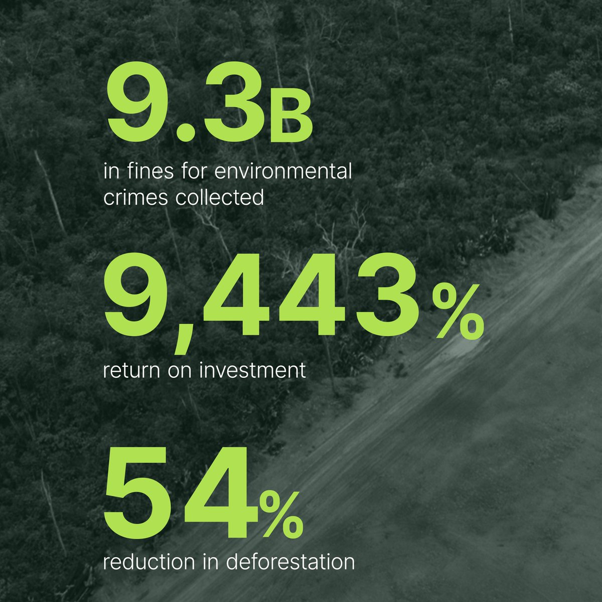
Transparency helps everyone do better.
Our 2025 Impact Report shows how Planet data turns Earth’s change into action, helping people focus on what matters most.
From climate and conservation to security and resilience, see how Planet is stewarding Spaceship Earth: https://t.co/Z0qdgw9lUS
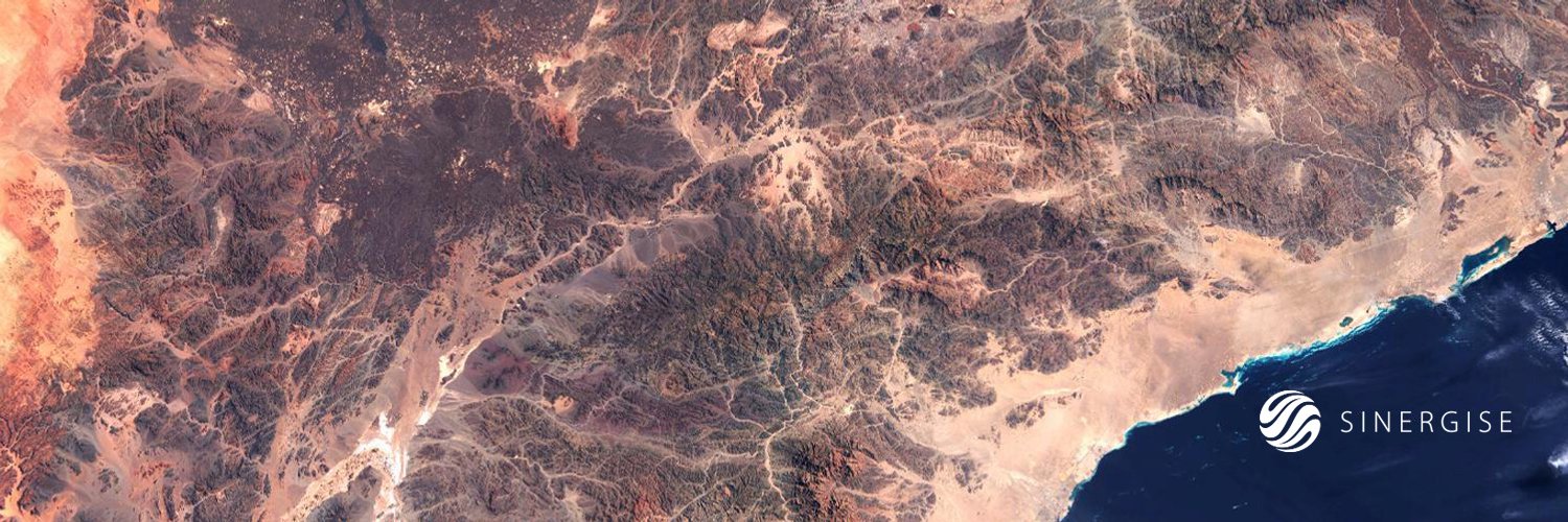
Planet has signed an enterprise agreement with Slovenia's Surveying and Mapping Authority (GURS) 🇸🇮 to provide high-cadence satellite imagery and tasking capabilities.
This deal establishes a unified spatial data resource, supporting the country's civil public administration in:
🌳 Agriculture & Forest Monitoring
🏙️ Urban & Infrastructure Planning
🔥 Rapid Disaster Response
Read more: https://t.co/pAUxqbHCvQ
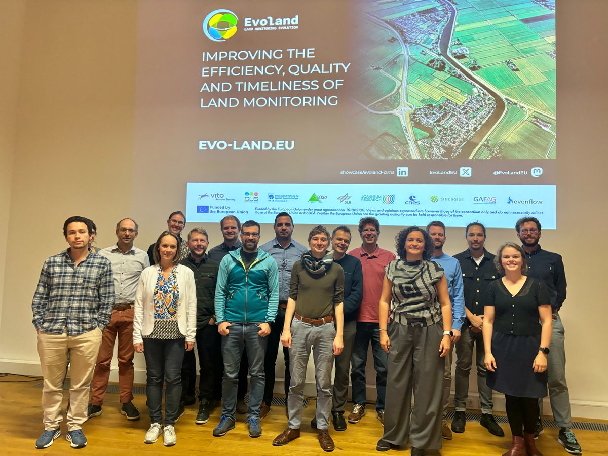
🚨 The EvoLand Results Portal is LIVE!
🔍 Explore 12 interactive EO prototypes directly in the Copernicus Browser!
➡️ More about the portal 👉 https://t.co/zTNgXo0zfo
📝 Register for our final webinar 👉 https://t.co/eDtmaA73hD
#Copernicus#CLMS#EarthObservation#EvoLand
🌲 #EvoLand C1 improves timeliness in HRL #Forest Monitoring, delivering monthly resolved yearly info at 10 m resolution. Almost fully automated.
👉 Explore via our Results Portal https://t.co/zTNgXo0zfo
☝️#EOExcellenceAward 2025 – Nomination phase open
Know someone who had a breakthrough in #EarthObservation solutions or research? Nominate them for the EO Excellence Award! The Nomination phase is open until 🗓️ 5 December 2024.
✍️ Nominate Now - https://t.co/G7CwiFL2LU
Every tree, every forest, every quarter.
We just launched our AI-powered Forest Carbon Monitoring product that measures changes to forest carbon and canopy across the globe at 3 meter resolution.
This is the world’s first forest monitoring system offering insights at this granularity and scale.
Read more: https://t.co/fRzSQUFaBI
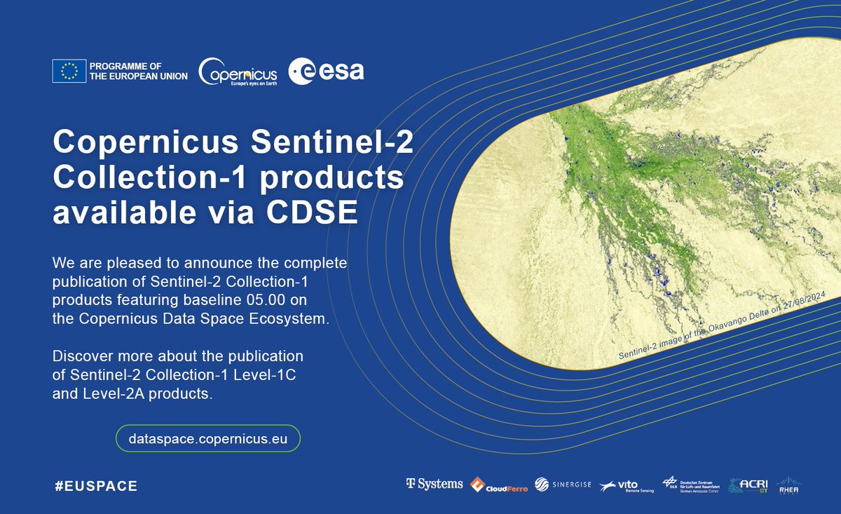
🆕 #CDSE announces the publication of #Sentinel2 Collection-1 L1C & L2A products featuring baseline 05.00! 🛰️
Read more about the publication, product generation and proceedings of the reprocessing ⤵️
https://t.co/XQEz2anjOf
#EUspace#Copernicus#CopernicusEU#CDSE
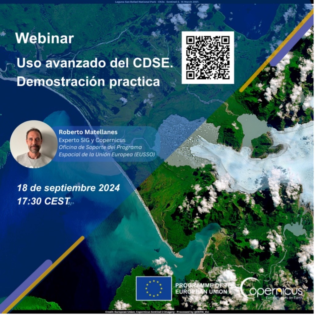
¡El segundo webinar sobre el CDSE inicia en una semana!
Siga con su ordenador la demostración práctica del uso avanzado del #Copernicus Browser!
🗓️ 18 de septiembre, 17:30 CEST
📍 En línea
Inscripción e información👇
https://t.co/1pXPeyPix5
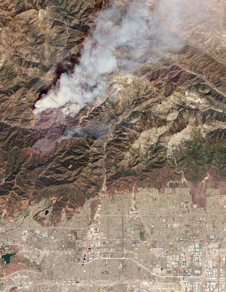
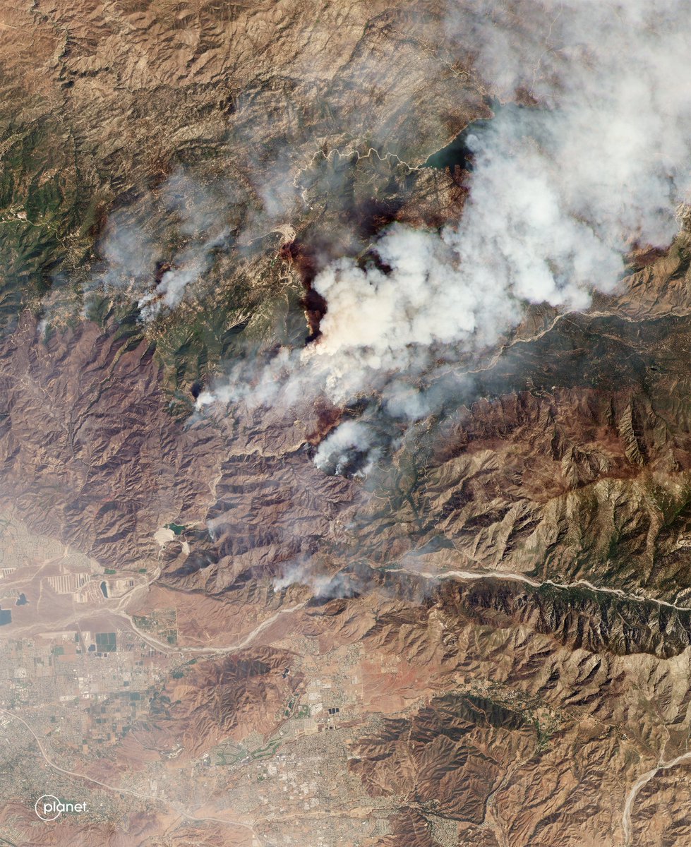
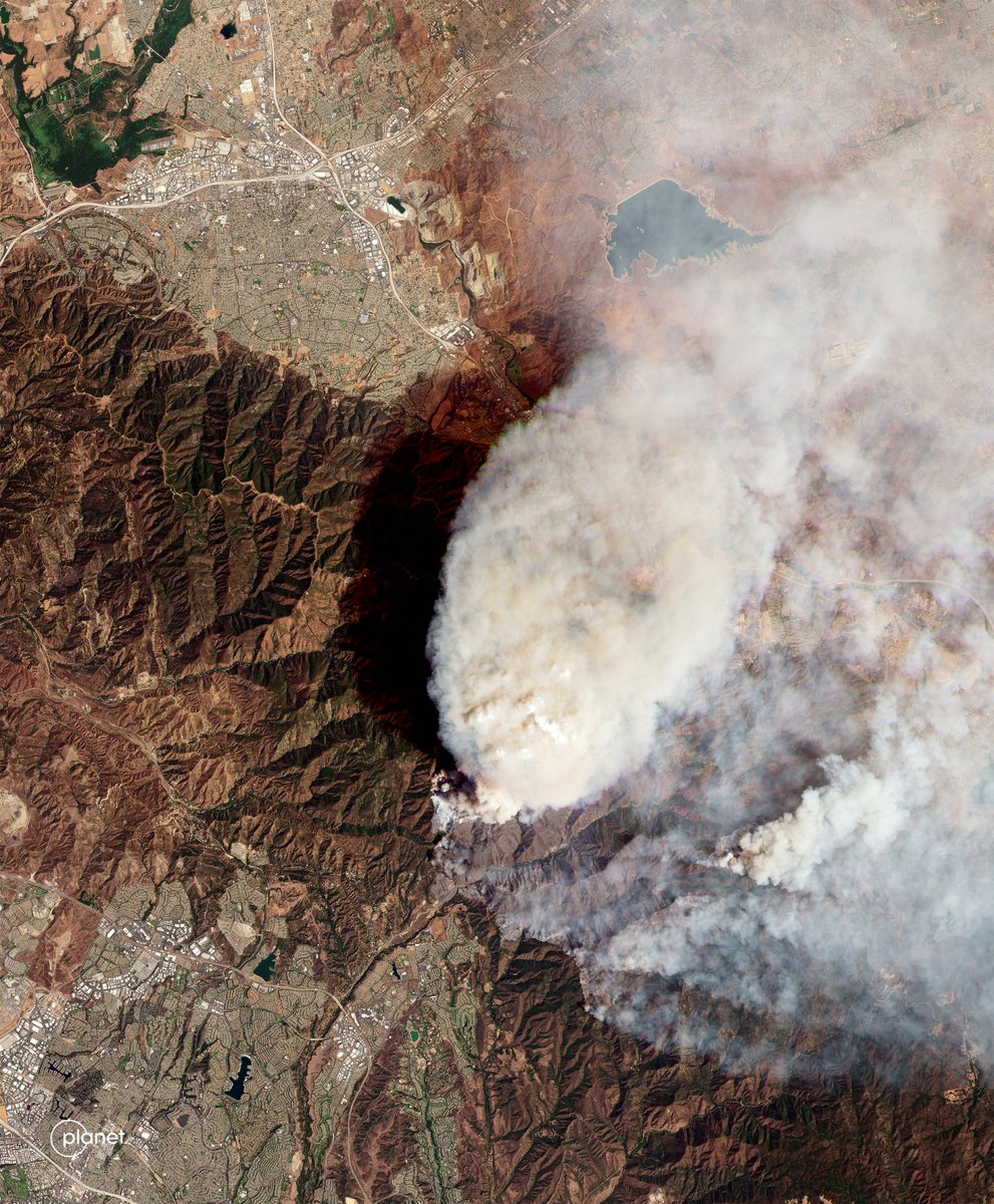
Thousands have been evacuated as a series of wildfires erupted in Southern California following a severe heatwave last week. The Bridge, Airport, and Line wildfires can be seen burning here all on Tuesday, September 10.
🚀 Excited to celebrate our midterm achievements & review in Munich! Presentations, workshops, and insightful visualisations that highlight the incredible work we've done so far! Stay tuned for more!
#EOData#SatelliteTech#Innovation#openEO#MidtermReview@EU_HaDEA
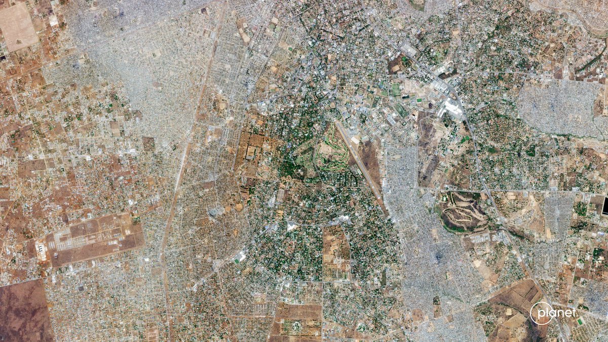
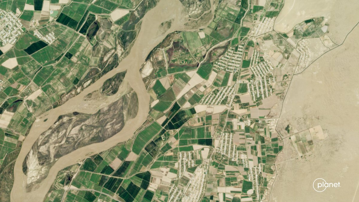
On Friday, we launched 36 SuperDoves into orbit on @SpaceX’s Transporter-11 Mission, and today, our “first light” satellite images are already here!
This is the fastest we’ve ever received our first light data; and gee wiz(!), the world is looking beautiful!
Here are just some of the images taken today August 20th:
1. Cankuzo, Burundi
2. Lebap Region, Turkmenistan
3. Lusaka Province, Zambia
4. Tanganyika Province, DRC
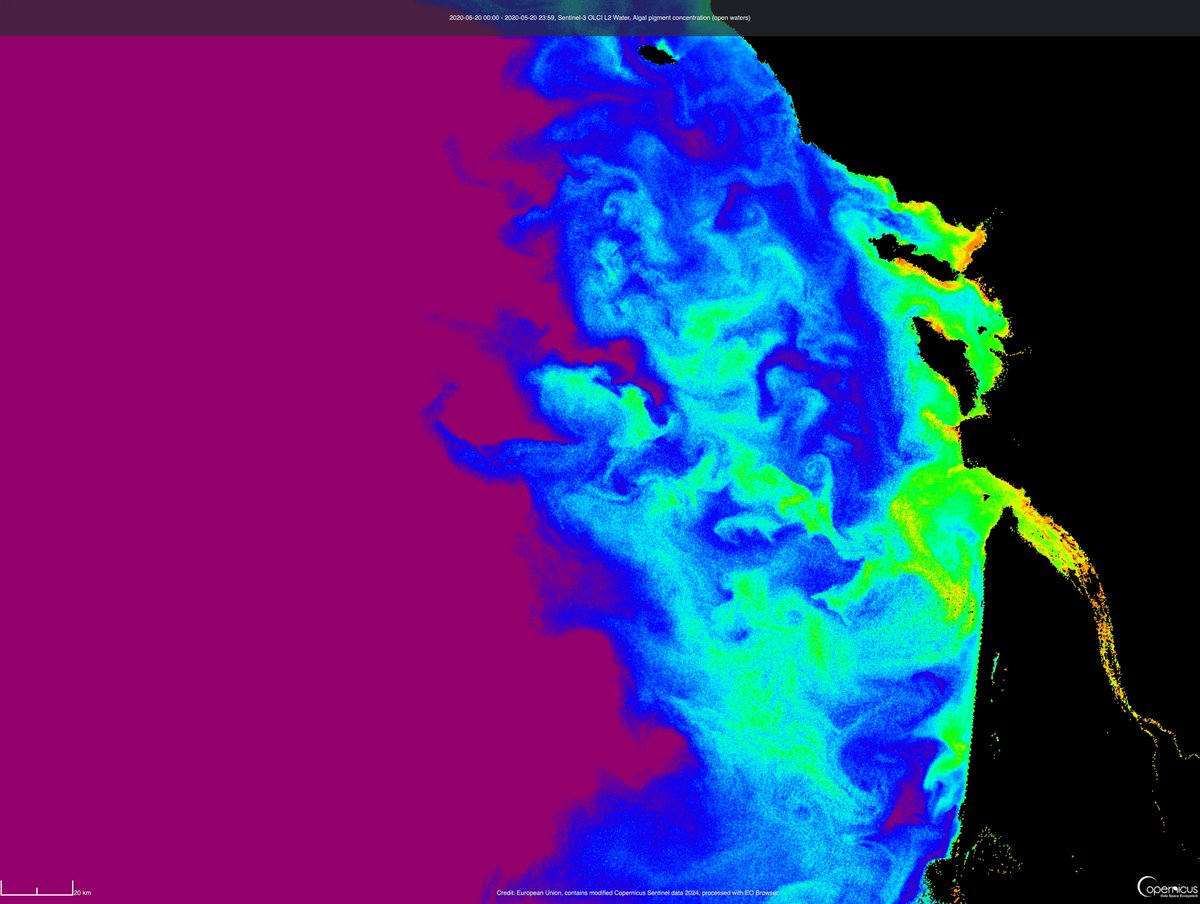
🤩 We are happy to share that the Sentinel-3 OLCI L2 data collections are now available for browsing and visualisation in the #CopernicusBrowser and are also accessible via @sentinel_hub APIs through the Copernicus Data Space Ecosystem.
Read more here ➡️ https://t.co/QnQfesmrxr
🔵 Sentinel-1 monthly mosaics were recently added to #CopernicusBrowser 🙌
☝️ Read the latest #CDSE blog post where we describe their access, use and interpretation together with the process of creating them, and plans for this dataset. 👀➡️ https://t.co/i1ms1R6wNz
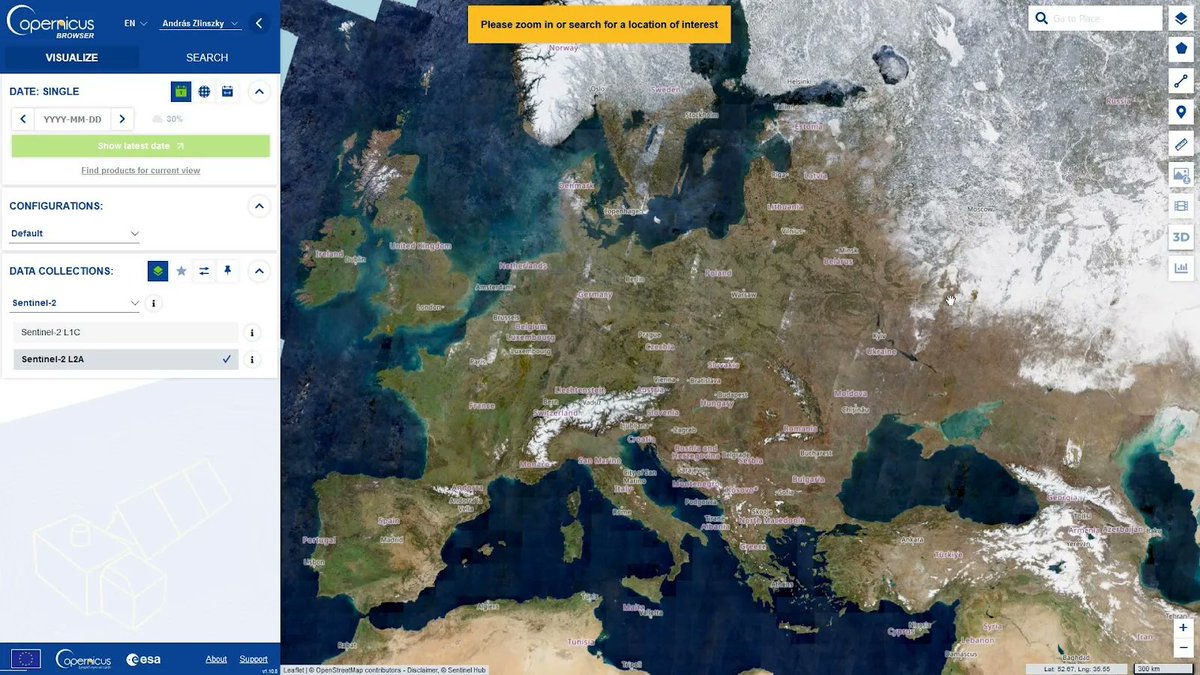
Have you used #EOBrowser for education, art or to view beautiful #satellite images?
☝️ #CopernicusBrowser is open and public, and has more free quota and analysis-ready mosaics. 🌐👀🛰️
Non-commercial users, switching is super easy. Read our guide here 📄➡️ https://t.co/SuMqeFpaov
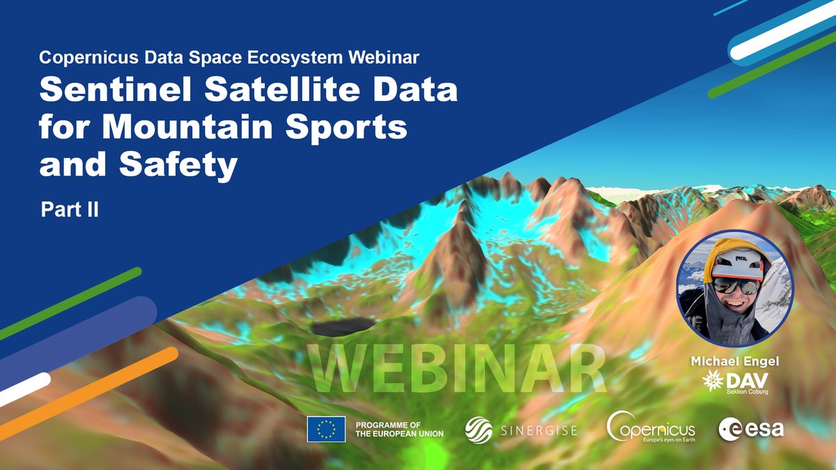
👀 Watch #CDSE#webinar 𝗢𝗽𝗲𝗻 𝗦𝗮𝘁𝗲𝗹𝗹𝗶𝘁𝗲 𝗜𝗺𝗮𝗴𝗲𝗿𝘆 𝗶𝗻 𝗦𝘂𝗽𝗽𝗼𝗿𝘁 𝗼𝗳 𝗠𝗼𝘂𝗻𝘁𝗮𝗶𝗻 𝗦𝗽𝗼𝗿𝘁𝘀 🏔️ Explore new routes, check snow conditions, follow up on disasters & even load Sentinel-2 imagery to your smartphone map viewer! ▶️ https://t.co/T0fJMomOMs
📢 Sentinel-1 monthly mosaics have been added to the @CopernicusEU Data Space Ecosystem! These rasters provide unobstructed views across large areas with less noise and better detail than individual #Sentinel-1 🛰️ imagery. Explore the new datasets! 👇
👀🔗 https://t.co/NuKLc9yHTw