We’re sponsoring the CommEO Award with @creativedlab + @esa 🚀
We're backing the winner with:
- $10K in data credits
- 12 months of BUILD + API support
- Dev + GTM guidance
If you're building in climate, resilience, or infrastructure, check it out
https://t.co/VYAXqSz6fO
Orthomosaic drone imagery from @SpexiGeospatial is now live on the SkyWatch platform.
Access ultra-high-resolution (2.8 cm) standardized drone data for mapping, AI training, infrastructure monitoring & more.
Learn more: https://t.co/0GWNiYJzcq
@SpexiGeospatial orthomosaic drone imagery is now live on the SkyWatch platform.
Access ultra-high-resolution (2.8 cm) standardized drone data for mapping, AI training, infrastructure monitoring & more.
Learn more: https://t.co/0GWNiYJzcq
@SpexiGeospatial orthomosaic drone imagery is now live on the SkyWatch platform.
Access ultra-high-resolution (2.8 cm) drone data for mapping, AI training, infrastructure monitoring & more.
Satellite. Aerial. Drone. One platform.
Learn more: https://t.co/0GWNiYJzcq
Earth observation data is changing how teams:
• Track infrastructure
• Assess risk
• Monitor environmental change
• Respond to events
We put together a beginner’s guide to EO data, no remote sensing background required.
https://t.co/c8e14fEejp
#EO#GIS#SatelliteData
Satellite imagery is an enterprise staple, but choosing a provider isn’t simple.
❓ Direct contracts vs. aggregation platforms
❓ Resolution vs. revisit
❓ Licensing, latency, and scale
Demystify the evaluation process with our guide: https://t.co/NkHaPQGSmu
#SatelliteImagery
Satellite data doesn’t equal insight.
Common EO mistakes:
❌ Overpaying for resolution
❌ Ignoring revisit rates
❌ Letting clouds break workflows
❌ Buying data instead of answers
How to avoid them 👇
https://t.co/soihGRZmUy
#EarthObservation#SatelliteImagery#Geospatial
New partnership announced 🚀
SkyWatch + @Nearmap are expanding access to high-resolution aerial imagery for planning, analysis, and decision-making, now available through SkyWatch and Content Store for ArcGIS.
https://t.co/ZOBJhWd1aE
#RemoteSensing#AerialImagery#Geospatial
With satellite imagery, enterprises can automatically detect:
• Restricted zone activity
• Vegetation risks near power lines
• Changes at remote assets
Learn how satellite imagery enables compliance: https://t.co/G6JtU6vSik
#SatelliteImagery#Compliance#Infrastructure
Is a true “live satellite view” possible? Not quite yet, but near-real-time satellite imagery is already delivering actionable intelligence in hours, not weeks.
Here’s what’s possible today 👇
https://t.co/NhDxlE4qHT
#SatelliteImagery#Geospatial#EarthObservation
We’re partnering with @spexigeospatial to bring standardized drone imagery to SkyWatch & ArcGIS users.
Spexi’s ultra-high-res data will be available soon on the SkyWatch platform, incl. Content Store for ArcGIS.
https://t.co/PQyXb0irez
#SkyWatch#Spexi#DroneImagery#ArcGIS
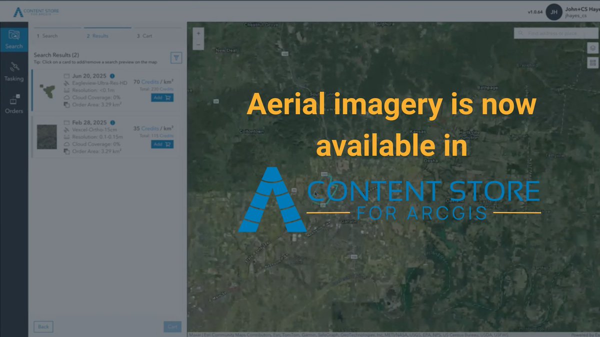
High-res aerial imagery is now available directly in SkyWatch’s Content Store for @Esri ArcGIS!
Access premium data, preview & purchase it right inside your Esri environment.
Learn more 👇
https://t.co/KIyC4k8d6G
#GIS#ArcGIS#AerialImagery#EarthObservation
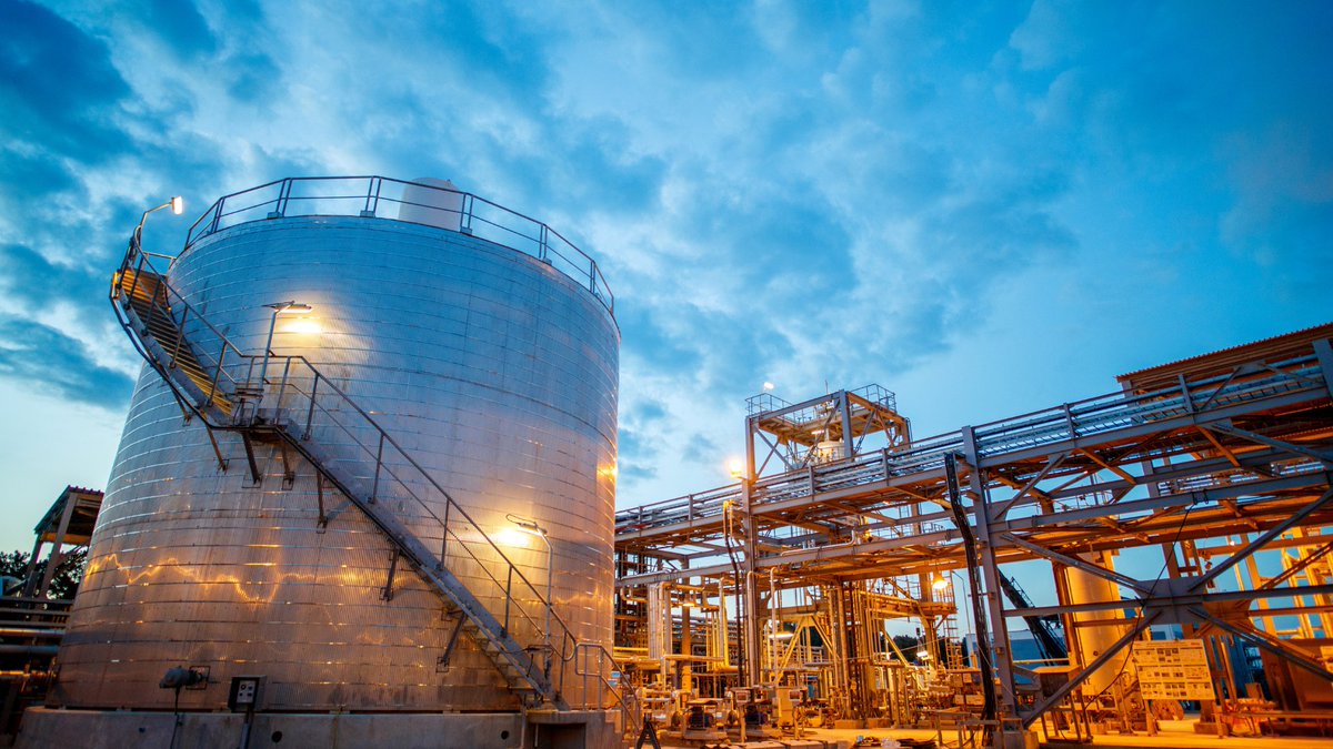
⛽ Keeping pipelines and assets consistently monitored is no small task, especially at scale.
Learn how satellite imagery helps:
⚠️ Detect leaks early
💲 Cut inspection costs
☑️ Meet regulatory goals
https://t.co/E2C3MmFJqQ
#OilAndGas#SatelliteImagery#AssetMonitoring
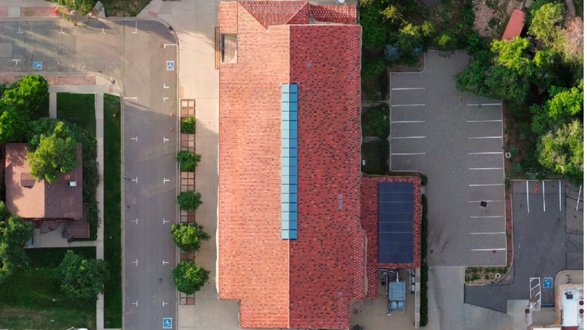
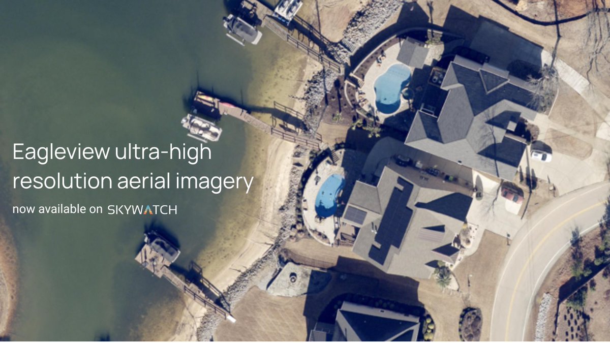
New data source alert 🚨
Today, we announced a collaboration with @EagleViewTech to bring ultra-high resolution aerial imagery to the SkyWatch platform.
Read more here: https://t.co/aMtMWea7co
Want to see what it looks like? Check it out: https://t.co/rmtvp56ttM
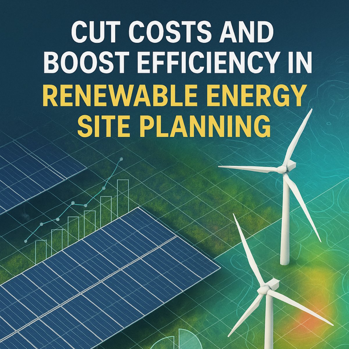
Discover how geospatial data transforms renewable energy site planning 🌱
From solar to wind projects, satellite-based planning delivers speed, accuracy, and ROI.
Check out our use case https://t.co/yd4kIASFpY
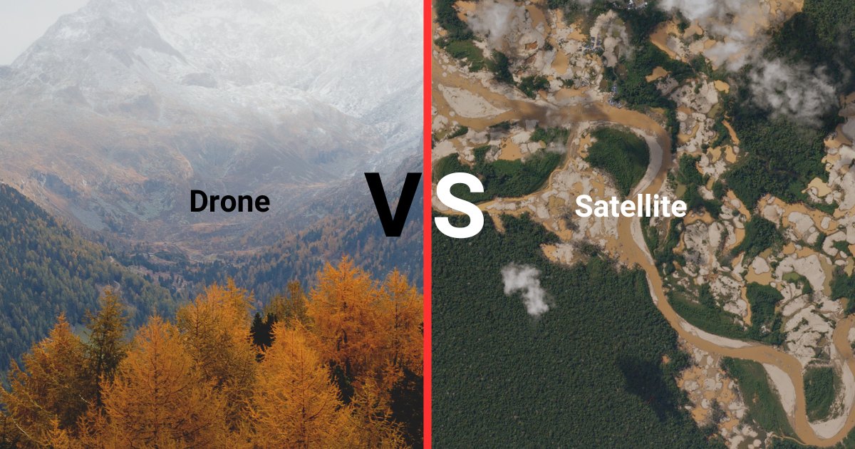
Drones vs. Satellites: Which option is better for project site monitoring?
Explore the unique advantages of each and find the best fit for your needs in our use case.
🔗 https://t.co/Z8m5YTreOY
#Drones#Satellites#ProjectMonitoring
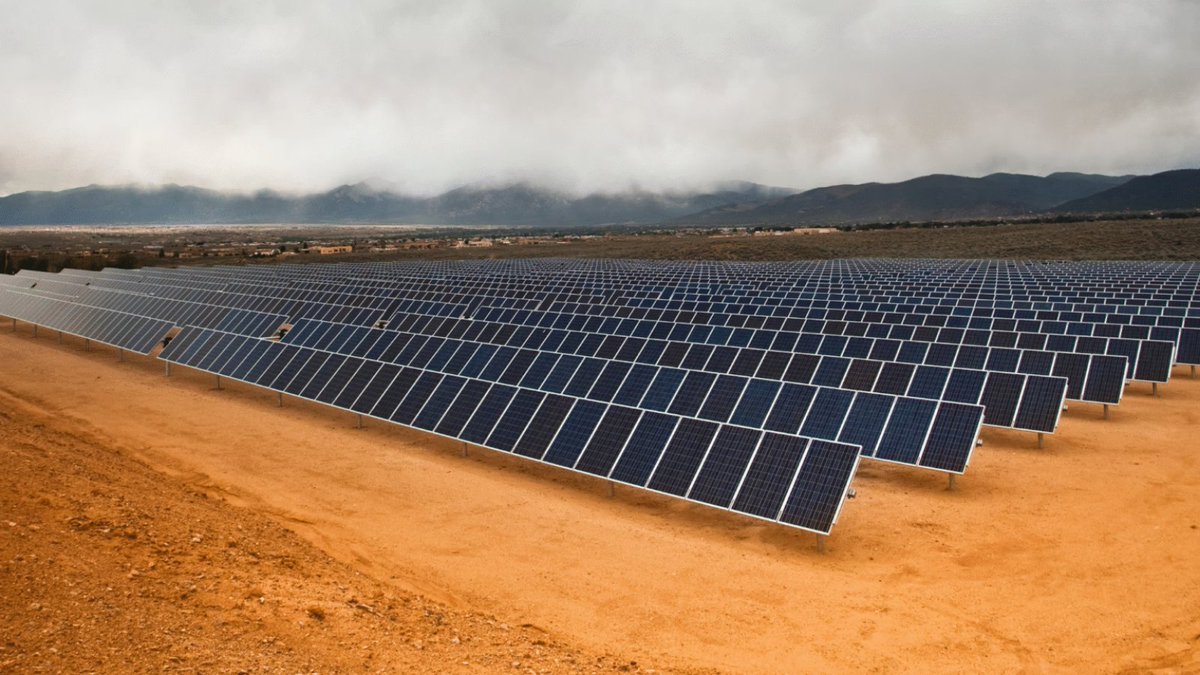
Check out our use case on using satellite data for solar farm site selection. Factors like sunlight, land shape, and infrastructure matter to maximize efficiency.
🔗 https://t.co/OOyF9eRIIY
Stop shopping around for imagery when building maps in ArcGIS, use Content Store instead.
Learn more: https://t.co/hkdYO12Nf9
Watch the full presentation from PDAC 2025: https://t.co/VPmGd1KJYI