We're a group of GeoAI/GeoICT based in Rwanda, delighted to pave your way to success through: ♤GIS & Remote sensing ♤Machine & deep learning ♤Web & mobile apps
@Anaconda Inc., provider of most popular #datascience platform, announced a collaboration with @Esri, provider of #GIS software, mapping... This collaboration supports #geospatial community by providing users with preloaded geospatial packages for use with #Python.
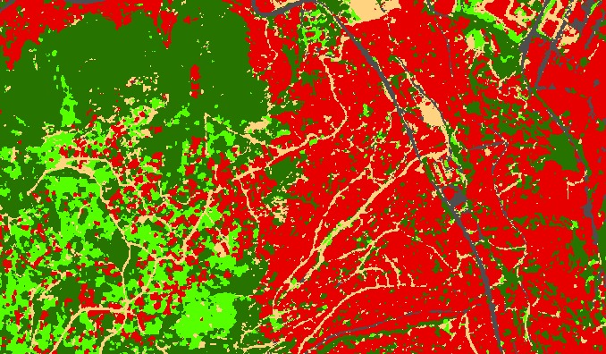
@EnviroRwanda@EnvironmentRw@REMA_Rwanda@NewTimesRwanda With the increased use of smartphones in the local community, we are ready to contribute through the provision and use of mobile apps (#geo-apps) for engaging local communities to monitor #forests. This will provide timely #data necessary for sustaining forests in #Rwanda
Maize is the main crop that is being monitored for Rwanda. "@SpaceRwanda & @AKADEMIYA2063 can work together to improve other staple crops like banana, beans, cassava, which are so common not only in #Rwanda but in other areas of this region of #Africa" Col Ngabo, CEO @SpaceRwanda
Finaly the course is now opened. Join us and learn #spatial data #analysis using #python programming in an easy and flexible pace for you. Only 8hours a week for 1 month.
Other courses are loading....
Access the course through the link below
https://t.co/ZzAq4xTlVB
Up-coming specialized Courses !!!
Courses tailored in a hybrid-learning mode – with live classes and pre-recorded videos.
1. Analyzing spatial data using python
2. Web GIS development
3. Deep learning and machine learning for Remote Sensing
Register here
https://t.co/ZzAq4yaXkb