@beyondwattsuk@Julian_H0ffmann Great work and a really nice website as well! May I ask what the ads-b source data is? My version had only "simulated" flights along all existing flight routes but no real data.
Blender geometry nodes - 25.000+ flight routes from a single csv-file into airport positions and simulated aircrafts along the routes.
Source data: https://t.co/ErilIfcsRK
#blender3d#blendergis#cartoblend#b3d#openflights
@stevefaeembra I've been scratching my head over great circles (and best practice concerning geographic coordinate translations in general) in Blender. Could you elaborate a bit on your method?
@pinakographos Ah, sweet memories! RRT1 and 2 was the foundation of my american geography knowledge! And together with these two classics I guess mappy games was my thing back then...
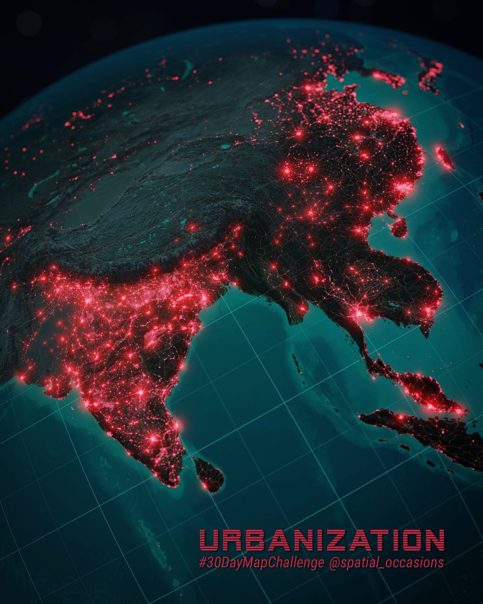
A wonderful list of geospatial 3D-artists that have inspired me a lot. But mind-blowing that my occasional free time fiddling is mentioned amongst these giants. Let's continue to create, inspire and develop!
3D maps can look complex & difficult to make…
Here are 12 humans who proved to me that 3D is not out of reach:
Different tools, many styles... all fantastic: 1/14🧵 #dataviz#3dmaps#gis
@simon_eliasson Thanks! I haven't decided if or how I will make high-res versions available. But if you have any questions about the workflow, I'd be happy to guide you.
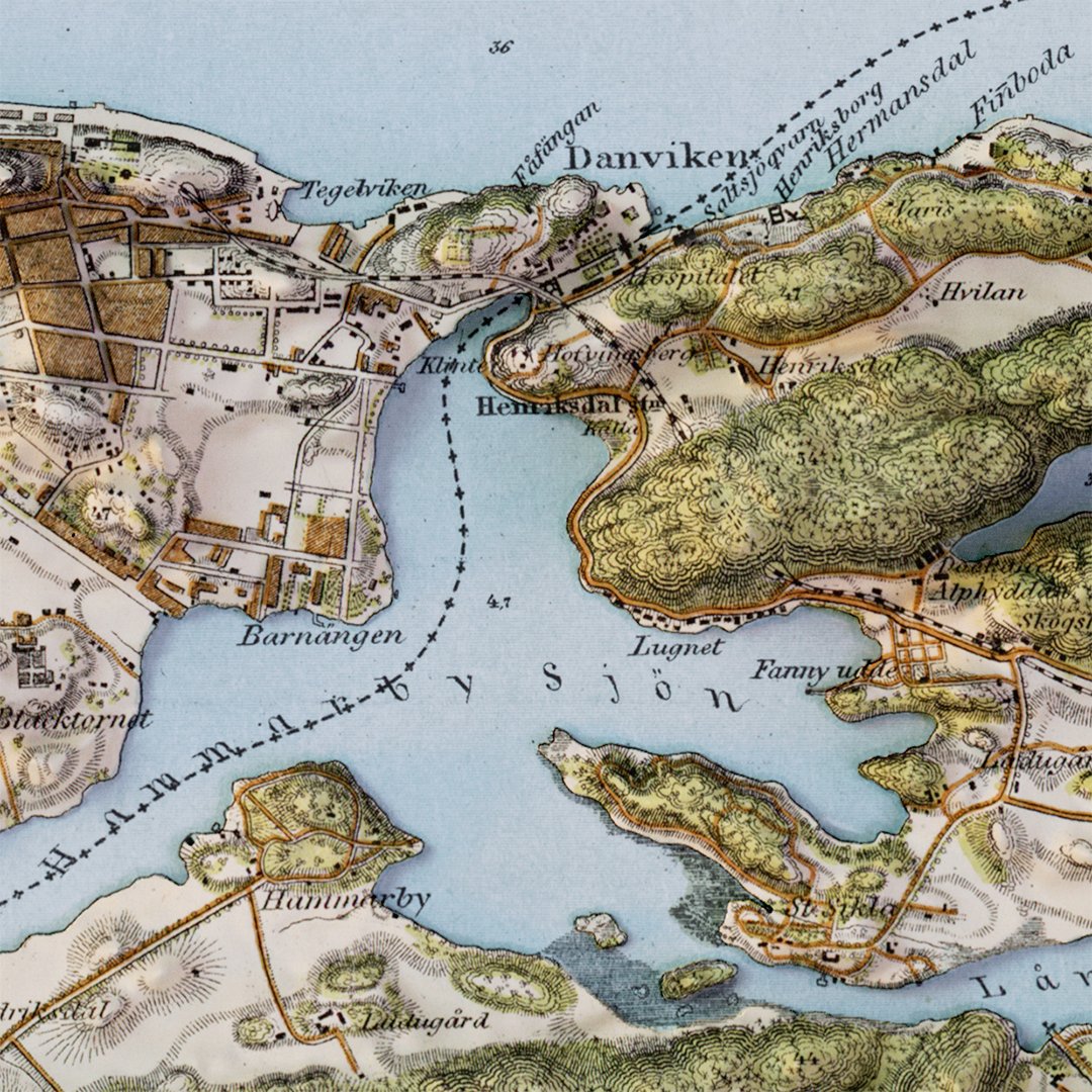
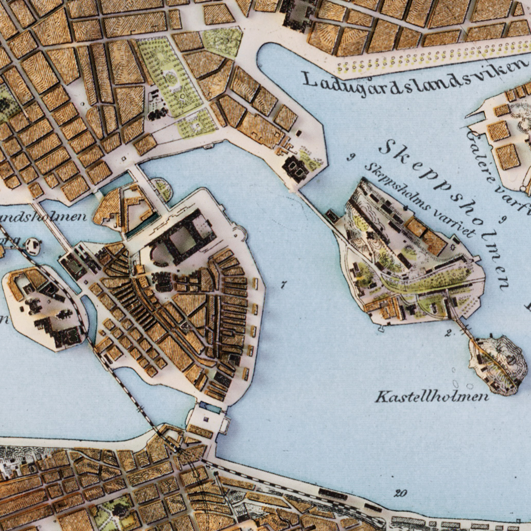
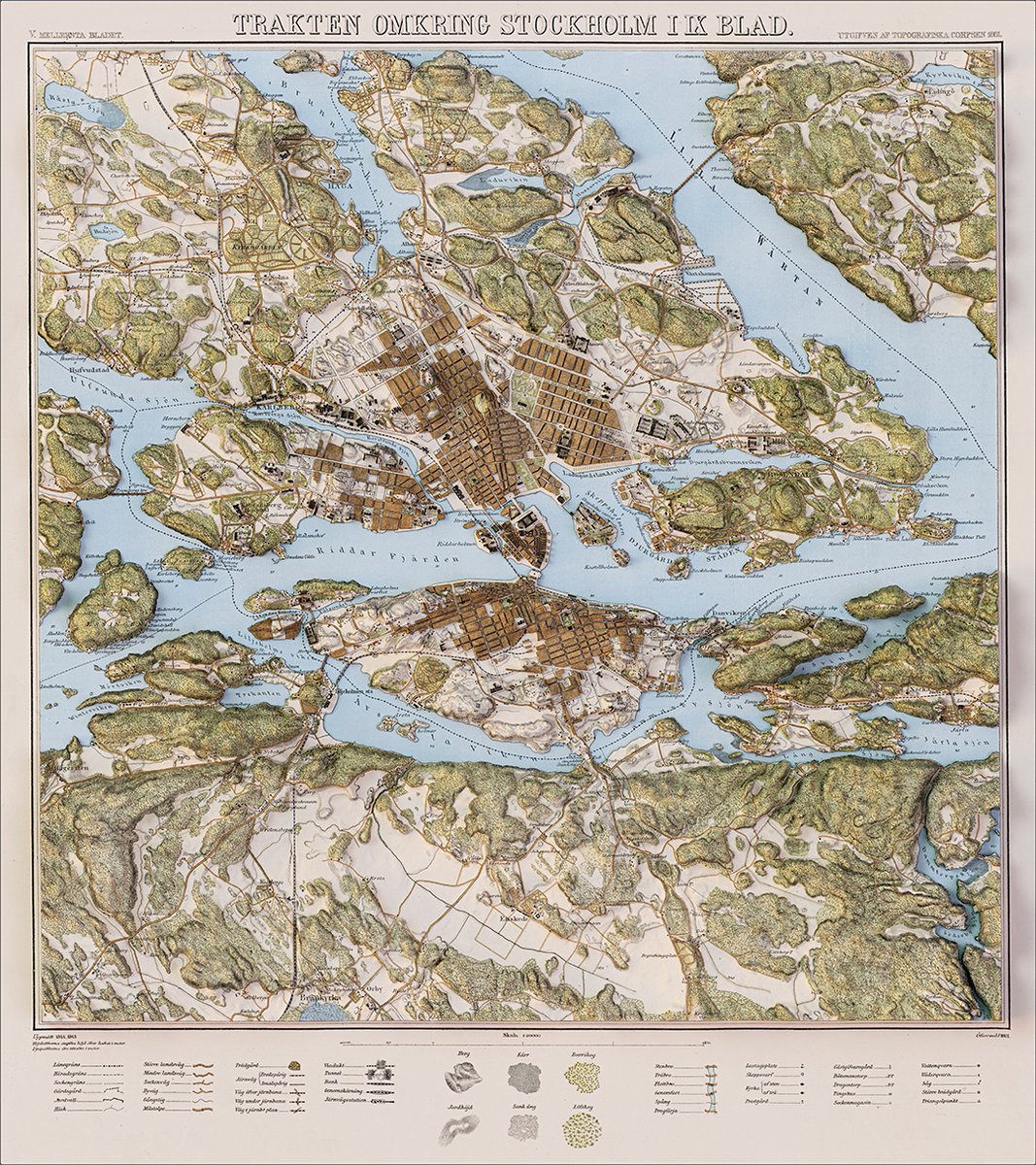
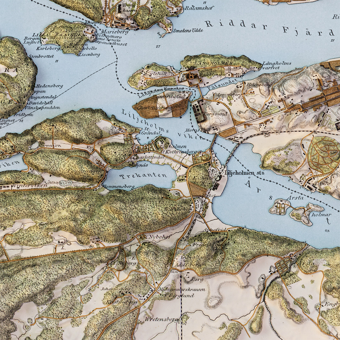
A bit late to the "elevated vintage map"-party, but here is my finished version of this lovely 1845 (rev. 1891) 20k map of Stockholm.
(Map sheet available as public domain: https://t.co/X1RpPR5hFn)
#blendergis#stockholm#b3d
One last render from Bryce Canyon before moving on to something else. Great fun to develop one simple DEM with some tools and techniques from both GIS and the more creative softwares. #b3d#blendergis
@robhawkes@swisstopo Not really my idea - I got it from this quick tutorial (credit @MrZulubo): https://t.co/T5tqbDTZNM
Still trying to develop my landscape lighting and sky setups.