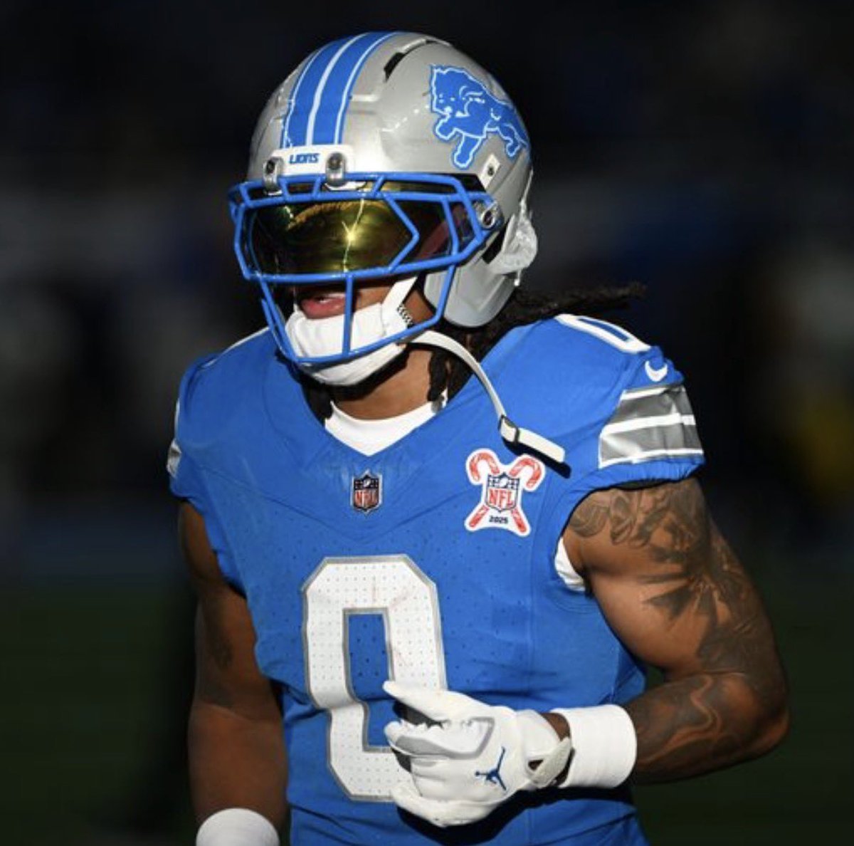
With Jonathan Taylor and Bijan Robinson’s deals done, Jahmyr Gibbs is next up, knowing what it will take to become the NFL’s new highest-paid running back.
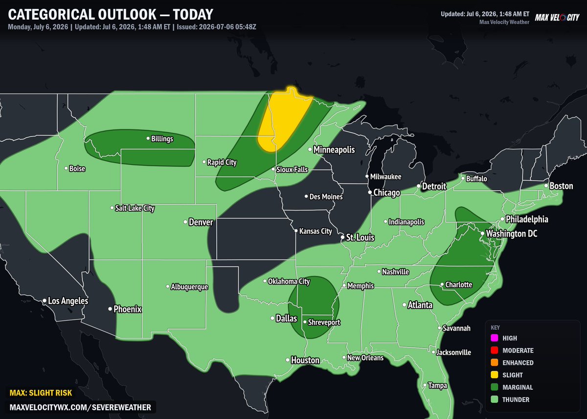
A level 2 risk in place is in place across the eastern Dakotas and western Minnesota. A cold front will be moving out of Canada, where decent moisture will intersect an elevated mixed layer. Instability will increase, and thus scattered thunderstorms are set to develop by the afternoon hours across eastern North Dakota. Starting off as supercells, these storms will be capable of producing large hail in excess of 2" in diameter, although the lack of spin in the atmosphere means the tornado threat will be generally low. By the evening hours, storms will grow upscale into a linear system as it enters South Dakota and Minnesota, bringing with it a primary threat of damaging wind gusts.
A level 1 risk is in place across northeastern Idaho, southern Montana, and northern Wyoming, where a shortwave trough entering the northern Rockies will enhance wind shear across the region. Thunderstorms developing in the mid-afternoon will have steep lapse rates, where isolated supercells and bowing structures will be present. Some models indicate the potential for a mesoscale convective system over northeastern Wyoming by the evening hours, but the limited areal coverage at this time prevents a level 2 risk from being issued a this time.
Another level 1 risk is in present across the Mid-Atlantic into the Carolinas, where a moist boundary layer will sit ahead of a trough west of the Blue Ridge Mountains in addition to a backdoor cold front. Forcing in addition to shear will remain week, but low-level convergence should be enough that scattered thunderstorms will develop in the afternoon. Low-level lapse rates are high, indicative that there is solid downdraft potential for these storms. As they grow upscale into disorganized clusters by the early evening hours, they will carry a threat for damaging winds. There is a chance that a upgrade to level 2 occurs, but only if it becomes clear that a concentrated corridor of wind damage potential becomes present.
Finally, a level 1 risk is in place across the lower Mississippi Valley, where a vorticity maxima tracking through Arkansas will provide enough lift for thunderstorms to develop. Storms will not be able to sustain themselves for long due to weak vertical shear, but the presence of a moist, unstable air mass will support pulse-type downdrafts capable of producing isolated instances of damaging winds and large hail.
We are LIVE covering TORNADO WARNINGS and MAJOR flooding in Kentucky, as well as an ENHANCED (3/5) risk of severe weather across parts of the Northern Plains!
LIVE: https://t.co/ImE43v3ioc
The Minnesota Vikings are “exploring all possibilities” to improve their quarterback play in 2026, executive vice president of football operations Rob Brzezinski said Tuesday.
More via @SeifertESPN:
https://t.co/OPX6StzNyr
Chiefs are 0-7 against the spread in their last seven games. No team ever has gone on to win the Super Bowl in the same season it had a six-game against-the-spread losing streak.
More on this week’s 6-pack with @tyschmit:
📺 https://t.co/opS9mCtsjd
Tight ends update:
49ers TE George Kittle, listed as questionable for Sunday due to a rib injury, is expected to play vs. the Cardinals, per source.
Cardinals TE Trey McBride, listed as questionable for Sunday due to a rib injury, is expected to play vs. the 49ers, per source.