@TumukundeTT I once saw him drive in Lira City, and thought “What’s this kid doing driving like that in town & Police isn’t stopping him?” I later landed on his interview on TV…and settled my thoughts.
@wekesa_amos I wouldn’t be surprised if it’s later discovered that the Consular Office/r in question is a front for the ‘duplication of Ugandan passports’😎.
#JustWildThoughtsHere
GIS Data Analyst: Cadastral Management.
As a GIS Data Analyst, your expertise extends far beyond crunching numbers and mapping datasets. You are often the strategic linchpin of asset management who is safeguarding value and enabling informed decisions. If Cadastral Management is unfamiliar territory, consider this an invitation to expand your toolkit.
What is Cadastral Management?
Cadastral management generally refers to the systematic process of registering, maintaining, and administering records of land parcels, also known as a cadastre, to ensure clear documentation of property boundaries, ownership, rights, and values. It serves as a foundational tool for land administration, enabling governments, individuals, and organizations to track land tenure, resolve disputes, and support taxation, valuation, and planning. At its core, Cadastral Management involves creating and updating a comprehensive public record or record, which is often graphical via maps that details the metes and bounds (precise measurements and directions) of real property, including dimensions, area, location, and associated attributes like cultivation or restrictions.
On that note, cadastral management, which is the systematic recording, mapping, and administration of property boundaries, rights, and ownership, can be applied beyond traditional land parcels. While its core focus is on terrestrial land divisions, the principles have been extended to various non parcel contexts to aid in resource management, legal enforcement, Public Works Infrastructure, Planning, Code Enforcement, and etc.
Keep learning and analyzing!!!
GIS Data Analyst: Notice I do not say Data Analyst or GIS Analyst?
In an era defined by rapid technological evolution and economic uncertainty, the age old adage "do not put all your eggs in one basket" has never rung truer. This is especially in the professional world. Relying solely on a single skill set, no matter how specialized, will leave you vulnerable to market shifts, automation, or industry disruptions. To thrive and remain competitive, you must cultivate a diversified portfolio of expertise. For those in the geospatial field or data analytical field, this means evolving beyond a narrow focus GIS analysis or standalone data analytics. Instead, aspire to become a versatile GIS Data Analyst. A hybrid professional who seamlessly integrates spatial intelligence with data-driven insights.
This is not just a nice to have thing, it is a strategic analysis. Here's why diversification in this space is not only smart but transformative:
1⃣The Job Market Demands Interdisciplinary Expertise
Employers seek versatile pros over specialists. Pure GIS roles lag in data storytelling or AI, while data analysts miss geospatial edges in logistics, planning, health and Public Works. Blending them together taps 20-30% projected growth and makes you essential.
2⃣ Industries evolve rapidly
For instance, past COVID-19 pandemic surged demand for geospatial outbreak tracking, while e-commerce explosions supercharged logistics data analysis. A narrow skill set invites obsolescence but diversification fosters resilience by mastering integrated tools like ArcGIS with Python, SQL, and Tableau or QGIS with SQL, R, Python and Power BI. This allows seamless pivots from renewable energy consulting to smart city planning transforming disruptions into career accelerators.
3⃣ Versatility translates directly to the bottom line Employers pay a premium for professionals who can deliver end to end solutions. A 2023 LinkedIn analysis highlighted that hybrid tech roles (data + domain specific skills like GIS) command 15-25% higher salaries than siloed counterparts.
Also, it opens doors to leadership. Imagine leading cross functional teams on projects that require both technical depth and strategic breadth. Diversification equips you to influence outcomes at higher levels, while fostering innovation and career acceleration.
4⃣ Personal Growth and Fulfillment
Beyond the professional perks, diversification keeps things exciting. Sticking to one basket can lead to burnout from repetitive tasks, but merging GIS with data analytics sparks creativity. You'll uncover patterns in data that tell compelling stories sch as mapping urban heat islands to advocate for equitable green spaces, or forecasting disaster risks to save lives, assets and money. It is intellectually stimulating and purpose driven and turns your work into a force for real world impact.
On that note and in today's data saturated world, true competitiveness comes from breadth as much as depth. Do not settle for being a specialist in one arena. Become a GIS Data Analyst who redefines what is possible.
Keep analyzing and learning!!!
Hello Data Team. I have been pondering. Would you all be interested in content on Excel spreadsheets and how to build Excel Sheets like the one I built below? Like, share and bookmark if you are interested in learning about Excel.
Keep learning and analyzing!!!!
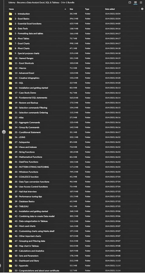
Data Analytics from Zero to Expert Free Course 😲
A Udemy Complete Paid Course for Free.
This Course covers;
- Excel
- SQL
- Python
- Tableau
→ Many more..
To get it simply Dm 24 hours
1. Follow (so that I can DM)
2. Like & Repost (Must)
3. Reply "Learn" to get Link in DM
Excel is difficult to learn, but not anymore!
Introducing "The Ultimate Excel ebook "PDF.
You will get:
74+ pages cheatsheet
Save 100+ hours on research
And for 48 hrs, it's 100% FREE!
To get it, just:
1. Like & Retweet
2. Reply "SEND"
3. Follow