Well here it is, over three months of work, research, interviews, and deep dives into the internet to reconstruct one of Florida's most unknown and misunderstood tornado outbreaks. Documentary coming soon. @WeatherManSeek@CeltonHenderson@FLStormChasers_@850Chaser@TheEmWx
It's overshadowed by the bigger tornadoes earlier in the day, but one of the wildest parts of the April 17th tornado event on the IL/WI border was the ~6:45 tornadoes at Delavan, WI with this supercell that kept reaching back toward the buoyant air - the hook was 7+ miles long!
Got structure? Simple, clean shot of the N IL/S WI tornado-fest supercell. 3:20pm I got to that road, didn’t move until 5pm when the tornado crossed it. Talk about kicking back and enjoying the show.
Some more footage of the Rockton/Harrison, IL tornado from earlier. Arguably some of my best shots yet. Was surprisingly photogenic, under a sculpted, structured supercell. Ya really can’t beat it! #ilwx#wiwx#tornado
Caught like 3 tornadoes from NW IL into S WI. What a day! Lots of footage and pics to sort through. May be one of my best days! Expect some sick footage and photos soon!
What a way to celebrate severe weather awareness week in Wisconsin... we're going 10 rounds with Mother Nature who's punching like prime Mike Tyson.
3 straight days of technically being in a Tornado Warning. That's a first.
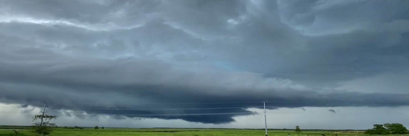
Incredible shelf cloud Monday night over Lake Mendota in Madison, WI with a tornado warned line of storms. There were constant power flashes across the lake. Straight line winds for 15+ minutes kicked up some pretty solid waves.
Can anyone confirm touchdown? This was somewhere between Dodgeville, Ridgeway, Barneveld, WI. At around 6:15pm-ish. Obviously got rain wrapped/trees blocking view. I’m very convinced however.