A SHELTER IN PLACE order has been issued for Oxford, Mississippi as a crippling #icestorm continues. Hours of thunder freezing rain has accrued 1-2 inches of ice. Falling trees are a threat to life and property. #ice#winterstorm
❄️ Winter Storm Update ❄️
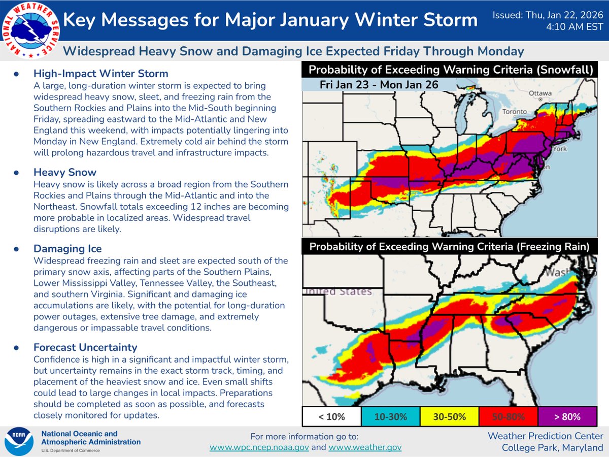
Here's the latest on the impending winter storm set to begin across the south-central U.S. on Friday. Confidence continues to increase for damaging ice accumulations across parts of the South. Preparations should be completed as soon as possible.
❄️The latest Key Messages describe a lengthy & highly disruptive winter storm for much of the southern & eastern U.S. starting Friday & lasting throughout the weekend. From significant snow to treacherous ice, expect numerous travel impacts in affected areas. Here's the latest-
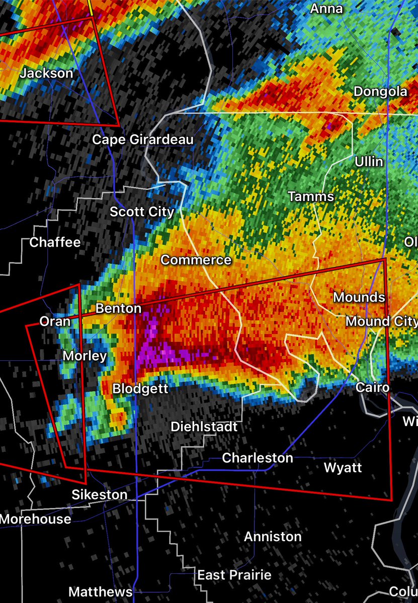
7:48am CDT #SPC Day1 Outlook Moderate Risk: over portions of east-central and southeast Missouri, western and central Kentucky, southern Illinois and Indiana, southwest Ohio, northwest Tennessee, and northeast Arkansas... https://t.co/TgJgC6cj9Y
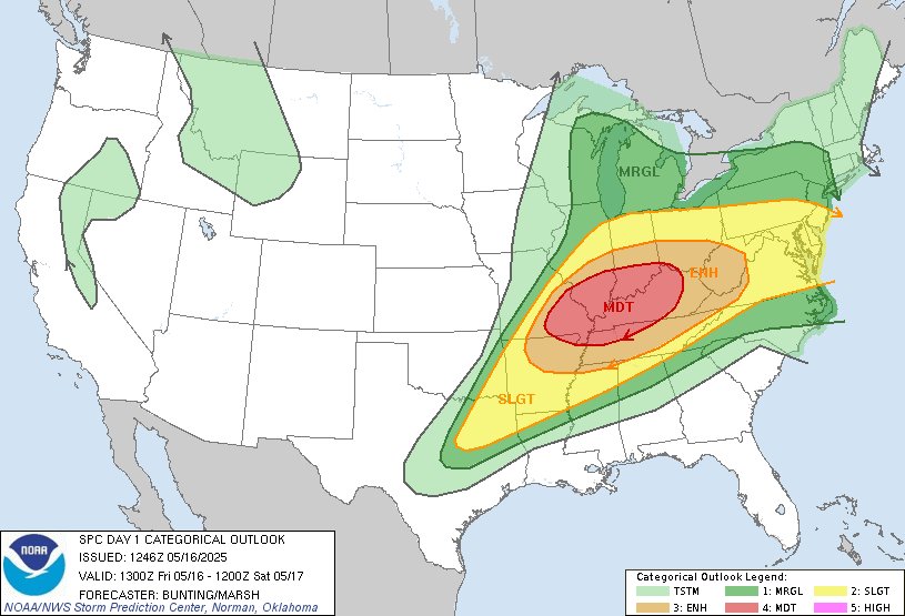
.@NOAA’s #GOESEast is tracking #SevereThunderstorms moving across parts of the mid-Mississippi and Ohio valleys this morning. @NWSSPC has issued a #ModerateRisk for another round of severe storms developing later today that could produce large #hail, damaging winds and several strong #tornadoes. #GOES19
Get the latest updates: https://t.co/WVBocq2Rl9
12:22pm CDT #SPC Day2 Outlook Moderate Risk: across parts of southeast Missouri, southern Illinois/Indiana, and central and western Kentucky https://t.co/Y1WiOd8m1i
An active severe-weather pattern will continue into Friday (5/16). Severe storms are likely across parts of the mid Mississippi Valley and Ohio Valley regions. Tornadoes (possibly strong), swaths of damaging wind, and large to very large hail are all possible.
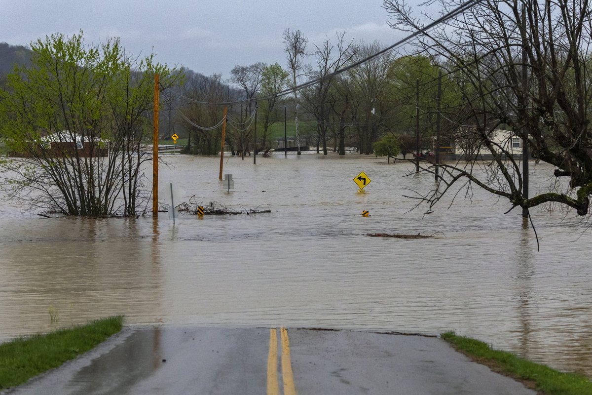
Had to leave work in a hurry this morning due to the roads flooding. Here are some pictures & videos that I took around the area, which includes Bardstown, Boston, Elizabethtown, & Springfield. #kywx#flood
https://t.co/8zcBnRRJDq
https://t.co/LNKVxI5QNT