Anvil forming earlier as cloud top reaches the tropopause and EL near 300-250mb. Weak upper level winds around the same level allowing the cloud to radiate outwards almost symmetrically. @NWSSaltLakeCity#utwx#slcwx
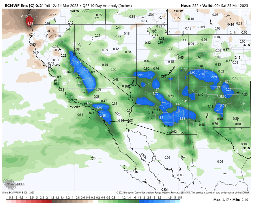
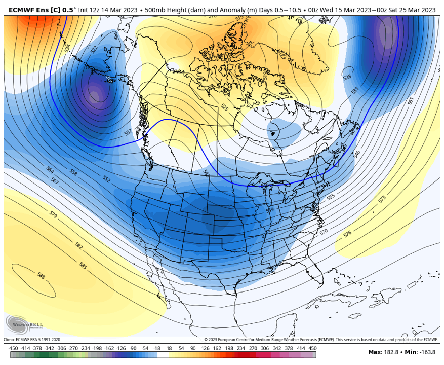
End of the quasi-omega block and a major pattern shift looking likely by the end of next week. Less afternoon thunderstorm activity in Utah if this plays out. #utwx#slcwx
Wildfire smoke swirling within a low pressure system in western Canada. Wildfires have already started in Alberta/BC Canada due to anomalously dry winter #candawx#utwx
After tonight's backdoor cold front, a steady warming trend sets in across Utah through early next week. Beyond 4-5 days, there is uncertainty in conditions as two closed/cut-off upper level lows in the west and east will dictate how the pattern progresses. #utwx#slcwx
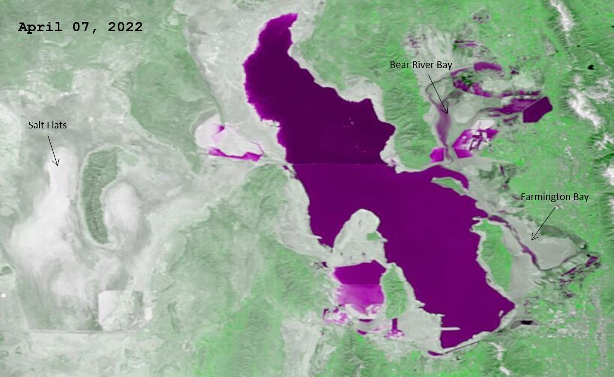
Hard to identify from the ground, but from satellite the slight increase (~3') in the GSL level has already altered the lake boundaries since last April 2022. Other key areas that were dry or mainly dry last year now have water. #utwx#slcwx@NWSSaltLakeCity
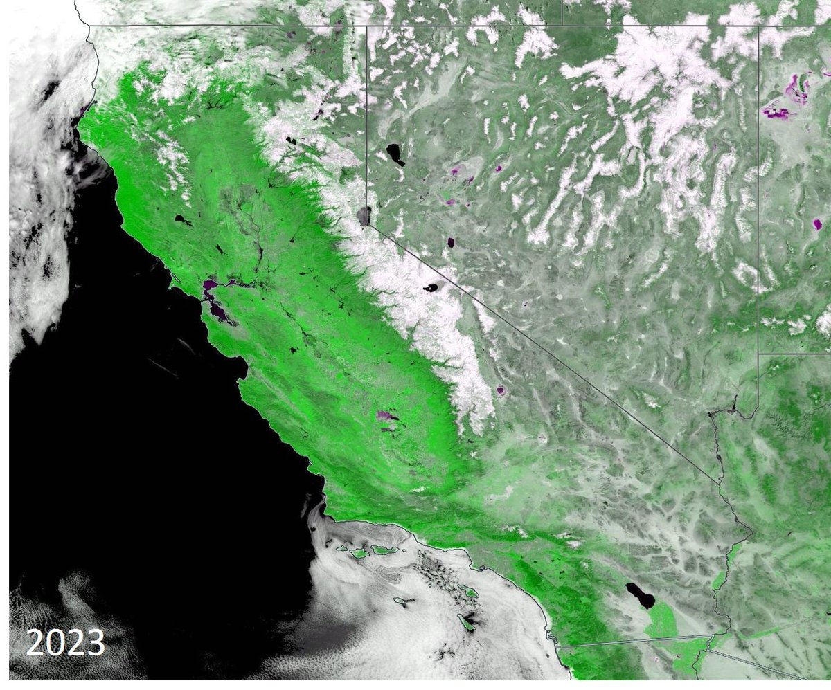
Using MODIS "veggie" band to compare California greening April 2023 to April 2022. Increased reservoir and river levels also noticeable in this band. Reemergence of Lake Tulare can be identified in S San Jaquin Co, which was drained in the late 19th century. #cawx#utwx
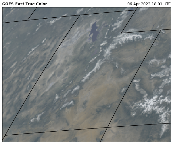
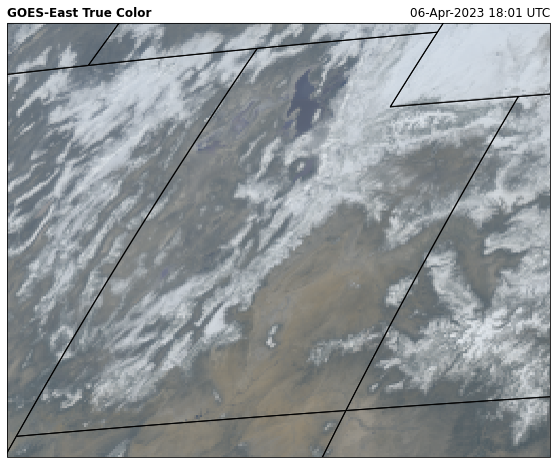
The difference a year makes. Significantly more snow coverage across Utah compared to this time last year. GOES true color imagery from 4/6/23 and 4/6/22. #utwx#slcwx
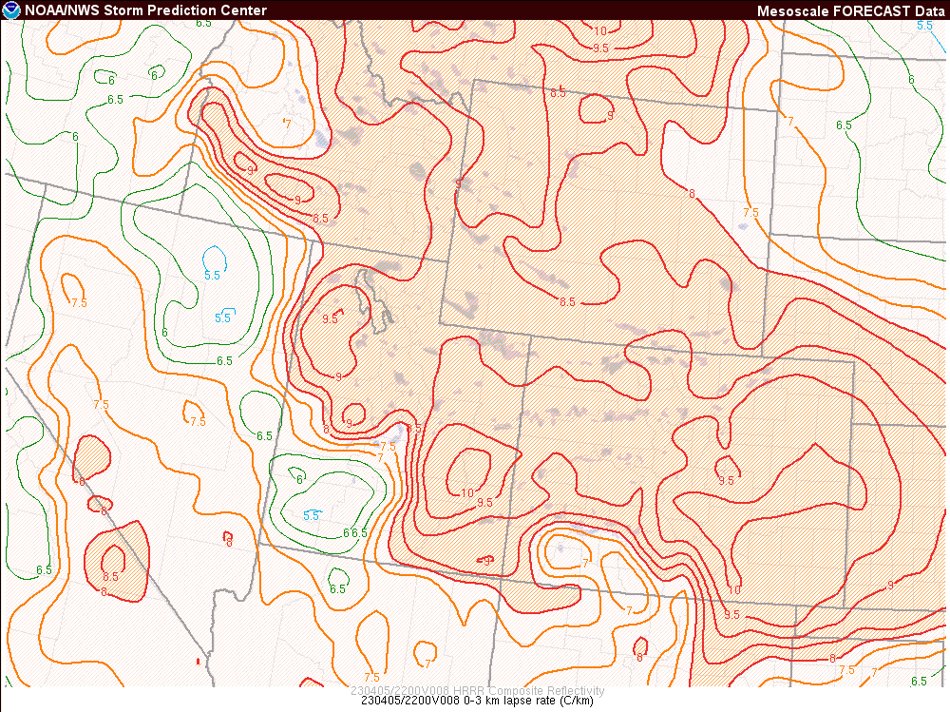
Another daily 700mb min temp at KSLC (-14.7C). Noticeably, steep low to mid level lapse rates, with some lingering moisture. Diurnal heating and breaks in the clouds will likely lead to some scattered daytime convective snow showers across N UT. #utwx#slcwx
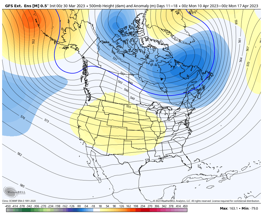
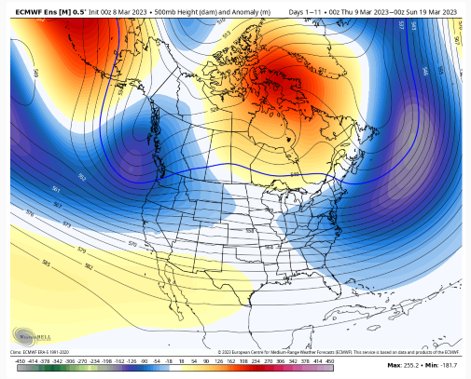
While winter continues across N Utah today, the long range offers a glimmer of hope for more spring-like conditions. Ensembles hinting at ridging across the west the second week to mid April, with warmer and drier weather possible. Will we finally hit 70F. #utwx#slcwx
The GSL has already risen 3' since it's low point in Nov 2022. For reference, the GSL on average increases by 2-3' total per runoff season. In 2022, it only rose about 1'. Interesting to see how much more the lake will rise with the melt off this year? #slcwx#utwx#SaltLakeCity
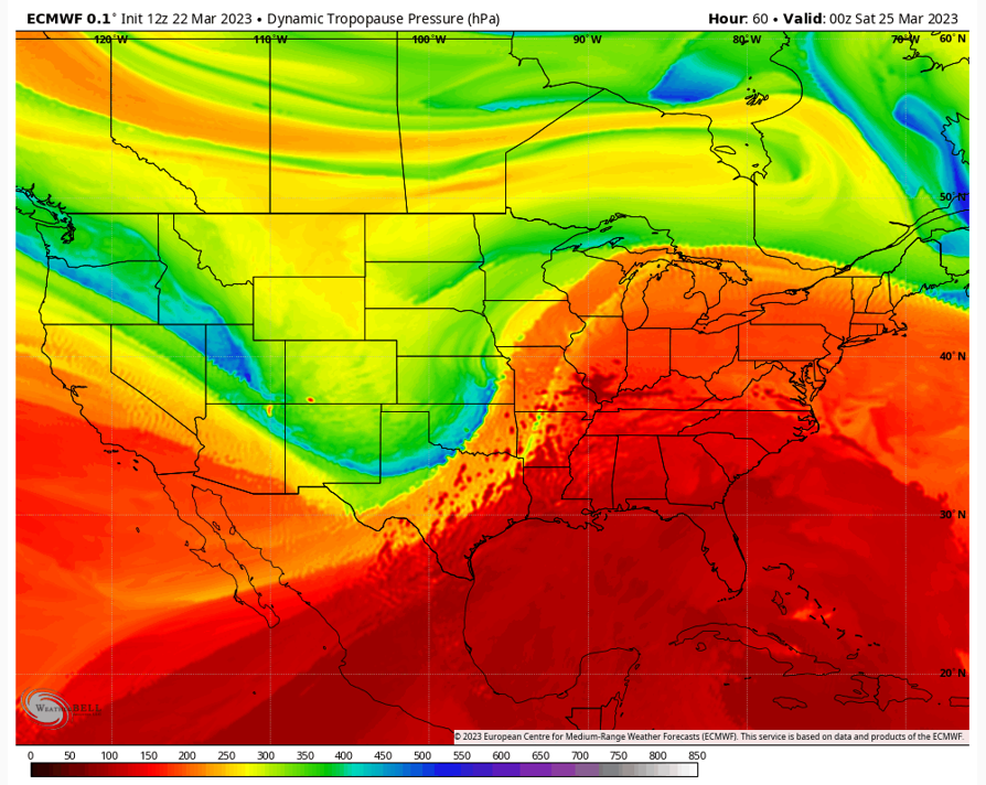
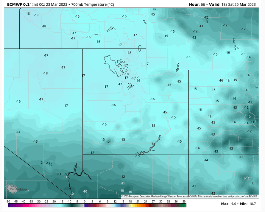
2nd-ish winter arrives Fri through the weekend as a blast of continental/maritime polar air moves into UT. Lowering of tropopause noted over the state. Flirting with the daily min 700mb temp at KSLC on Sat. Forecasted -17C 700mb at 12Z Sat and record min is -16.8C. #utwx#slcwx
Watching the band of thunderstorms and snow moving W to E across the Salt Lake Valley with yesterdays stout cold front. Fairly impressive shelf cloud along leading edge of storm line. video credit: @mesowestutah#utwx#slcwx
Thunderstorms and quasi-squall line possible in the afternoon as a bit of instability develops and a compact short-wave trough moves through Utah. Brief periods of graupel and snow possible in valleys under heavier showers. #utwx#slcwx
Drying out across N Utah Thu through the weekend. Pacific storms cycle through once again starting Mon-Fri. While temps will be below normal, Utah valleys will see mainly rain with some snow potential the second half of next week. #utwx#slcwx
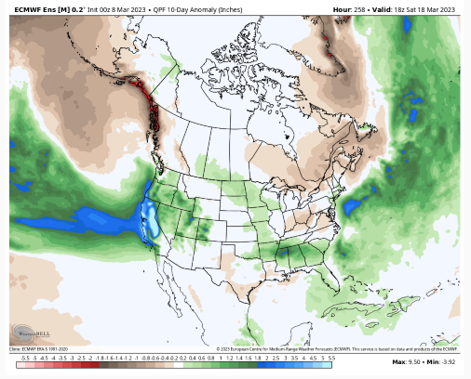
NE Pacific troughing the next 7-10 days, with a turbulent pattern across the west U.S. Multiple AR's possible, drawing warmer airmasses and abundant precip into Utah. Early "spring-like" conditions for UT valleys at times. Snow for the mtns. Potential 3-4" liquid. #utwx#slcwx
Strong AR making its way across the Sierra into UT FRI through the weekend. Ample moisture and relatively warm conditions means higher snow levels and denser snow. Currently, 1.5-2.0" liquid forecast for the cottonwoods. #utwx#slcwx