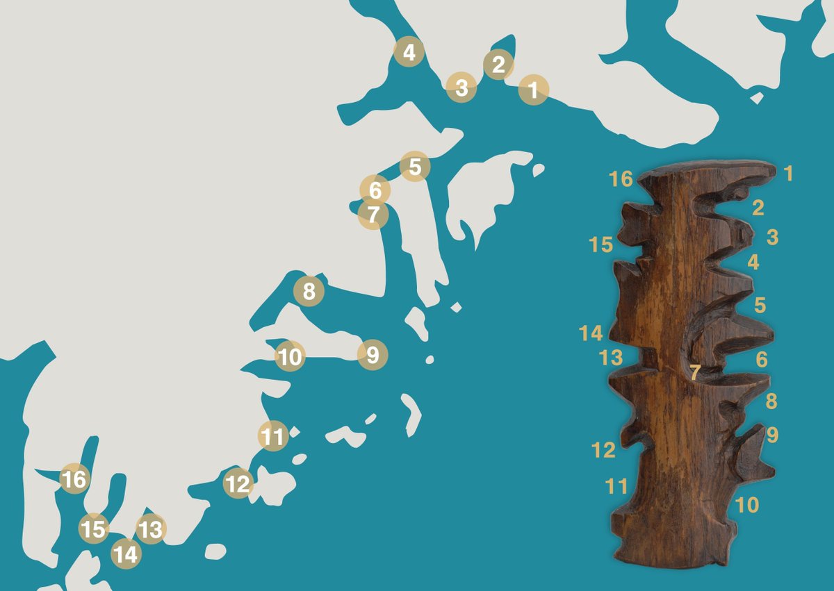
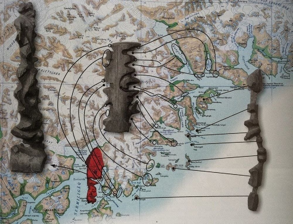
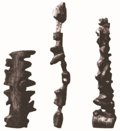
El pueblo INUIT de Groenlandia talla sus mapas sobre madera.
Representan exageradamente las líneas de su escarpada costa de manera que las puedan descifrar en la oscuridad pasando las manos, que están dentro de manoplas.
El explorador Gustav Holm descubrió este hecho sobre 1880.
💡🗺🧞♂️ Le DealberTool du jour : si vous avez besoin de récupérer des plans de villes en vecteur (Kiev par exemple, jdcjdr) basés sur Openstreetmap sans passer par l'affreux nettoyage sous Illustrator, un outil plutôt très pratique : https://t.co/DM7DpMEctd
This map superimposes the border of the German Empire (1871-1918) on the electoral results of the 2007 Parliamentary elections in Poland.
Another great example of the long term impact of past institutions.
Orange/red = PO, centre right
Blue = PIS, right (currently in power)
Before satellite technology was available, mapmaking required a tiring combination of trigonometry and hoofing it. These recently discovered photos show a group of men on a quest to map all of Britain, one revision point photo at a time https://t.co/QUl8LHIIRj