🛰️TBX Minotor™ | MINE SPOTLIGHT ⛏️⚒️
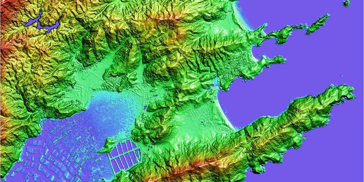
Bełchatów is a large open-pit lignite #coal mine central Poland, producing tens of millions of tonnes of annually
Using 37 years of #Landsat#satellite imagery, we can observe the migration of open-pit mine excavations
#earthobservation
@tbotix mentioned in @FT. The era of more transparent, independent, & objective GHG emissions measurement & monitoring is here & only increasing. We’re making sense of this data to bring it down to Earth for action https://t.co/UVWlAe3mjj
Join for our Emission Measurement and Monitoring Technology Showcase, in partnership with @NSTAuthority.
📅⏰ Thursday 21 March 2024, 13:30 - 17:00
📍 Net Zero Technology Centre, 20 Queen’s Road, Aberdeen, AB15 4ZT
🔗Register: https://t.co/jY6L6haO6N
🛰️ READ @scot_business' fantastic interview with Anna Dawson of Terrabotics, in which she discusses earth observation data, remote sensing and their huge potential to help businesses reduce carbon emissions ➡️ https://t.co/wC7L6V5h2R
@tbotix@TheScotsman#SpaceData#NetZero
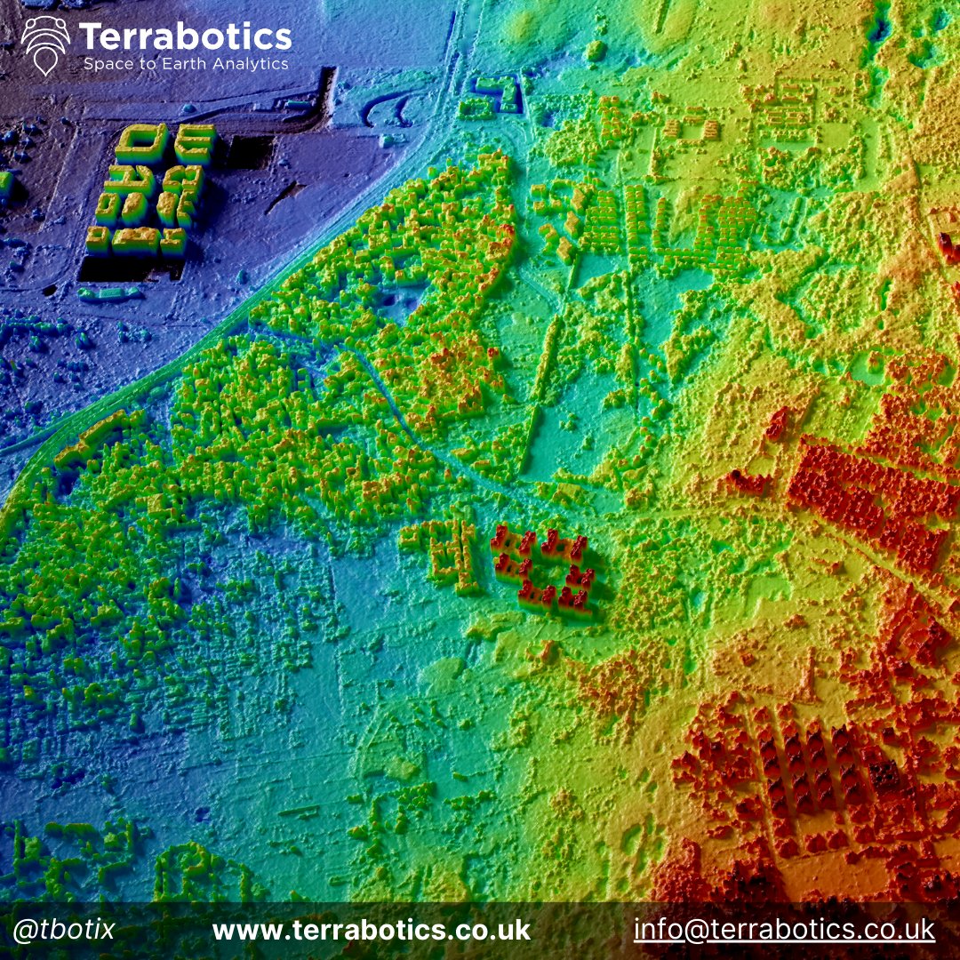
Satellite data provides the most spatially extensive, timely & cost-effective means to produce 3D models and DEMs of the Earth's surface.
Terrabotics' #Minotor™ platform provides ease of access to satellite imagery, 3D data and routine analysis via web bowser or API.
🛰️ ⛰️ #Satellite-derived DEMs can provide an unparalleled view of the Earth’s constantly evolving and dynamic #topography
Check out this @felt map to explore how Terrabotics satellite intelligence helped track over 9000 sand dunes in Wahibas, Oman!
https://t.co/jfNwEDCEH7
Our high-performance satellite, MANTIS, is gearing up for launch on #Transporter9. It hosts an advanced optical payload for #EO missions along with on-board #AI for instant insights.
Stay tuned for updates on the Vandenberg Space Force Base liftoff! 🛰️
#SpaceX#SatelliteTech
The Jagersfontein tailings dam collapse in September 2022 produced a 7.5 km long mudslide
Terrabotics has developed a tailings dam database to map, measure and routinely monitor tailings dams around the world
https://t.co/lgpi2nQjpx
#Mining#ESG#Satellites#EO#floodrisk
Upstream catchment and valley of the recently flooded Wadi #Derna river, #LibyaFloods, to visualise terrain and drainage networks (ESA/#Copernicus GLO-DEM and #Sentinel2)
Satellite-derived #DEMs are key to planning, #hydrology and engineering to protect downstream populations
Get a bird's-eye view of your operations with #ShaleAnalyst. Our satellite-image-based system tracks key oil & gas events over a complete pad life cycle, giving you a comprehensive understanding of energy sector performance. #Satellite#energyinsights#AI#datadriven#shalemarket
Weekly Update: New #Shale Well Pad Count from Space | #Permian Basin
No. of New Well Pads built so far this month: 204
Top Active Counties this Month: Lea, Midland, Martin, Crockett, Loving
Daily Satellite image analytics keeping an eagle eye on #shale well lifecycles #energy
Our Fragile Space, an exhibition from photographer Max Alexander, focuses on the impact of the millions of pieces of cosmic waste circling Earth https://t.co/Lfk7cjl80L