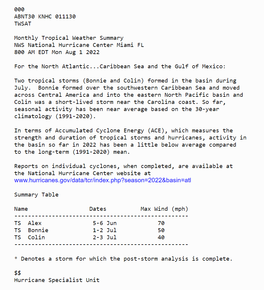
Here's the Monthly Weather Summary issued today for tropical cyclone activity in the Atlantic so far this season. Two tropical storms, Bonnie and Colin, formed in early July, and seasonal activity to date has been near to a little below normal.
https://t.co/dEg6cZu2ze
Here is the 5 pm CDT update for Hurricane #Ida. Ida is still an extremely dangerous category 4 hurricane with its eye very near Houma, Louisiana. See https://t.co/tW4KeFW0gB and your local weather office at https://t.co/SiZo8ohZMN for details.
As meteorologists at the National Weather Service Slidell office, we can't bear to see this on satellite. We have hard times ahead, but we will all persevere. Take all messages we, public officials and broadcast media are saying SERIOUSLY. Stay tuned for more frequent updates.
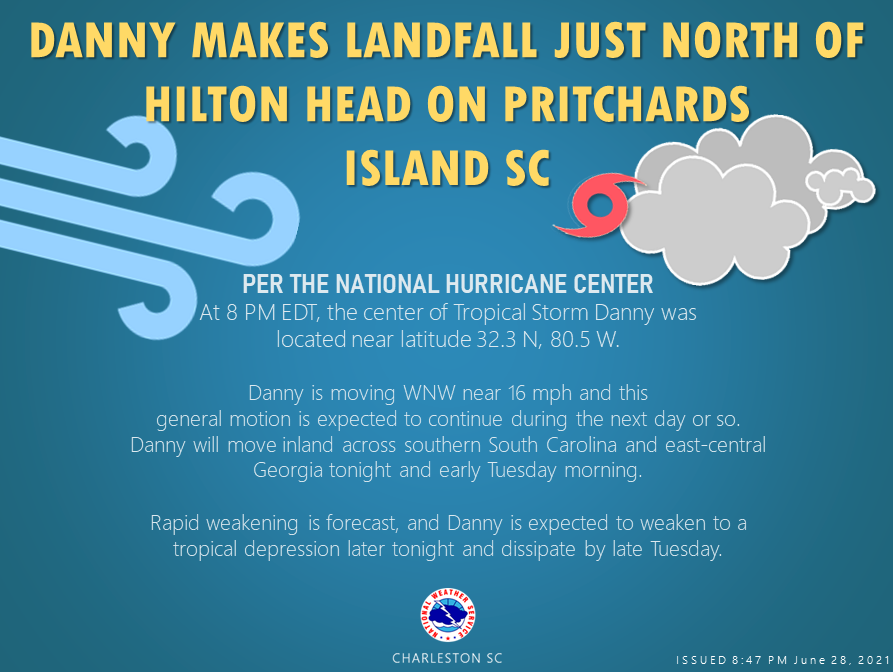
Tropical Storm Danny 🌀 has made landfall just north of Hilton Head, SC. Take a look at the details from the 8PM update from @NHC_Atlantic
https://t.co/UZCaXu0vo5
#chswx#scwx#savwx#gawx
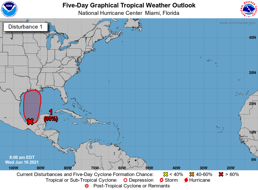
A broad low pressure area over the Bay of Campeche and southern Mexico is expected to begin moving northward on Thursday. This system is likely to become a tropical depression by Friday over the western Gulf of Mexico.
https://t.co/m9946DGzPQ
Good Morning from #hurricanemeeting2021 Day 2! Get ready, we have a full day ahead.
- Registration Desk opens 7:30a 🎟
- Classes start at 8:30a ✏
- Exhibit Hall opens at 9:30a 🌀
- Welcome Reception at 5:30p 🍻
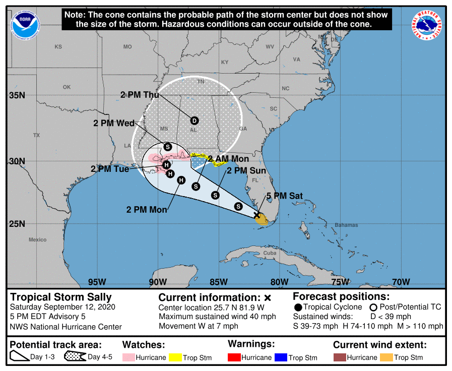
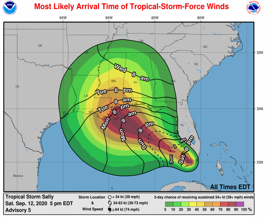
A Hurricane Watch is in effect from Grand Isle, LA, to the Alabama/Florida border, where hurricane-force winds are possible by early Tuesday, with tropical storm conditions possible on Monday #Sally https://t.co/tW4KeFW0gB
Hurricane #Isaias is near Andros Island in the Bahamas. The hurricane is expected to approach the southeast Florida coast late today and on Sunday. Go to https://t.co/tW4KeFW0gB for the latest info on #Isaias and https://t.co/SiZo8ohZMN for your local weather forecast.
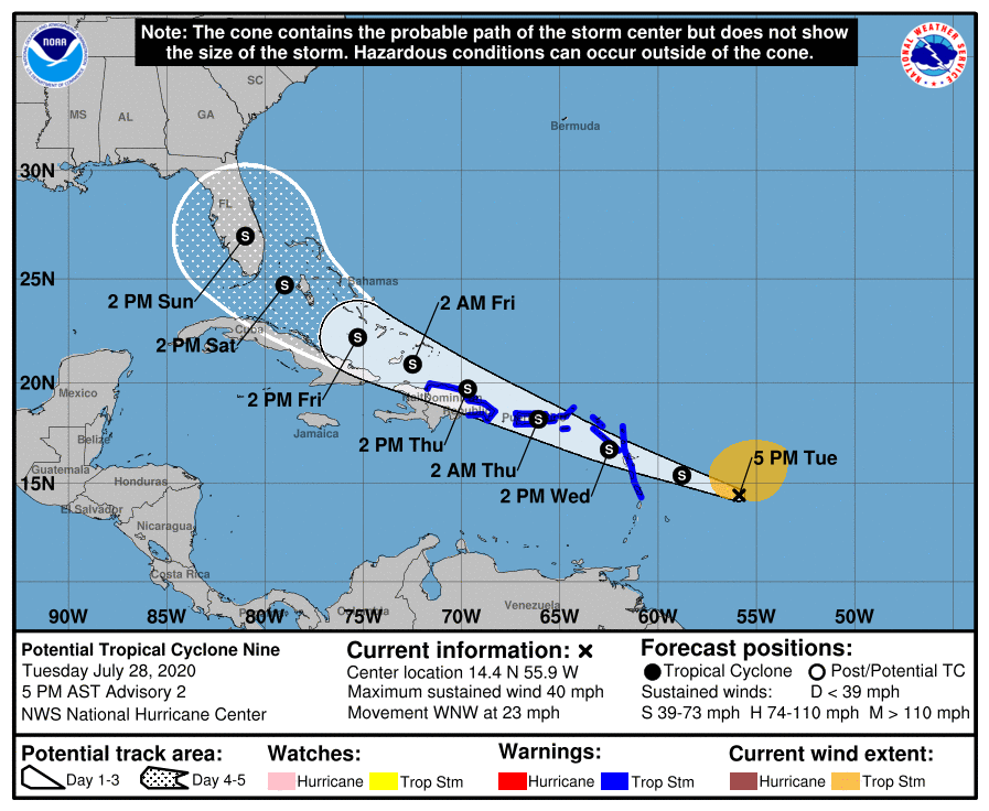
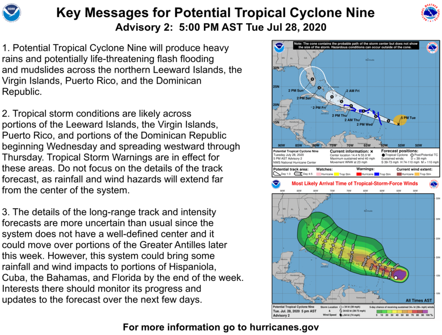
Potential Tropical Cyclone Nine is expected to become a Tropical Storm tonight prior to reaching the Leeward Islands. Tropical Storm Warnings are in effect for Puerto Rico and the USVI, with heavy rain and tropical-storm-force winds forecast to arrive Wednesday night.
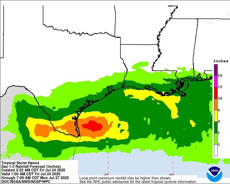
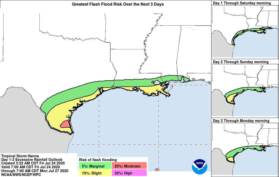
TS Hanna is expected to produce 4-8" of rain with
isolated maximum totals of 12" through Sunday night in south Texas (@NWSWPC forecast). This rain may result in life-threatening flash flooding, rapid rises on small streams, and isolated minor-to-moderate river flooding.
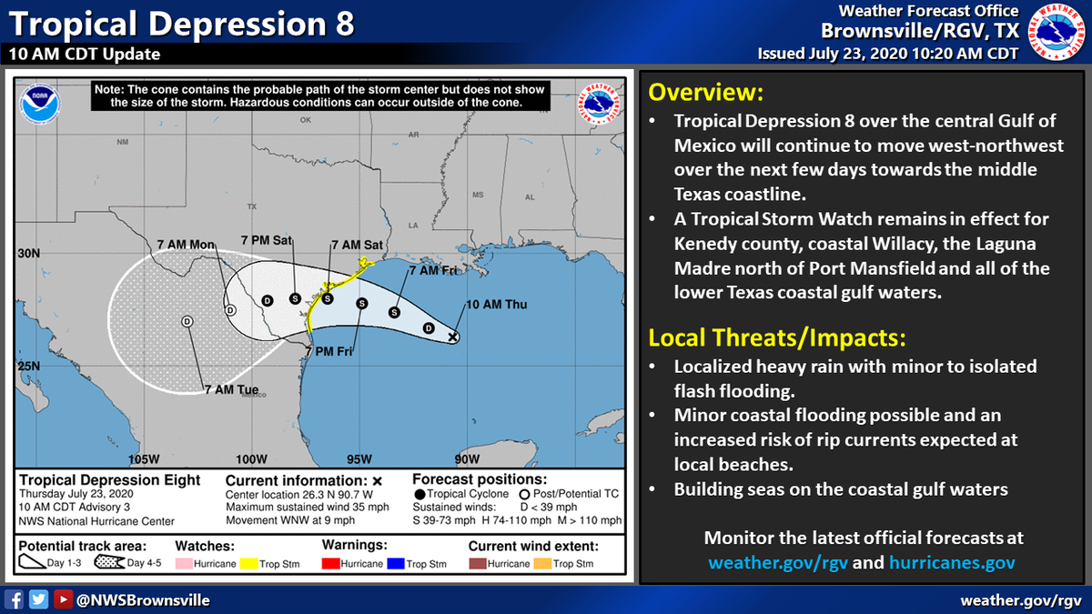
Tropical Depression 8 over the Central Gulf will continue to move west-northwest over the next few days towards the middle Texas coastline. The main impacts across Deep South Texas will be heavy rain with localized flash flooding. The heaviest rain will stay north of the RGV.
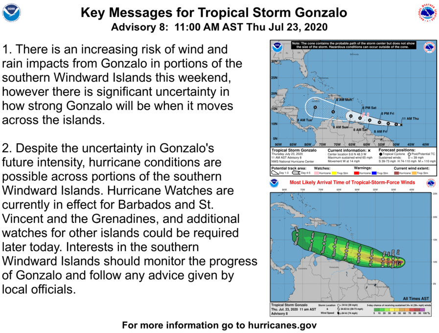
Here are the 11 am AST Thursday, July 23 Key Messages for Tropical Storm #Gonzalo. Interests in the southern Windward Islands should monitor the progress of #Gonzalo. https://t.co/Tz5fnGhV4y
Get updates on #COVID19 by listening to your state and local authorities and @CDCgov. Stay informed but avoid too much news on the pandemic. #Takebreaks from the news and social media. https://t.co/GmIXaFsIKt
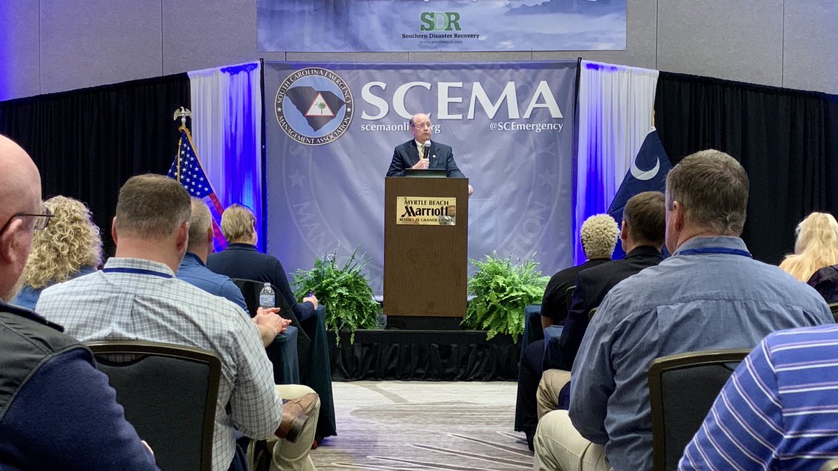
Addressing a crowd of almost 300 emergency management professionals, @SCEMD Director Kim Stenson provides updates on ongoing disaster preparedness and recovery initiatives throughout South Carolina. #SCEMA2020 @SCEmergency #AllHazards
Some locally heavy rain with possible flooding is expected on Tuesday and Wednesday from the South to Texas. This entire area is quite saturated and any additional rainfall may lead to more runoff issues and additional flooding. Areal average amounts of 1 to 3 inches is expected.