Hedgerows do more than mark boundaries - they prevent soil erosion and support wildlife. 🌿
For Day 27 of #30DayMapChallenge - Boundaries, Production Consultant Thomas Bristow maps hedgerow density across GB using OS NGD Field Boundaries & Local Authority data.
The OS Innovation Festival is happening this year 🌟
Industry leaders and innovators will connect to explore transformative trends in geospatial tech, AI, and sustainability: https://t.co/iGAW1NHZID
This map visualises the results of OS employees plotting towns and cities in Hampshire on a blank map from their memory. Southampton had the highest accuracy, while Andover scored the lowest.
By Graduate Rebekah Spratt for Day 23 of the #30DayMapChallenge - Memory.
Our latest blog talks about how we installed 31 Swift boxes and 8 call players on part of the @MDSuperCluster - supported by @Gameandwildlife Fordingbridge Greener Living and a @hantsconnect Councillor Grant
https://t.co/tb1DCXPrzX
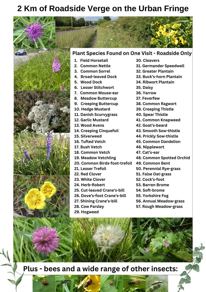
The UK has 500,000 kilometres of rural road verges PLUS urban ones!
57 plant species were found on 1 visit to 2 Km of road verge on the urban fringe yesterday along with a range of insects
Share this if YOU want ALL councils to SAVE money AND British Nature! #MeadowManagement
So good see @IoloWilliams2@BBCSpringwatch showcasing the jewel in our crown: MartinDownNNR & talking about our Supercluster & some of the successes we've had on MartinDownFarmerCluster (1/3 supercluster)tonight. Thank you!
Farming and nature can go hand in hand @Gameandwildlife
Highly recommend! Paul, Jess and Hannah are excellent speakers and our geo-visualisation experts at OS. Any GIS/map enthusiasts out there you are in for a treat.
Join a cartography masterclass with our experts! In this free webinar - meet our cartographers to learn more about the fundamentals of map making 🗺️
⏰ 6th June at 7pm.
Secure your spot: https://t.co/9ZMyiUr7zX #Cartography#MapMaking#MapMasterclass
Great to see that this project to reintroduce the New Forest cicada is progressing. The @OpenAcoustics AudioMoth was developed during our first attempts to search for this rare insect in the New Forest. https://t.co/HwCF8nWIil
Set your alarms bright and early on Sunday for #InternationalDawnChorusDay! 🎵
These are just some of the magical musicians you might hear singing 🐦 https://t.co/3EG9juRGoi
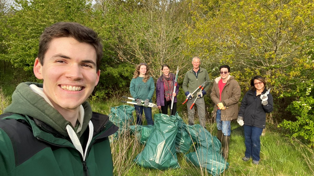
Really great team of volunteers helping to remove old plastic tree protectors and do a bit of woodland management around OS recently. Looking forward to sharing some of our other initiatives in the next few months! 🦇🌳🌸
Thanks to sustainability initiatives including our colleagues from OS Wildlife Group,OS HQ is thriving with diverse flora and fauna. Recent activity includes:
🐜 Creating brush piles for invertebrates
🌿 Reducing the scrub on the meadow
🦆 Installing wildlife monitoring cameras
Location data and intelligence is critical for enabling projects such as:
🌱 Safeguarding moorland life in the South Pennine Moors Special Area of Conservation: https://t.co/FjhR5uWBSo
Today is #WorldWildlifeDay, a day to celebrate and protect the amazing diversity of life on our planet. 🌿🐾
We can all play a role in conserving wildlife by using digital innovation and location data to support projects that safeguard habitats and restore ecosystems. 🌎
The Supply Chain Data Partnership was announced at COP27 - a proposed solution seeking to provide a location dataset for global supply chains.
A year on, as we attend #COP28 - Donna Lyndsay reflects on the progress so far and the future of the SCDP 👇
#SupplyChain
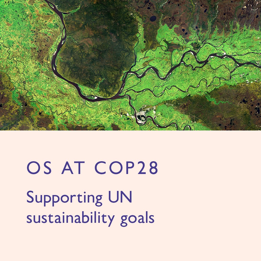
OS will be at COP28, where the international community comes together to discuss the climate agenda. 🌏
Location intelligence is critical to achieving the agreed 1.5°C global limit by 2050.
Very pleased to have championed the roll out of our biodiversity strategy this year.
As part of our monitoring we used iNaturalist to involve colleagues in our biodiversity work. In true OS style, here’s a map of the observations made so far!
As part of biodiversity work here at OS, we regularly monitor the local #wildlife near our HQ - Explorer House. 🌿
OS Remote Sensing Surveyor Thomas Bristow created this dataviz for #30DayMapChallenge, Day 20 - Outdoors to showcase some of the sightings.
With the most detailed and accurate view of Great Britain’s landscape, make location-based decisions with confidence.
🗺 Easy access to OS data and APIs
🛣 Building, road, greenspace, address data, and more
📑 Support and tutorials available
Learn more: https://t.co/zfsk16r0ZL
The scale of the fires currently burning across northern Australia is pretty unfathomable.
This animation visualises just the last two months of fire captured by #DEAHotspots - for context, the map covers an area larger than France, Spain and Germany combined...