The BCPD! (Brier Creek Parents Department) Proudly serving #BCES since 2014! Safety Concerns, Complaints, Suggestions for BCES Students, Families, Staff!
@MichaelKGarrett Here's an opportunity... #Disney has been planning to build the “Lake Nona Parcel 20A Office Complex” on 60 acres in Orlando, and relocate 2000 employees from California. Act quickly and incentivise them to build in RTP instead! 🧐🤔
@wxbrad Yes! So true! Callery Pear Trees! On a recent walk I first thought someone had enjoyed steamed crabs in recent days and the scraps were rotting in the trash! #ncwx#StinkyTree
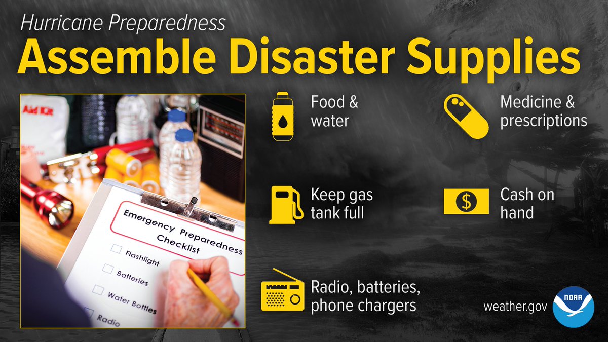
With the potential for Ian to impact central NC late next week, now is a great time to think about assembling disaster supplies. This preparedness is beneficial throughout the year, regardless of potential hurricane impacts. #NCwx
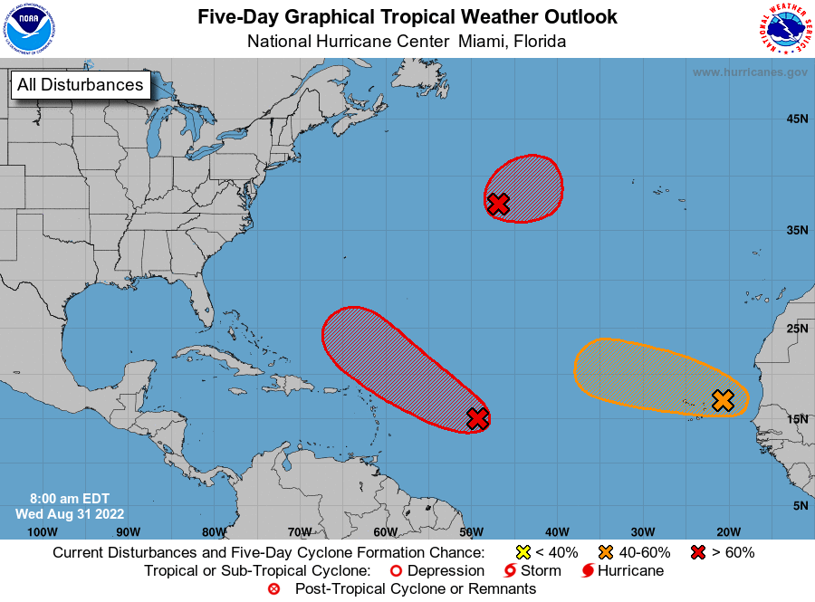
Hurricane season is heating up! NHC is monitoring 3 areas for tropical development during the next 5 days in the Atlantic basin. See here for details: https://t.co/m9946DoYYi
From the real estate listing when this house sold in 2020: "This area experiences ocean over wash which requires sand removal but the home is priced accordingly. It’s not a bad trade off when enjoying such amazing views of the beach." https://t.co/Xh7IVUpU3P
Heads up! Strong, gusty winds are likely across central NC Saturday, especially in the afternoon through evening. Sustained winds of 15-25 mph are expected to gust to 30-40 mph. Be sure to bring any light outdoor objects indoors! #ncwx
Ron Desantis believes in herd immunity by everyone getting covid. He refused to promote the vaccine because a big chunk of his base is against it. We don’t allow any mitigation efforts in FL. The plan was to bank on therapeutics to deal with severe cases. Now there is no plan.
Breaking News: NC breaks record for most people hospitalized with COVID-19 -- more than 5,000 people are in the hospital with the virus https://t.co/v9CpLNgEuK
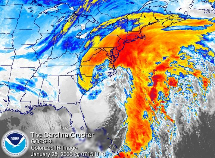
❄️Snow fans! Today marks the 22nd anniversary of the Blizzard of 2000, which was one of the most powerful winter storms on record for parts of North Carolina. The low pressure system developed off the FL coast and rapidly strengthened as it moved toward central NC. #NCwx
Southwesterly flow ahead of a cold front will result in the warmest day of the week today, so enjoy it while you can! Highs will be in the mid-to-upper-50s, with 60 possible in the far south. #ncwx
Here's the updated snowfall map from noon. Minimal changes from the previous one (many locations in the 2-3" range went from the lower part of the range to the higher part of the range), but we will issue another map after our full afternoon forecast package is released around 4.
We have just expanded our Winter Storm Warning farther to the west. The western edge of heavier snowfall has shifted to the west with the latest model runs, particular during the evening hours. We will post an updated storm total snowfall map shortly.
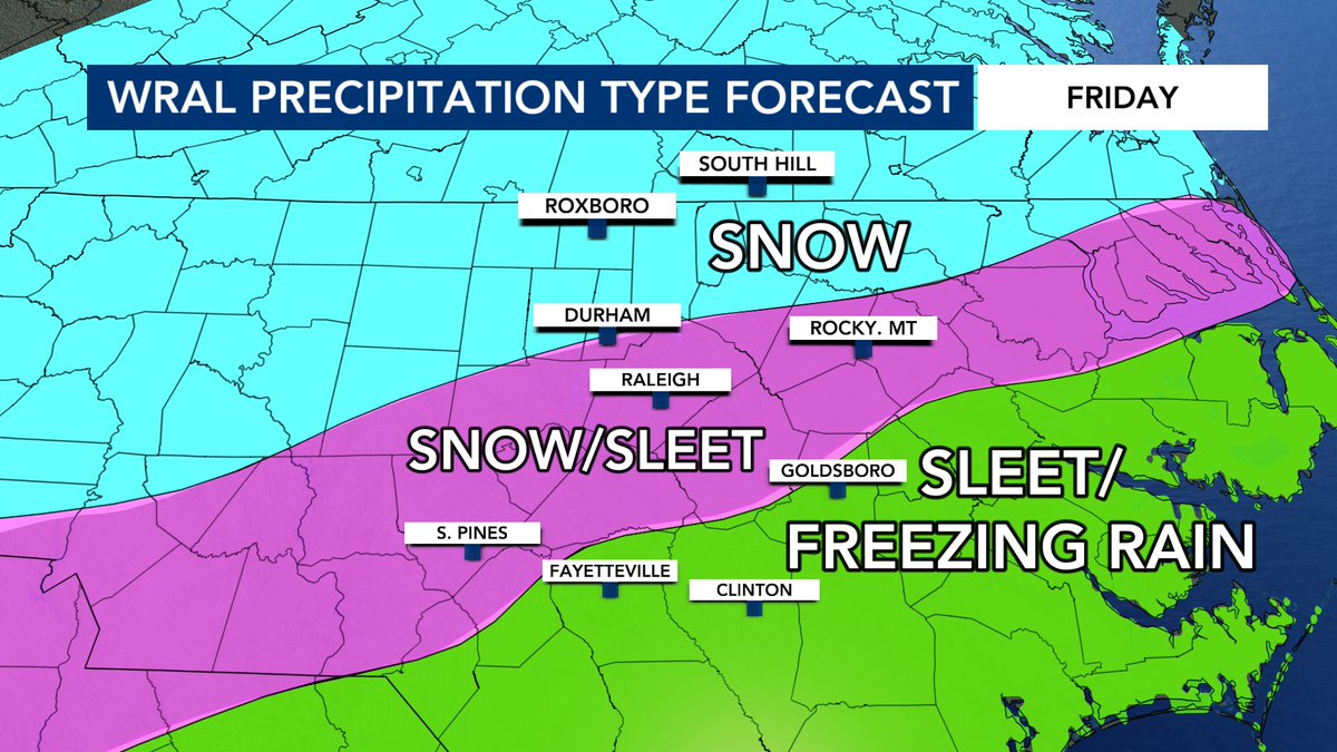
TUESDAY UPDATE: Here's our first call customized precipitation type forecast for Friday after looking over all the new data in this afternoon. It's too early to talk totals but we will get there soon. Join me on WRAL News for a closer look at the timing and impacts
@wralweather