Catalyzing Resilience 💪 Collaboration 🤝 and Innovation 💡
Click our Linktree below for resources and discounts for FIRMAN Power Equipment and Ready America!
We have been doing after action reports since Hurricane Harvey, but a disaster review board would help internalize learnings from previous disasters inside the federal government.
In honor of ISD's 20th Anniversary on August 27, we're highlighting a few of our reports from over the years! Click below to read about the long-term recovery challenges faced by small towns and underserved communities impacted by Hurricane Harvey. https://t.co/sfZrJCE9yw
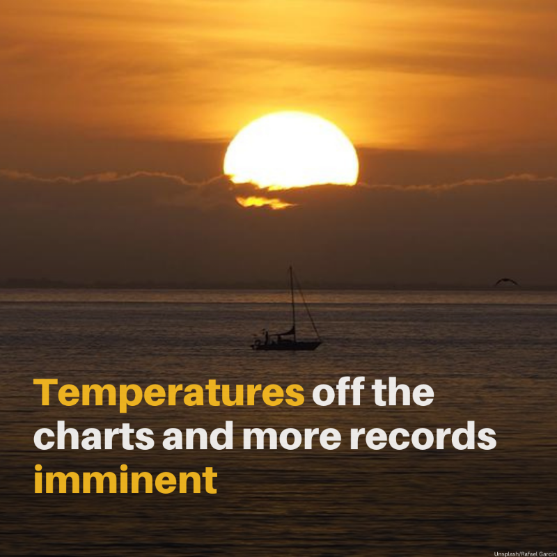
Millions of Americans are being impacted by extreme heat waves, which are growing in intensity, frequency, and duration due to climate change.
Go to https://t.co/3TJomgAgGk and https://t.co/qen7iqY3xA for more on preparing for and staying safe during these extreme heat waves.
El Niño is here! ENSO can influence and disrupt weather, ocean, and climate patterns all over the globe. Learn more about ENSO and how NCEI data and products help detect and monitor different ENSO phases and their impacts: https://t.co/WyaE6F95Hs
@NWSCPC@NOAAClimate
Global sea surface temperatures reached a record high in May and June, with the warmest week ever recorded in July.
According to @WMO, the weather pattern is expected to make one of the next five years the warmest on record.
Don't underestimate the effects of extreme and lingering heat.
Check on friends, family, and neighbors during heat waves.
#SummerReady | https://t.co/IQxR2ZQP40
Another blog post fresh off the presses! ✍️
Let ISD take you on a journey through our past five years of landmark research reports 🕮 strategic partnerships 🤝 and innovative ways of thinking 🧠 Read more at https://t.co/UU6z1wFEZP
#catalyzingresilience#communitydevelopment
New blog post 📝 "Shall we in the U.S. care about whether a country at 'the bottom of Africa' – albeit at the top of Africa economically – implodes? Does anyone care anymore? Should anyone?" Read more at https://t.co/8lwkpN00zc
#resilience#humanitarian#collaborations
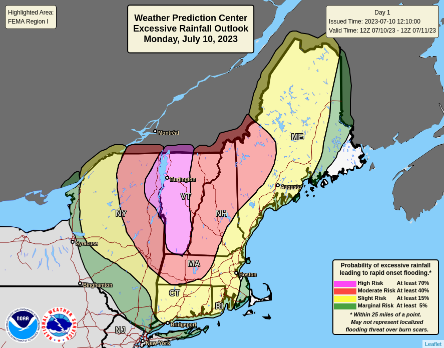
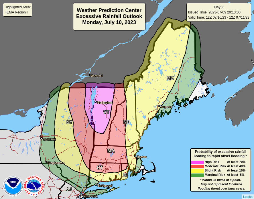
⚠️ There is now a HIGH Risk of Excessive Rainfall in effect for part of interior New England tomorrow (Mon July 10). Widespread flash flooding is likely with considerable flood impacts expected for much of Vermont.
Remain weather aware tomorrow. Turn around, don't drown.
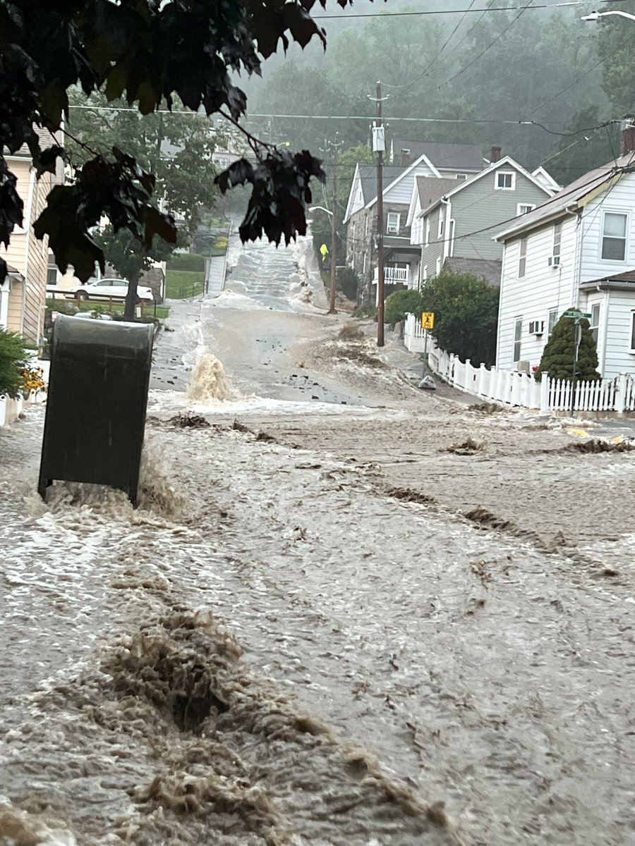
Numerous roadways consisting of State Route 9W and Palisades Interstate Parkway are experiencing heavy flooding and washouts. The Palisades Parkway Northbound is closed from exit 14 to Long Mountain Traffic circle.
📍 Drew Road, Highland Falls, NY
A considerable flood threat with a high risk of excessive rainfall is expected across much of New England on Monday. Organized areas of heavy rain and thunderstorms are expected to produce intense rain rates, especially in the high risk area of Vermont and northeastern New York.
Federal disaster assistance can help jumpstart your recovery if you, your family, or your home were impacted by a major disaster. Avoid long wait times by applying online.
Download the FEMA App (https://t.co/bCOlw2Mh7B) for easy access or visit https://t.co/gryh5A6N9X directly.
Widespread and extreme flash flooding is possible across interior New England today as heavy rains continue to fall. Multiple Flash Flood Warnings are in effect and many roads are washed out with another 3-5 inches of rain to come. #TurnAroundDontDrown