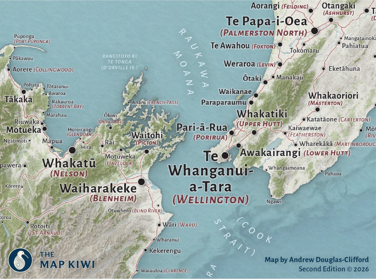
Introducing Ingoa Wāhi o Aotearoa - a map of Māori place names from the traditional south-is-up Ao Māori perspective.
Now available from The Map Kiwi. https://t.co/6KkDm4s92O
Introducing the second edition of our Te Reo #Māori Place Names wall map of #Aotearoa#NewZealand! Now featuring highly requested dual Māori and English language place names, more detail/corrections, and a refreshed aesthetic.
https://t.co/6KkDm4rBdg
Day 30 of #30DayMapChallenge: Makeover 🗺️🌟
To wrap the month, I'm revisiting perhaps one of my most shared (and sometimes misunderstood) maps - Nobody Lives Here. Now with added explanations for why we have so much unpopulated space!
Day 27 of #30DayMapChallenge: Boundaries 🍰
Crossing culinary boundaries, last week's GIS Day celebration included a Christchurch property boundary themed cake!
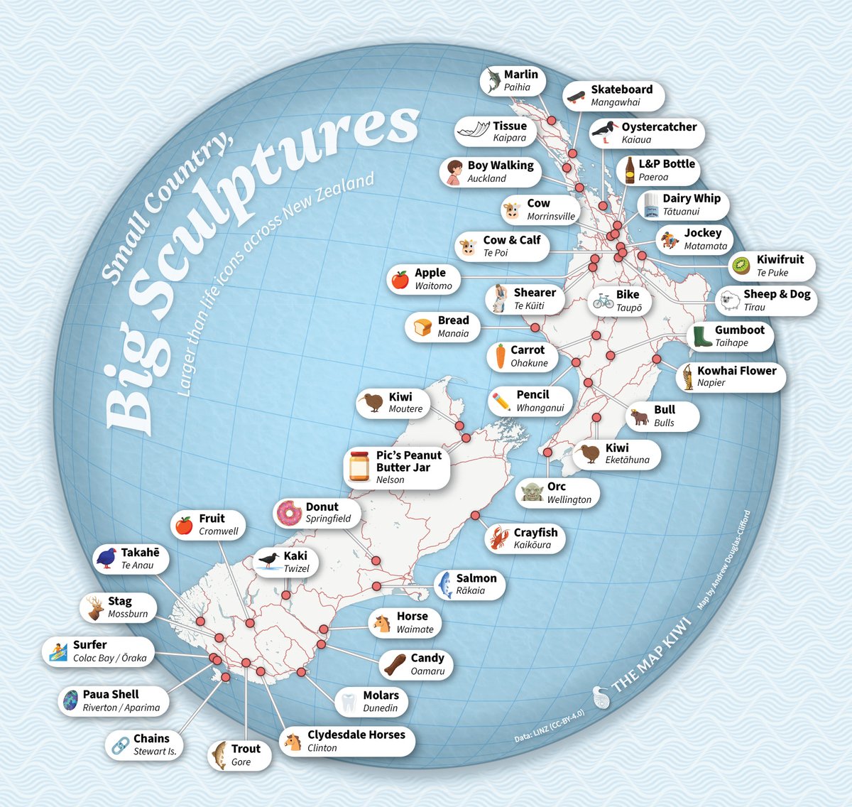
Day 21 of #30DayMapChallenge: Icons 🥝When taking a road trip through #NewZealand, you might spot a range of larger than life oddities on the road side. These iconic statues can be found all across the motu.
Day 20 of #30DayMapChallenge: Water 🌊
Revisiting a map I produced for The Conversation with Tom Shand earlier this year - how a monster ocean swell can spread from one side of the vast Pacific Ocean to the other. https://t.co/6XtuFbaqRZ
Day 15 of #30DayMapChallenge: Fire ☀️
From the great fireball in the sky to your power socket - Christchurch buildings have a lot of potential for solar energy production! ⚡
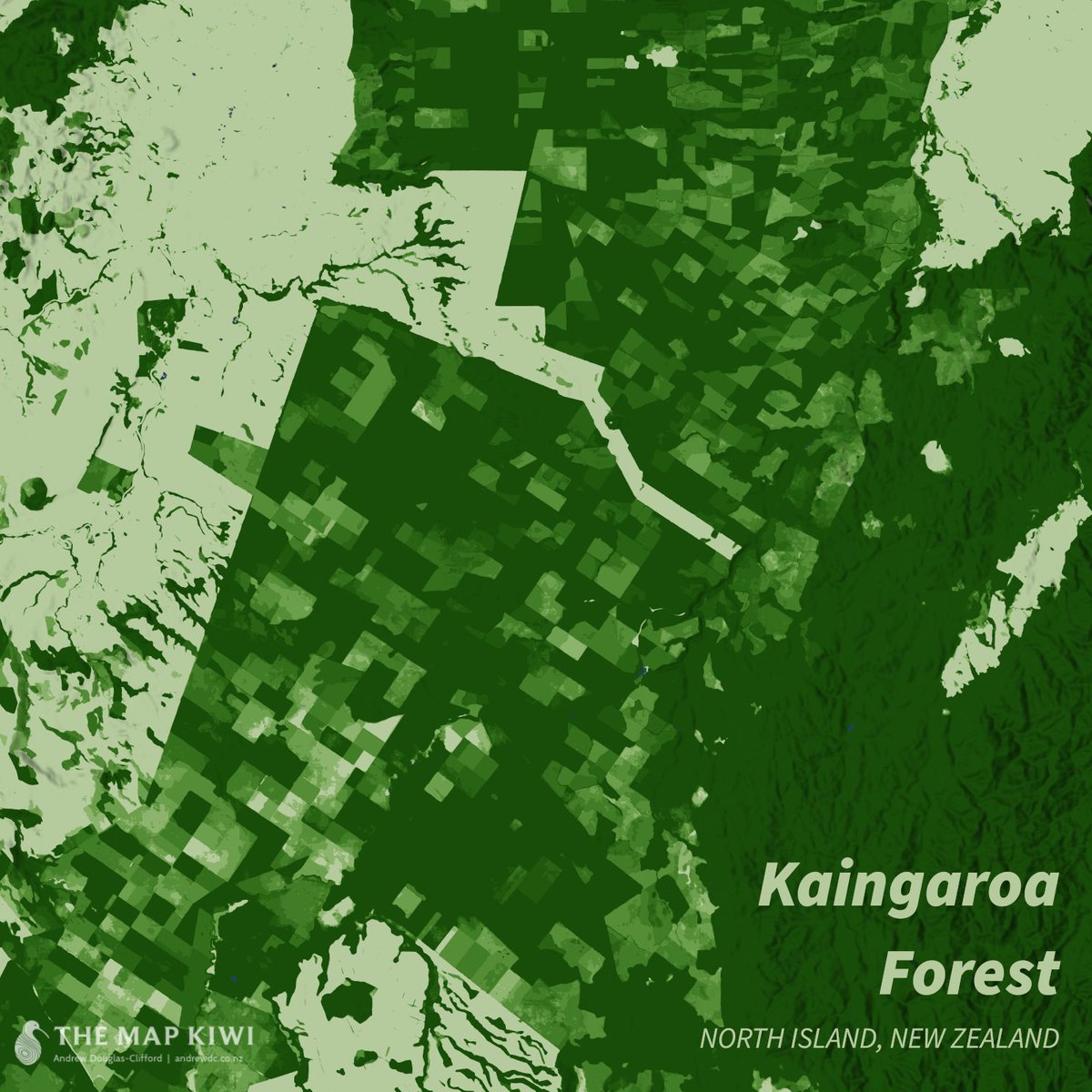
Day 13 of #30DayMapChallenge: 10 Minute Map ⏱️
An ever dancing pattern of harvests in the Kaingaroa Forest in New Zealand's North Island. Darker patches reveal trees that have been around for longer.🌲
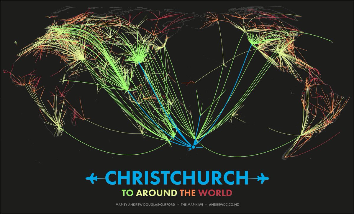
Days 10 and 11 of #30DayMapChallenge: Air and Minimal 🛄
The radial paths of flight connections from Christchurch, New Zealand, coloured by the number of jumps between routes ✈️
Day 4 of #30DayMapChallenge - My Data 📑
One of my longer running projects has been my Te Reo Māori Place Names project, collecting names for thousands of features across NZ. Coming soon - a sneak preview of the second edition update to the printed wall map!
Day 2 of #30DayMapChallenge - Lines 📈
We see roads with North, South, East or West in their names all the time - but do they actually travel in their stated direction overall?
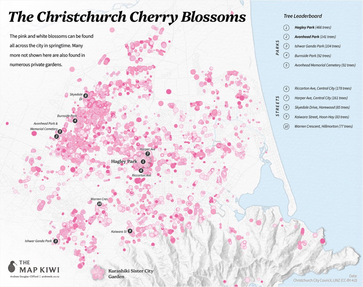
Day 1 of #30DayMapChallenge - Points 🌸
Of the Garden City's botancial delights, the site of the pink and white Cherry Blossoms is perhaps one of the most anticipated and visually dramatic.
An expedition to the New Zealand Pole of Inaccessibility (the most remote place in New Zealand) is not for the faint of heart! My map originally identifying the location they reached was featured in Stuff recently. https://t.co/aCoYk6UcPA
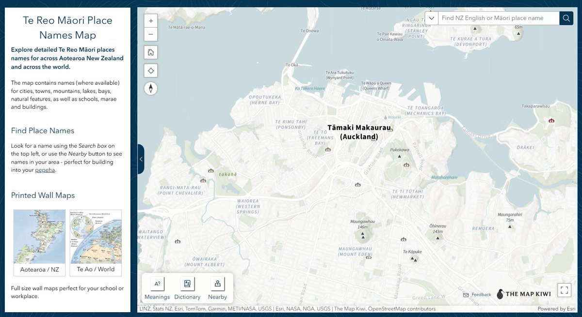
Some long awaited updates to my interactive Te Reo Māori Place Names map, with a brand new look, search and even more detail! Check it out here: https://t.co/WEmJe2FfVe
#TeReo#Maori#Maps
Day 22 of #30DayMapChallenge: 2 colours
Taking the stricter interpretation that the map background counts as a colour (and because I'm enjoying this style), here's a wine themed map of vineyards in Marlborough's Wairau Valley around Blenheim.
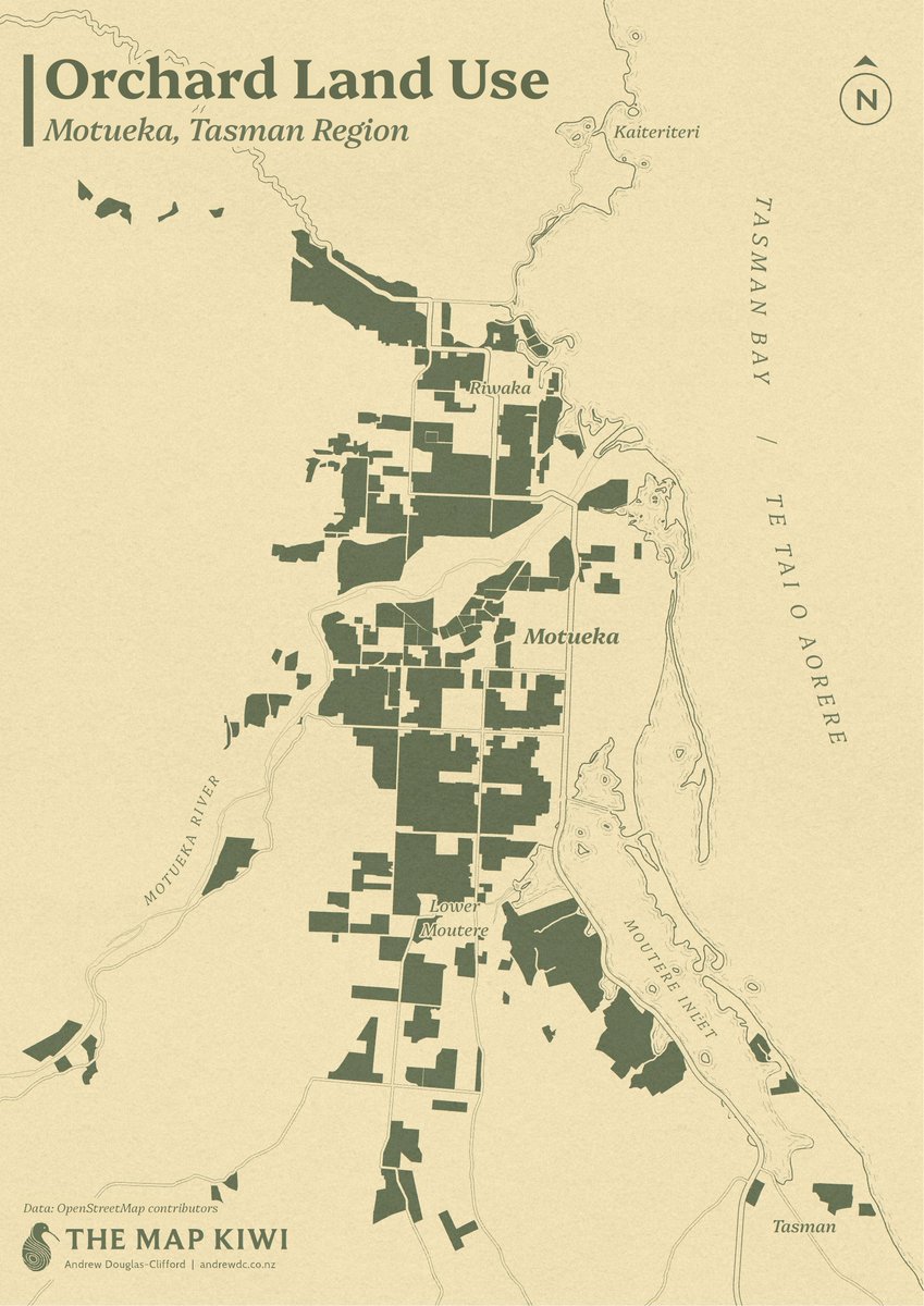
Day 20 of #30DayMapChallenge: OpenStreetMap
The Motueka area, situated northwest of Nelson in the Tasman District, is well known for its many orchards.
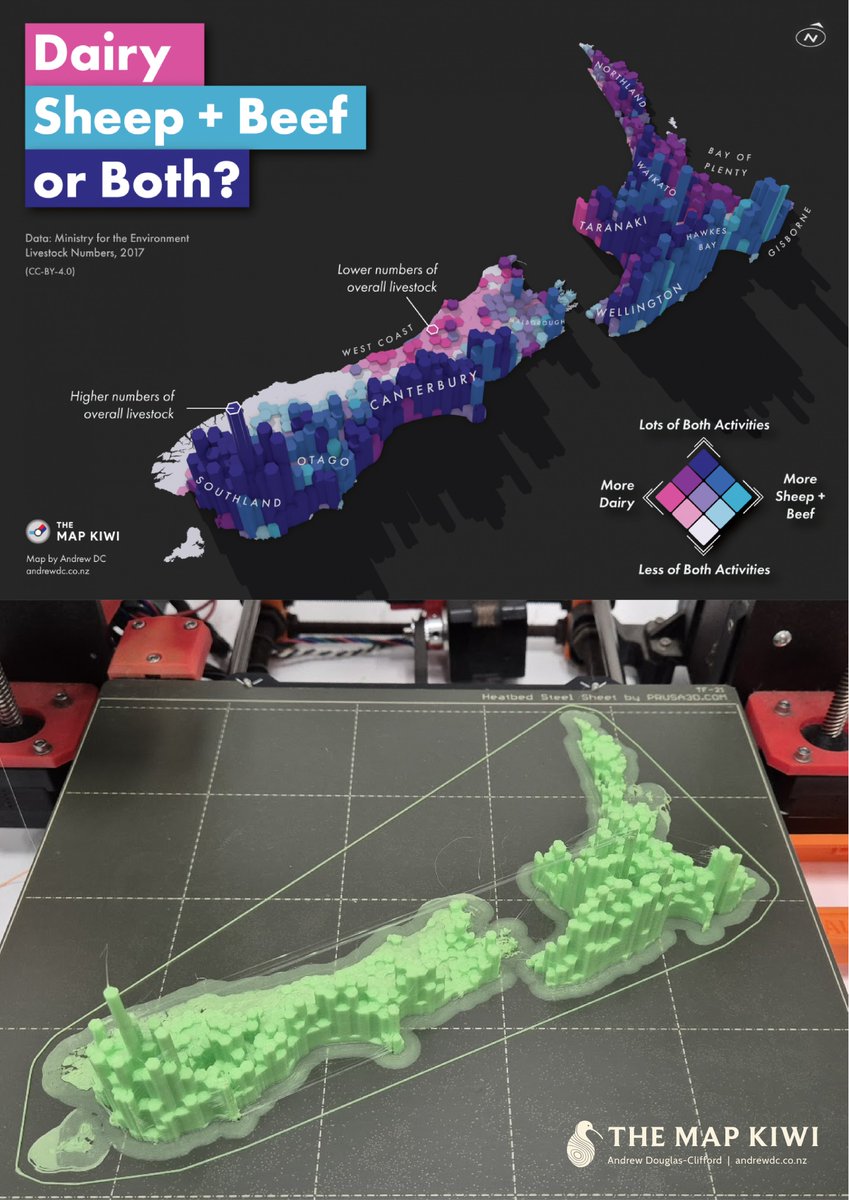
Day 18 of #30DayMapChallenge: 3D
I recently had a chance to experiment with our office 3D printer, so here's my previous livestock counts map rendered with physical materials!
You can find the original map here: https://t.co/lWI7RHMpZb
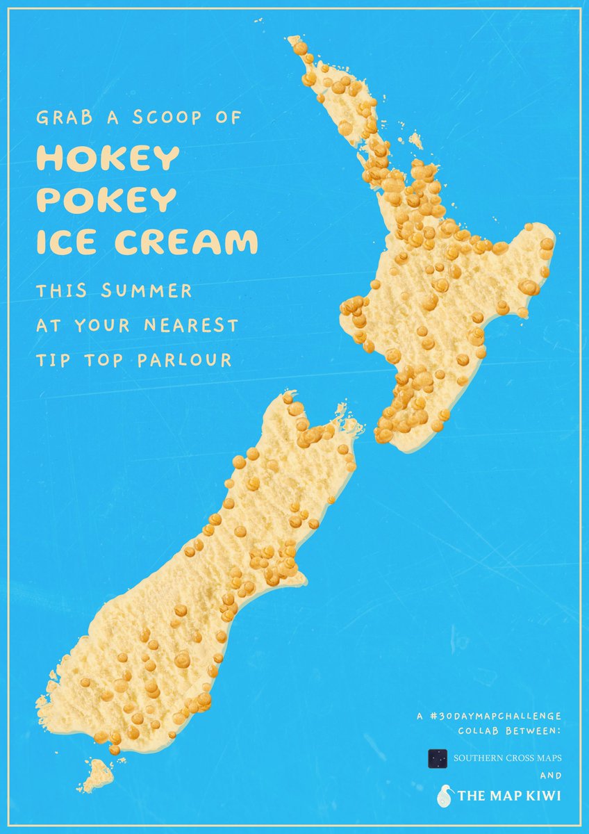
Day 17 of #30DayMapChallenge: Collaborative map
With summer just around the corner, here's a tasty Hokey Pokey ice cream map. This map was a collab with Sam Keast (@SouthCrossMaps)!
Day 13 of #30DayMapChallenge: A new tool
Today I'm trying out the AerialOD height mapping tool to produce this render of New Zealand's Pole of Inaccessibility, the furtherest inland point from the coast or roads!