Reluctant to leave twitter because your favoured institutions and projects are still here? Don't stay for us, we are already enjoying ourselves with friends over on Bluesky as https://t.co/YyGCOzmlWD. Join us!
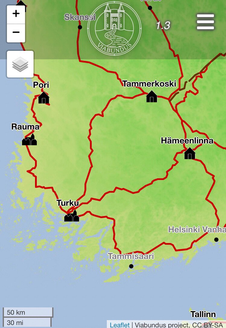
There it is: The Viabundus Update 2.0 including the new dataset created by the team of @ViabundusSuomi !
We invite you to a virtual event packed with short presentations on Friday, April 25, 10-12 CEST.
Find the programme and the registration here: https://t.co/xMZHZbDV61
Very much looking forward to our #IMC2025 session @IMC_Leeds on "Routes Reimagined: Digital Methods in Historical Mobility Analysis" scheduled for Tuesday, 8 July 2025: 11:15-12:45, with @theroadsproject, Pierre Fütterer and Laurin Herberich!
@jwhpverhagen@tombrughmans@Archaeologue1@True_Q @paudsoto Hey Philip, you may remember your visit to us in Göttingen in 2018 at a small workshop when we discussed the very first ideas of what would become viabundus. What a journey since. Bedankt for your contribution then and now!
On travaille actuellement sur un atlas sonore du français, on a récolté des milliers d'enregistrements <3 Comment vous dites, #anana ou #ananasse ? Pour écouter >> https://t.co/nfJ1eKtYW4 #AtlaSonore
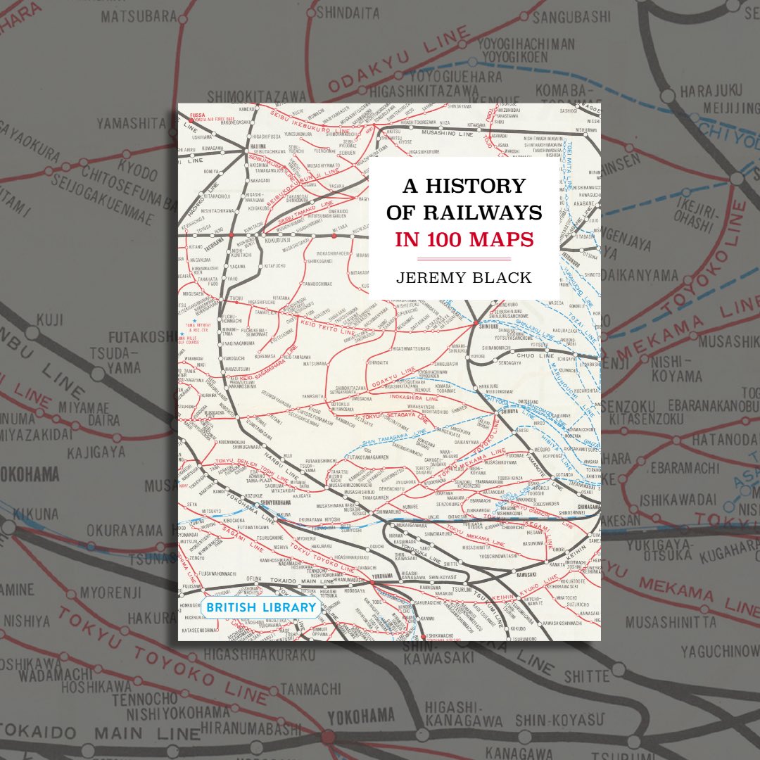
All aboard for a journey through history! 🚂
The latest in our series, A History of Railways in 100 Maps, takes you from the first railways in England to those in fantasy literature, with 140 beautifully photographed maps from our archives.
https://t.co/j0emKuEaZC
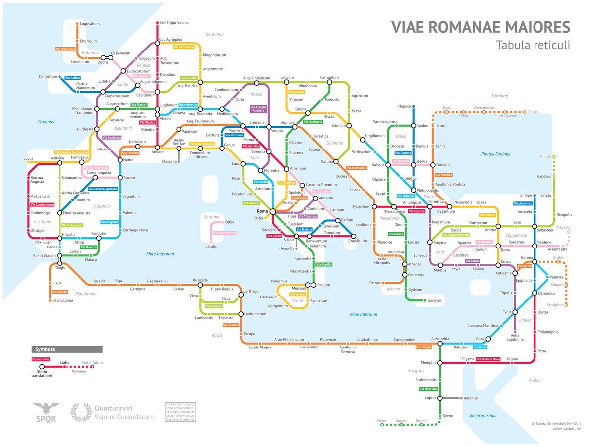
Wie lange hat es im römischen Reich gedauert, um von London nach Rom zu kommen und wie viel denarii hat es gekostet?
30 Tage, 3000km u.a. mit dem Esel
Ein Routenplaner für das Römische Reich
Oh mein Gott, diese Website ist ein fantastisches Spielzeug! 😍
https://t.co/jAJ9CDeyuM
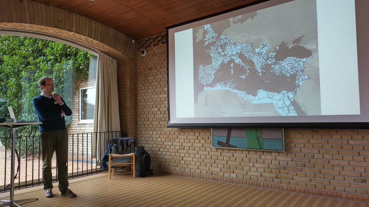
Viabundus on the Road: Meet our PI Bart Holterman today in Washington D.C. at #DH2024 (https://t.co/MnLC9d9MSQ). In the panel "Grounding Truth: Critical and Data-Driven Approaches to the History of Travel" @rmidura and other @emdigit members discuss premodern spatial data. Fresh!
Geospatial methods can detect location names from historical maps, make them searchable, and allow for the automated extraction of geographic data from those maps.
https://t.co/8yRT1zpYHx
This summer, explore street maps of late medieval and early modern northern Europe (1350-1650) with Viabundus @theroadsproject. It includes a database of settlements, towns, tolls, and other information that would be useful to any pre-modern traveler.
➡️ https://t.co/MVqUahEUWx
The real reason why the Roman Empire was such a success, and sustainable, too: great public transport infrastructure...
Nice idea well done by Sasha Trubetskoy @sasha_trub
https://t.co/6oNfaROWwH
Congratulations to all involved! A great project and made even more amazing by making the data publically available. A sure template for other similar projects!
Competition between Dutch Skippers, German Ship-owners, and the Transition to Steam. Read in Hein Klemann's article in TSEG how small-scale skippers and their families competed with steam ships and the new railways https://t.co/YyQWcM7gyY
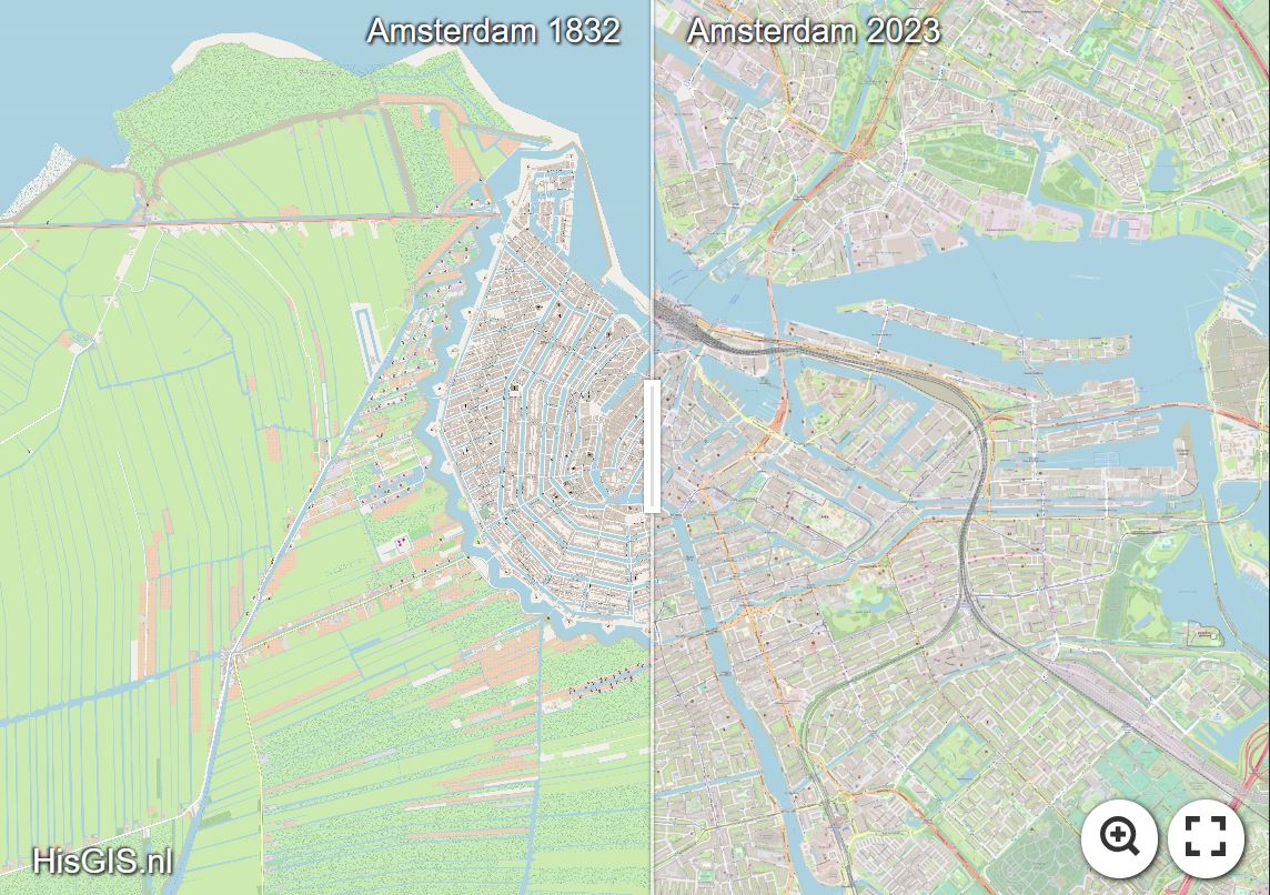
Heel mooi nieuws voor Rombert Stapel & Thomas Vermaut! https://t.co/BQa10ndoxD wordt dankzij nieuwe financiering duurzamer en gebruiksvriendelijker 🥳 De basis van HisGIS is het gedigitaliseerde eerste kadaster, dat in 1832 in werking trad. Meer weten? https://t.co/kS5d2pZ5hN