fysisch geograaf voor de klas ~ Die Mitte der Welt ist für jeden woanders, je nachdem, wo man steht.
St.Bonifatiuscollege | @HU_Utrecht | @ak_olympiade |🏳️🌈
This animated globe by @tylermorganwall gives us a rather immersive view of global population. I particularly love how clear the "empty hemisphere" appears.
Orkaan #Melissa is nóg sterker geworden (295 km/uur) en bereikt nu kust van Jamaica.
Witte kleuren is meer dan 200 km/uur wind.😱
Dat waait wel over, maar de overlast van water, uitvallen van elektra & schoon water, aardverschuivingen, etc. gaat nog weken/maanden gevolgen hebben.
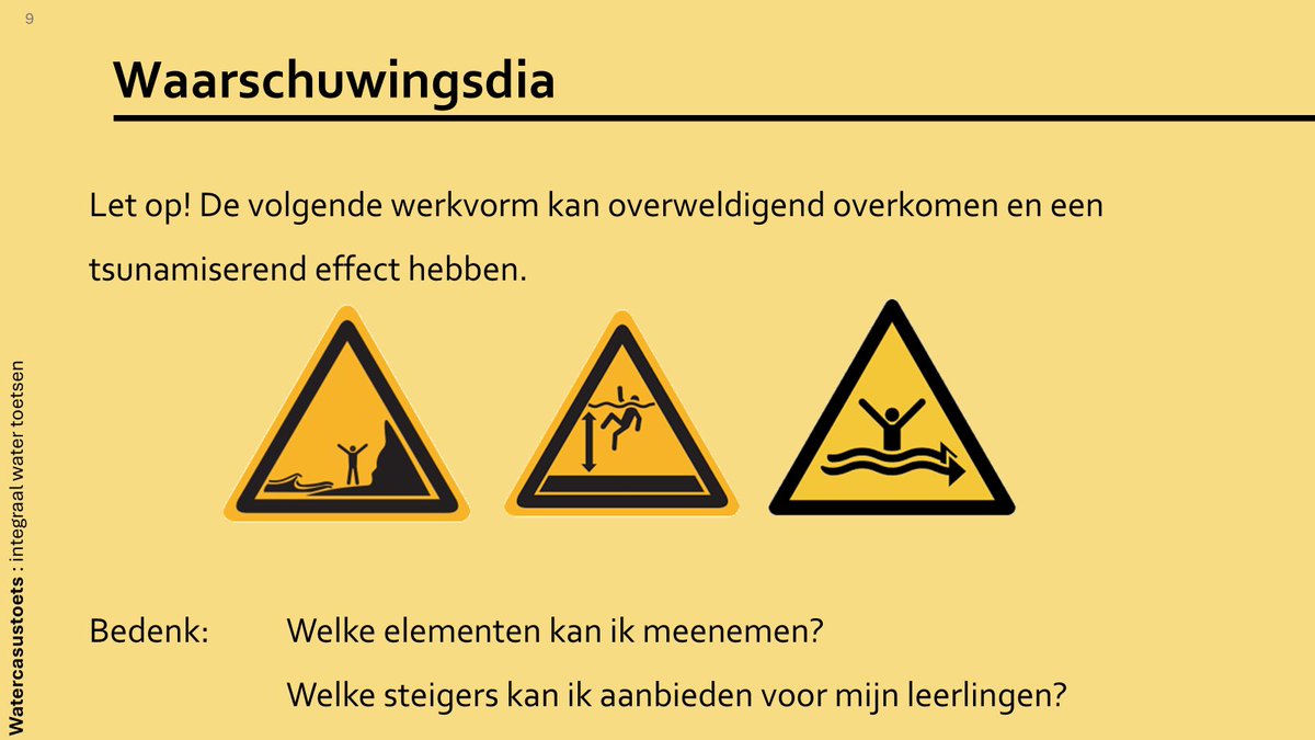
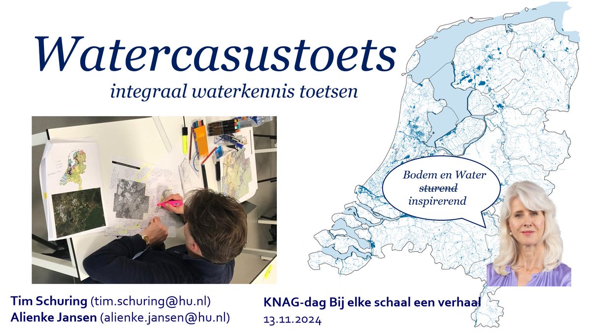
Workshop op de @knag-dag 2024 over de Watercasustoets die we op de HU ontwikkeld hebben voor onze masterstudenten en hoe je in het VO ook kunt gebruiken. Water (en bodem) zouden sturend moeten blijven! #bijelkeschaaleenverhaal#knagdag24
Mooie uitwisselingsles met het Leonard Gymnasium in Basel vandaag tijdens de examenreis. Kennismaken d.m.v. kaarten van hun “everyday geography”, landen Venn-diagrammen en puzzelen met bevolkingsdiagrammen van beide landen.
"Dear friends, scientifically, this is not a #ClimateCrisis. We are now facing something deeper. Mass extinction. Air pollution. Undermining ecosystem functions. Really putting humanity’s future at risk. This is a #PlanetaryCrisis."
— Professor @jrockstrom#ActOnClimate
Heavy rain is moving across... the Sahara Desert? 🤔
Mali and Mauritania are experiencing unusually high levels of rainfall right now.
This may be one reason why the Atlantic has had so few hurricanes so far. Tropical waves, which often develop into hurricanes, have not been emerging as strongly from central Africa.
One key factor for the formation of tropical waves is the intertropical convergence zone (ITCZ). It has shifted farther north than usual.
This, combined with a record positive North Atlantic Oscillation (NAO), has altered weather patterns across the Atlantic and Africa. This shift has led to more rain in regions like the Sahel and the Sahara Desert, where Mali and Mauritania are located. And so far, fewer hurricanes.
If the ITCZ returns to a more typical position, we could see an increase in tropical wave activity, and more storm formation.
Very impressive weather pattern in Europe right now.
Strong easterly winds and hot in Central/Northern Europe meanwhile heavy rain plagues the west with much cooler conditions. The heat is breaking records (for this time of year).
THREAD
Beach profile data presentation: This example compares fieldwork data from Swanage Bay and nearby Studland Bay. A single beach angle recording as shown here can help keep things simple if you have large groups. Includes template and example analysis. Link above. #geographyteacher
⛈️ LIVE: spectaculaire supercell zuidwest van Nijmegen! De enorme kolom die omlaag zakt rechts is een downburst (valwind)... #onweer
https://t.co/UsAsuMGjEt
E ancora, sempre confronto tra camera a infrarossi (sinistra) e visibile (destra) dei flussi piroclastici che entrano in mare dopo aver percorso tutta la lunghezza della Sciara del Fuoco.
Video fornito dai progetti #UNO e #Dynamo.
#Stromboli#INGV
😂 wie gut, dass die Fussball EM in Europa gespielt wird und nicht in Katar oder so 🤷
Was die Amis mit der Kuss Kamera können , das kann Deutschland auch. Einfach nur herrlich 😂
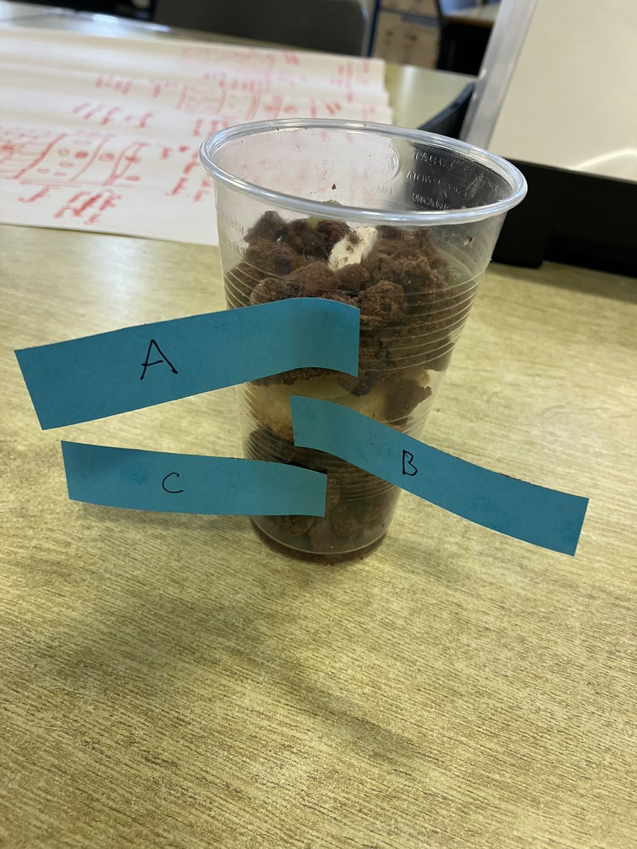
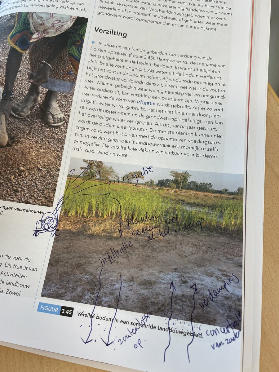
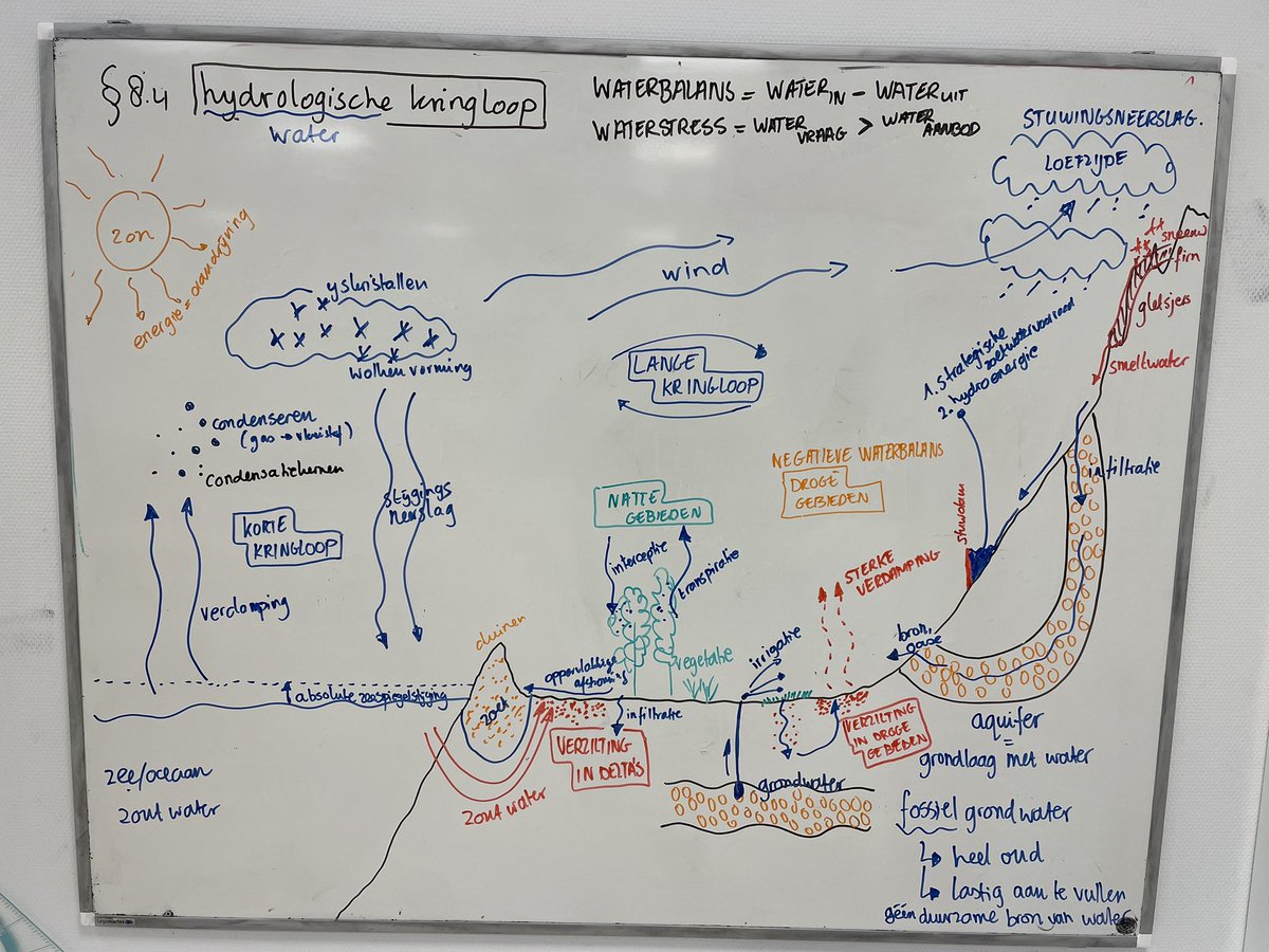
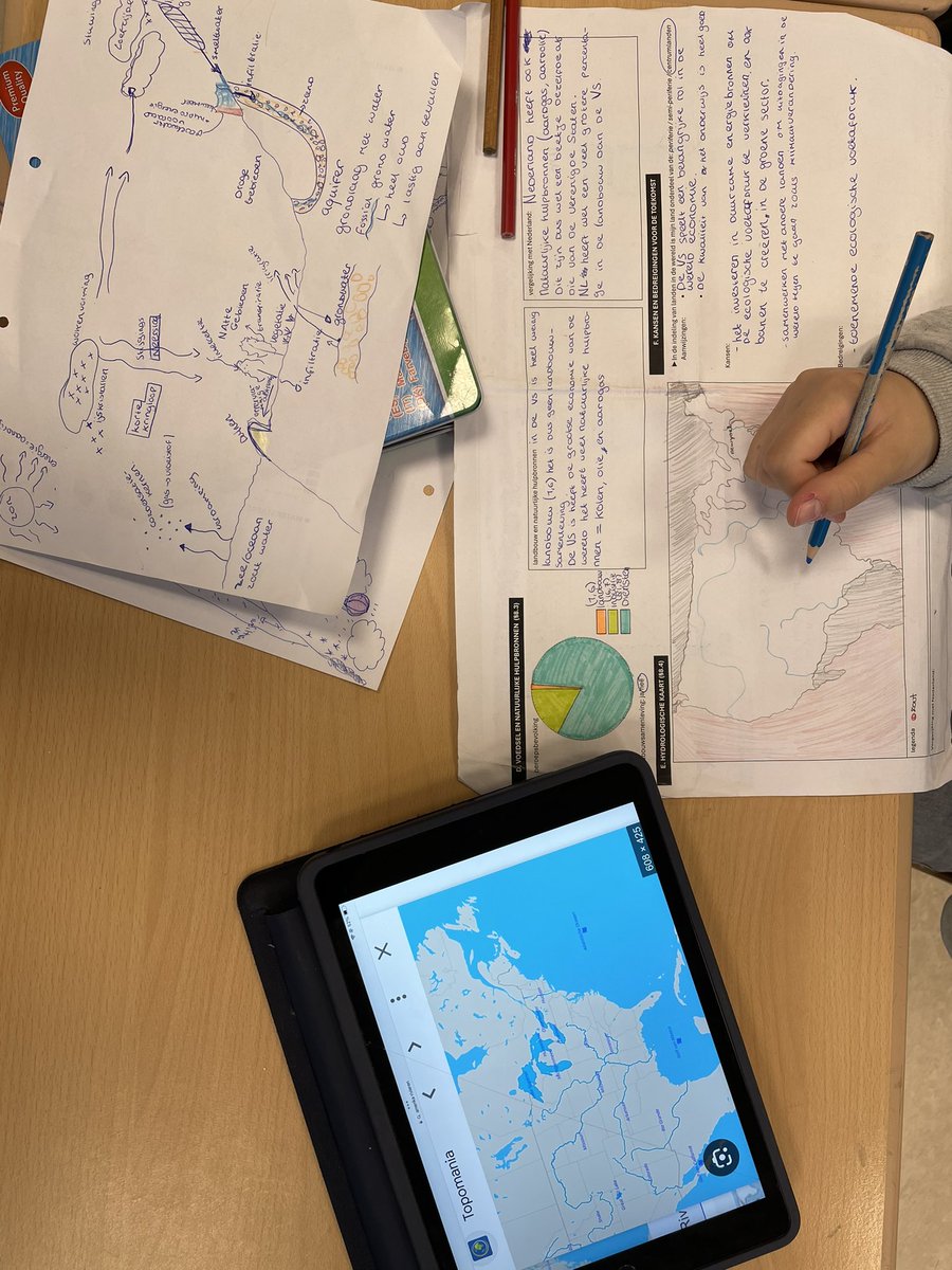
Samen bordtekening hydrologische kringloop opbouwen . Daarna toepassen in een waterkaart van het eigen land van het PO landenrapport. Ook scaffolden door met leerlingen mee te tekenen in foto in het boek: hoe zie je wat er in de tekst staat terug in de foto in het boek.
Toe removal landslide model making its way into an actual presentation…I really like the initial movement phase on this one. Reactivation with toe removal continues until the slide block breaks up due to slight changes in slide plane dip. Glass microbead sliding horizon.