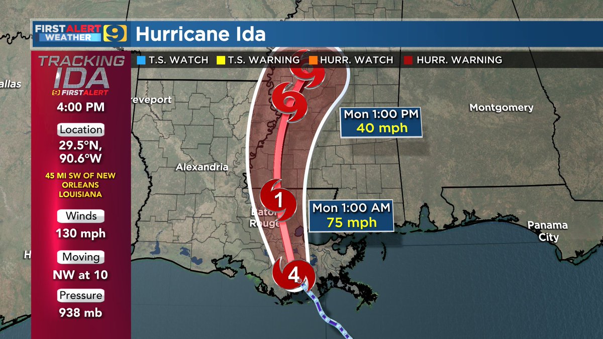
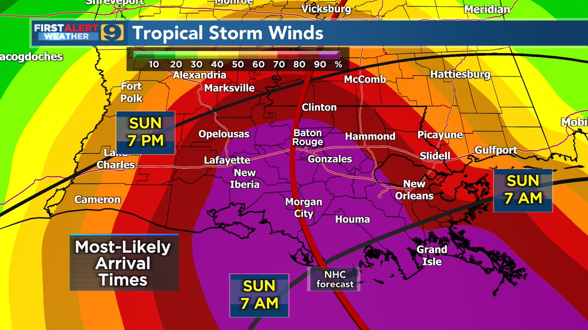
4 PM UPDATE: #Ida still a Cat. 4 hurricane with max winds of 130 mph.
Located about 70 miles SSE of Baton Rouge...that should have the core moving through our region within a couple hours either side of midnight.
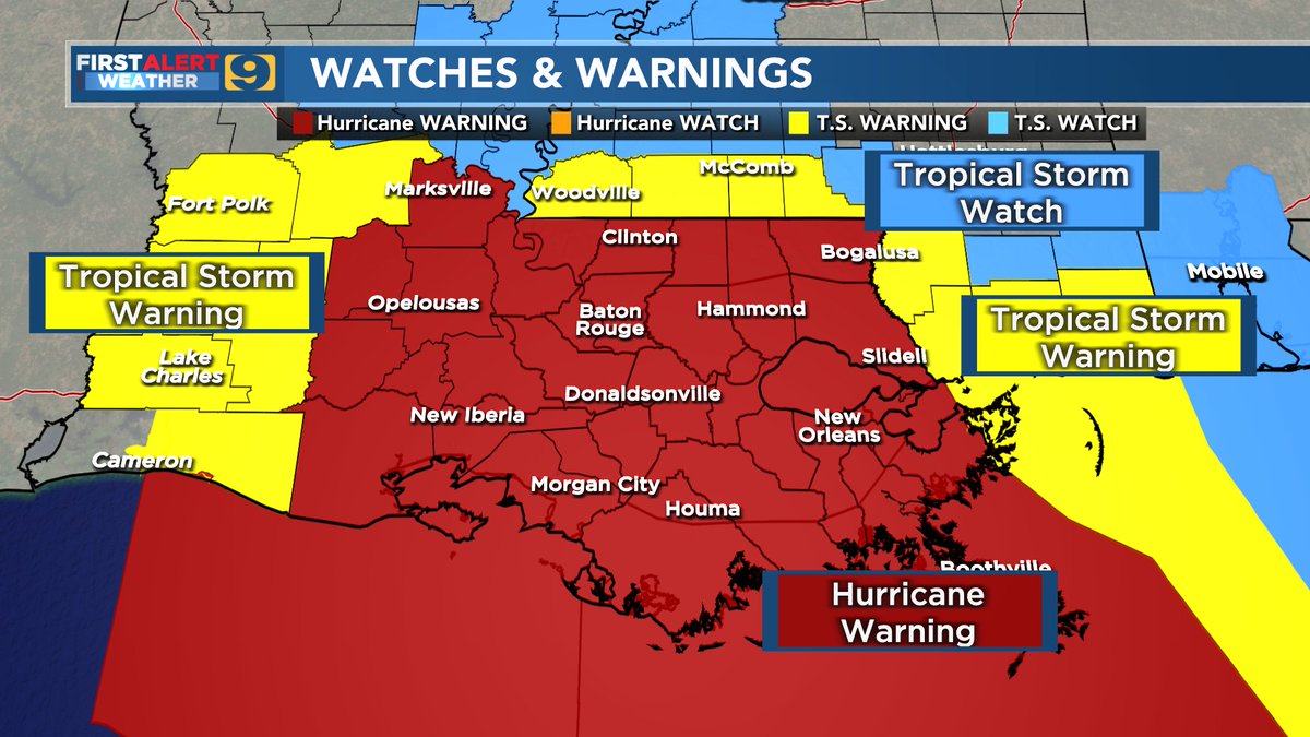
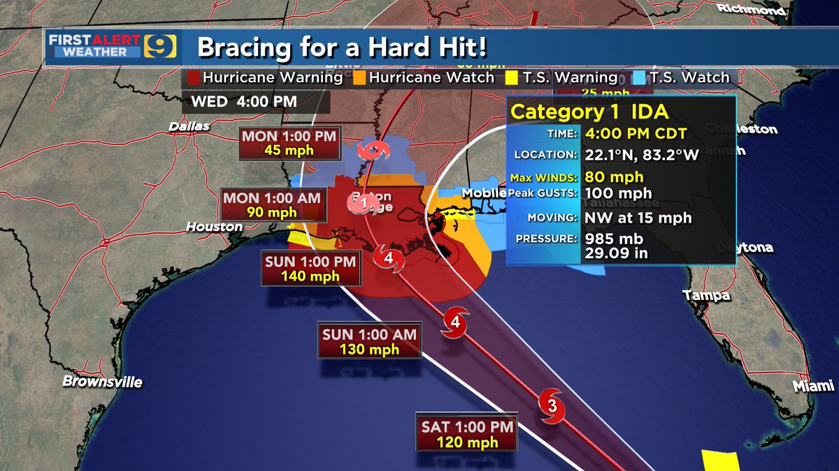
Hurricane Ida continues to strengthen and is now a strong Category 4 hurricane. Some additional strengthening is forecast before it makes landfall around noon along the SE LA coast.
In 25 years of TV broadcasting ... I have never presented a more worrisome tropical forecast for the WAFB area. Ida has the potential of being more troublesome than 2008's Gustav, more problematic than 1992's Andrew."
Get your final hurricane preps completed ASAP!
Jay
A loss of electricity changes a lot. Consider all of the implications as you finalize preparations by Saturday night.
#Ida Forecast --> https://t.co/2G531kI5tv
Friday 10PM Hurricane Ida Update (60 sec)
Potentially catastrophic landfall for SE Louisiana on Sunday.
- sustained winds of up to 130-140 mph at landfall
- storm surge estimates of up to 10-15 feet
- widespread double-digit rainfall
#WAFBFirstAlert
4 AM UPDATE: #Ida now forecast to make landfall as a major cat 3 hurricane Sunday afternoon/evening. Preparations must be done Friday and Saturday. Conditions go down hill Saturday night with the worst expected Sunday into Sunday night. Stay tuned! #BeOn4