Farmers are warned to be aware of the risk of exposing young sheep to the common weed, lesser loosestrife (Lythrum hyssopifoli). After the flooding across Victoria conditions are good for this weed – so keep an eye out. For more info go to https://t.co/Dsg3zdPeQ3 @PyreneesShire
The new & expanded 2023 Forage Value Index tables help you make better-informed decisions when selecting ryegrass cultivars. These tables use industry-supported Pasture Trials Network data to rank ryegrass cultivars according to profitability. Download ➡️ https://t.co/8tWwZVJi5X
Vetch has become a cornerstone of our modern cropping systems.
It offers:
Grass weed control
Disease management
Nitrogen to following crops
Flexible “end uses” (hay, brown manure, grazing & seed) We are currently helping clients through this years decisions.
1 We’re all looking for #rain so here’s a thread of short term #rainfall rainfall links for #ausag#agriculture#farmers#agchatoz Not in order. RT or share your favs too. First is BoM 7 day chartviewer https://t.co/pa7X3ZncWT
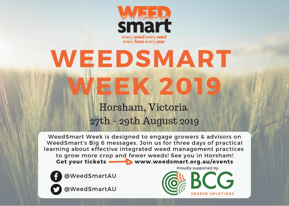
WeedSmart Week in Horsham!
Starting on Tuesday 27 August, It will focus on delivering the latest information about the WeedSmart ‘Big 6’, featuring leading growers, farm advisers, agronomists and researchers, followed by a series of farm visits. #ryegrass#Resistance#HWSC
**REMINDER** If you're a farmer around Maffra, Tatura, Serpentine or Birchip you might be able to take part in our On-Farm #IoT Trial but be quick, EOIs close on Friday. Go to https://t.co/iIRIVKjIh6 #VicAgIoT#agchatoz#agtech
Are you in the 'Internet of What' camp? That’s ok, we’ve put together this short video to help explain what the Internet of Things is and what it means for farmers https://t.co/aMz74tfUVs #VicAgIoT#IoT#AgTech#SmartFarming#DecisionAg#ausag
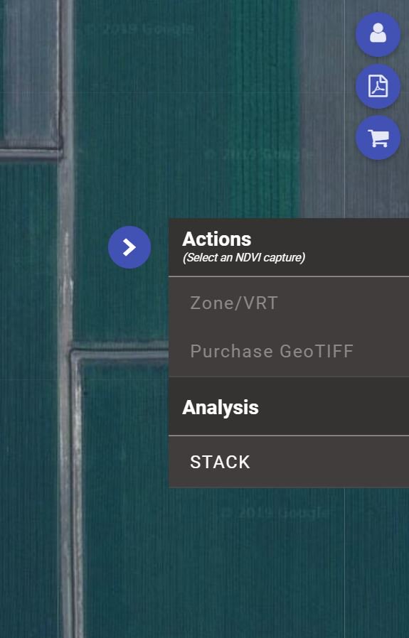
When using the DataFarming platform make sure you check for cloud or shaddow before getting NDVI as it will affect readings significantly. Click the cloud icon on each date and it displays true colour image.
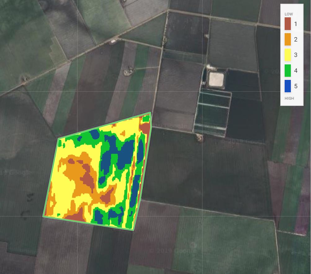
At @data_farming we have released our STACK tool. You should see it pop up when you log on. It allows you to STACK 5 years of satellite #NDVI data together to get long-term productivity zones, which you can then export out as a prescription shapefile. Only $0.60/ha. Check it out!